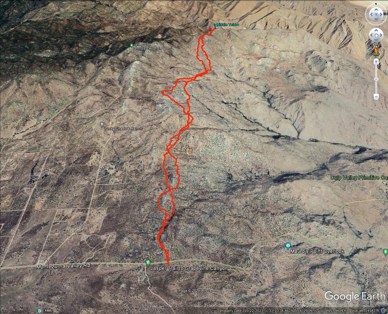
Distance: 11 miles round trip cross country
Summit Elevation: 5855'
Elevation Gain: 4211'
Elevation Gain (in Empire State Buildings): 3.3
Round trip time: 11 hours
Recommended water: 160 oz.
Parking/Fees: Free on Highway S2
Difficulty: Very Strenuous (route finding, brush)
Middle Ysidro is an unofficial peak in the center of the San Ysidro mountain range. It is extremely remote and not on any list. Only a handful of people have climbed it. The previous week, I discovered the Cherry Canyon parking spot covered with private property and no trespassing signs. I updated my route plan starting from Highway S2, longer and with a more difficult approach. Sean Green joined me for the adventure. We started at a small turnout on S2 just past the Anza-Borrego sign. After a wet winter and recent rain, the brush was thicker than usual. On the plus side, the ground was soft but stable.
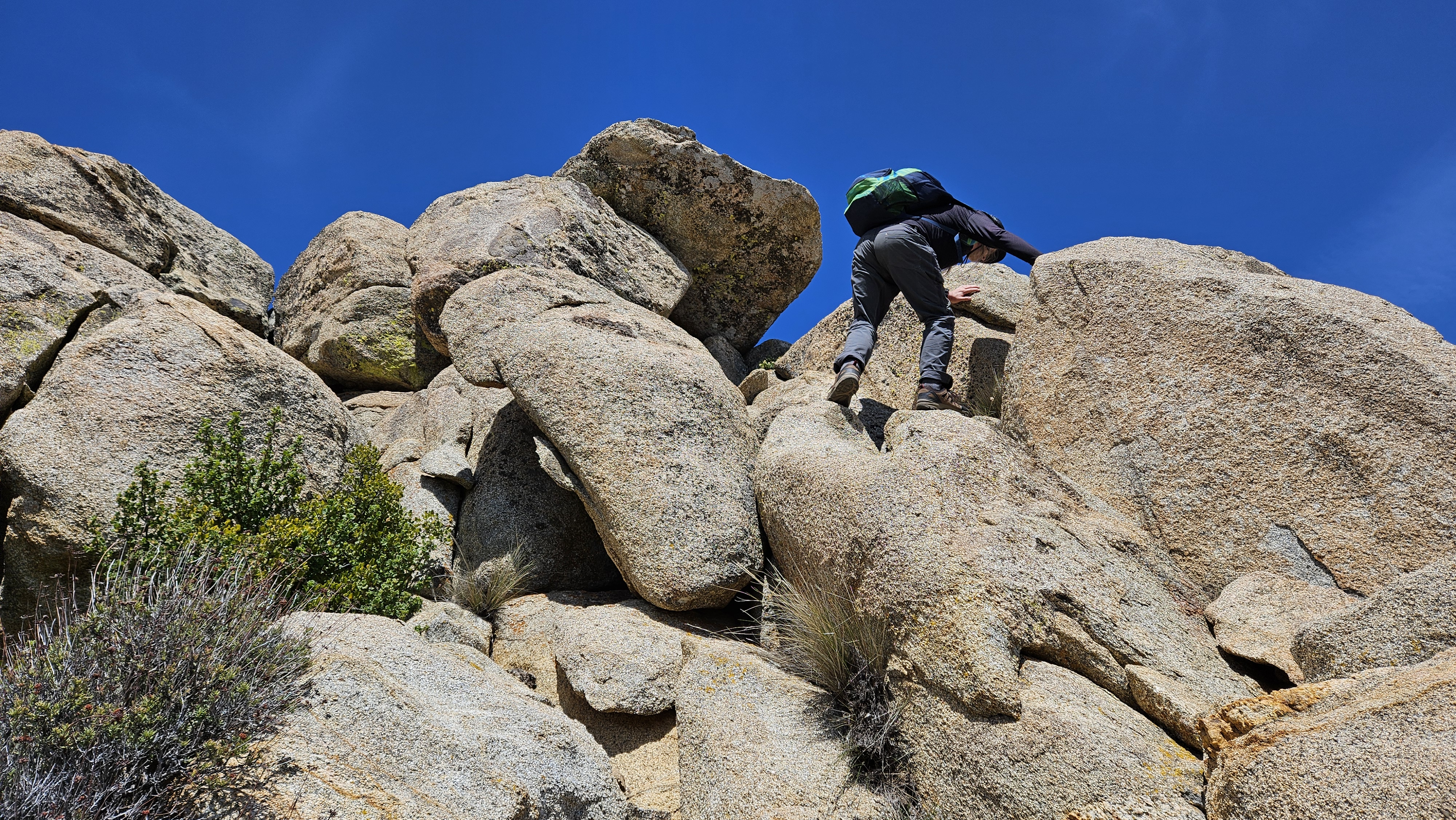
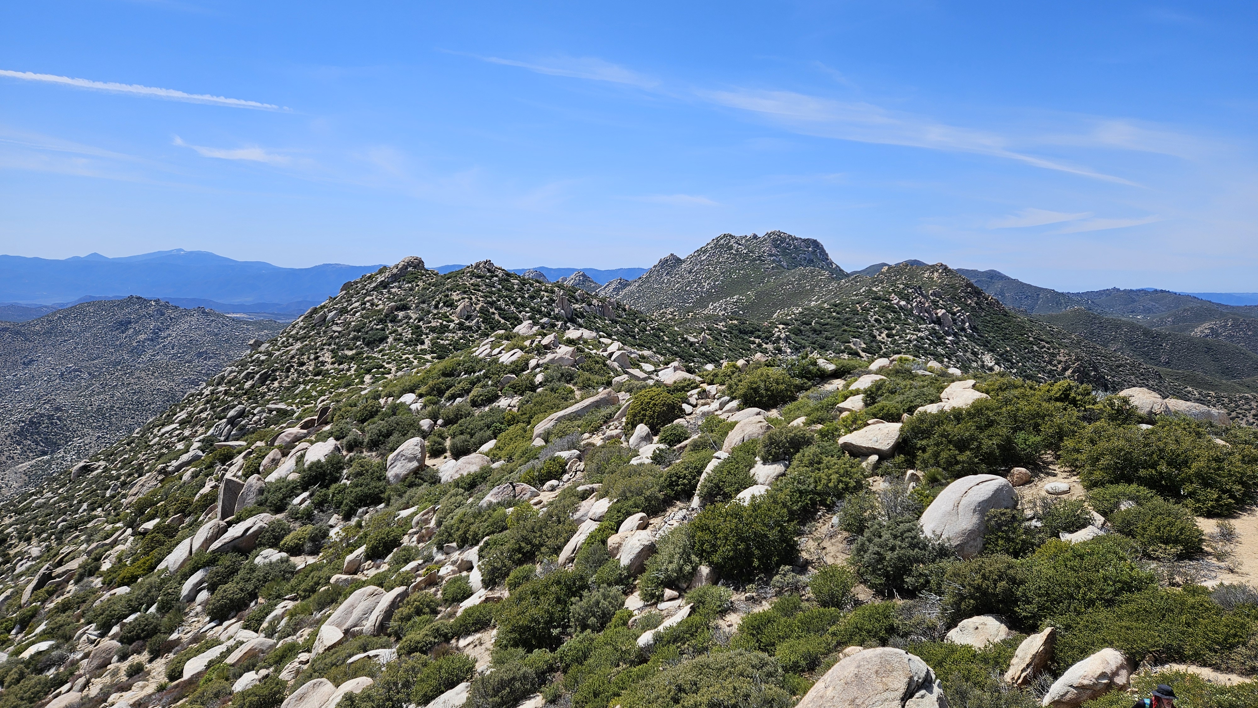
We made our way past the Bonnie and Clyde benchmarks, then spent a couple miles side-hilling around White BM. As a bonus, I wanted to check out some granite formations that caught my attention on a previous trip. There were four towers (30'-70') on a shelf above the drainage that leads to Hob BM. I called these Hobs Knobs #1-#4. They are nearly in a direct line between The Thimble and Goat BM. Sean waited patiently for me to explore a couple of them. Number 4 was the closest and I found an easy class 2 ledge to the top. Next, I checked out Number 1 to the east. I saw a good class 3 line using ledges and slabs. I saved Number 2 and 3 for a future trip. We crossed the drainage and started up the ridge toward Hob. It would have been easier if we had followed the major gully east of Hob since it had less brush. After reaching the ridge line, we got a look at Middle Ysidro across a brushy saddle.


We worked our way to Middle Ysidro, then Sean led the route up some boulders to avoid the worst vegetation. The highest point was northeast of the false summit. The high point was a boulder requiring a single class 3 mantle. There were no marks and no register. Views from the middle of the range were striking. It took us six hours to reach Middle Ysidro. I had planned an eight hour round trip, so water and food were going to be a problem. On the way back, Sean collected some emergency water from a small snow patch and from a puddle on top of a boulder. We descended the gully and made better time. Instead of going back through Hobs Knobs, we followed the drainage, trading extra steps for an easier grade. We took frequent breaks in the shade on the way back. I rationed both food and water. Sean treated the murky water he collected with purification pills and drank up. I drank some of the snow melt, but was not keen on the boulder water. Sean's route finding was key in certain places and I don't think I would have completed this hike without his help. When we reached the truck, I guzzled the water I had, but was very dehydrated. We stopped at the Pala mini-mart on the way back and I loaded up on ice cold drinks. After downing a gatorade, I was right as rain. I took 112 oz of water (3.3L), but needed another 48 oz, reflected in my recommended water stat. Caching some along the way would be a good idea. I underestimated the effort required for Middle Ysidro. My ankle was sore, but with minimal swelling and no lingering pain. The ankle appears to be back in working order.


No comments:
Post a Comment