Hiked: 8/3/2023
Distance: 10.3 miles round trip on trail
Summit Elevation: 12633'
Prominence: 6039'
Elevation Gain: 3353'
Elevation Gain (in Empire State Buildings): 2.7
Round trip time: 7 hours
Recommended water: 108 oz.
Parking/Fees: Free at Humphreys Peak Trailhead parking lot
Difficulty: Strenuous
Humphreys Peak is the Arizona high point. Leisa and I drove to the Humphreys Peak trail parking lot at 7 AM. It's a huge lot that could hold at least 100 cars and there were already about 20. Some hikers were just starting out like us, others had started early. There were four portable toilets at the trailhead. Take advantage of them as privacy was an issue on this hike. The start of the trail goes through dense, shaded forest with tall deciduous and coniferous trees. The trail was damp but not wet. The first mile had a lot of medium sized rocks and exposed roots: trip traps. Long zig zag switchbacks define the trail below the saddle. At 10,500', the deciduous trees faded. The tree line ended at the saddle where the Weatherford trail joins the Humphreys trail. Beyond the saddle, the trail was harder to follow. It immediately dropped below the ridge line and was marked with wooden poles. There were rocky, uneven strips where large 18-24" steps were necessary. We were one of a few parties that kept leap frogging each other as we took turns resting at different spots along the trail. We also met some early risers on their way down. We not expecting the number of dogs on the trail. I counted six of various breeds, including a German Shepherd mix that looked very much like our own dog, Ripley. The dogs didn't seem bothered by the elevation, but I was more worried about their paws on the volcanic rock that made up the mountain after the saddle. While the going was not overly steep, I was feeling the elevation. It wasn't altitude sickness, just a touch of that space cadet glow.
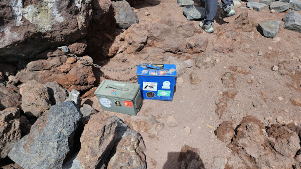
We traversed over three false summits at a steady pace, arriving on the summit just before 11 AM. Counting us, there were ten people and two dogs on the summit. Views were stellar in all directions. I had packed the drone and launched it, after a warning from the controller that it was too high and it might fall out of the sky. After I acknowledged the warning, I ran it through a couple of basic maneuvers before bringing it back. I've gotten quite adept at hand launches and catches. While the footage was not great, it was something, and set a personal altitude record for piloting unmanned aircraft. There were two ammo register boxes with lots of notebooks. I signed us in with the masses of other climbers. The wind started blowing enough to make things cold and we started down. With so many people on the trail and a sparse forest, it's a problem finding a place to relieve yourself. We discovered a hidden spot just above the saddle, fifty feet off trail, surrounded on three sides by pines and the other side by a bump in the ridge. It was the only place we found for a moment of privacy. The descent was uneventful and we were back at the truck by 1 PM. Humphreys had been on my wish list for six years so it was sweet to check that box. It is one of only five ultra prominent peaks in AZ. It was a surprise to learn that it was only the second most prominent in AZ. That honor belonged to Mount Graham with 6320' of prom.


Humphreys has been on my radar for a long time too. It's just so dang far away. Aggasiz is off limits is it not?
ReplyDeleteMadison,
DeleteYes, Agassiz is off limits due to the threatened status of the San Francisco Peaks Groundsel (Senecio franciscanus), a dwarf alpine species of the sunflower family. However, it is legal to climb when covered in snow. It is the only other 12er in Zona. Humphreys is a great hike and Flagstaff is a cool town to spend a few days.