Distance: 4.8 miles round trip on trail
Summit Elevation: 6323'
Prominence: 603'
Elevation Gain: 2047'
Elevation Gain (in Empire State Buildings): 1.6
Round trip time: 3 hours 20 minutes
Recommended water: 48 oz.
Parking/Fees: $15 Red Rock fee (OR National Parks Pass) + $2 online reservation fee
Difficulty: Moderate
Leisa and I were in Vegas for her birthday and took one day to explore Red Rock Canyon National Conservation Area. To limit traffic, Red Rock requires a timed entry reservation. Reservations were plentiful, and we started at 8:00 AM on what would be a warm day. The loop through Red Rock is one way with hiking trails branching out from various stops. We planned two hikes that both started at the Sandstone Quarry parking area: Turtlehead and Calico Tanks.
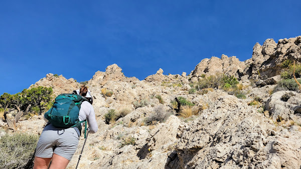
The parking lot was only half full. Turtlehead is a prominent feature sticking up over the red and white Calico hills. Most people were hiking the Calico Tanks trail with only a few heading toward Turtlehead. A well maintained trail with plenty of signs led into a gravel wash, then into a wide drainage toward the saddle west of the mountain. Half way up the drainage, white and green paint dots marked the main route, though there are still a few signs. The trail stayed left of the main gully and there were a few use trails that might cause some confusion. Most of the gain was done by the time we reached the saddle. The final section has many braided use trail options similar to what you find near the top of the Mount San Antonio Ski Hut trail. Some are easier, some are harder, but they all end at the top. The views explode when you reach the rim of Turtlehead. Bright red rocks were spread out below and higher mountains were visible across canyons on both sides. Snow was visible on distant Griffith Peak (11060'). A plaque or marker had been pryed out of the summit and the peak was too popular for a register. We rested a while on top and soaked in the sun before heading down. It's a worthy adventure if you are in the Vegas area.
After we got back from Turtlehead, we took a short break, then hiked the Calico Tanks trail. The stats don't include the Calico Tanks trail, which was 2.5 miles and about 500' of gain. This trail was busier and involved some scrambling to reach the tanks where water would pool in wet conditions. The tanks were dry when we got there but had knee high green grass. We stopped at an overlook just past the tanks. On the way back, the wind started gusting strongly (40 mph) and discouraged us from taking on any other hikes. Not only was it blowing dust in our faces, it made scrambling on other routes more hazardous. We completed the scenic loop and called it a day.


No comments:
Post a Comment