Distance: 20.2 miles round trip on trail and cross country
Summit Elevation: 10284' (Grinnell), 10977' (Bighorn), 10056' (Zahniser)
Elevation Gain: 4833'
Elevation Gain (in Empire State Buildings): 3.8
Round trip time: 10 hours 40 minutes
Recommended water: 168 oz.
Parking/Fees: Free online permit from SGWA
Difficulty: Strenuous
A 10k triple play in the San Bernadino Mountains. I wanted to do Grinnell (HPS #15) and Bighorn Mountain (HPS #3) last year, but they were suspended due to fire. Zahniser was a bonus on the way back and probably the easiest peak in the SB Mountains (once you reach elevation). I started at Fish Creek Trailhead, a seven mile drive on a good dirt road. I recommend high clearance for ruts and rocks. There were no other vehicles in the parking lot.
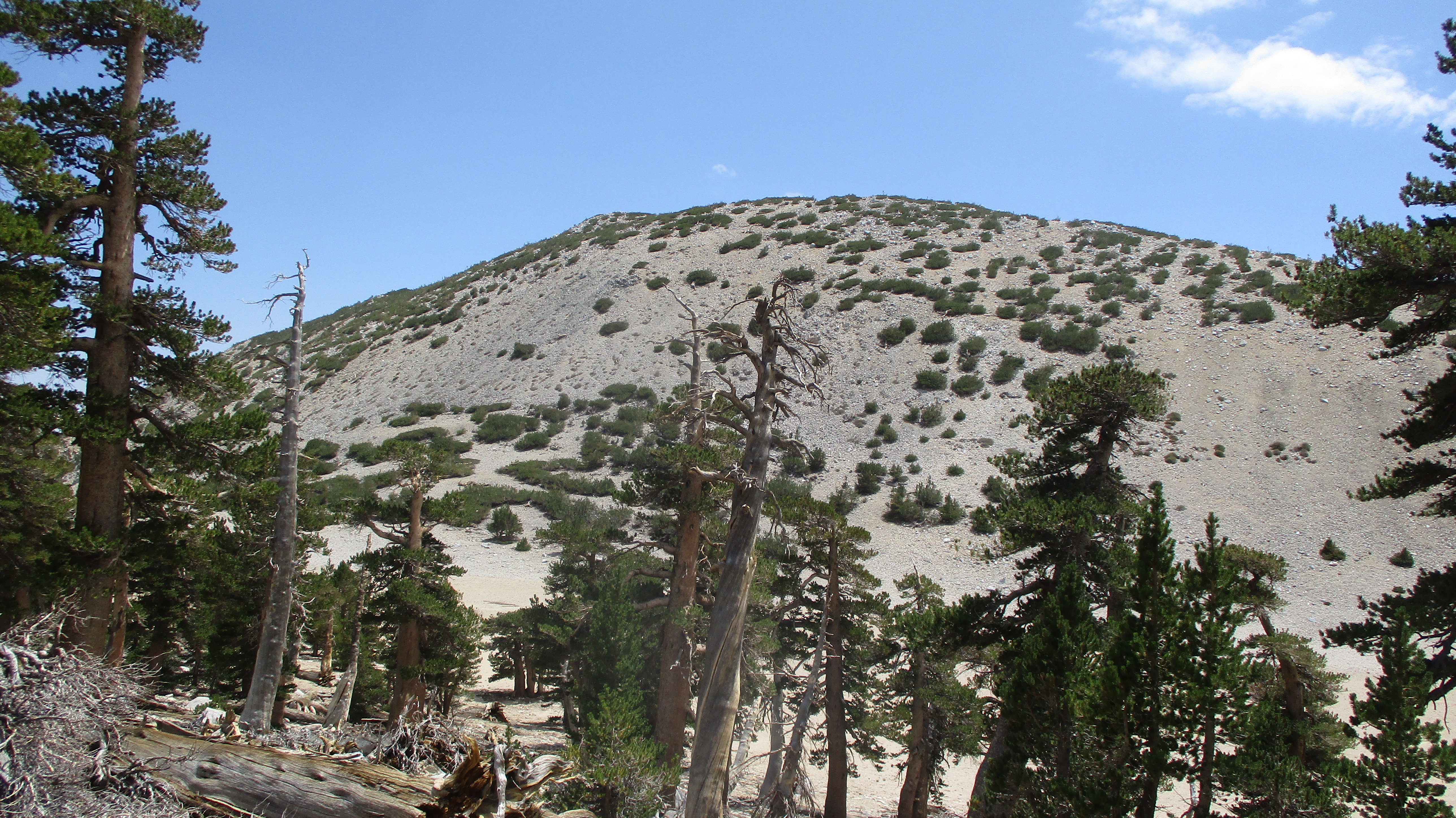
The trail was in better shape than the last time I was here. The first couple of miles don't gain much until you start the switchbacks up the side of Grinnell. I was tempted to take a cross country route up the east ridge of Grinnell, but glad I didn't. It looked brushy and was steeper than it looked from a distance. At Fish Creek Saddle, I followed a use trail through open pine forest toward Grinnell. The use trail faded at the top. The summit area was flat and long. The Garmin map had the summit marked, but I didn't find anything there. I wandered back and forth checking each 10' mound of dirt looking for the high point. The GPS track showed that I stumbled over the official summit on the north end, but it was anti-climactic. Views from Grinnell were blocked by tall trees. I found no register or marks. There was a great view of Gorgonio heading back to the trail. I stayed on the Fish Creek Trail toward San Gorgonio, walking in the shadow of Lake Peak.


At Mine Shaft Saddle, I began the long climb up tight switchbacks on the northeast flank of San Gorgonio. Not far up the switchbacks, I found the C-47 crash memorial. Debris sat just off the trail and more was scattered in the gully below. For some reason, I thought I could leave the trail around 10500' to head to Bighorn, but instead I had to climb to over 11000' on the Sky High Trail before reaching a drop point. Across from the Bighorn high point, I left the trail down a steep slope and waded through knee high ground cover. I headed directly for the summit up the 50 degree talus, a mistake that became obvious immediately. After sliding back a few times, I aimed for anything solid. A dead tree, a big rock, brush. Anything that allowed upward progress. I struggled to the bouldery summit and found a register in an ammo box. Many registers in the SB Mountains have been destroyed, but Bighorn was probably too hard for vandals to reach. The small book was placed in 2017 and was about 1/3 full. Awesome 360 views were the reward for my sweat. The views were arguably better than from San G itself, since the bulk of San G blocks some of its own summit views.


When I left the summit, I followed a use trail to the lower end of the ridge. This was the way. I also found a brush free ascent line back to the trail. I strongly recommend my exit lines and not my approach. No need to make Bighorn harder than it is. On the way down, Zahniser looked like a small knob. It's only a 120' gain from the saddle. I went over the top where I found a smashed and empty ammo box. Vandals. No marks had been placed on Zahniser. I descended the other side to intersect the trail. The rest of the return was uneventful. Aside from a few deer and ground squirrels, I didn't see much wildlife. Surprisingly, I never saw another person, and didn't see or hear anyone on San G. It felt like I had the entire range to myself.


Yes! Congrats Tekewin, i know BH has been on your radar (and mine) for some time...i was thinking i might just beat you to it--not! Good work on collecting the additional two 10ks, stoked for ya!
ReplyDeleteGloop,
DeleteThanks, I wasn't going to miss it this summer. I'm not really chasing the Hundred Peaks List but now I've got all 19 HPS 10K peaks. And all 25 USGS 10K peaks in SoCal, which was a goal.
What peak are you looking at about 25 seconds into the video?
ReplyDeleteMike M
Mike,
DeleteThe peak directly ahead is a continuation of the Bighorn ridge. The ridge to the left is 10K ridge and the closest one to the right is Snow Peak.
Did Grinnell and Lake yesterday. It was amazing how few people were out there given the millions in the flats down below. I've been wanting to do bighorn, but am wondering if it might be a shorter trek from Vivan creek or even south fork. Why did you choose fish creek?
ReplyDeleteJoe,
DeleteThe main reason I started from Fish Creek is so I could get Grinnell on the way. I think it's about the same distance from all three trailheads. Vivian might be a little closer, and might save some driving, but adds about 1000' of gain.