Distance: 14.2 miles round trip on trail
Summit Elevation: 11209'
Elevation Gain: 4251'
Elevation Gain (in Empire State Buildings): 3.4
Round trip time: 8 hours
Recommended water: 164 oz.
Parking/Fees: $30/car National Park Fee (good for one week)
Difficulty: Strenuous
Alta Peak is one of the popular high sierra peaks in Sequoia National Forest (SPS #200). Leisa and I picked up a couple of sandwiches from Sierra Subs in Three Rivers the previous day. We spent the night in Buckeye Tree Lodge, right outside the park entrance. We drove to Wolverton Trailhead and started hiking around 6:45 AM. The weather was perfect, mid-50s and sunny most of the day. The first three miles of the hike were shaded by large trees. The trail was in perfect condition and well signed. We climbed up to Panther Gap, then took the Alta Trail. At the gap, views started to open up to the Mineral King peaks. The only ones I recognized were Castle Rocks and Ampitheater Dome. The rest were unknown granite spires. The Alta Trail started out mild with the gain spread out until Alta Meadow. What became clear was the final two miles were going to be difficult. The final two miles gain 2000' to the summit, about the same amount of gain as the first five miles to Alta Meadow.
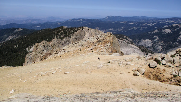
We cached some water at the Alta Meadow junction, lightening our packs before the push upward. The trail was noticably steeper. It switchbacked below Tharps Rock, eventually coming back north of it. At this point, we were out of the tree line. Only a few hardy bristlecone pines made a living at this elevation. A few hundred feet higher, there was no vegetation at all. Above the tree line, we were hit with steady 5-15 mph winds. We met a few hikers coming down from the summit and we could see two hikers on the summit 400' above. The final push took extra effort, but we rolled up below the summit block as the two hikers were on their way down.
A ramp in front of the 30' summit block got us close enough for a couple of class two moves to reach the top. The summit was a slab angled down at 30 degrees. On the other side of the slab was a long vertical drop. The register was in an ammo box at the top of the slab. Leisa climbed up ahead of me and we both signed the register. A reference mark was by the register, but the benchmark was on a ledge on the risky side of the summit. I climbed down 4' onto the ledge to snap a photo of the benchmark. I'm not sure everyone finds it. Because of the wind, we climbed down from the summit and located shelter in a nearby boulder pile for lunch. We enjoyed taking in the Sequoia and Mineral King vistas. After more photos, we started down, taking advantage of gravity. We took many breaks on the way up, but only one on the way down. Below Panther Gap, we met a friendly doe who came up the trail within 10' of us. We backed off the trail to give it space, then it stepped to the side to graze. It was clearly comfortable with people. We got back to the car with a round trip time of 8 hours. I had over 48 oz of water left, a rare overestimate of my water needs due to the shade and cool temps. 5 hours up, 3 hours down. Leisa really impressed me with her performance today at high altitude.
Tried to shepherd it off the road but it got defensive.


Nice trip. That's been on my radar for awhile now. I've been out to Heather Lake and have taken the HST from Crescent Meadow to Hamilton Lakes, but haven't yet made this trek. Looks cool.
ReplyDeleteMadison,
DeleteWe were debating whether to hike to the lakes or Alta. Sounds like you know the area better than I do. I haven't heard of most of the big mountains in this part of the Sierra. Great hike, though, recommended!