Distance: 7.6 miles round trip on trail and cross country
Summit Elevation: 3520' (Eagle Rock), 3348' (Seek)
Elevation Gain: 985'
Elevation Gain (in Empire State Buildings): 0.7
Round trip time: 2 hours 45 minutes
Recommended water: 48 oz.
Parking/Fees: Free at Warner Springs Community Center
Difficulty: Easy
With rain threatening half the state, I looked for a shorter hike and settled on Eagle Rock and Seek Benchmark. Eagle Rock is an interesting feature along the PCT in San Diego County. I parked at the Warner Springs Community Center where a big "Welcome PCT Hikers" banner was on display. I followed the trail through three metal gates along a smooth trail next to a creek. I passed thru hikers about every 10 minutes, all looking strong at this stage of their journey. There was very little gain on the way, with only gentle ups and downs. Spring growth was raging with high green grass under the large oaks. Further along, the trail left the creek and desert manzanita and sparse brush took over. From afar, Eagle Rock looks like any random pile of boulders. However, when you reach the northeast side, they take the form of a giant eagle. I set my camera up for a shot, but nearly cut off the top. I'm such an amateur photographer. I climbed up the right shoulder to get a shot riding it, Lord of the Rings style. The trip to Eagle Rock took a little over an hour, and since my luck was holding out with the rain, I headed back intent on finding the Seek Benchmark.


Approaching the Eagle Rock formation


Fly like an eagle


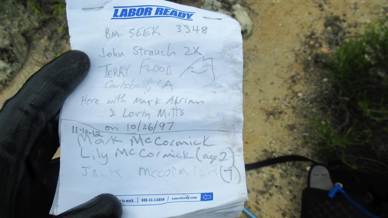
Seek Benchmark appeared to be only a quarter mile off trail. It started through deep grass that thinned out almost immediately. I was surprised to find footprints in the sand and some good animal trails heading sort of in the right direction. On the first low ridge, I followed a firebreak too far and had to come back and cross another field of deep grass. Foxtails were a minor annoyance as I waded through the grass. It soon became a GPS exercise and I am not sure I would have found Seek on the next low ridge without it. Reference mark number 1 was almost on top of the triangulation mark, a metal pole, and a register in yellow cans. The register was placed in 1997 but only three pages had been filled. I took a picture of all the pages. Another seldom visited point. Eric Newcomb was the last one to visit in April. Following a short break, I worked my way back to the trail. With little elevation change and no major obstacles, it was enjoyable, and probably the easiest hike I've done all year.

Leaving the trail towards Seek


Looking back toward the trail and Hot Springs Mountain lost in the clouds


Horses are allowed on trail, but not bikes


No comments:
Post a Comment