Distance: 2 miles round trip on trail (combined)
Summit Elevation: 4530'
Elevation Gain: 450'
Elevation Gain (in Empire State Buildings): 0.36
Round trip time: 1 hour
Recommended water: 16 oz.
Parking/Fees: $7/adult, $4/child Arizona State Parks
Difficulty: Easy
Tonto Natural Bridge is an Arizona State Park near Pine, AZ. There are a number of trails that lead to viewpoints and down to the entry on both sides of the giant oval tunnel under the bridge. All four viewpoints are above the feature but much better views are available below. At first, we took the trail down from viewpoints #3 and #4. We scrambled over very slick rocks to the center of the tunnel where water dripped steadily from above. Then, we went to the other side of the parking lot for viewpoints #1 and #2. The Anna Mae trail heads down to the other side of the tunnel where the views were even better. Also, the rocks on that side were less slick. Then, we continued upstream on the Pine Creek trail, which was fun and undeveloped in parts, eventually climbing back out to the parking lot. I highly recommend the loop down Anna Mae to the natural bridge and back on Pine Creek trail or reverse. Skip the very short Waterfall Trail. It led to a moss covered wall with water trickling over it, not even worthy of a photo. The Tonto Natural Bridge is a fun area, but the entrance fees are steep. We shelled out $25 for our family of four.
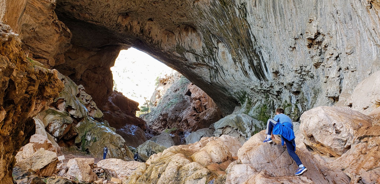
Parker scrambling into one entrance

Shelby and Leisa inside the tunnel


Parker at the other entrance


A small hole in the top of the bridge
No comments:
Post a Comment