Distance: 2 miles round trip cross country
Elevation: 2295'
Elevation Gain: 1012'
Elevation Gain (in Empire State Buildings): 0.81
Round trip time: 1 hour 45 minutes
Recommended water: 32 oz.
Parking/Fees: Free on South Indian Valley Road
Difficulty: Easy
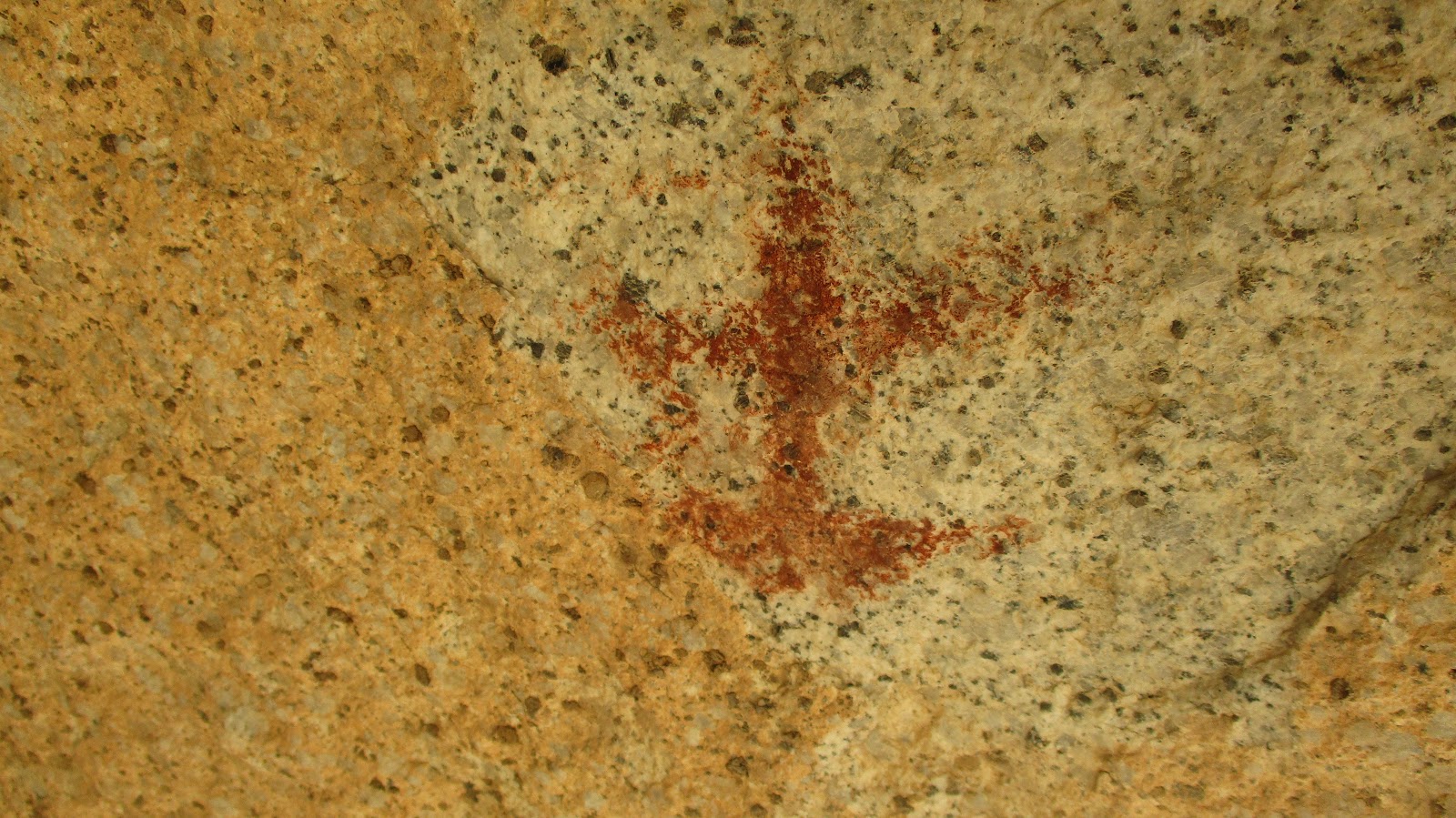
Solstice Cave is a sacred site of Native American pictographs in the Anza-Borrego desert. The pictographs are mainly variations of the sun. To preserve the artifacts, it's exact location is not mine to divulge, but with a little research, many people have been able to figure out it's location. The hike is a cross country desert scramble. There were fragments of human and animal use trails along the way. Because of the terrain, it is possible to be within 50' of it and miss the cave entirely. I walked by it initially, then hunted around what looked like the right area. The cave itself is about 25' deep, created by piles of giant boulders. There were two smaller openings in the back. The pictographs remain bright on the rock, though they must be hundreds of years old. After only a few minutes in the cave, an overwhelming feeling of tranquility washed over me. Earthpower is strong here. I don't know if it was shelter from the heat, my mind playing tricks on me, or salve for the bruise on my soul at the fate of Native Americans. In any case, it was unexpected and I didn't want to leave. I eventually gathered myself and started back. On the drive out, I spotted two immaculate bighorn rams just off the road. They weren't very concerned about me. One was busy crashing his head into a barrel cactus. He did this to open up the top to get at the juicy flesh. I watched him knock a chunk out of it, then eat it. The inside of a cactus is one place to get water in the desert. Special thanks to Ben Baumann for suggesting this hike.

Sombrero Peak in golden light

Early in the canyon

Solstice cave

Red and orange pigments in this pictograph


Bighorn, deer, coyote?


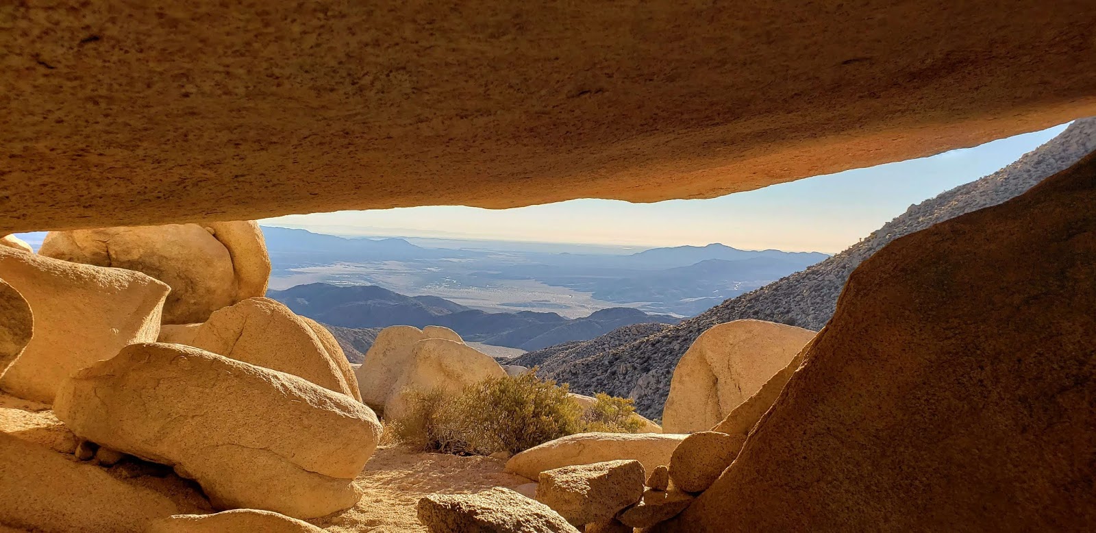
View from inside

Jack rabbit


Bighorn rams


great video!
ReplyDeleteUnknown,
DeleteThanks! I had no idea they ate cactus that way. Amazing animals.
Hi Tekewin
ReplyDeleteGreat post! I have a couple of questions if you wouldn’t mind answering. From the fork in the road, how far of a hike would you say it is to the cave?
Unknown,
DeleteI'm not in a position to give out the exact location. All I can say is it's about a mile up the gully. You want to start at the trailhead for Sombrero Peak. If you are talking about the fork where Indian Gorge splits into North and South Indian Canyon Road, it would add a couple of miles each way. However, if your vehicle can make it to the fork, it can make it to the trailhead at the end of South Indian Canyon Road.
Do you have an email I could send information to?
ReplyDeletetekewin at gmail.com
Delete