Distance: 15.6 miles round trip on trail and cross country
Summit Elevation: 3394' (high point above Devil Gulch)
Elevation Gain: 2700'
Elevation Gain (in Empire State Buildings): 2.16
Round trip time: 9 hours 30 minutes
Recommended water: 172 oz.
Parking/Fees: Adventure Pass
Difficulty: Strenuous
Dima and I made an attempt on Devil Gulch in the ANF. The gulch feeds the San Gabriel River and has three waterfalls in the lower half documented by canyoneers. The upper half was a complete mystery. It's a wild canyon in a rough neighborhood. Our ultimate goal was to follow the gulch to its source at the northwest ridge of Rattlesnake Peak, climb Rattlesnake and descend to Shoemaker Road. The effort fell far short, but we got some redemption by finding the Horseshoe Annex Mine on the way back.
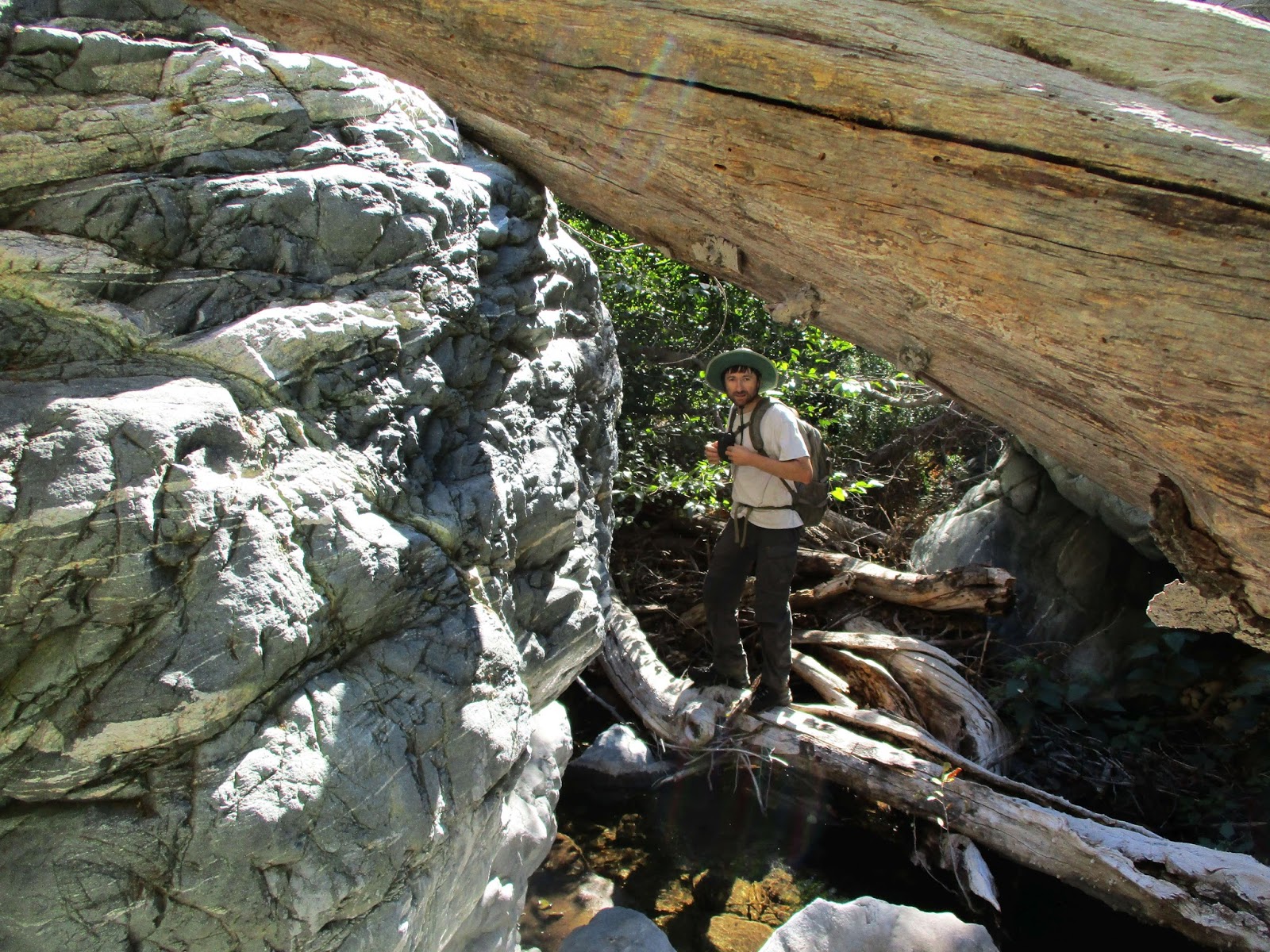
We met at Shoemaker and shuttled to Heaton Flat, getting on the Bridge to Nowhere trail around 5:30 AM. The river had a strong flow. We completed the five-odd crossings and reached the use trail to the river just after daylight. The use trail down to the San Gabriel River was in great shape. We turned down river and headed for the start of the long abandoned PL&P trail. Dima had scouted parts of the trail a month earlier and we wanted to take it as far as possible up the gulch to bypass the known waterfalls. We diverted slightly at the start so I could check out the old PL&P sign he found on the first trip, then we followed it up and over the ridge into the gulch. Once inside the gulch, the trail got increasingly faint but we could still barely make out the cuts from a distance. It was sketchy and loose several hundred feet above the canyon. Quickly, we ran into a ravine that stopped our progress. Faint cuts were visible in the next cliff but getting there was a problem. Dima scouted above for any continuation or some kind of access not visible from below, but didn't see anything. We debated dropping a few hundred feet down a scree slope and trying to get back up to it across the ravine, but decided to just take the scree slope into the gulch and start up from there. I dropped down the scree and Dima left a big gap between us to avoid knocking rocks down on me. We entered at a small waterfall and it was at once both beautiful and terrible. Thick, healthy trees grew in the gulch, but the ground was filled with decayed trees, boulders, leaves, and water. There was more water than I expected flowing gently toward the river. The decayed trees were so rotten that even 2' diameter logs would not support my weight. We fought slowly upstream until we hit the second major waterfall as described in the canyoneering report. It was a 20' fall with a long, deep pool below it. We followed a side wash on the left, then did some light class 3 on loose dirt/rock to bypass the waterfall. I had hoped we could average slightly less than 1 mph in the canyon, but it was closer to 1/2 mph. Looking upstream, I did the calculus of our rate plus the odds of running into a waterfall we could not bypass and suggested we turn around. Dima would have continued, but agreed to head back. We decided to follow the gulch out instead of try to scramble up the scree slope to the PL&P.

Devil Gulch from the Bridge to Nowhere trail

Use trail to San Gabriel River

One of ten river crossings

PL and P trail sign

Sketchy trail

Bridge to nowhere from PL and P

Devil Gulch from the PL and P

Descending the scree

Dima on the way down

Welcome to the jungle

Pool below the 2nd waterfall


Above the 2nd fall, turnaround point
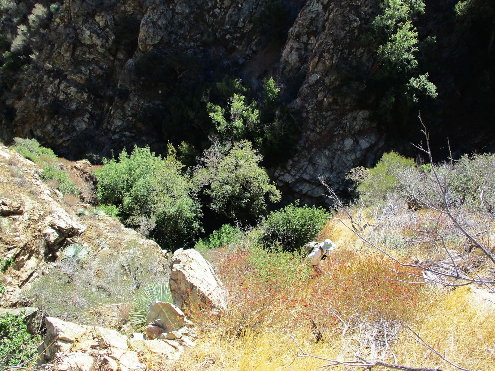
The descent was as slow as the ascent and it took us over an hour to reach two-tiered Devil Gulch Falls, 15' for the upper tier and 60' for the lower. Dima recalled a fixed rope bypass nearby, but we couldn't find it. We backtracked to the first steep gully that looked climbable and started up. It was a mix of class 2/3 dirt and crumbling rock with some cactus and dead shrubs to keep it interesting. Half way up, Dima scouted right for the bypass with no luck. I continued left to reach the spine of the gully, following it over the top to get around Devil Gulch Falls. We descended more or less straight down on animal trails. We passed cabin ruins near point 2612', then followed the river up a bit, searching the north wall for the Horseshoe Annex Mine. Eventually, we stumbled on a thick cable and a cairn that marked a use trail to the mine. The adit was behind a large tree. We dropped our packs, unpacked our lights and headed inside. At the entrance, we found sheep bones and continued slowly, announcing our presence with "Hello, Mr. Mountain Lion". Hearing no reply, we proceeded deeper into the main tunnel. We passed other tunnels branching left and right, stopping more than 100' deep into the main tunnel where we had to crawl to continue. Overall, the main tunnel of the mine was in good shape. Finding the mine was a balm on the cuts and bruises from dancing with Devil Gulch. Based on this trip, I would guess a full ascent over Rattlesnake would take at least 15 hours. The upper half of the gulch remains a mystery.

Heading down the gulch

Dead end at the top of Devil Gulch Falls
Escape gully

Devil Gulch Falls from above

Back in the river

Entrance to Horseshoe Annex Mine

Bones

Inside the mine
Raw mine video, Blair Witch style


Other Reports:
Devil Gulch (Ropewiki)
Looks like a real adventure! Great photos as usual.
ReplyDeleteJoseph,
DeleteIt was great fun but left some marks. My point and shoot camera is a little better after breaking my last one on North Iron.