Hiked: 9/28/2014
Distance: 10.5 miles round trip on trail and cross country (estimated from topo)
Summit Elevation: 10834' (San Jacinto Peak), 10670' (Jean), 10480' (Folly), 10400' (Miller)
Prominence: 8319' (San Jacinto Peak)
Elevation Gain: 3500' (estimated from topo)
Elevation Gain (in Empire State Buildings): 2.80
Round trip time: 8 hours 50 minutes
Recommended water: 168 oz.
Parking/Fees: Parking is free, Aerial Tramway ticket $24
Difficulty: Strenuous
There are seven named summits over 10000' in elevation in the San Jacinto Mountains (counting the unofficial Shirley Peak). Summiting all seven in a single day hike from Mountain Station was proposed in July, 2013, by Hikin' Jim, who included a suggested route. The route is mostly off trail, requiring a lot of route finding and bouldering. Sean, Madison, and I set out to tackle the seven summits, but for a number of reasons, returned with only four.
We met at the Aerial Tramway and took the first tram to Mountain Station where it was a crisp 45F. After the short stop for a permit, we started down the trail. When we got about a mile down the trail, we reached the Round Valley sign where we left the trail to head up the drainage. We didn't find the use trail on up the right side of the drainage until we were on the way back, so we followed the actual drainage. It wasn't really difficult, but it was slow getting around obstacles. We followed the wrong fork and made a course correction based on my GPS. While traversing back to the right drainage, I lost the GPS. Fifteen or twenty minutes of searching proved fruitless, so we marked the spot in the drainage for another search on the way back. Now, we relied solely on maps. Soon after, we ran into Tamarack Valley campground and trail. At a three-way junction, we took the branch that followed the drainage and eventually, Miller came into view. The trail faded away in spots but we headed in the direction of the Jean saddle looking for the main trail. After picking our way through manzanita, we got the main trail and finally reached the Miller summit. We only stayed a couple of minutes before finding the east use trail to San Jacinto.

The drainage where we left the trail

Sean and Madison

Super fungus

Tamarack Valley

Three-way junction on Tamarack trail, we turned right to continue following the drainage

Cornell Peak (I think), not on our list today

Sean navigating through the valley

Miller Peak

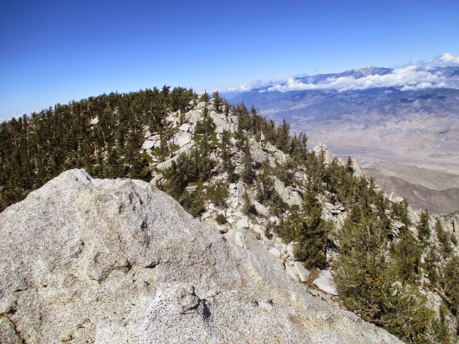
View from Miller
The east ridge trail to San Jacinto was pretty gentle and in good shape. There were two other hikers at the summit that left after we arrived. We took some photos and grabbed some snacks while Sean drank a beer. When he mentioned he had brought a beer on the tram, I had thought he was joking, but here it was. The wind on San Jacinto was a steady 20mph and that dropped the chill to something uncomfortable. I had gloves for bushwhacking, not warmth, and my hands were frozen, despite some chemical warmers. With potentially five summits to go, this was very concerning. We started down the ridge toward Folly and the wind was brutal, so we dropped down on the south side a little. About half way to Folly, we picked up a use trail along the ridge. Most of the trip from San Jacinto was scrmabley boulder fun. I spent a total of 30 seconds on the Folly summit before moving down out of the wind. Sean signed the register and we all studied the map for the best way to get to Newton-Drury. On the approach to Folly, I had been blowing on my hands to warm up my fingers and continued to do so as we side hilled. This led to me to hyperventilate and when combined with not eating and drinking enough left me with with some mild AMS. The headache and nausea was enough for me to abort the ambitious seven summit plan. Madison was nursing a bruised left foot and also planned to head back. This left Sean in a lurch, and he didn't want to continue alone. I forced myself to eat and drink as much as I could and Sean offered an ibuprofen, all of which eventually helped.
We retreated along Deer Springs Trail up to the Jean-San Jacinto saddle. Sean and Madison were up for hitting Jean, and by then, I had recovered enough so we left the trail again for Jean. Most of the obstacles were below the peak and the final approach to the summit was a walk up. We climbed the summit boulder and signed the register and took our final food break. Shirley and Marion Mountain were in clear view from Jean, but appeared to be too much for today. We went back to the saddle, down the main trail, then left the trail again to return along the drainage. We had some route finding problems getting through the manzanita, but eventually found the Tamarack trail. We found a use trail on the north side of the drainage that would have made it much easier on the way up. I was surprised that we found the cairns in the drainage we built on the way up. Another fruitless search for the lost GPS chewed up more time before we gave up and headed home. I was quite disappointed with my performance on the day, but glad to have learned some of San Jacinto's secrets.

San Jacinto summit looking down to Folly Peak

Sean and Madison on the San Jacinto summit

Three amigos

Sean downing his beer
Approaching Folly Peak

Looking back at San Jacinto from Folly Peak

Fuller Ridge from Folly Peak

Jean Peak from the main trail

Marion Mountain from Jean Peak

On the summit block of Jean Peak

Twisted tree near the Jean summit

San Jacinto from Jean Peak
No comments:
Post a Comment