Distance: 25.7 miles one way on trail (Bright Angel to North Rim Lodge)
Summit Elevation: 6850' (South Rim), 2400' (Colorado River), 8300' (North Rim)
Elevation Gain: 6105'
Elevation Gain (in Empire State Buildings): 4.88
One way trip time: 12 hours 7 minutes
Recommended water: 290 oz. (water available along the trail)
Parking/Fees: $25 National Parks (one week pass)
Difficulty: Very Strenuous
Considered one of the seven natural wonders of the world, the Grand Canyon is unique. The gorge is 277 miles long, up to 18 miles wide, and over 6000' deep in places. Some consider day hiking across the canyon the mother of all hikes in the US. The entire trip is one awe inspiring view, almost to the point of visual overload. It is also a challenge and quite dangerous due to the heat. Park rangers discourage people from attempting to hike down to the Colorado River and back in one day, much less rim to rim. Nevertheless, scores of people complete the hike safely and ultra marathoners even go across and back again, rim to rim to rim. A quick note on distance. The rim to rim distance from South Kaibab to North Kaibab is about 21 miles, from Bright Angel to North Kaibab is 23.9 miles, and from Bright Angel to the North Rim Lodge, the end of our hike, was 25.7 miles.
Rod and I drove up the night before and spent the night in the Thunderbird Lodge on the South Rim. On the way into the park, we passed a herd of elk grazing just off the road. After checking in, we took some shots from the south rim and the start of the Bright Angel trail. The south rim was packed with tourists as expected.

Elk in the south rim forest (day before the hike)

View looking north (day before the hike)


Bright Angel Trailhead (day before the hike)

Start of Bright Angel trail and first tunnel (day before the hike)
Because of the heat, we wanted to get an early start to try to be past "The Box", the hottest part of the inner gorge, before noon. The forecast called for a high of 104F at Phantom Ranch, meaning the inner gorge would be in the 110F range. We didn't choose the shortest possible path, either, descending the Bright Angel Trail, then up North Kaibab. Our original plan was to start at 4:30 AM, but after stopping in Needles on the way up and getting hit with a 108F blast wave, we moved the start time back to 4:00 AM. We could see a few bobbing lights down in the canyon from other early hikers. Making great time down, we hit Indian Garden in about two hours. Most of the hikers we passed were going up.

Descending in the dark
Trans-canyon pipeline taking water to the south rim

Sunrise on the south rim

Indian Garden

Caution: stunts performed by professional hikers on a closed course. Do not attempt.

Deer just past Indian Garden
We still had good shade from the canyon descending the Devil's Corkscrew switchbacks. At the bottom of the switchbacks, we found a benchmark at 2781' reading "Datum Canyon". In a short time, we arrived at the Colorado River, deep and green. As we approached the Bright Angel Bridge (aka silver bridge), we spotted a couple of rafts passing underneath. The silver bridge is only for hikers, but also supports the trans-canyon water pipeline. We continued to Phantom Ranch, arriving in just under four hours, and four minutes before the store opened. Here we met the first couple of other rim to rim hikers, also going south to north. The older of the two said they had started at 3:00 AM and lectured us on our late start. I found that amusing since we passed them shortly after and never saw them again. We refilled our water and browsed through the store. Rod mailed some postcards to be delivered by USPS mule, and we ate "lunch" in the early morning. We also taped some hot spots on our feet before setting out again.

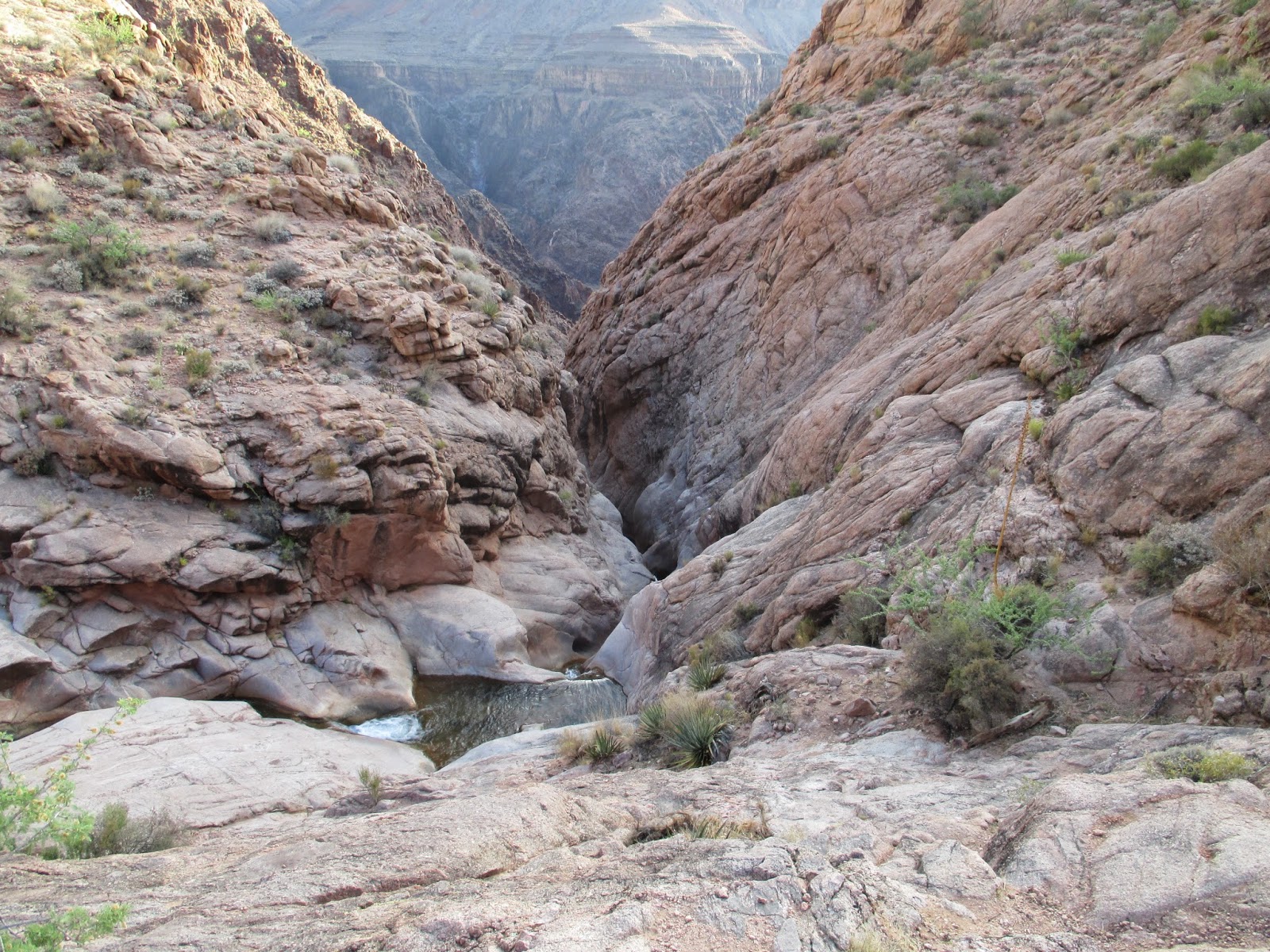
Side canyon within the canyon

Below Indian Garden


Devil's Corkscrew

Benchmark at 2781' reading "Datum Canyon"

River lizard

Colorado River, deep and green

Long distance dedication at the bottom of the canyon


Bright Angel Bridge (silver bridge)

Break on through to the other side

Phantom Ranch store
As we entered The Box, the temperature was hovering just under 100F and we still has some shade from the high canyon walls. The six mile stretch from Phantom Ranch to Cottonwood campground is the longest section of trail with no amenities. Still, we never needed to filter water from the stream. We passed more groups of hikers, all of them coming down from the north, and also spotted more deer. We took the splinter trail toward Ribbon Falls, then promptly lost it in the brush along the stream. We scrambled back up to the North Kaibab trail and from higher ground saw where we made the mistake. We could also see the falls from higher up and decided to skip the side trip since we were both starting to feel the distance and heat. Our next stop was Cottonwood Campground with the worst maintained, fly filled restrooms in the canyon. It did have fresh water, but I only filled my bladder half way trying to stay light for the climb out. We met another couple of south to north rim to rim hikers at Cottonwood, a couple of Green Berets, who started two hours after we did and caught us. They introduced themselves as Cab and Mike. Cab was an ultra marathoner who talked his buddy into doing this "fun" hike over the weekend. While they rested, we pressed on toward Roaring Springs.

North Kaibab trail

Inner gorge


More deer, deep in the canyon

More gorge

Rod under a shaded overhang

Hillers Butte (left) and Clement Powell Butte (right)

Ribbon Falls


Cottonwood Campground
The heat rose over 100F past Cottonwood under full exposure to the sun. The elevation angle picked up, too, as we climbed past Roaring Springs. As we made progress up the north rim, we both had some blistering and Rod starting having a few leg cramps. We had both been taking sodium/potassium supplements since Phantom Ranch, but probably not enough. With shade scarce, we started taking more frequent breaks. On a steep set of switchbacks, Cab caught up with us again and sprinted past, trying to break the 10 hour mark. He said Mike was some distance behind but had plenty of water and food. We spotted Mike far below and he never caught up to us, having some kind of knee injury that slowed him down. 10 hours 40 minutes into the hike, thinking we had less than two miles to go, I told Rod I wanted to break the 12 hour mark. He supported my attempt so I picked up the pace. The heat was still high, but started to break at 6800'. My faster pace meant I was consuming more water, and now I regretted having only filled up half way at Cottonwood. I went through the Supai Tunnel and quickly filled an empty 20oz Gatorade bottle at the last available rest station. I was watching my elevation and time closely past Coconino Overlook. I had a good idea of how much gain was left, but not distance. I could not muster a final sprint at the end and finished in 12 hours 7 minutes. At the north rim, I found Cab, who also did not hit his mark, but completed the trip in 10 hours 25 minutes. A few minutes later, Rod made it to the top, then we waited a few more minutes for Mike. The bad news for south to north rim hikers is the North Lodge is another 1.8 miles away. Rod and Mike got a lift from a friendly couple with a car while Cab and I hiked the extra distance to the lodge. At check in, we got more bad news, as our room was a half mile from the main lodge. We were both exhausted and gave up plans for the bonus hike to Red Butte the next day. On the trans-canyon shuttle the next morning, we spotted some wild bison, elk, and more deer than we could count.

Near Roaring Springs


Dry falls

Hanging out in the dry falls

First view of the north rim

Looking back into canyon

Coconino Overlook

Pine forest on the north rim

North Kaibab trailhead on the north rim

North rim lodge

Looking back from the north rim to the south rim

Bison on the north rim (day after the hike)

Bison herd (day after the hike)
Rod made a great video of the adventure...
I made a choppy crappy video...
Special Considerations for hiking the Grand Canyon Rim to Rim
The two biggest obstacles on this hike are heat and logistics. The north rim is only open from June-October, limiting attempts to seasons when it is very hot in the inner gorge (usually >100F). You can go in either direction. There is about 1000' more elevation gain going south to north, but the North Kaibab Trail follows a stream so there is a constant supply of water.
Whatever direction you choose to go, you should arrange for lodging or a ride on the other side. It is about 200 miles to drive around the canyon. If you don't have a ride, commercial shuttle service is offered by two different companies. We used the Trans-canyon Shuttle, $85 one way (at the time) to get back the next morning.
Weather is always a factor in any big hike. July and August tend to have more storms, so I thought June was a better time. We had nice weather with no threat of rain or thunderstorms. During a storm, lightning is a risk and even though the canyon is deep, the rims are mountainous forests at high (>5000') elevation.
Other Trip Reports:
South Rim to North Rim: Day Hiking the Grand Canyon

Bright Angel to North Kaibab

Bright Angel to North Rim Lodge

Would you like to know more...?
Very informative and nice presentation.
ReplyDeleteThanks. antman3322. I hope it is useful to someone in a future rim to rim adventure.
DeleteWow! Sounds epic!
ReplyDeleteThanks for you advice and post on Mount Whitney.... I made it! http://hikinginsocal.blogspot.com/2014/06/mount-whitney-14508-via-main-trail.html
Joseph,
DeleteThe GC was great. Congratulations on summiting Mt. Whitney. A big accomplishment. Your photos are awesome with memories to treasure the rest of your life.
Amazing post! Your images are very helpful to gain more knowledge about Grand Canyon. You can get several other fun and adventures activities to do in the Grand Canyon Rafting Trips. Thanks for sharing such a beautiful post.
ReplyDeleteJasika,
DeleteGlad you liked the post. Rafting through would offer a different and cool perspective of the canyon. You could see parts that would be hard to see on foot. It's something I would consider in the future.
Fantastic Post. Thanks for sharing your experiences.
ReplyDeleteAjar,
DeleteOf course. If you haven't been there, I hope you get an opportunity.
Hi great reading your bllog
ReplyDeleteBrady,
DeleteThanks! I hope you find something useful.
I'd love to hike this trail someday.
ReplyDeleteMya,
DeleteAny time after May should be good weather. Remember, it's much hotter at the river than on the rim. If you didn't want to do it one go, there are three campgrounds along the trail.