Distance: 13 miles round trip on trail, use trail, and cross country
Summit Elevation: 6709' (Bobcat Knob), 7558' (Goodykoontz), 7760' (Pallett)
Elevation Gain: 4791'
Elevation Gain (in Empire State Buildings): 3.8
Round trip time: 9 hours
Recommended water: 128 oz.
Parking/Fees: Adventure Pass at Buckhorn Campground
Difficulty: Strenuous
Warm weather was ideal for a high country trip in the Angeles. I planned a loop starting on the Burkhart Trail to:
- Bobcat Knob
- Goodykoontz Peak
- Pallett Mountain
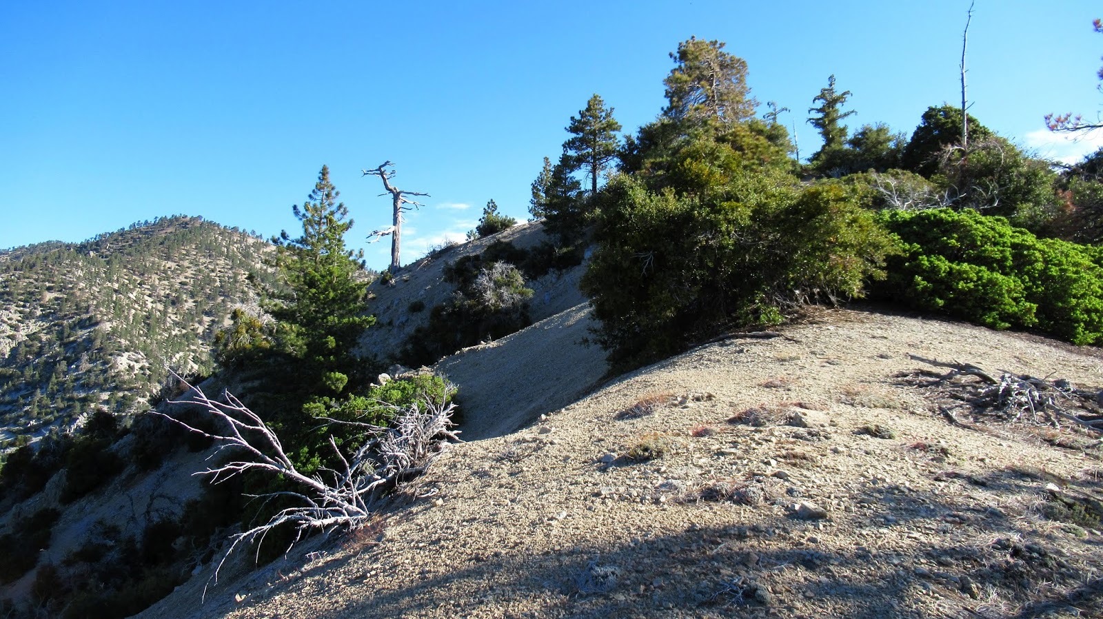
The grind to Bobcat Knob was pleasant with an occasional cairn for guidance. Interesting rock formations grew in the canyons on both sides. Bobcat was marked with a rock cairn, but no register. I took a few breaths, then got back to the grind toward Goodykoontz. This seemed like the steepest section of the entire hike, but maybe it just felt like it after climbing up to Bobcat first. A good use trail appeared on the ridge to Goodykoonntz and got better as I went along. I found register cans in between two small outcrops on the summit, no benchmarks. This mountain was named after Frank Goodykoontz who was an active leader in the Sierra Club. A memorial newsletter was in a separate plastic baggie inside the register. It was idyllic on the summit and I was tempted to just nap in the morning sun. But I had a lot on the itinerary, so fueled up and started down the other side in search of the C-119 plane crash.


Girthy!

Cooper Canyon waterfall
Approaching Bobcat Knob

Pallett from Bobcat Knob

Arriving on Goodykoontz


I dropped to the saddle between Goodykoontz and Williamson, then continued up toward Williamson. Along the way, I found a side use trail that headed toward the ridge with the plane crash. It was unexpected, but saved some gain and distance. The use trail continued along the south, then north side of the ridge and led right into the debris field on the north side. The C-119 apparently crashed near the top of the south ridge sending debris over the top. Most of the plane remained on the south side and large pieces have been washed down the side over time. I focused on the south side, descending about 200' down the slope. There were more parts farther down. There was another crash site farther down the north side, but I didn't explore it to conserve energy. The debris field was large. After some photos, I started back for Pallett with a few small aircraft pieces in tow.

Saddle between Pallett and Williamson

Landing gear?


Part of the tail?


Steep slope, much more debris downhill

I returned on the use trail until I was close to the creek below Pallett. I went straight down, crossed, and started up. I was surprised again to find a good use trail on Pallett. The trail led to the very long and wide summit plateau. I found what I thought was the high point, but no markers or register. Nothing to indicate the summit. I wandered all over the top looking for something that marked the high point, but didn't find anything. I continued down the other side to the Burkhart saddle, rejoining the official trail. I noticed how close Will Thrall was from the saddle and I was still feeling energetic. In the end I decided to skip it so I would have an excuse to come back for Will Thrall and Pleasant View Ridge. It is such a pristine area of forest. On the way out, I met a few hikers/campers. The climb out of Cooper Canyon was mild compared to the slopes I had been climbing all day and presented no challenge. I was pleased at how the hike unfolded and enjoyed every hour.

Pallett in front, Will Thrall behind left, and Pleasant View Ridge behind right


Pallett high point, but no markers or register


Burkhart Saddle

Goodkoontz left, Bobcat Knob right, from the trail


I always enjoy these epic write-ups!! I tried a climb to Bobcat and Goodykoontz in late June 2018 from the Burkhart. I tried 5 different spots at about 6,000' on the other side of the Cooper Canyon bottom, but I couldn't get a good foothold on the loose scree, and ended slipping on my rear each time! To get to Goodykoontz a week later, I hiked from Islip Saddle over all 3 Williamson bumps, Peak 8160, down a 900' slope to the connecting ridge over 7560 and Goodykoontz, with about 1,300' climbing on the way out. Epic but very draining!! Where is the best spot to leave the Burkhart trail to avoid the worst of the "quicksand" like scree and hoof it up to Bobcat?
ReplyDeleteUnknown,
DeleteI took the longest ridge to Bobcat that starts shortly after the Rattlesnake trail sign and junction. From the sign, the trail goes left and after the first right turn there is a small clearing. The ridge starts there. It is still steep and has loose scree, but is the least steep way up. I used some small trees as aid. A trekking pole also helps. If you have a GPS, you can download my track from peakbagger.com to find the precise spot.
Going from Islip Saddle is long but also a good option. I think it is the standard route to Goodykoontz.
Thanks! I still have unfinished business with Bobcat Knob!
ReplyDeleteBobcat is an out of the way bump but worth a visit.
DeleteWhy would you take wreckage home with you? Have you no respect for the deceased?
ReplyDeleteAnonymous,
DeleteThere was no disrespect. Bodies are retrieved from airplane crash sites, but debris is too heavy and expensive to remove. We don't leave wreckage from a fatal car crash spread out on the highway out of respect. The debris is litter in the forest and if I could carry it all out, I would.
False analogy. We remove debris from roads because cars need to drive the roads still. If you're trying to clean up the site then say so and organize a hike. Hell I might even show up and help. But "taking a few small pieces home" doesn't sound like that. It sounds like wanting a little wilderness souvenir. From a fatal wreck. Which is disrespectful.
ReplyDelete