Hiked: 5/24/2019
Distance: 21.5 miles round trip cross county, use trail, and trail
Summit Elevation: 6640' (Rabbit), 4853' (Zosel), 4485' (Crab), 2795' (Dawn)
Prominence: 1200' (Rabbit)
Elevation Gain: 7628'
Elevation Gain (in Empire State Buildings): 6.1
Round trip time: 20 hours
Recommended water: 254 oz.
Parking/Fees: Free on Fillmore Street
Difficulty: Very Strenuous
Henry and I had been discussing doing a big hike for months, looking for the right hike and an overlap in availability. We had tentatively agreed on the southwest ridge of Big Iron, but Henry was leaning toward Rabbit Peak by the Salton Sea. Rabbit had long been on my wish list, but was overshadowed by the San Diego List for the six years it took me to finish it. Rabbit is usually done as a two day backpack. Jerry Schad recommends that in his authoritative book. Of course, Henry and I were going to day hike it, and agreed to ascend the east ridge, a tough 18 mile route by itself. But "Hardcore Henry" pushed for a longer loop descending a ridge near Villager to pick up 3 additional benchmarks:
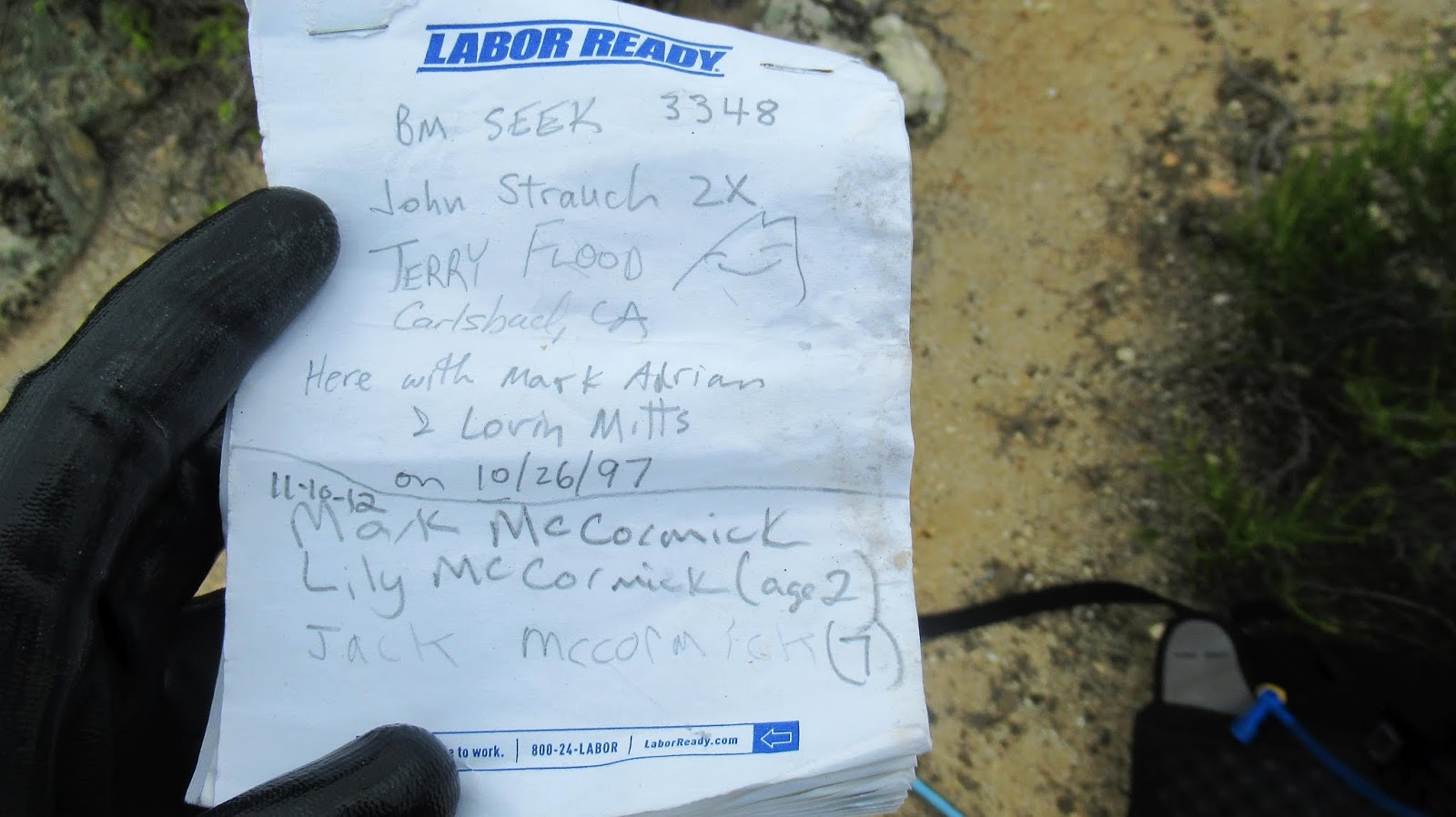
- Zosel BM
- Crab BM
- Dawn BM
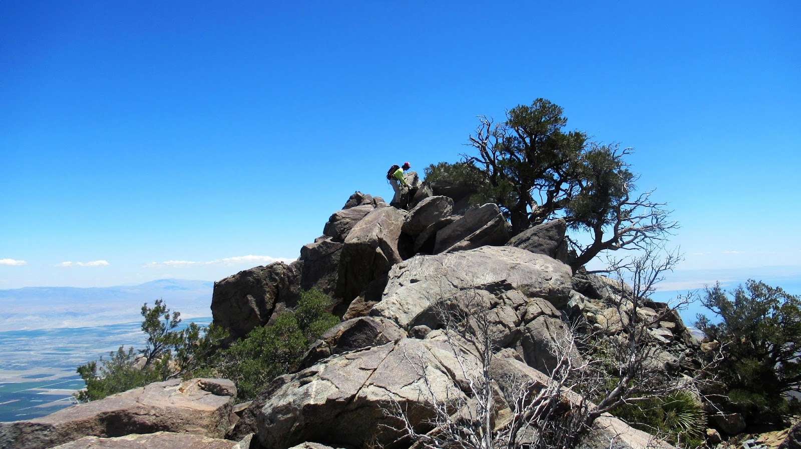
We marched out at 3:45 AM with headlamps and gibbous moonlight. After walking half a mile through lemon groves, we reached the "flat" desert approach to Rabbit. The flat part is about 3.3 miles in Barton Canyon. It is braided with washes and large rocks that make it slow and difficult. Some cairns were placed with white rocks that stand out at night easing part of the ordeal. After 90 minutes, the headlamps were no longer needed, but it took us a full 3 hours to get out of the canyon and start up the ridge. We found a decent use trail to gain the ridge crest that ended in a class 2 section below a flat area. At around 3300', we began 2000' of sustained and steep class 2. It was a long, grueling section of ridge. Above that was a short, brushy, class 3 traverse around a prominent outcrop. Henry ended up going over the top of it, while I scrambled around below. The final section was crossing a couple of false summits, arriving at the broad summit plateau. We found boulders that make up the apparent high point, but didn't find the HPS register there. Instead, we found it at another set of boulders not far away, but clearly not the high point. The view east down to the Salton Sea was blocked by trees and I had to move closer to the western side to see the great views into Clark Valley. It took us 7 hours to reach the summit, at least an hour more than expected. We spent another 30 minutes loitering and signing the register. Henry and I both thought the descent ridge we planned would be safer than returning down the east ridge. I had bars from Verizon, so I texted my wife that we would be later than expected not knowing that we had severely underestimated the time required for the descent ridge.


Rabbit in the golden hour from the boulder filled "flat" section of Barton Canyon

400' in 1/6 mile

Finishing up the easy part of the east ridge

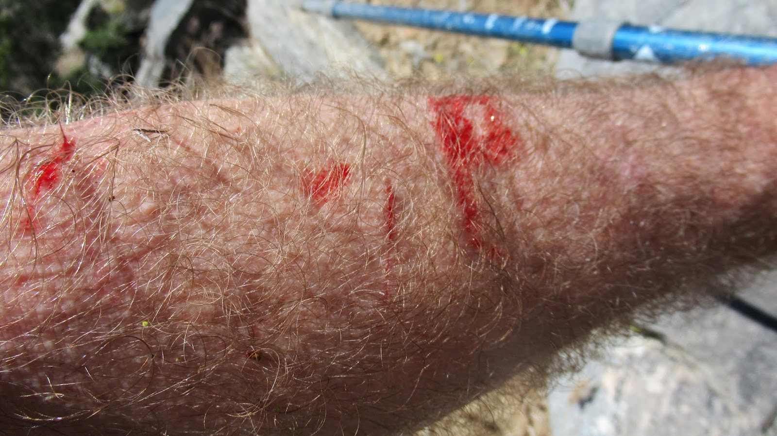
Lost a fight with catclaw


Scrambling up the class 3 section
Henry going over the top of the obstacle

Another false summit, but getting close


The HPS summit


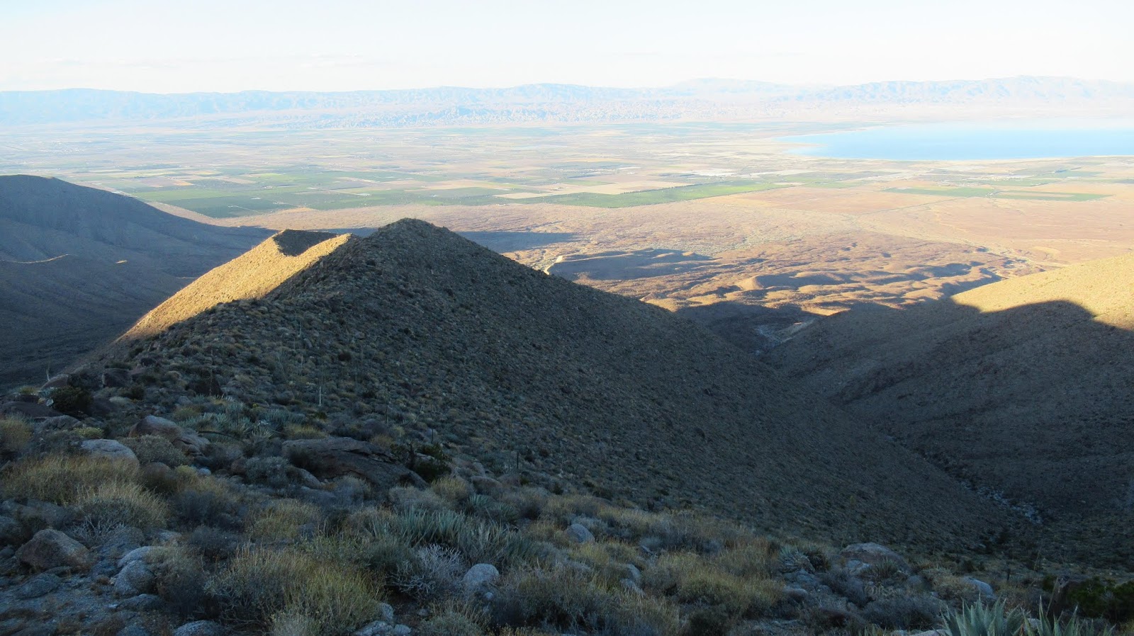
After fresh coats of sunscreen, we dropped 800' from Rabbit to the Santa Rosa ridge toward Villager. Views on this ridge are phenomenal. To reach the descent ridge, we endured 3 miles of undulating bumps, almost reaching Villager Peak. After climbing to Rabbit, these bumps were unwelcome. As we started down our descent ridge, we startled a quail with a dozen or so tiny hatch-lings. They scattered quickly, following their mom into hiding. The ridge was mostly open, unclogged with brush or other obstacles. A pleasant surprise. It wasn't as fast as a trail, but we made reasonable time moving down the gentle slope. I had loaded GPS waypoints making it easy to find Zosel benchmark, then Crab benchmark. Both had registers with few signatures, especially Crab with a register stuffed in a 35mm film canister. As the late afternoon daylight started to cast shadows, I wished the ridge was dropping faster. Half of the 5000' drop to Barton Canyon came at the end and we would end up doing it in the dark.

Toro about 13 miles away, looks like a Bob Ross painting


Coyote Mountain far below

Dropping onto the descent ridge

The east ridge of mighty Rabbit


The final benchmark we visited was Dawn. This is where I ran out of water, a consequence of misjudging the time required. Henry brought more than he needed (as he usually does) and shared some. He reminded me this wasn't the first time he had bailed me out and I acknowledged the dire straits I would have been in otherwise. We found no register at Dawn, but knowing what was ahead, unpacked our headlamps and hurried down as fast as we could. The setting sun was partially blocked by the Santa Rosa ridge, leaving us in a long, lingering twilight. We tried to get off the ridge before nightfall, but it didn't happen. Instead, we had about 2 miles of the steepest part of ridge left when it got dark. In the last gasps of light, a bighorn darted down the ridge below us, but it was too dark for a photo. Just after that, my headlamp fell off and broke open, spilling its 3 triple AAAs into the dirt. I was only able to find 2. No problem, I had a strong backup handheld flashlight and deployed it immediately. Meanwhile, Henry's phone had died trying to record our epic GPS track. Also, his rechargeable headlamp was toast from the early morning. No problem, he had a backup handheld light as well. So far, so good. The final drop off the ridge was very steep and both of us took short slides. We worked our way very slowly to the canyon, dropping in about a mile from our entry track. We worked our way back, dipping in and out of 20' gullies and stumbling over boulders. With a couple miles left, my flashlight went dark. No problem, I always pack spare batteries. Score one for battery operated devices. With one mile to go, Henry's rechargeable light went dim, but it managed to eek out weak illumination the rest of the way. We would have been seriously in trouble without light. We got back to the truck at 11:45 PM utterly pooped. It was a 13 hour descent from Rabbit and 20 hours truck to truck. Still technically a day hike, 20 hours from 3:45 AM to 11:45 PM! At the park and ride on the way back, Henry and I both took naps before driving the rest of the way home.

Still 3000' up, not dropping fast enough

Dawn before dusk

Here comes the night


Step count from phone is not accurate but shows almost continuous activity the whole day
Would you like to know more...?
See Also:
Estimated Energy to hike Rabbit East Ridge Loop