Distance: 4.2 miles round trip on use trail and cross country
Summit Elevation: 1795' (high point in canyon)
Elevation Gain: 850'
Elevation Gain (in Empire State Buildings): 0.68
Round trip time: 3 hours 45 minutes
Recommended water: 60 oz.
Parking/Fees: Adventure Pass
Difficulty: Moderate (terrain)
With an unplanned free day, I decided to check out Wildhorse Canyon in the San Mateo Wilderness. I had scouted a little of it last month. I drove to the Tenaja Falls trailhead, then started down the Tenaja Falls trail. I was looking for a use trail that went up Los Alamos Canyon. I had seen a use trail from the road and suspected it could be found early on the trail. I found it to the right of the first trail sign, directly across from the trail that goes to Fisherman's Camp. The use trail followed the right bank of the canyon a little ways, then crossed over. There are places it goes directly up the stream bed. With water flowing strongly, the crossings were fairly wet. It was only a half mile to mouth of Wildhorse Canyon. A somewhat overgrown use trail is right of the canyon and gets around the water dumping into Los Alamos. I continued up the canyon to the main waterfall and pool. I found what looked like a beaver dam at the main pool. I've read there are beavers in this part of the forest, but I've never seen any signs before. The wall looked far too orderly to have been random drainage. In addition to exploring upstream, I wanted to follow a north side canyon to a rock formation I had seen in satellite views. I decided to go upstream first.
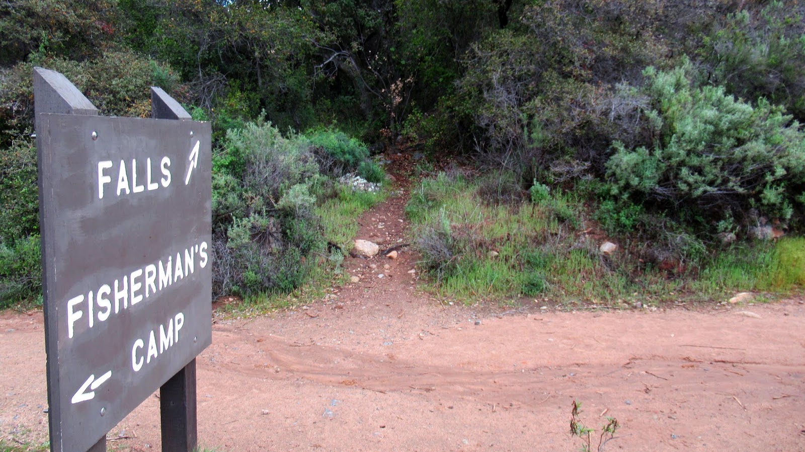
Use trail to Los Alamos directly across from the sign

Los Alamos pool, looked deep enough for jumping


Start of Wildhorse Canyon

Possible beaver dam below main waterfall

Main waterfall
Beyond the main fall, it was relatively easy going with light to moderate bushwhacking outside the stream. Not far up canyon, I found heavy poison oak. I powered through it and planned to wash off with dish soap as soon as I got home. Several crossings were required as I explored higher. None of the obstacles were tough, but it still required attention to navigate the canyon. The next thing I found was tubing from an illegal grow operation. It looked long abandoned. I kept going higher but the scenery did not change much. Lots of water flow and minor obstacles, but nothing major that would prevent further progress. After about 1.5 miles, I decided to head back and check out the north side canyon.

Upstream

Tubing from a grow operation

Where I turned around
Wildhorse Canyon runs generally north/south, but there are some curves east and west. At the first big eastern bend, the side canyon continues north up a steep gully. After some initial tall grass, it led to a 200' boulder pile. This was some fun boulder scrambling and one of tallest piles I've seen around the Santa Anas (technically Riverside County here). The veneer had worn off some of the boulders exposing clean granite. At the top of the pile, a gully continued toward peak 2588 but was covered in a carpet of poison oak. I started down, making one more stream crossing below the main fall. Once I was out, I crossed Los Alamos creek and took the road back to the car. There were some fresh monster boulders strewn across the road. It could be a couple more years before Los Alamos road is opened again.

Boulder pile in the north side canyon


Looking down canyon from the boulder pile

Rock structure with what looks like a large bird nest

Clean granite


"I found heavy poison oak. I powered through it..." Haha, you're a maniac! Ironman indeed (did that dish soap work out?) Cool explorations.
ReplyDeleteGloop,
DeleteSo far, no poison oak rash, but still on guard the next 48 hours. I had light gloves on and immediately washed everything when I got home. I have to be in the right mood (or maybe the wrong mood) to wade through bad poison oak, but sometimes I do. :)