Distance: 11 miles round trip on trail and cross country
Summit Elevation: 4647' (Tule), 3679' (Rozzie), 2732' (Groan), 3223' (Gasp)
Elevation Gain: 4419'
Elevation Gain (in Empire State Buildings): 3.53
Round trip time: 8 hours 45 minutes
Recommended water: 168 oz.
Parking/Fees: Free on Unnamed Road off McCain Valley Road
Difficulty: Strenuous
December is a good month for desert peak bagging when the temperatures are tolerable. This was my first hike with Eric Su, a luminary in the California hiking scene. When we were discussing possible hikes, it was apparent how differently he thinks. When I look at a map to plan a hike, I check to see if there are other nearby peaks. I often try to string a few together to make it more efficient or challenging. I think Eric starts by looking at an entire mountain range and goes from there. Instead of hitting every peak in the In-Ko-Pah range, Eric graciously agreed to limit our effort to 5 peaks, still a formidable challenge for me:
- Mt. Tule (SDC)
- Rozzie Mountain
- Groan BM (SDC)
- Gasp BM (SDC)
- Grunt BM
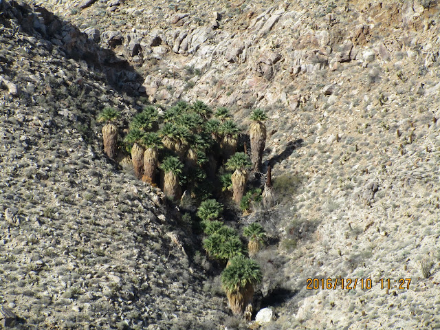
Sidebar on photos: My camera was destroyed in the rain on Cachuma, so this was a new one. It still had the default timestamp setting on and the time was off by an hour because it didn't account for daylight savings. Unfortunately, all these photos were marred by the timestamp, except the first one that I took with my phone.
The ridge to Groan was rougher than the one to Rozzie and not contiguous. After a short descent, we switched to an adjacent ridge that connected with Groan. There were small bumps to navigate and the cactus grew thicker the farther we went. It was about a 100' class 2 scramble up to Groan. We found the benchmark in a flat area and a nearby reference mark both incorrectly stamped "Moan". The real Moan BM is on the other side of the gorge and the benchmark there is correctly stamped. From Groan, we got the best view of Goat Canyon Trestle. The oldest entries in the Groan register went back to 1982. Next up was Gasp. We dropped steeply off the northwest ridge across a field of giant boulders. Along the way, we both had encounters with cholla but neither of us suffered direct hits. My pliers stayed in the pack the whole day. Finally, we dropped into a small feeder canyon of the gorge. This marked the low point on the day for me and the most isolated point on the hike. Eric hit a lower point on his way to Grunt. The temperature warmed up to the low 60s and I shed my base layer before starting the hard work to reach Gasp.
There were three major bumps and about 1700' of total gain along the ridge to Gasp. Eric had been moving at half speed so I could stay with him, but I slowed down a lot going up to Gasp. Most of it was class 2, but steepness, cactus, and lack of conditioning kept me at a snails pace. Eric waited for me on each bump. Grunt was always a game time decision for me, and by the third bump, it was clear I was not going to give up my precious gain for it. I suggested we separate there so he could get Grunt and I would head back after Gasp. I rested on the third bump while Eric blazed up toward Gasp at a bighorn pace. There was a 130' drop from the third bump before the final section of ridge to Gasp. By the time I started up, I saw Eric top out on Gasp and disappear. The final section of ridge was the most interesting with a few small trees among the cacti. Some rock formations were weathered into vertical wafers. Gasp was not the highest point at the top of the ridge, but the register and some wooden poles indicated its location. I could not locate any marks. We were the first visitors to Gasp in about a year. After signing the register, I looked down the ridge toward Grunt but saw no sign of Eric. Spotting a person in this terrain would be almost impossible unless you could see them moving. I left Gasp and side hilled around peak 3475, eventually finding a dirt road that would take me back to the truck. I took a shortcut across a field at one point and headed toward two tall plastic poles. Below the poles was a benchmark named "Cadastal Survey". It was clearly not any kind of high point. A quick Internet search turned up a BLM surveyor program with the same name. After a few plodding miles, I got back and half expected Eric to be waiting for me. About 5 minutes later, he showed up, having run back along the roads. I'm not sure he broke a sweat all day. Despite missing Grunt, this was a spectacular and fun hike amid the beauty of the raw desert.
Would you like to know more...?
Other Trip Reports:
Eric Su's report


No comments:
Post a Comment