Distance: 8.7 miles round trip on trail and cross country
Summit Elevation: 3814' (Mount Mel), 4484' (Keys Peak)
Prominence: 324' (Keys Peak)
Elevation Gain: 2000'
Elevation Gain (in Empire State Buildings): 1.6
Round trip time: 4 hours
Recommended water: 112 oz.
Parking/Fees: $15 National Parks (one vehicle, good for a week)
Difficulty: Moderate
Mount Mel and Keys Peak were the last two Joshua Tree Lower Peaks. With these two, I have climbed 63 of the 84 Sierra Club Lower Peaks. Mount Mel and Keys are frequently combined, and I followed the script heading out from the trailhead near Indian Cove Campground at the west turnaround. There are about 5 parking spots there and three were taken by what appeared to be a rock climbing class, getting busy on a tall structure just above the parking area. I started down the nature trail as indicated in the Sierra Club guide, then went cross country where the short trail ended. Mount Mel was visible, so I aimed directly toward the left side. I arrived at the base quickly and made a direct assault from the southwest. Mount Mel is a big pile of boulders and I needed to make a few class 3 moves near the top. On the summit boulder was an unusual looking tube holding the register. I didn't see a benchmark anywhere. The summit area on the boulder was small so I didn't do much but sign the register and take a few quick photos, On the way down, I angled toward the canyon so I could descend to the Boy Scout trail. I spotted a few cairns on the way that favored the left side of the canyon and that way did seem to be less cluttered. Still, the 300' scramble down to the canyon required some attention. Not really hard, but picking my way through the brush and boulders slowed me down. The Boy Scout trail was sandy and wide, perfect for upping the pace. There are some spectacular sheer walls at first that drop away as you continue. In a mile or so, the trail starts to switchback up the canyon and narrows to a single track. The trail is well signed and in great shape.

Rock climbing class near the trailhead

Starting down the nature trail, Mel in view

Climbing the jumble of rocks named Mount Mel

Unusual tube where the register was stored

Looking back at the parking area from Mount Mel summit

The north side of Mount Mel

Boy Scout trail

Lonely tree
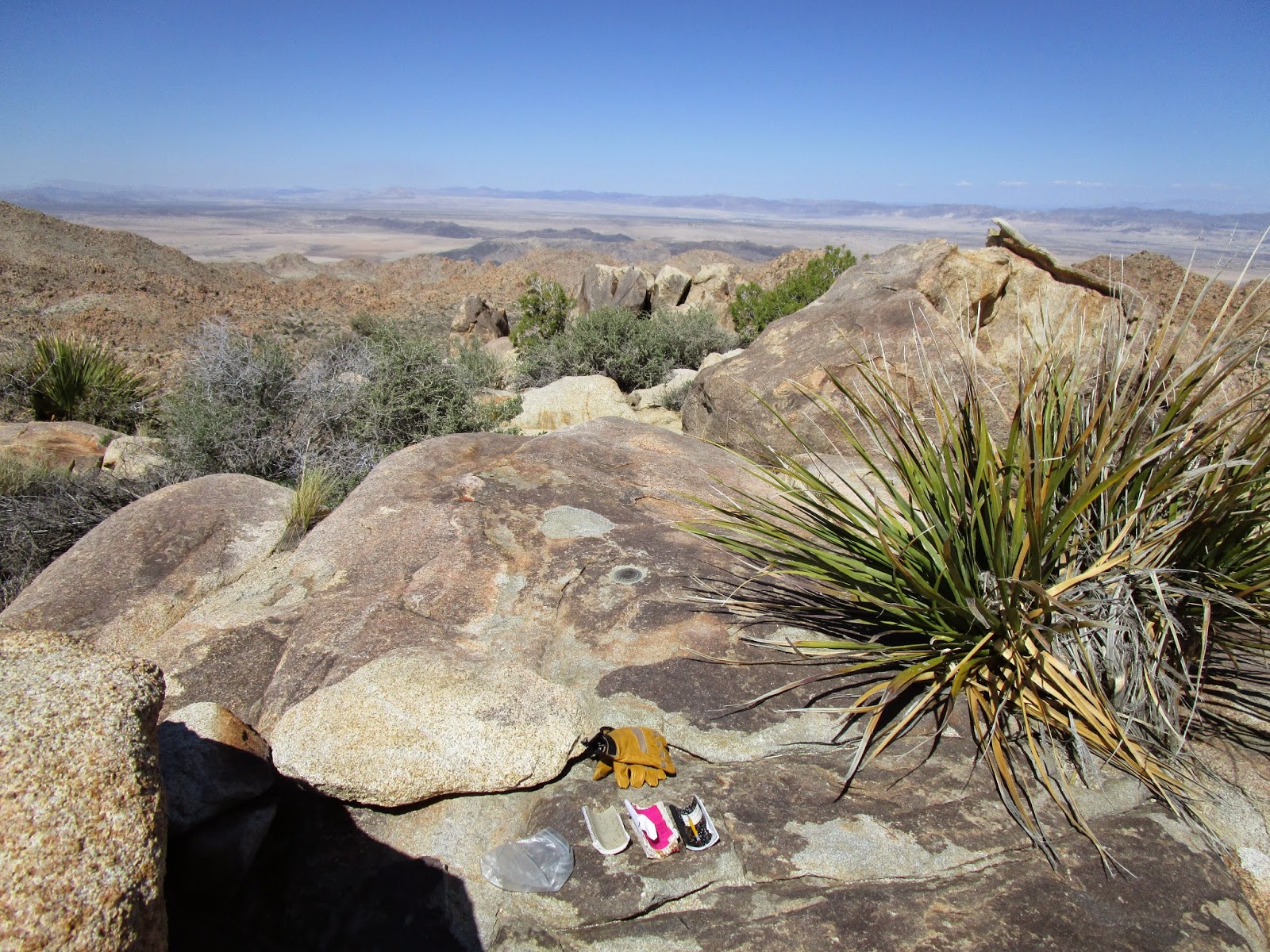
I ran into several groups of hikers on the trail, including a large group of actual boy scouts. Everyone was cordial as we passed. Eventually, the trail led out of the canyon and Keys Peak appeared. Keys had some vegetation and trees growing on it but not enough to be in the way. While the ascent was steep, it was nothing more than class 2. Unlike Mount Mel, the summit was long and wide with lots of flat spaces to eat or nap. The weather was so nice I was tempted to do both. Instead I signed the register and located the benchmark and one reference mark labelled No. 2. I thought with such a large summit area, the USGS would have placed reference mark No. 1 somewhere but I couldn't find it. I followed the same path down and returned along the Boy Scout trail. The final challenge was the ascent of the canyon back toward Mel. Going up, I favored the right side, the side I came down, but ended up drifting toward the center. Once past Mel, I could see the parking area and had an easy cross country trek the rest of the way.

Approaching Keys Peak

Straight up the north side

Keys Peak benchmark placed 1939
Popular peak with three registers

Long, flat summit

I think this a pencil cholla (Opuntia arbuscula) with eye catching golden needles


No comments:
Post a Comment