Distance: 9.5 miles round trip on trail
Summit Elevation: 3273' (Sitton), 3240' (Boy Scout)
Prominence: 773' (Sitton), 400' (Boy Scout)
Elevation Gain: 2150'
Elevation Gain (in Empire State Buildings): 1.72
Round trip time: 4 hours
Recommended water: 80 oz.
Parking/Fees: Adventure Pass
Difficulty: Moderate
Sitton Peak is one of the lower peaks in the Santa Ana Mountains, but still offers nice 360 degree views. It had rained the day before I went so the trail was damp and lush. It remained partly cloudy to overcast the whole day. There is a lot of forest cover at the beginning and plenty of vegetation, but very few yucca and thorny shrubs that plague other hikes. The trails are well groomed and easy to follow. From the 4 corners, I made a hard right onto Sitton Peak trail, although there was no sign.
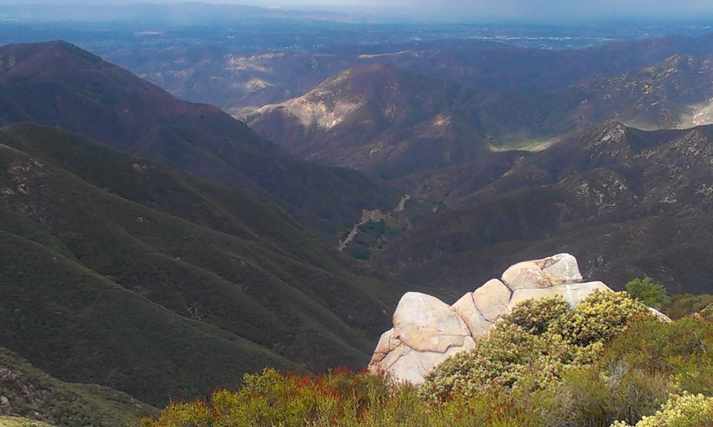
I took a short detour to climb what I later learned was Boy Scout Peak at 3250' before Sitton Peak to photograph the boulders near the top (second shot). There are large outcroppings of boulders scattered around the mountains in every direction. After passing the bump, the trail descends a good distance to a saddle where you start the ascent of Sitton Peak. The use trail is a little brushy in spots, but not severe. Just remember the general location for the return trip. There is a benchmark at the top and great views into the San Mateo wilderness and down to Ortega Highway. I was glad to made it through a hike without smashing my phone or losing my sunglasses or anything else.

Bear Canyon trailhead next to the Ortega Candy Store

Boulder at the top of Boy Scout Peak

Sign marking the use trial to the summit
Looking down on Ortega Highway from Sitton Peak

Sitton Peak summit

Sitton Peak benchmark
No comments:
Post a Comment