Hiked: 12/1/2017
Distance: 7.6 miles round trip on trail and cross country
Summit Elevation: 2541' (high point on ridge)
Elevation Gain: 2100'
Elevation Gain (in Empire State Buildings): 1.68
Round trip time: 4 hours 30 minutes
Recommended water: 80 oz.
Parking/Fees: Free on Foothill Parkway
Difficulty: Moderate
Tin Mine Canyon is a popular hike on the eastern side of the Santa Anas. The trailhead on Foothill Parkway is the starting point for many hikes including Hagador Canyon, Hagador Peak, Sierra Peak,and Pleasants Peak. To get to the Tin Mine trail, follow the paved path to the Skyline trail. At the first switchback where the road starts going up, continue straight. There is a sign for the Tin Mine Canyon and a single track begins just beyond. The trail is well shaded from tall oaks and maples. It might even be pleasant on a summer morning. A small creek ran next to the trail and there was a trickle of water. In about a mile, I reached the first adit of Tin Mine. It had been sealed with a metal grate. I took a picture inside the grate and it looked a lot safer than the Horseshoe Annex Mine that Dima and I explored in the San Gabriels. Not far up the trail was the second adit sitting about 20' above the trail. A loose and exposed class 2 ledge got me to the entrance which was also sealed with a grate. It looks like the whole mine is still in good shape, though it was a commercial bust. I passed two rest areas with benches on the way to the official end of the trail. It took about 45 minutes to hike the 2.3 miles to the Trail End sign. Most people turn around here for an easy 4.6 mile round trip. I continued exploring up the canyon on a shockingly good use trail. Elevation started to pile up from small, but easy boulder scrambles. The upper canyon was quite nice at first.
I met a few wood rats in the upper part of the canyon, always scurrying for cover. About half a mile past the end of the trail, there is a major fork. The main canyon continues southeast, while the southwest fork branches right. I stayed on the use trail that went up the main canyon, then veered east along another fork and ended at a crumbly, 30' dry fall. I was thinking I might get some bearings in the view above the fall so I risked a loose class 3 bypass up the right side with an assist from the brush clinging precariously to the wall. Instead of a view, more brushy scrambles greeted me. I kept thinking I would get a view after the next loose scramble. Nope, more of the same. This pattern repeated until I decided to return and check out the southwest fork. At the main fork, I found an interesting and relatively clear animal trail going up the main ridge that separated the two forks. It was also steep with loose dirt. Eventually, it got a little bushwhacky and required some crawling. However, it was clear enough that I could see a path up and so I continued for a while. This was all unplanned exploration. As the thrashing grew moderate, it became tedious. The ridge, being a deer hang out, dropped a couple of ticks on me. I brushed them off before any blood loss. On the way down, I lost the animal trail and instead of going back up to look for it, continued straight down into the northwest fork. I followed it back to the main canyon, then out. Checking the topo map later, it looks like I was 0.6 miles and about 500' below the doppler radar tower on Main Divide Road. A return trip might be warranted some day with a loop up the Skyline Trail to the doppler tower, then down the ridge and canyon. It might be rough sledding on the ridge below the tower. In any case, I found Tin Mine Canyon an enchanting diversion.
Friday, December 8, 2017
Friday, November 24, 2017
Mount Lukens
HPS Star Emblem Peak
Hiked: 11/24/2017
Distance: 10.1 miles round trip on trail and dirt road
Summit Elevation: 5074'
Prominence: 1794'
Elevation Gain: 3100'
Elevation Gain (in Empire State Buildings): 2.48
Round trip time: 4 hours 40 minutes
Recommended water: 64 oz.
Parking/Fees: Free at Deukmejian Wilderness Park
Difficulty: Moderate
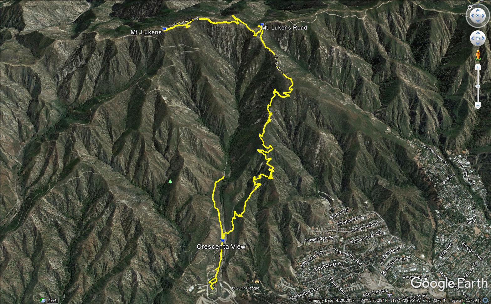
Leisa and I drove to Deukmejian Wilderness Park in Glendale on Black Friday to take on Mt. Lukens. It had been on my to do list a long time but never bubbled to the top until now. Mt. Lukens is #273 on the HPS list and is actually within the Los Angeles city limits making it the highest point in the city. It was named after Theodore Lukens, former supervisor of the Angeles National Forest and former mayor of Pasadena. The Deukmejian park has nice restroom facilities and water. The plan was to do a well known loop up the Crescenta View Trail and down the Rim of the Valley Trail. We started up the trail looking for the Crescenta View junction. The arrow sticker on the sign at the junction was torn off leading us to continue up Dunsmore Canyon. We got about half a mile before I realized we were on the wrong trail. Leisa was not impressed. We had to descend about 300' back to the junction before the hike really got started. The trail is heavily switchbacked and the steepness of the ascent kept us in shadow most of the way up. The higher we got, the better view we had of the greater LA area, including downtown. When we reached the rock windbreak, we were well above the Verdugo Mountains and could have seen the ocean if not for the haze. There was a "Trail Log" box there with a single piece of paper in it. I signed us in knowing the paper would probably last about two more days.
The Crescenta View Trail ends at Mt. Lukens Road and so does most of the elevation gain. We took a left and drifted up the road to the Lukens summit. At the first tower, I decided to leave the road and explore the towers on the east side of the summit. Leisa continued up the road. I met another couple resting under one of the towers and exchanged some small talk. I looked around for reference marks but didn't find any on this part of the summit. I had a vague idea that the HPS register was on this side of the long summit but had no luck finding it. I continued west and met up with Leisa again. She told me about a close encounter she had with three deer along the road. I was glad to see she got some nice photos. We walked to the west end of the summit where the official benchmark was on the map, but only found reference mark number 5, stamped "La Crescenta". The topo map also names it "Sister Elsie" so there appears to be some confusion and controversy over the name. I did more mark hunting and came up empty, finally giving up and sitting down for some fuel. While we enjoyed the summit, two more hiking groups arrived. The proximity to four million people makes this a pretty popular destination. Because I had led us astray, I suggested that we return on the Crescenta View Trail to save time instead of completing the loop. Leisa supported this idea and we started down the way we came up. We went back along the road, and were surprised to find the deer still hanging around. They were lying down until my clumsy presence alarmed them. One bounded away while the others put some distance between us but were curious and stopped to stare. We continued down and lost elevation quickly, getting back to the car in less than two hours. A hilarious "Infinite Clearance" sign in the park caught our attention. An internet search turned up an LA Times article on fake signs a local artist installed around town, including this one. It was a nice touch.
Other Trip Reports:
Mt. Lukens: Crescenta View - Rim of the Valley Loop (Wild Southland)
Hiked: 11/24/2017
Distance: 10.1 miles round trip on trail and dirt road
Summit Elevation: 5074'
Prominence: 1794'
Elevation Gain: 3100'
Elevation Gain (in Empire State Buildings): 2.48
Round trip time: 4 hours 40 minutes
Recommended water: 64 oz.
Parking/Fees: Free at Deukmejian Wilderness Park
Difficulty: Moderate
Leisa and I drove to Deukmejian Wilderness Park in Glendale on Black Friday to take on Mt. Lukens. It had been on my to do list a long time but never bubbled to the top until now. Mt. Lukens is #273 on the HPS list and is actually within the Los Angeles city limits making it the highest point in the city. It was named after Theodore Lukens, former supervisor of the Angeles National Forest and former mayor of Pasadena. The Deukmejian park has nice restroom facilities and water. The plan was to do a well known loop up the Crescenta View Trail and down the Rim of the Valley Trail. We started up the trail looking for the Crescenta View junction. The arrow sticker on the sign at the junction was torn off leading us to continue up Dunsmore Canyon. We got about half a mile before I realized we were on the wrong trail. Leisa was not impressed. We had to descend about 300' back to the junction before the hike really got started. The trail is heavily switchbacked and the steepness of the ascent kept us in shadow most of the way up. The higher we got, the better view we had of the greater LA area, including downtown. When we reached the rock windbreak, we were well above the Verdugo Mountains and could have seen the ocean if not for the haze. There was a "Trail Log" box there with a single piece of paper in it. I signed us in knowing the paper would probably last about two more days.
The Crescenta View Trail ends at Mt. Lukens Road and so does most of the elevation gain. We took a left and drifted up the road to the Lukens summit. At the first tower, I decided to leave the road and explore the towers on the east side of the summit. Leisa continued up the road. I met another couple resting under one of the towers and exchanged some small talk. I looked around for reference marks but didn't find any on this part of the summit. I had a vague idea that the HPS register was on this side of the long summit but had no luck finding it. I continued west and met up with Leisa again. She told me about a close encounter she had with three deer along the road. I was glad to see she got some nice photos. We walked to the west end of the summit where the official benchmark was on the map, but only found reference mark number 5, stamped "La Crescenta". The topo map also names it "Sister Elsie" so there appears to be some confusion and controversy over the name. I did more mark hunting and came up empty, finally giving up and sitting down for some fuel. While we enjoyed the summit, two more hiking groups arrived. The proximity to four million people makes this a pretty popular destination. Because I had led us astray, I suggested that we return on the Crescenta View Trail to save time instead of completing the loop. Leisa supported this idea and we started down the way we came up. We went back along the road, and were surprised to find the deer still hanging around. They were lying down until my clumsy presence alarmed them. One bounded away while the others put some distance between us but were curious and stopped to stare. We continued down and lost elevation quickly, getting back to the car in less than two hours. A hilarious "Infinite Clearance" sign in the park caught our attention. An internet search turned up an LA Times article on fake signs a local artist installed around town, including this one. It was a nice touch.
Other Trip Reports:
Mt. Lukens: Crescenta View - Rim of the Valley Loop (Wild Southland)
Friday, November 17, 2017
Where the Wild Things Are v1
Hiked: 11/17/2017
Distance: 8.4 miles round trip on trail and cross country
Summit Elevation: 1538' (at trailhead)
Elevation Gain: 1415'
Elevation Gain (in Empire State Buildings): 1.13
Round trip time: 3 hours 30 minutes
Recommended water: 48 oz.
Parking/Fees: Free at Fisherman's Camp Trailhead
Difficulty: Moderate
Let the wild rumpus start!
-- Maurice Sendak
I am often inspired by animal photos from the trail cameras of rangers and other outdoor enthusiasts. As a natural extension of exploration, I deployed a Bushnell 20MP Trophy Cam HD Low Glow back in October. I placed it off trail in an area I expected to get some animal traffic. The camera was configured in hybrid mode to capture both photos and video. Daytime photos are shot in color, while the red light flash at night produces black and white. As a first effort, I wasn't sure if the experiment would produce anything interesting. After a month or so, I collected the SD card and starting looking over the photos and videos. The first thing I learned was that tall grass blowing in the wind triggered the motion activated camera. There were almost 900 photos and videos recorded and most of them were of tall grass blowing in the wind. The camera was also triggered by large flying insects at night. It did capture a single animal:
I plan to move it to different locations periodically and hope to capture more wildlife.
See Also:
Where the Wild Things Are v2
Wild Things v4
Distance: 8.4 miles round trip on trail and cross country
Summit Elevation: 1538' (at trailhead)
Elevation Gain: 1415'
Elevation Gain (in Empire State Buildings): 1.13
Round trip time: 3 hours 30 minutes
Recommended water: 48 oz.
Parking/Fees: Free at Fisherman's Camp Trailhead
Difficulty: Moderate
-- Maurice Sendak
I am often inspired by animal photos from the trail cameras of rangers and other outdoor enthusiasts. As a natural extension of exploration, I deployed a Bushnell 20MP Trophy Cam HD Low Glow back in October. I placed it off trail in an area I expected to get some animal traffic. The camera was configured in hybrid mode to capture both photos and video. Daytime photos are shot in color, while the red light flash at night produces black and white. As a first effort, I wasn't sure if the experiment would produce anything interesting. After a month or so, I collected the SD card and starting looking over the photos and videos. The first thing I learned was that tall grass blowing in the wind triggered the motion activated camera. There were almost 900 photos and videos recorded and most of them were of tall grass blowing in the wind. The camera was also triggered by large flying insects at night. It did capture a single animal:
I plan to move it to different locations periodically and hope to capture more wildlife.
See Also:
Where the Wild Things Are v2
Wild Things v4
Tuesday, November 14, 2017
North Pinyon Mountain (Peak 3640) and Peak 3300
Hiked: 11/13/2017
Distance: 4.5 miles round trip on trail and cross country
Summit Elevation: 3640' (North Pinyon), 3300 (Peak 3300)
Elevation Gain: 1665'
Elevation Gain (in Empire State Buildings): 1.33
Round trip time: 2 hours 30 minutes
Recommended water: 48 oz.
Parking/Fees: Free on Plum Canyon Road
Difficulty: Easy
An overcast day was perfect for climbing North Pinyon Mountain (Peak 3640), #58 on the San Diego Peaks list. The trailhead is close to Sentenac, but on the eastern spur of Plum Canyon Road. Any car should be able to travel the road to the end. I arrived late in the morning and was the only one there. I didn't see anyone all day. The path followed a sandy wash about a half mile before it started gaining elevation toward the ridge line. Past the sandy part, the wash held three dry falls, though only one required a class 2 move. The others could be easily bypassed. True to the name, a few pinyon pines grew in or near the wash. I emerged from the wash on peak 3300 with good views and clearing skies. Next came a 100' drop to a saddle to reach the North Pinyon ridge. There was plenty of agave, cholla, barrel cactus, and cats claw to dodge. The first major summit was false, though it was only slightly lower than the North Pinyon high point. From the false summit, it was a short and easy walk up. There were no summit boulders to scale. The register was mostly loose papers in a glass jar inside the normal red cans. An older set of papers was hard to get out so I only looked at the most recent entries that went back to 2012. There were no benchmarks. The views were quite nice of Granite, Grapevine, the Laguna Mountains, and Earthquake Valley. I also had a hazy view of the Salton Sea. After signing in, I returned the same way and enjoyed a second pass through the wash. When I got back to the sandy section, I slow jogged the rest of the way. One step closer to the SDC list finish.
Distance: 4.5 miles round trip on trail and cross country
Summit Elevation: 3640' (North Pinyon), 3300 (Peak 3300)
Elevation Gain: 1665'
Elevation Gain (in Empire State Buildings): 1.33
Round trip time: 2 hours 30 minutes
Recommended water: 48 oz.
Parking/Fees: Free on Plum Canyon Road
Difficulty: Easy
An overcast day was perfect for climbing North Pinyon Mountain (Peak 3640), #58 on the San Diego Peaks list. The trailhead is close to Sentenac, but on the eastern spur of Plum Canyon Road. Any car should be able to travel the road to the end. I arrived late in the morning and was the only one there. I didn't see anyone all day. The path followed a sandy wash about a half mile before it started gaining elevation toward the ridge line. Past the sandy part, the wash held three dry falls, though only one required a class 2 move. The others could be easily bypassed. True to the name, a few pinyon pines grew in or near the wash. I emerged from the wash on peak 3300 with good views and clearing skies. Next came a 100' drop to a saddle to reach the North Pinyon ridge. There was plenty of agave, cholla, barrel cactus, and cats claw to dodge. The first major summit was false, though it was only slightly lower than the North Pinyon high point. From the false summit, it was a short and easy walk up. There were no summit boulders to scale. The register was mostly loose papers in a glass jar inside the normal red cans. An older set of papers was hard to get out so I only looked at the most recent entries that went back to 2012. There were no benchmarks. The views were quite nice of Granite, Grapevine, the Laguna Mountains, and Earthquake Valley. I also had a hazy view of the Salton Sea. After signing in, I returned the same way and enjoyed a second pass through the wash. When I got back to the sandy section, I slow jogged the rest of the way. One step closer to the SDC list finish.
Saturday, November 11, 2017
Bluewater Canyon Reloaded
Hiked: 11/10/2017
Distance: 11.8 miles round trip on trail and cross country
Summit Elevation: 1561' (highest point in canyon)
Elevation Gain: 2010'
Elevation Gain (in Empire State Buildings): 1.61
Round trip time: 6 hours 30 minutes
Recommended water: 84 oz.
Parking/Fees: Adventure Pass
Difficulty: Moderate
Last year, I started exploring the wild part of Bluewater Canyon but turned back shortly after finding a dismembered deer. Bluewater is about as remote as you can get in the San Mateo Wilderness. It wasn't the deer alone that spooked me but a combination of the deer, the terrain, the feel of the canyon, and being solo. Steve agreed to take on the return trip with me. I was confident that if it came to it, two apes were greater than one lion. Apes together strong! (or maybe not)
The satellite view of the canyon didn't show any technical parts. It would have the normal obstacles of a Santa Ana canyon: boulders, trees, brush, poison oak and run off debris. The morning started out cool, a plus for keeping the snakes away. We started at the Fisherman's Camp trailhead on Tenaja Road and quickly completed the three mile hike through Fisherman's Camp to the mouth of Bluewater Canyon. We didn't see any campers. We both realized we had carried in too much water and decided to cache some at the entrance to reduce weight. We followed the trail into the canyon and left it at the first switchback heading up to Oak Flats. The start of the canyon was dry. Many of the rocks were covered in some kind of strange white organic material. It looked like paper mache. If it was some kind of toxic run off, I might grow a third arm. We returned to the spot of the deer massacre and found most of the bones and body parts from last year except the head. I'm not sure why an animal would drag the head away so I am guessing it was taken by someone as a trophy.
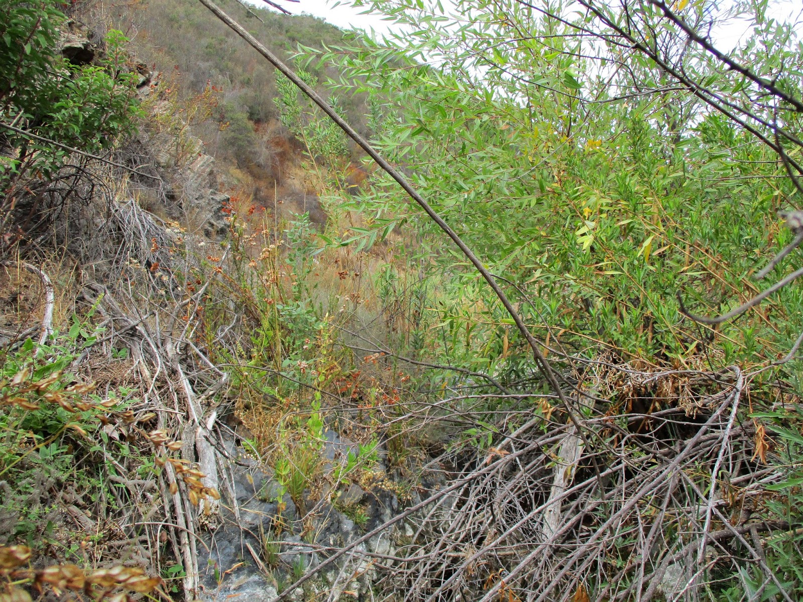
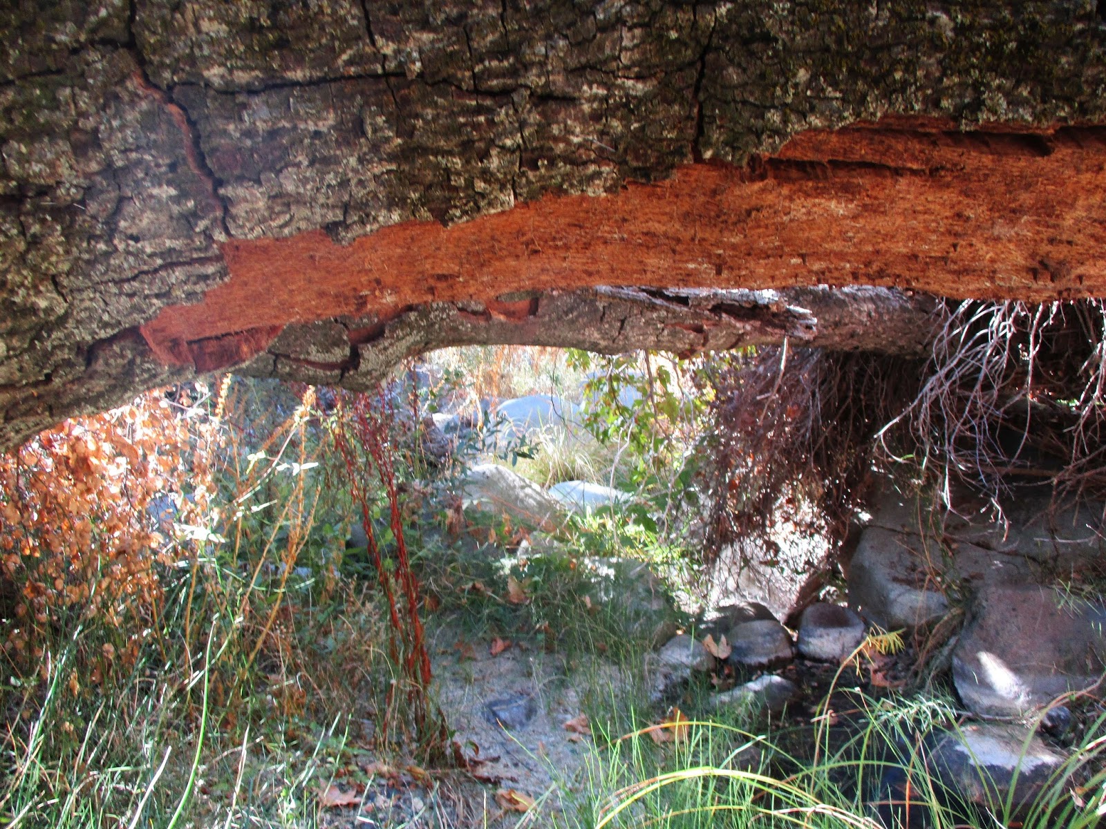
Immediately upstream, the canyon was fairly open and the obstacles easy. Then we came to a shady section with a high canopy of trees. I was surprised to find water. Small pools formed and rivulets ran across some of the rocks. The pools were home to frogs and small turtles. Grass, brush, and poison oak were thicker here, and a moderate bushwhack was required for about half a mile. Poison oak was a constant threat through most of the canyon. Fresh vines grew across the ground in places and would sometimes get tangled around our ankles. I'm glad we pushed through it because the canyon opened up again into a beautiful stretch of rock hopping with black, striped, and with reddish hues. We still hit a tricky obstacle now and then. One landmark was a pair of maple trees growing next to each other but curved in opposite directions. Steve called it the golden arches. The canyon had been wide up to this point, providing bypass options outside the stream. A short distance above the arches, it started to narrow. Eventually, it narrowed to about 20' across and was thoroughly clogged. I bushwhacked through nasty chaparral along the wall a few hundred feet to look for an opening, but all I saw was more of the same. That was our turnaround point with about a mile and a half of the upper canyon unexplored.
See Also:
Fisherman's Camp, Bluewater Canyon, San Mateo Canyon
Distance: 11.8 miles round trip on trail and cross country
Summit Elevation: 1561' (highest point in canyon)
Elevation Gain: 2010'
Elevation Gain (in Empire State Buildings): 1.61
Round trip time: 6 hours 30 minutes
Recommended water: 84 oz.
Parking/Fees: Adventure Pass
Difficulty: Moderate
Last year, I started exploring the wild part of Bluewater Canyon but turned back shortly after finding a dismembered deer. Bluewater is about as remote as you can get in the San Mateo Wilderness. It wasn't the deer alone that spooked me but a combination of the deer, the terrain, the feel of the canyon, and being solo. Steve agreed to take on the return trip with me. I was confident that if it came to it, two apes were greater than one lion. Apes together strong! (or maybe not)
The satellite view of the canyon didn't show any technical parts. It would have the normal obstacles of a Santa Ana canyon: boulders, trees, brush, poison oak and run off debris. The morning started out cool, a plus for keeping the snakes away. We started at the Fisherman's Camp trailhead on Tenaja Road and quickly completed the three mile hike through Fisherman's Camp to the mouth of Bluewater Canyon. We didn't see any campers. We both realized we had carried in too much water and decided to cache some at the entrance to reduce weight. We followed the trail into the canyon and left it at the first switchback heading up to Oak Flats. The start of the canyon was dry. Many of the rocks were covered in some kind of strange white organic material. It looked like paper mache. If it was some kind of toxic run off, I might grow a third arm. We returned to the spot of the deer massacre and found most of the bones and body parts from last year except the head. I'm not sure why an animal would drag the head away so I am guessing it was taken by someone as a trophy.
Immediately upstream, the canyon was fairly open and the obstacles easy. Then we came to a shady section with a high canopy of trees. I was surprised to find water. Small pools formed and rivulets ran across some of the rocks. The pools were home to frogs and small turtles. Grass, brush, and poison oak were thicker here, and a moderate bushwhack was required for about half a mile. Poison oak was a constant threat through most of the canyon. Fresh vines grew across the ground in places and would sometimes get tangled around our ankles. I'm glad we pushed through it because the canyon opened up again into a beautiful stretch of rock hopping with black, striped, and with reddish hues. We still hit a tricky obstacle now and then. One landmark was a pair of maple trees growing next to each other but curved in opposite directions. Steve called it the golden arches. The canyon had been wide up to this point, providing bypass options outside the stream. A short distance above the arches, it started to narrow. Eventually, it narrowed to about 20' across and was thoroughly clogged. I bushwhacked through nasty chaparral along the wall a few hundred feet to look for an opening, but all I saw was more of the same. That was our turnaround point with about a mile and a half of the upper canyon unexplored.
See Also:
Fisherman's Camp, Bluewater Canyon, San Mateo Canyon
Subscribe to:
Posts (Atom)