Friday, May 16, 2025

Burnt Peak, Little Burnt Peak, Sawmill Mountain, and Sawtooth Mountain

Hiked: 5/15/2025
Distance: 13.4 miles round trip on dirt road and firebreak
Summit Elevation: 5790' (Burnt), 5526' (Little Burnt), 5516' (Sawmill), 5201' (Sawtooth)
Prominence: 2450' (Burnt)
Elevation Gain: 3473'
Elevation Gain (in Empire State Buildings): 2.7
Round trip time: 6 hours 30 minutes
Recommended water: 110 oz.
Parking/Fees: Free on Forest Route 7N23
Difficulty: Strenuous (combined)

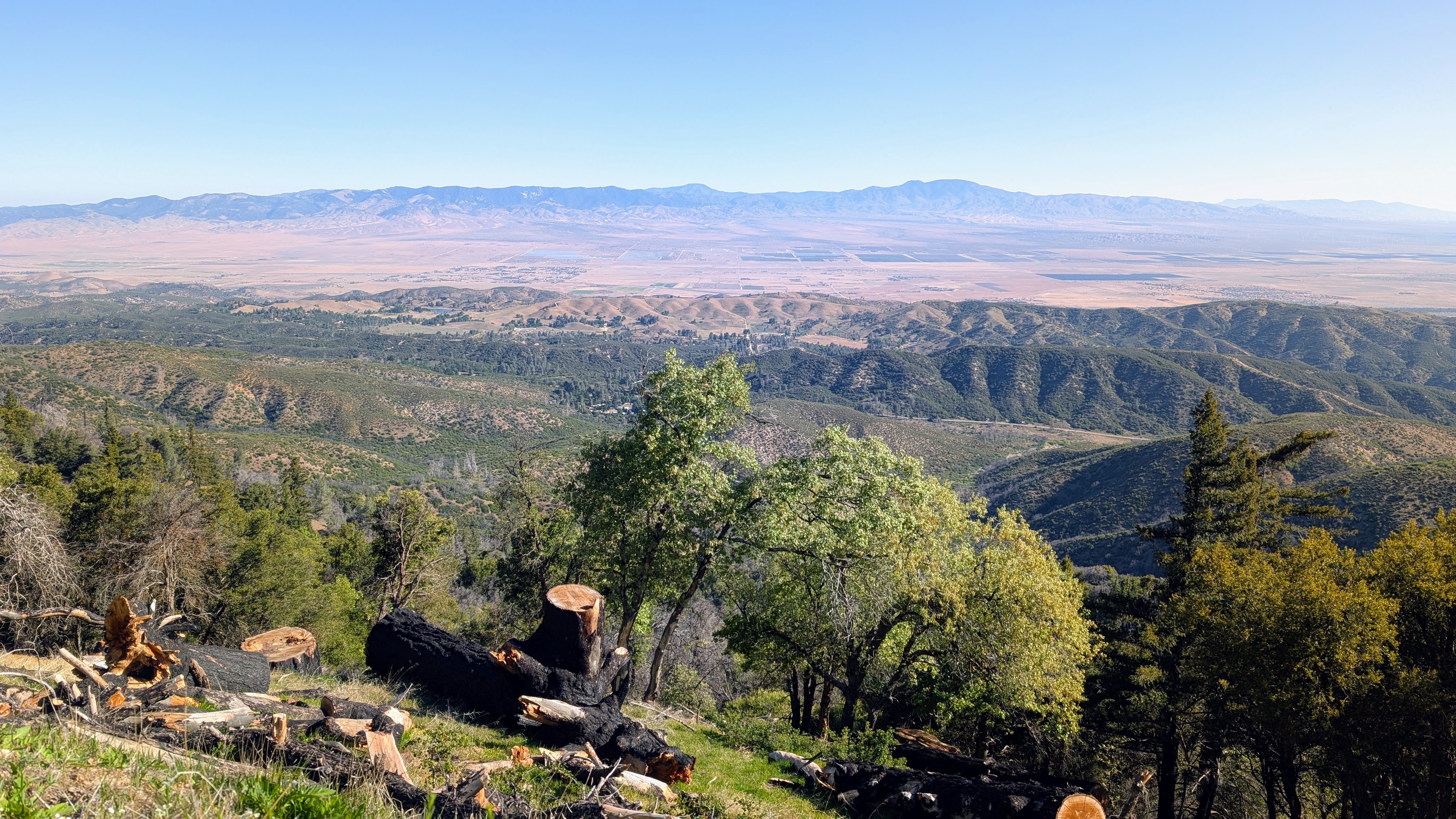
A handful of HPS peaks reside in the northernmost mountains of the Angeles National Forest. My main goals for the day were Burnt Peak (HPS #205) and Sawtooth Mountain (HPS #262). I was prepared for a longer hike if the gate to Forest Route 7N23 was closed, but it was open, allowing time for a couple bonus peaks. I parked at the intersection of 7N23 and Sawmill Mountain Road. The road was smooth and sedan friendly. The PCT also crosses this intersection. First, I headed to Burnt Peak, dirt road all the way. There was another gate on the road to Burnt and I noticed it was unlocked. I could have driven to the top, but I part of my motivation was to log some miles. A few minutes later, a construction worker drove by in an SUV, informing me that a lot of heavy equipment was coming behind him for a project on the Burnt summit. A dozen trucks, including a cement mixer, passed me leaving a dozen dust clouds in their wake. At the summit, I found a strange tower surrounded by what looked like sealed mailboxes. Internet research identified the tower as a Doppler VHF Omnidirectional Range (DVOR) station, part of the FAA's aircraft navigation infrastructure. The central cone and cylinder structure is the main antenna, and the smaller ground-level antennas around it help generate the Doppler frequency shift necessary for precise bearing information. I found no benchmark or register. Nice views from the edges including Cobblestone Mountain in Los Padres.


Burnt summit


Looking south to the San Gabriels

On the way down from Burnt, I left the road for a short cross country maze of small trees and yucca to Little Burnt Peak. Little Burnt had a register, but no benchmark. I also went up a freshly cut firebreak to Sawmill Mountain. I found a metal post half way up and another one on the summit. No benchmark or register. I continued down the other side to a dirt road that took me back to the truck. Round trip stats for Bunrt, Little Burnt, and Sawmill were 6.1 miles, 1335' gain, 2.5 hours. Most of the gain was ahead on Sawtooth Mountain.

Approaching Little Burnt Peak

Looking back at Burnt


Sawmill Mountain on the left

Sawmill summit


I expected most of the hike to Sawtooth to be on a dirt road. I was half right. The rest was on a wide firebreak about 1.5 miles long across rolling hills. Sawtooth itself was not jagged, but the path to get there was. The road gained a couple hundred feet before the firebreak. The first drop on the fire break was 300', followed by 150' up, then the big 600' drop, then 550' up the final firebreak to the flat summit. Looking up the final firebreak was pretty impressive. Photos don't capture being there. The summit held a register in green cans (unusual) but no benchmark. I went 0 for 4 on benchmarks. The prominence of Burnt was more obvious from Sawtooth, and other views were nice. I took a longer break on Sawtooth before facing more than 1000' of gain on the way back. I found the ups and downs kind of fun, making for a solid workout. Stats for Sawtooth alone were 7.3 miles, 2138' gain, 4 hours.

Sawtooth from the truck

Sawtooth from the start of the firebreak


Burnt Peak

Cobblestone on the horizon


The way out

Dust in the wind


Thursday, May 8, 2025

Wye Benchmark

Hiked: 5/7/2025
Distance: 1.6 miles round trip on trail
Summit Elevation: 3651'
Elevation Gain: 465'
Elevation Gain (in Empire State Buildings): 0.3
Round trip time: 45 minutes
Recommended water: 16 oz.
Parking/Fees: Free on service road by I-15
Difficulty: Easy

My third and final hike of the day was Wye Benchmark. It is a noticeable bump at the Cajon Pass, the intersection of I-15 and highway 138. The intersection is always busy, and the gateway to Wrightwood and the northern San Gabriel mountains. There used to be a flag flying on the summit. The trail to Wye starts on a dirt utility road running parallel to northbound I-15. I made an awkward left turn from the 138 over a low curb to reach the road. There were a few shallow mud puddles and some ruts, but I didn't need 4x4. The trail looked like it was used by motorcycles and mountain bikes. It made a wide curve to the ridge behind Wye, then went directly up the north slope. The trail was in good shape all the way. On top, the flag pole was still in place, but it had no flag. There were solar lights aimed at the pole to illuminate it at night. A chained ammo box held a combination of registers and geocache goodies. Looking through the register, it seemed to be a popular hike for firefighters, whose signatures outnumbered those who were not firefighters. I had a great view of Ralston Peak, where I had just been. I wanted to hang out on top a bit, but I must have disturbed a flying ant nest, because I was suddenly swarmed by them. Not just my head, but my whole body was attacked. I was barely able to scribble my name in the register and close it before beating a hasty retreat down the trail. Once I was 50' off the summit, the attack stopped, allowing me mop up the unlucky ants still on my person. Robbed of summit basking time, I walked back to the truck. Because of the location of the access road and the traffic in the intersection, I was forced to get on I-15 north and turn around at the next exit. Since I drive by it all the time, Wye was a nice get.


Wye summit, Ralston Peak in the background


Ralston Peak

Hiked: 5/7/2025
Distance: 2 miles round trip on use trail
Summit Elevation: 4559'
Elevation Gain: 810'
Elevation Gain (in Empire State Buildings): 0.6
Round trip time: 1 hour
Recommended water: 16 oz.
Parking/Fees: Free on shoulder of Lone Pine Canyon Road
Difficulty: Easy

Ralston Peak is a prominent bump not far from Mormon Rocks. It was the second short hike of the day. I parked on the shoulder of Lone Pine Canyon Road and crossed over to start. There were two ridge options. A direct, very steep ridge that led more directly to the summit, and a longer east ridge. I opted for the longer ridge since it looked more open. Brush was light and generally avoidable. The bottom half of the mountain had a lot of poodle dog bush and it was hard to completely avoid. Early on, I found three metal poles with no apparent purpose. A good use trail appeared on the ridge and went all the way to the top. At the false summit, I found a metal triangle marker. The summit had another triangle marker, but no benchmark. There was a register inside three painted cans. Based on the busy register, the peak was far more popular than I would have guessed. The summit had very nice views of the Mormon Rocks and I-15 stretching to the horizon in two directions.

Ralston Peak, summit not visible


Metal triangle with summit in background


Metal triangle on summit


Looking south

Mormon Rocks

San Andreas Rift Zone


Pinyon Ridge

Hiked: 5/7/2025
Distance: 1.3 miles round trip on firebreak
Summit Elevation: 6548'
Elevation Gain: 943'
Elevation Gain (in Empire State Buildings): 0.7
Round trip time: 1 hour
Recommended water: 16 oz.
Parking/Fees: Free at turnout on Big Pines Highway
Difficulty: Easy

There is a short way (firebreak) and a long way (dirt road) to get to Pinyon Ridge (HPS #151). I chose the firebreak so I could hit a couple other short peaks around Wrightwood. I parked at a turnout on Big Pines Highway, on the opposite side of the highway from Pinyon Ridge. I crossed over and started up the very steep firebreak. I used shallow drain channels as switchbacks, making it less of a straight up affair. The high point was in a grassy area surrounded by trees, therefore no views. Before the summit, there were decent views of the northern San Gabriels. I didn't find any marks or a register. The ridge was not at all peakish. I noticed a shed on the way down, but still more than half way up. Upon inspection, it was designed to capture rain water into a tank below a metal roof. For firefighting? Getting down was much easier and I made it without falling on my butt. These kind of HPS peaks make me wonder why they got added to the list.


Summit


Looking north