Hiked: 1/2/2017
Distance: 0.5 miles on use trail
Summit Elevation: 209' (high point at turn out)
Elevation Gain: 200'
Elevation Gain (in Empire State Buildings): 0.16
Round trip time: 20 minutes
Recommended water: 0 oz.
Parking/Fees: Free on Kahekeli Highway (highway 340)
Difficulty: Easy
The Nakalele Blowhole is a geological oddity on the north shore of Maui, just north of Poelua Bay. The ocean dug a hole through the lava shelf and when waves hit the shore, water blasts up through the hole making it look like a geyser. To get to the blowhole, park at the public parking lot on highway 340 and hike a quarter mile down. The terrain is dirt/mud and volcanic rock, dropping about 200' from the highway. There are a couple of light class 2 moves required for the descent, though you can get good views of the phenomenon from higher up. Leisa and Shelby had flip flops and didn't want to make the full descent. Parker and I had tennis shoes, not ideal footwear, but good enough and we worked our way to the level to the blowhole. We stopped 30' short, though several tourists were standing right next to it. An unlucky slip could send you into the blowhole and certain death. One tourist died in 2011 in the blowhole, and a few others have died from falls on the way down, but it is not really more dangerous than most undeveloped coastal areas. The parking lot was almost full, but the hike was not overcrowded. We watched the blowhole explode a few times before returning to the car. It was a cool diversion.
Descending to the blowhole
Pools in volcanic rock
Some of these boulders looked sponge-like, but were sharp and brittle
Hiked: 12/31/2016
Distance: Drive up
Summit Elevation: 10023'
Prominence: 10023'
Elevation Gain: 0'
Elevation Gain (in Empire State Buildings): 0
Round trip time: 0 minutes
Recommended water: 0 oz.
Parking/Fees: $20 National Parks (good for three days)
Difficulty: Easy
The family weighed the pros and cons of the road to Hana or the Haleakala crater and decided on the crater. Haleakala is a giant shield volcano, and the highest point on Maui. It makes up more than half of the island. All the Hawaiian islands are made of clots of earth blood. Tourists usually drive up in the early morning to catch the sunrise. With the weather questionable in the morning, we decided for a sunset trip. Rain in Lahaina stopped late morning, and in the afternoon we began the scenic drive. However, the wet side of the island was still covered in clouds and drizzle and so was the lower part of the mountain. Everything was surprisingly green, with shrubs and trees I didn't recognize. Around 6000', we broke out of the lower cloud cover into a dry zone, but there were higher clouds above. By the time we hit 7000', we were back in clouds and drizzle that stayed with us all the way to the summit.
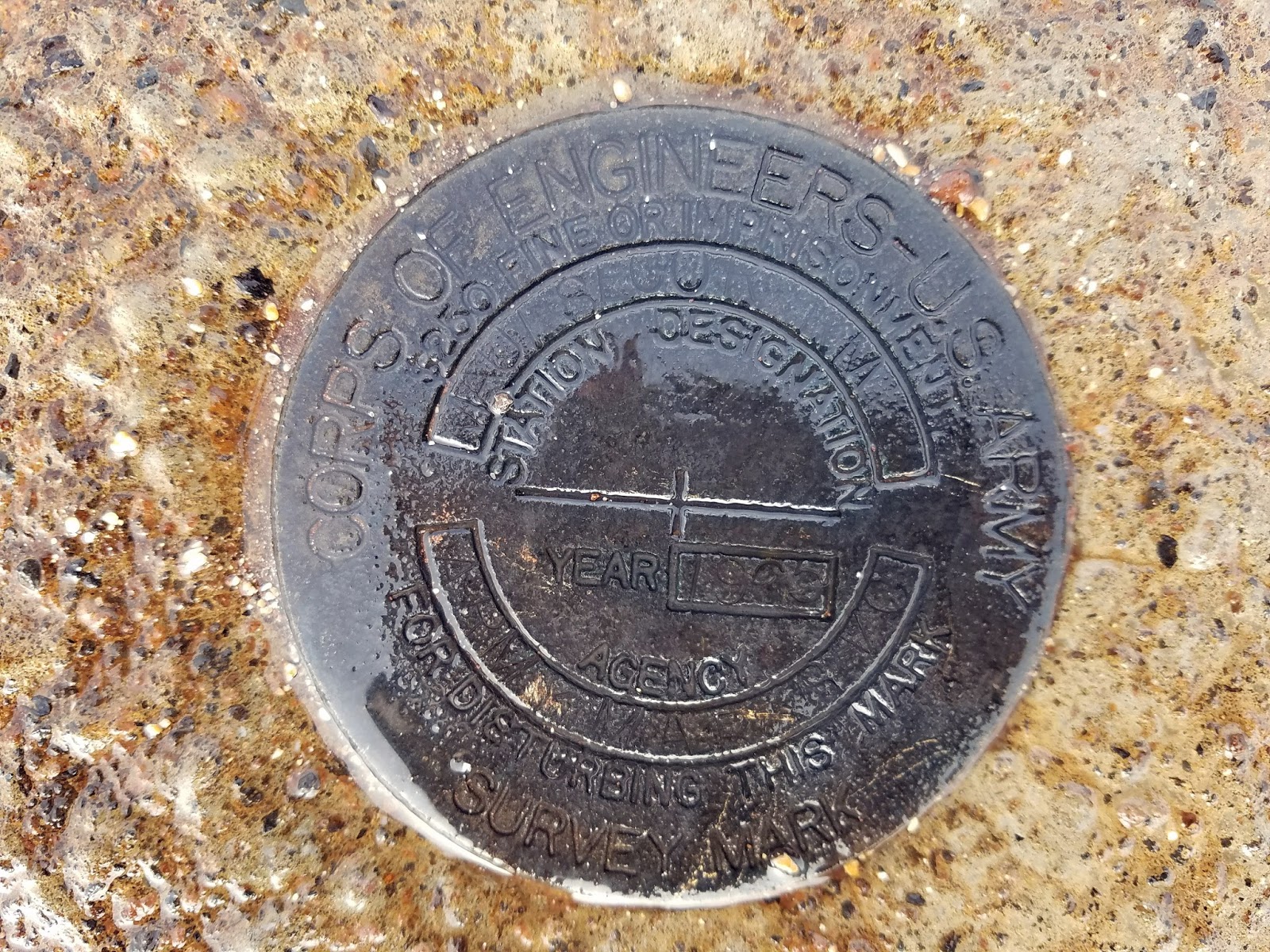
Red and black volcanic rock dominated the last 2000' of the drive as vegetation dwindled. It was about 40F on the summit and we layered up, even if it was only for a short visit. I found a reference mark and the benchmark from the Army Corps of Engineers. The benchmark was not at the high point, but just off the sidewalk. The crater and valley were filled with clouds. Visibility was low. We didn't get our sunset views, but we did see some native silversword plants and stopped for two nene crossing the road on the way down. The Hawaiian nene is a small goose native to the local islands with striking black and white coloring. We also had to stop for cows in the road, which apparently have free reign on the mountain for grazing.
Hiked: 12/28/2016
Distance: 14.5 miles round trip on trail and cross country
Summit Elevation: 1538' (at trailhead)
Elevation Gain: 2340'
Elevation Gain (in Empire State Buildings): 1.87
Round trip time: 7 hours
Recommended water: 104 oz.
Parking/Fees: Adventure Pass
Difficulty: Strenuous (combined)
I spent a respectable amount of time this year exploring the San Mateo Wilderness. One feature that caught my imagination was Bluewater Canyon, a gorge near the center of the wilderness. The Bluewater trail enters the canyon for less than a mile, then switchbacks up toward Oak Flats. I wanted to explore the wild places in the canyon.
I parked at the Fisherman's Camp TH on Tenaja Truck Trail and displayed my Adventure Pass. To get there from I-15, exit on Clinton Keith Road, go west/southwest until it turns into Tenaja Road. In less than 2 miles, you will come to a stop sign where you need to turn right to stay on Tenaja Road. Go another 4 miles, then turn right on Cleveland Forest Road (7S01). Go past the Tenaja Trailhead for 3 more miles to the Fisherman's Camp Trailhead at a turn out on the left. The small turn out only has enough parking for 3-4 cars. The trail leads to Fisherman's Camp only 1.6 miles away at the confluence of Tenaja Canyon and San Mateo Canyon. Three trails converge on Fisherman's Camp. The first one you hit before reaching the camp. That trail leads to the Tenaja Falls trailhead. Two trails converge on the other side of the camp. One leads to the Tenaja trailhead and the other leads to San Mateo Canyon and Bluewater Canyon. One of the undeveloped camp sites at Fisherman's Camp was occupied. I greeted the two guys having breakfast by their tent and passed through to the connecting trail toward Bluewater Canyon.
Start of the trail to Fisherman's Camp
Fisherman's Camp and an empty camping spot
Trail to Bluewater Canyon on the far side of the camp
Reflections in San Mateo Canyon
I passed the North Tenaja junction, continuing to the Bluewater Trail, then entered Bluewater Canyon. I crossed a flowing stream four or five times on the way in. The gurgling water made it seem different than the first time I was there. I quickly reached the start of switchbacks where I abandoned the trail. At first, the canyon was pretty clear. If I could not easily stay in the stream, I picked whatever bank looked the least dense and advanced slowly, switching sides as needed. I was surprised to find a pretty good use trail on the east bank, but it didn't last long. Less than half a mile from the trail, I stumbled on a deer head, an 8 point buck separated from its body but still attached to a single, long flap of fur. The eyes were still intact, but it was not a fresh kill. Part of the spine and rib cage lay next to the head. Two partial legs were about 10' away, gnawed to the bone above the ankle. About 20' away was a hip bone and the lower part of the spine. Two faint animal trails led to the feeding area, one from a side canyon and one upstream. Given the remoteness and confinement of the area, it was a little unsettling. After some photos and video, I headed upstream. The bushwhacking was only moderate. Chest high soft brush and grass mixed with dead trees. I don't remember seeing much poison oak, but maybe the vines were bare. Not far past the killing field, I found what looked like a lion day bed, about 8'x8'. And not far past that, another potential day bed. I felt like I was stomping through brush, kicking the front doors in on every house on lion street. I didn't like the tactical situation. There was only one way in and one way out. I decided this canyon was not a solo project. In the sequel, I'll return with the colonial marines.
Stream crossing in Bluewater Canyon
Start of the wild canyon
Head
Hips and spine
One of the legs
Continuing upstream
Turn around point
After retreating from Bluewater Canyon, I had some time left. Since I had not been down San Mateo Canyon, I decided to follow that trail a few miles. It was in good shape and easy to follow. Cairns marked the places to cross to the other side. Water was flowing strongly after several days of rain. Sections of the trail climbed up above the canyon, then dropped back to the bottom. San Mateo Canyon had large boulders, some larger than cars. The flowing water was broken up periodically by serene pools. I stopped at one of the scenic overlooks for a break. The trail gradually got overgrown with high grass and became more difficult to follow. I stopped at a somewhat tricky crossing, a little short of the Clark trail junction. On the way back, I climbed the largest boulder I had seen on the way out. Between the Bluewater junction and Fisherman's Camp, I saw another group of campers on the south side of San Mateo Canyon. Arguably, this area is gaining in popularity.
Hiked: 12/23/2016
Distance: 4.3 miles round trip on trail and cross country
Summit Elevation: 5556'
Elevation Gain: 1048'
Elevation Gain (in Empire State Buildings): 0.83
Round trip time: 2 hours 20 minutes
Recommended water: 32 oz.
Parking/Fees: Adventure Pass
Difficulty: Easy
Manza Benchmark is another SDC peak that starts on Sunrise Highway. The Sunset Trailhead is only a few miles from Wooded Hill. There was ample parking on the side of the road and a few other cars were parked there, though I didn't see anyone during the trip. While it is a short hike, Manza had a reputation for giving people route finding fits, so I gave it plenty of respect. When I started, the temp was 37F with a light mist falling. Clouds hid everything more than a couple hundred feet away so it became a GPS navigation exercise. I didn't want to risk my camera in the mist, so I took most photos with my allegedly water resistant phone. The phone survived the water just fine.
The sunset trail goes left at the first split, which comes quickly. I went right and had to make a course correction. Enticing boulder piles appeared not far from the trail but I stayed focused on Manza. Multiple vague use trails branched off in several directions. I knew there was supposed to be a short cross country section down a drainage to find the clipped use trail up to Manza. I also knew that finding that trail was paramount. The trail started dropping and I looked for signs of a path into the drainage. I found what looked good enough and left the trail. When I thought I was close to the bottom of the drainage, I started poking around in the brush, not finding the cut use trail. I continued further down the drainage over a large fallen tree and the path appeared under my feet.
Sunset trailhead
Trail going around a large boulder
Wet pine forest
Leaving the trail toward the drainage
Continue past this tree to find the clipped trail
The use trail followed the drainage a little more before turning uphill near a barbed wire fence. A cool rock feature marked the first false summit. More use trails branched away from the main trail. I could see how navigation might be a problem, but the GPS kept me on the right path. The bushwhacking was light, but even light bushwhacking through the wet brush drenched me. Water ran down my pants into my socks. So much for the water proof boots. There was a large boulder at a second false summit and I stopped to climb it. I had a lot of trouble with a simple class 2 boulder simply because there was no traction. Everything was slippery and my boots would not hold imperfections on the rock. I finally stepped on a bush to reach a crack with both hands and pulled myself up. Of course, the clouds meant there was nothing to see. A waste of time. I got back on the trail and scrambled over a few more boulders on the way to the summit. The true summit was an easy walk up. Instead of a USGS mark, there was an Army Corps of Engineers benchmark. I signed the register and added a second plastic bag for protection. On the way back, I took a better angle to the trail from the drainage. The scenery was amazingly lush and green for San Diego county.
First false summit
Manza Manzanita
Manza summit
Manza benchmark
Lousy view from the summit
Register
Descending back into the drainage past mossy rocks and green