Monday, November 14, 2016

Postal Ridge

Hiked: 11/14/2016
Distance: 10.1 miles one way on trail and firebreak
Summit Elevation: 2301' (Peak 2301), 3011' (Peak 3011), 3426' (Peak 3426), 3800' (Bedford Peak), 3840' (Peak 3840)
Elevation Gain: 3680'
Elevation Gain (in Empire State Buildings): 2.94
Round trip time: 5 hours 5 minutes
Recommended water: 116 oz.
Parking/Fees: Adventure Pass
Difficulty: Moderate

Note: Trespassing signs have been installed near where I started. It might not be easy to gain the ridge near the post office.

The first time I hiked Peak 2301 in the Santa Ana Mountains, I wanted to continue to Peak 3011 and up the ridge to Bedford Peak and beyond. However, the Silverado Fire closure order was in effect at the time. The closure order was lifted in September and I got a chance at "Postal" ridge (since it starts by the Silverado post office) on an unusual Monday off due to Veterans Day falling on a Friday.

The agenda was to hit peaks in this order:
  1. Peak 2301
  2. Peak 3011
  3. Peak 3426
  4. Bedford Peak (3800')
  5. Peak 3840
Since they had the day off too, Steve and Noel joined me, though Noel opted to skip the ridge and take the Silverado Trail up to the intersection with the ridge, then meet us on Peak 3426. I dropped off my car at the Maple Springs Visitor Center so we could finish there and Steve drove us down Silverado Canyon to the base of the ridge near the post office. We started up a good use trail and climbed 1100' to Peak 2301. I remembered to bring a small notebook to add to the register box, an improvement over the loose scraps of paper filling it. We took a short breather, then started down the other side to a saddle, appreciating the size of Peak 3011 looming above -- the centerpiece of the ridge. A trail led down into Ladd Canyon, but we took the firebreak leading up. It was easy to follow and most of it was just high angle class 1 dirt. There were a couple of short sections that required hands for balance and some light bushwhacking. It was a 1000' gain in less than a mile before it leveled out near the top. The summit was a pile of rocks with no signs of previous visitors or official marks. There were interesting views of Pleasants Peak and Hagador Peak. After another short break, we started toward Peak 3426, where we could see Noel pacing around, waiting for us.


Good views about half way to Peak 2301


Peak 3011 from Peak 2301


Climbing the firebreak to Peak 3011, Peak 2301 behind


Half way point on Peak 3011


Steve and I on the summit of Peak 3011


Looking up at Peak 3426

The route to Peak 3426 was slightly overgrown with harsh grasses. Easy enough to wade through while climbing another 500' dirt section. We reached 3426 and Noel joined us as we traveled under an electrical tower before hitting the junction with the Silverado Trail. We followed the single track to Main Divide Road, turning northeast to reach Bedford Peak. The benchmark was vandalized and has been missing for a while, but the register was there in an ammo box. I signed us in, then walked over to the bench on the summit. The old bench had collapsed, but a newer one dedicated to someone named "Gary" was there. It had taken us a little longer than planned to reach Bedford. Steve and Noel were ready to head back while I continued on to Peak 3480. I dropped off the east side of Bedford, then followed Main Divide another half mile before reaching the firebreak up to Peak 3480. The summit of 3480 was wide and flat. The high point was easy to spot and I found an Orange County benchmark dislodged from it's original location. It was out of the ground but embedded in cement with the anchoring pole still attached. There was no register. I had clear views of the San Gabriels, Lake Elsinore, and the San Bernardino mountains in the distance. Generally the same views you get from Bedford Peak. I looked around the summit area finding nothing else of interest, then descended back to the road. When I got to the Silverado Trail, I followed it down to my car at the Visitor Center. We didn't see anyone else the whole day. Damage from the 2014 Silverado Fire was apparent across most of the area, but that didn't diminish a fun ridge exploration.

Sidebar on the difficulty rating: I try to rate hike difficulty using the subjective Sierra Club rating system -- from Easy to Very Strenuous. With only four ratings, there are some big variations. While the regular Bedford Peak hike on the Silverado Trail is on the lower end of Moderate, this one is on the upper end. It is significantly more difficult than the regular Bedford trail.


Looking back at Peak 3011 from Peak 3426


Heading to the junction with the Silverado Trail


Bedford Peak and Peak 3840 from the Silverado Trail


Bedford Peak register


Gary's bench on Bedford Peak


Firebreak to Peak 3840


Orange County benchmark on Peak 3840


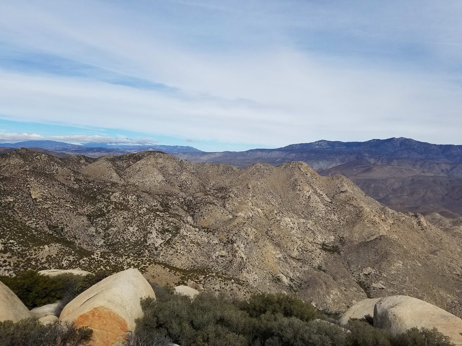
Lake Elsinore and the San Bernardino Mountains in the distance


Burn damage looking toward Modjeska


Tuesday, November 1, 2016

Square Top

Hiked: 10/31/2016
Distance: 8.4 miles round trip on trail and cross country
Summit Elevation: 4649'
Elevation Gain: 2950'
Elevation Gain (in Empire State Buildings): 2.36
Round trip time: 7 hours 45 minutes
Recommended water: 92 oz.
Parking/Fees: $10 Los Coyotes Reservation day hike fee
Difficulty: Strenuous (class 5 summit block)

Square Top is #34 on the San Diego Peaks List. The trailhead is near the end of Tukwet Road in the Los Coyotes Reservation. The dirt roads leading there are relatively smooth until you reach Tukwet Road. A low clearance vehicle could probably make it, but there are some deep ruts and vegetation that will slap the underside of your vehicle. Square Top is the only San Diego Sierra Club peak with a class 5 summit block. I wanted to do this hike solo to test my novice rope skills. I don't aspire to do big walls, or even trad climbing, but I do want to be able to handle an occasional class 5 problem or canyon rappel.

Are you on the square?
Are you on the level?
Are you ready to swear right here, right now
Before the devil
-- Ghost BC, Square Hammer

I arrived before the Los Coyotes station opened, so I taped my day hike fee plus enough to cover my previous trips in an envelope to the station door. Nothing wrong with a little karma. The trail started by descending the remaining section of Tukwet Road into Cougar Canyon. Square Top was visible from the trailhead but disappeared as I descended. Once you get into Cougar Canyon, a faint use trail comes and goes, but it is generally easy to find your way even if you lose the trail. I crossed water in the canyon several times before reaching the point to leave the canyon and head toward the granite pinnacles guarding Square Top. Some of the boulders making up the pinnacles and on the slopes of Square Top are enormous. I skirted the flank of a prominent pinnacle, then followed the remnants of an old road before dropping down into the south fork of Sheep Canyon. I took a short water break there and cleared my shoes of debris. As I started up the south slope of Square Top, I had problems with my make-shift rope bag. I packed the rope, rock shoes, gloves, webbing, autoblock, and carabiners in a bag meant for snowshoes. It weighed 12 pounds and had a strap that I carried over my shoulder. While convenient for packing, it was a nightmare when I tried any kind of scrambling. Not only was the extra weight slowing me down, scrambling caused the bag to slide around and create imbalances. Square Top was steep class 2, and it was tiring to carry all that gear up to the summit area.


Sunlight starting to flow through the canyons in Los Coyotes Reservation


Square Top from the start


Entering a fork of Cougar Canyon


One of several deer I spotted


Leaving the canyon


Heading toward the pinnacles area


Boulder near one of the pinnacles


Approaching Square Top


Starting up the south slope


Looking back near the top of the south slope

Once I got to the top, I unpacked the rope and gear, then walked around the summit block to figure out the best direction to make my attempt. The west side looked like the easiest (as other reports had mentioned) so I started hunting for an anchor on the other side. I thought finding a nearby anchor might be difficult, but I found a good boulder leaning against the east side. I wrapped 1" nylon webbing under the boulder and evened it out in a basket hitch. I tied the ends in an overhand knot to create a master point. It felt solid. Next, I attached the rope to the anchor with a figure 8 follow through and two opposite and opposed carabiners. The next step was to throw the rope over the summit block. This turned out to be my biggest problem. The 40m static 9mm rope I brought ended up being too long, but better to bring one too long than too short. My first throw went over the wrong edge and I couldn't position it correctly. My next nine plus throws, I lost count, were whipped off the north side by a strong and steady 25mph wind. The wind gusted up to 40mph and it created havoc with my throws. I tried to compensate by throwing the rope south without luck. I thought seriously about giving up on the rope, but I didn't want to try an unprotected ascent with the wind howling so hard. Finally, I tied a knot to the loose end and attached three carabiners. I eventually got the rope over. The last thing to do was get my harness on and set up the two prusik knots I used to ascend. The beginning of the block is vertical with no real holds. I used the lower prusik as a foothold, and the upper as protection, alternating the load between the two to move the other one up. This was my first time to perform a prusik ascent. I had not even tried it once in a gym. Do or die, baby! It was kind of an awkward ascent, but it worked. After I got past the vertical section, I left the lower prusik behind. The rock after that was more of a class 3 friction climb and I just used the upper prusik as protection. Just over half way, a gust of wind tore my hat off and it tumbled over the side. I was too stoked to worry about it and reached the top shortly after. I had set up my camera below to record my victory or demise. Later, I discovered the wind had turned it to record a random spot on the ground. I did haul up the Ricoh Theta for a 360 shot from the summit, something that would have been impossible using my phone. I also carried my phone up and fought the wind to take a few photos and a poor attempt at a selfie. The wind was too strong to stay on the summit block for long. I had planned to rappel down with an ATC-XP, but decided to descend with the prusik instead. In all, I spent about an hour and a half on the summit.


Rope throw


Anchor


West side of the summit block


Looking down from the summit on the east side (anchor side)


Looking down from the summit on the west side (ascent side)


Poor selfie taken during wind blasts


Final resting place of my hat

Back on the ground, I hunted down my hat and checked out the register. The register was in a pair of yellow cans, a variation on the normal red. There were two small registers inside, the oldest one going back to 1991. The newer one was made of strips of old computer greenbar paper and had a lot of familiar names. I found a small spot to sign and replaced everything. There was no benchmark that I noticed. Heading down Square Top, I had the same imbalance issues with my rope bag. Maybe I'll try bringing a large pack that I can stuff all the gear into next time. The return around the pinnacles went easily. As I dropped back into Cougar Canyon, something large crashed through the small trees. I am guessing it was a mule deer since I had seen four on the day, but in Cougar Canyon, who knows. Whatever it was went unseen. The canyon looked quite different going back and I had to check my GPS a couple of times to get back on track. I was quite pleased when I got back to the car. This hike was a long term goal. A transcendental object at the end of time. Getting the class 5 block and handling every aspect of the rope system was a first for me. This was one of a handful of hikes where I came back a different person.


Collins Valley and assorted benchmarks below, Toro Peak distant left


Collins Benchmark, a tough SDC hike for the future


Rock solidified in smooth, sharp perfection


More interesting jumbles


Returning to Cougar Canyon, Pike BM in the distance

Other Trip Reports:
Square Top (Peaks for Freaks)
Square Top (Benjamin Baumann)


Square Top has a middle finger profile

Friday, October 28, 2016

Turtle Rock Park High Point

Hiked: 10/28/2016
Distance: 1.5 miles round trip on trail
Summit Elevation: 530'
Elevation Gain: 400'
Elevation Gain (in Empire State Buildings): 0.32
Round trip time: 22 minutes
Recommended water: 0 oz.
Parking/Fees: Free on Turtle Rock Drive
Difficulty: Easy

A Santa Ana ridge hike was queued for today, but the National Weather Service predicted an 80% chance of rain with a chance of thunderstorms. I cancelled the ridge hike, only to wake up and find light cloud cover and nothing that looked threatening. With other arrangements made for the day, there was no chance of doing anything substantial. I wanted to at least do some light cardio, so I found this peaklet in Irvine. I parked at Chaparral Park on Turtle Rock Drive and started toward the back of the park past parents pushing their strollers. At the top of some stairs, I branched onto a dirt trail heading to the viewpoint. The high point was a short distance past the viewpoint. I continued over the high point, down the other side of the ridge to the end of the park and came back. I took a couple of photospheres with a newly acquired Ricoh Theta S. The one click simplicity and reliability of the Theta S is a big upgrade from the tedious multi-shot effort required using Google's camera software. I was only getting good photospheres about half the time with my phone. Getting those on uneven summits when it was windy was sometimes dangerous. BTW, don't get the regular Theta to save money, the resolution is very bad. I returned the lower end model, but I am pleased with the Theta S. Since this hike wasn't much of a workout, I did another jog around the hood when I got home.

Sunday, October 16, 2016

Monument Peak and Hays Peak

Hiked: 10/14/2016
Distance: 3.5 miles round trip on trail and use trail
Summit Elevation: 6271' (Monument), 6160' (Hayes)
Elevation Gain: 750'
Elevation Gain (in Empire State Buildings): 0.6
Round trip time: 1 hour 20 minutes
Recommended water: 20 oz.
Parking/Fees: Free on Sunrise Highway (S1)
Difficulty: Easy

The day started with Garnet Peak, Garnet Mountain, and Roost Benchmark. I completed those in time for another short hike, but hadn't prepared for one. The Peakbagger android mobile app came to the rescue. I knew Monument Peak (SDC #2) was along Sunrise Highway, but didn't know the distance or where to start. I found the peak in the mobile app, checked a trip report that was less than 4 miles, and downloaded the attached GPS track to my phone. The app tracked my location in real time allowing me to locate the trailhead, just the way John Muir used to do it (haha). This is the reason I upload my own tracks, hoping they will be useful to future hikers.

I parked at the Big Laguna Trail turnout where one other car was already parked. The lot could have held at least 6 cars. The single track heads into verdure meadows with large Jeffrey pines and black oaks. The oaks were showing off some bright yellow color. In less than a mile, the trail intersects the PCT, with the left branch heading toward Monument Peak and the right toward Stephenson Peak. I went left and walked past an older couple sitting about 50 feet off trail enjoying the scene. At a sharp left turn, just after catching a glimpse of the towers on Monument Peak, an unsigned and narrow use trail cuts directly up the slope. It deposits you at a laser research building, and I took the road the rest of the way. Along the short section of road, on the right, was a black cylinder with a warning sign "DANGER: Laser Target". I didn't go in for a closer inspection.


Start


Pines and oaks


Monument Peak ahead


Fence around the laser research station


Target

The view from Monument Peak was great, but not quite as dramatic as Garnet Peak and Roost. Looking north, there is a unique view of the transition from forest to desert. I found the spike-style benchmark and register cans, replacing the torn plastic baggie around the registers with a new one. Hays Peak was back the direction I came up a wide firebreak. On the way back, I stopped at the use trail junction and checked the time. I had enough time to tag Hays Peak so I continued straight up the firebreak. There was a good use trail on the firebreak and within minutes I was on top of Hays. There were no benchmarks or ornaments on Hays, but I could see the PCT carved out below. I returned down the firebreak to a point where the brush had been cut down. I turned right and followed the brush line down to the PCT, then back to the start. I ended the day with 5 peaks (4 SDC) and 14.9 miles, not a bad day.


Monument benchmark


Zoomed in to Stephenson Peak


Nearby Hays Peak


Transition zone from forest to desert


Looking southeast


Monument Peak from Hays Peak