Saturday, May 24, 2014

Cobblestone Mountain, Sewart Mountain, White Mountain

HPS Star Emblem Peak
Hiked: 5/23/2014
Distance: 15.2 miles round trip on trail and cross country
Summit Elevation: 6733' (Cobblestone), 6841' (Sewart), 6253' (White Mountain #2)
Prominence: 1373' (Cobblestone), 401' (Sewart), 850' (White Mountain #2)
Elevation Gain: 6360'
Elevation Gain (in Empire State Buildings): 5.08
Round trip time: 10 hours 15 minutes
Recommended water: 248 oz.
Parking/Fees: Adventure Pass
Difficulty: Very Strenuous

One of the toughest day hikes in Los Padres National Forest, Cobblestone (plus Sewart and White) was a hike inspired by a post on the San Gabriel Mountain forum by David Stillman. Cobblestone is probably the most remote HPS peak in Ventura County. It is an off trail, yucca filled, waterless, destination with more than a vertical mile of gain. The hike is an all day commitment, and even savvy, experienced hikers run out of water by underestimating it. I had elaborately planned the trip for late April, but discovered Alamo Mountain Road was closed seasonally and would not open until mid-May. In May, I kept calling the Mt. Pinos Ranger station until I confirmed the roads were open. Unfortunately, the new hike date lost some of the original group and it ended up being just Sean and I. We met at the Verdugo Park and Ride, then Sean drove north and navigated the 24 miles of dirt road mazes to the trailhead. You can't even start this hike without a serious effort. As an added challenge, I was suffering from a serious sinus infection, the kind that makes your face and teeth hurt. I had visited the doctor the night before and he put me on Azithromycin, a big dog antibiotic. I was one day into my five day treatment when I faced Cobblestone. Other than having to blow my nose every 30 minutes, the sinus infection didn't cause me undo distress.

We started down the trail at around 8:00 AM, about an hour later than planned. There was a horrific crash on the I-5 that delayed me, and the dirt roads took longer to navigate than expected. I could not have made it in my low clearance vehicle, some of the ruts were too deep. We started at Buck Creek trailhead toward the first milestone, Sewart Mountain. The weather was pleasant, having cooled down from triple digits the previous week. Cobblestone is immediately visible from the trailhead, and looks much closer than it is. Heading up Sewart was a constant battle with large deadfall blocking the trail. Some you could get around, more you had to climb over. Both sides of the mountain were filled with deadfall obstacles. We spotted three deer right away, and a fourth later bounding across the slopes. They were all too fast for us to get photos. Coming down the east side of Sewart, we made the first of two big navigational mistakes. We bushwhacked directly toward the ridge, but the path required getting to a saddle between Sewart and the ridge first. We figured it out about half way down and traversed over to the saddle. On the way, I tripped on some brush and hit my hand on a rock. It didn't seem like much at the time, but I learned later I had a bone bruise in the metacarpal of the small finger on my right hand. It got worse as the day proceeded, but in the heat of battle, I just continued. There were a lot of discarded bottles and cans on Sewart and between us, we packed out about 8.


Cobblestone from the Buck Creek trailhead, farther than it looks


Sewart from the Buck Creek trailhead


Sean signing the Sewart register


Deadfall on Sewart Mountain

At the saddle, we took David Stillman's advice and cached some water at the bottom of Sewart, cache #1. This turned out to be great advice because at the end of a long day, the thousand foot climb up Sewart is tough and would be beyond miserable without water. I took 248 oz. (>7 liters) of water and used every drop. We immediately continued the climb to White Ridge. The trail was in better shape along the ridge. In about two miles, we found an old wooden sign that said "Stewart Mountain 3 1/2, Alamo Mountain 8". Apparently Sewart used to be named Stewart or the sign was a misprint. [Update: According to the USGS, it has been named Sewart since 1/19/1981] Sean spotted an overgrown use trail behind the sign that appeared to descend toward the saddle between the ridge and Cobblestone. We decided to give it a shot. The trail was overgrown in spots and washed out in spots, but very usable. It made the descent to the Cobblestone saddle a non-event. At the saddle, we cached more water, cache #2, and Sean decided to drop his pack, taking only one liter and energy bars for the ascent. I continued carrying my pack up Cobblestone.

Heading up the saddle, we found some ducks and tape to lead the way. Still, there were unmarked sections where we drifted and the 1400' climb in less than a mile was at 30 or 40 degree angles. There were cool "cobble" like rock formations along the way. The ridge along Cobblestone is open and sandy, and we were glad to reach the summit for an extended break. The aluminum register from 1960 still looks brand new. Entries go back to 1981. I flipped through to find people I knew, Bob Burd, and both entries from David Stillman. I took a good look down "Redrum Ridge" and it looked very unfriendly. I don't want to go there, Mrs. Torrance. We signed the register, and after taking in the remarkable views, went down at an exuberant pace. This is where we made our second navigational mistake. We drifted left of the major cliff area and came out a good distance from the saddle. We decided to cross country just below the cliffs to get back to the saddle. The dirt was so loose that we frequently would slide 5 feet down the slope and have to scramble back up, only to slide again a few steps later. The brush was thick in places and forced us lower and farther away from the cliffs than we wanted to go. Eventually we fought back up to the saddle and retrieved cache #2.


Rare shaded area along the White Ridge


Old sign for "Stewart" Mountain and Alamo, use trail to Cobblestone saddle starts behind it


Coming down the use trail to Cobblestone saddle


Descending to the saddle between White Ridge and Cobblestone


Cobblestone boulder on Cobblestone Mountain


Baby pine in the burnt forest


Cobblestone benchmark


Dedication of register box to Jack Cross


Fancy aluminum register box on Cobblestone summit, secured to the rock


View southeast from Cobblestone summit


White Mountain and ridge from Cobblestone summit


Sean on Cobblestone summit


Checking the summit register

The next decision was how to get back up to the White Ridge. We considered a direct ascent, but that held little appeal. Instead we chose to side hill toward White Mountain following deer trails. We eventually reached the spot we were aiming for, but it turned out to be a good 200' below the ridge. We started angling higher, more directly toward the ridge and I led us up a short, but completely unnecessary section of class 3 rock for fun. We quickly headed down the lupine filled ridge toward White. As we got closer, it once again became a deadfall obstacle course. Poodle dog bush crowded some sections. We passed over two false summits on the way to White and I stopped on one to eat some snacks for much needed energy. The summit register was a glass jar inside the standard red cans. The views are great in some directions, and partially blocked by brush in others. We only rested a few minutes before starting back along the ridge line. It was mostly pleasant coming back along the ridge, but the gain was far from over. Two major sections offered 500' and 200' climbs before descending back to the saddle below Sewart, where we collected cache #1.

At this point in the day, Sewart looked like a monster. We decided to stick to the trail along the overgrown road for the final 1000' slog. Again, as you reach the midway point on Sewart and for the rest of the way, you are fighting the deadfall. I finished my last drop of water as we reached the car. This was a mild day with temps never reaching much over 70F. On a hot day, I would have needed at least 300 oz. (about 9 liters). Cobblestone left me with plenty of bruises, scrapes, and bumps, and a swollen hand for about a month, but also images of a beautiful, isolated pine forest, burned but recovering, and big peaks to challenge your resolve. Special thanks to David Stillman for valuable beta while preparing for this hike.
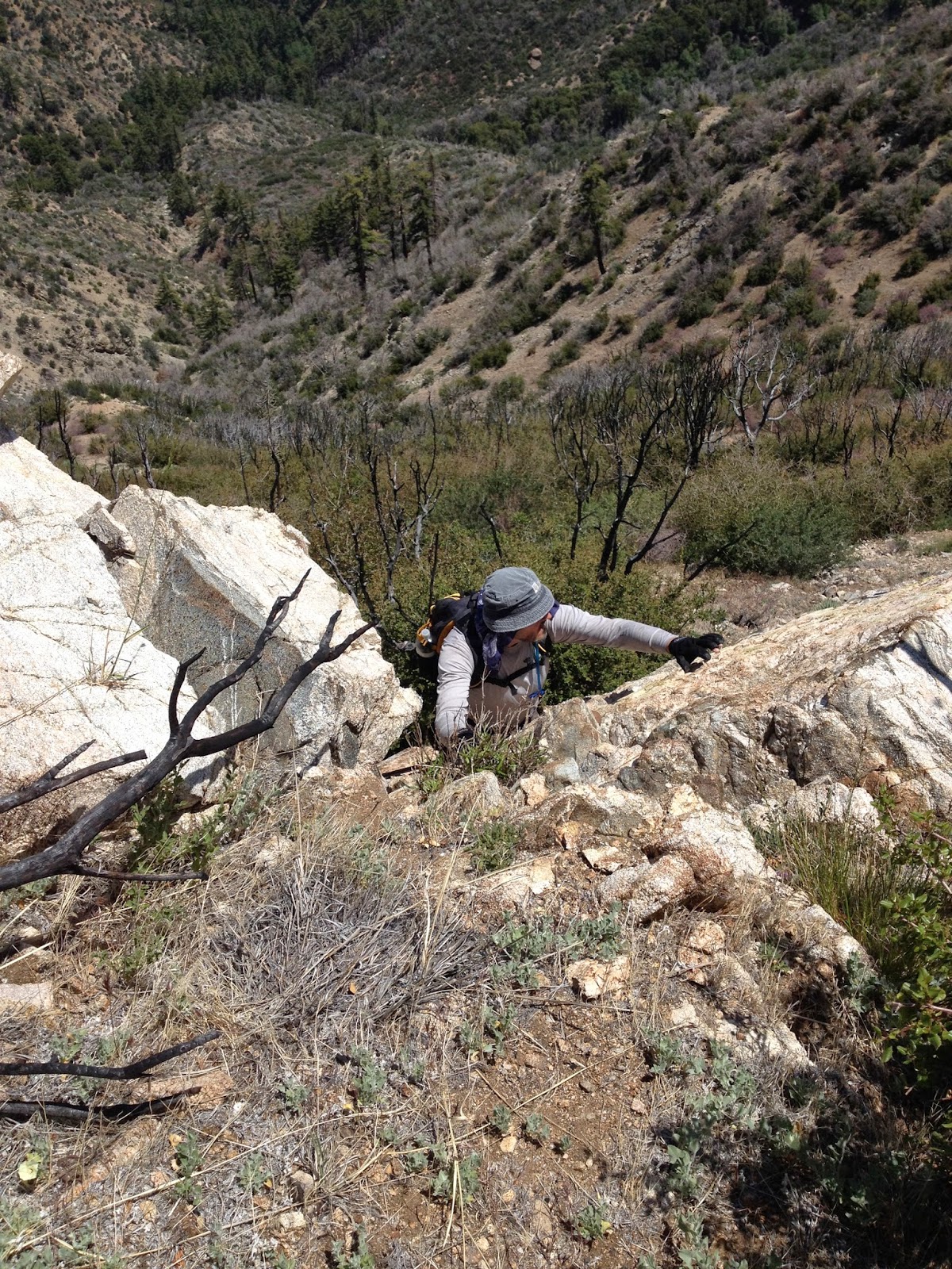

Unnecessary, but fun, class 3 section ascending to White Ridge


Same short class 3 section


Heading to White Mountain through a lupine meadow along the ridge


White Mountain register


Cobblestone from White Mountain summit


Dead giants


Would you like to know more...?

Other Trip Reports:
Cobblestone Mountain (David Stillman)

Saturday, May 17, 2014

Verdugo Mountain, Point 1815

Hiked: 5/17/2014
Distance: 5.3 miles round trip on trail
Summit Elevation: 3123'
Prominence: 1344'
Elevation Gain: 1981'
Elevation Gain (in Empire State Buildings): 1.58
Round trip time: 2 hours 10 minutes
Recommended water: 80 oz.
Parking/Fees: Free at Wildwood Canyon Park
Difficulty: Moderate

After dropping my daughter and her friends off at Universal Studios, I made the 20 minute drive north to Burbank and the Verdugo Mountains. The quickest route I could find from the south was from Wildwood Canyon Park. I started at the second trailhead that had a nice portal and restroom. I was surprised there was plenty of parking on a nice Saturday morning.

The climbing starts promptly at a moderate incline. It gets a little steeper once you reach the Vital Link trail, which switchbacks up the ridgeline. Most of the work is done on Vital Link. It was hot in the late morning and I passed several hikers on the way up that looked like they had taken on a little too much in the heat. There were more people coming down than going up, having started earlier in the morning. Once I reached the Verdugo Motorway, it was an easy road hike to Verdugo Mountain. Communication arrays lined the whole ridge, and there is a large one on Verdugo itself, along with a building surrounded by barbed wire. I could not find a register or benchmark, but didn't look very hard based on previous reports. Because of smog, the views were poor. I could barely make out downtown LA. On the way down, I jogged a few of the downhill sections of Verdugo Motorway and stopped by Point 1815 just off the trail. The only extra view I got from Point 1815 was the golf course, but there is a bench there if you want to watch a tournament or something. The smog hid the nice views, which must be great after dark, but at least I got a pretty good workout.


Portal at trailhead


Verdugo Mountain high above


Tail of a patch nosed snake with faster reflexes than mine


Looking back to Point 1815


Short, sharp, switchbacks on Vital Link


Verdugo Mountain from Verdugo Motorway


There's a smog upon LA


Mt. Wilson behind honeysuckle from Verdugo Mountain summit


Friday, May 16, 2014

Harrison Mountain

Hiked: 5/16/2014
Distance: 3.2 miles round trip on use trail and cross country
Summit Elevation: 4743'
Prominence: 1403'
Elevation Gain: 1725'
Elevation Gain (in Empire State Buildings): 1.38
Round trip time: 2 hours 40 minutes
Recommended water: 80 oz.
Parking/Fees: Adventure Pass
Difficulty: Moderate

Harrison Mountain is just under the 5000' cut off for a Great Lower Peak, ranked #6 on the list, and is the higher of two guardians of Highway 330, the lower one being McKinley Mountain. According to the Sierra Club, it was named for President Benjamin Harrison who signed the act creating the San Bernardino National Forest Reserve on February 25, 1893.

I parked at the turnout for the north trailhead and got ready in the 90F heat. I was sporting new Black Diamond talus gaiters. Bugs were annoying from the start, but mostly keep at bay with a liberal application of spray. Many experienced hikers have gotten lost at the start trying to find a use trail up to the first bump. Satellite recon suggested going down the road a ways, then up the firebreak. However, several reports showed ascending more directly on a faint use trail so I tried that going up. The first quarter mile was mostly cross country, picking through brush and deadfall until I found a more prominent use trail. It was very steep up to the first bump, then leveled out as it traversed toward the west ridge.


Harrison Mountain from the freeway


Break in the fence where a very faint use trail begins.
Heading up the firebreak from further down the road is better.


Looking back at the parking lot near the first bump

Sections of the use trail were in good shape, but along the traverse, there were sections completely overgrown with brush, buckthorn, and poison oak. Having just healed up from my last encounter, I was wary and somewhat alarmed at the amount of it invading the trail. I was also wearing shorts and a short sleeved shirt. I recommend long pants and long sleeves, regardless of heat if you are going to climb Harrison in the spring. I moved carefully, using burned branches to push the poison oak off the trail where I could. When I got to the west ridge, I stopped and improvised a way to cover my exposed legs by ripping my rain poncho in half and tying the pieces around my legs. It was flimsy protection, but better than nothing. I'll know in a few days if it was effective or too late. I also noticed a tick crawling on my leg and brushed it off. It was the first of nine I would find crawling on me before the day was done.


Buckthorn in the way


Lots of evil poison oak invading the trail


Improvised leg protection


Rocks at turn to head up the ridge


Firebreak to Harrison summit

The west ridge to the summit was mostly tall grass and open firebreak, clear of poison oak. I found the summit register cans and tried to sign the register, but both books were soaked. I could not even turn most of the pages to check out recent visitors. I walked to the far end of the summit for better views of Highland, Loma Linda, and the rest of the mighty IE. Harrison rises well above McKinley across the highway. There were hazy views of the high peaks and ranges. I completed another scan for ticks, then started down. Instead of going back the way I came, I decided to descend the firebreak on the lower section to see if was a better path than the crude way I ascended. It turned out to be much better without adding much distance. When I got to the bottom of the firebreak, I followed an animal trail back to the road and marked it with a waypoint. The faint trail is not visible from the road, but goes between two small trees a few hundred feet down from the parking lot. It seems like a better way both up and down.


Summit register


McKinley Mountain from Harrison summit


View southeast to the high places


The animal trail to the lower firebreak goes between these small trees


Friday, May 2, 2014

Armada BM

Hiked: 5/2/2014
Distance: 1.4 miles round trip on trail and cross country
Summit Elevation: 2220'
Elevation Gain: 729'
Elevation Gain (in Empire State Buildings): 0.58
Round trip time: 50 minutes
Recommended water: 40 oz.
Parking/Fees: $10 State Parks
Difficulty: Easy

After finishing Mt. Russell, I had scoped out some of the other peaks inside Lake Perris State Park. Terri Peak might have been the next highest, but it had no cross country. Armada, while shorter, was mostly a cross country scramble and more in line with the Mt. Russell theme of the day. It was still 100F and I would get no shade or break from the heat on this short hike. I parked at the Regional Indian Museum and took the trail heading to Terri Peak. Very soon, I left the human trail to follow goat trails toward Armada. There were plenty of goat droppings and footprints to keep me going the right way through the scrub. Soon, I hit the ridge and wandered to the right to look at some large boulders, then back the other way to hit Armada. There were three large painted lines around where the benchmark used to be. I had good views of the lake from the south end, but could not see Mt. Russell since Terri Peak was in the way to the north. When I returned to the car, I took a few minutes to cruise through the Indian Museum. It had two friendly state curators who warned me that red diamondback rattlesnakes were around. I told them I was expecting to see snakes on my hikes, but didn't see any. I was quite fine with that. I got a quick tour of the artifacts and stuffed animals and we chatted about hiking conquests before I drove home. On the way back, at the intersection of highway 60 and I-215N, the traffic came to a sudden stop and the third car ahead of me smashed into the back of a pickup truck. I swerved to the left, avoiding a further pile up, but the smell of leaking fluids and smoking brakes lingered. Fortunately, it was only the two vehicles in the crash, as they both limped to side of the freeway for the unpleasantries. When I hit highway 91W, it occurred to me that Mt. Russell had been my 91st Sierra Club peak.


Start of the trail to Terri Peak and Armada BM


Off trail toward Armada BM


Scrambly


Armada BM summit


Lake Perris from the south


Box Springs Mountain with San Gabriels behind


Crow lookout


Local animals in the museum


Desert cats in the museum


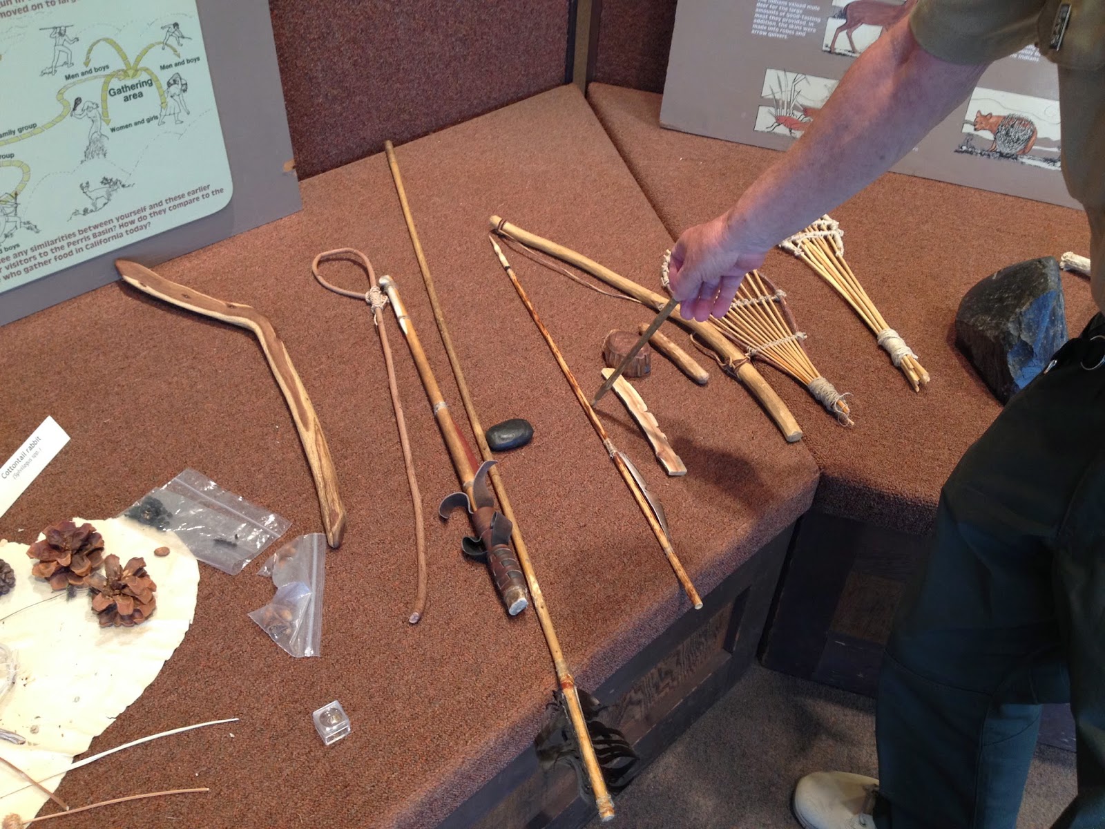
Learning about ancient Indian weapons


Mt. Russell

Hiked: 5/2/2014
Distance: 3.7 miles round trip on trail and cross country
Summit Elevation: 2704'
Prominence: 1109'
Elevation Gain: 1133'
Elevation Gain (in Empire State Buildings): 0.90
Round trip time: 1 hour 50 minutes
Recommended water: 60 oz.
Parking/Fees: $10 State Parks
Difficulty: Easy

Not to be confused with the Sierra 14er with the same name, this Mt. Russell is on the Sierra Club Lower Peaks List at the north end of Lake Perris State Park. The lake itself is a large reservoir and recreation area surrounded by hills with a small island in the middle. There are also horse facilities. I arrived around 9:00 AM and it was already 85F. I parked in the horse staging area at the north end of the park. This is also a quail hunting area (shotguns only), and I hoped not be mistaken for a bird. Turns out, I didn't hear one shotgun blast on the trip and saw no hunters, but I did see lots of spent shells. It was probably too hot for the hunters.

Despite being next to a lake, this is a desert hike. It was dry and dusty from the start. There were also plenty of bugs. Spray up before heading up. Mt. Russell loomed behind other hills at the far end of a canyon. Only the first half mile or so of the hike is on a trail, then you veer into the canyon filled with scrub and boulders. There are faint use trails on both sides of the canyon. I stayed to the right and sometimes wandered too far up the canyon wall, making corrections when I saw the use trail below. At the end of the canyon, I went up the left side of Mt. Russell with no trail, which was the wrong choice. This path led me up the steep slope while bushwhacking and boulder scrambling. When I got to the top, I spotted a faint use trail on the right side that bypassed the boulders. That was my descent path. With the heat wave, the whole area felt "snakey", but I didn't see any snakes. Plenty of big lizards and ground squirrels, though. There is enough brush on the route that long pants were justified, even in the hottest weather.


Hunting season around Mt. Russell


Heading out


Butterfly in the canyon


Bushes, boulders, and boiling heat


Tight squeeze just before the summit

The summit has a large wooden cross on it, cemented to the rocks, with a light aimed at it. There was also a metal pole, but I didn't find a register. The views of Lake Perris and the surrounding larger ranges were very nice. I took some photos and rested a bit on the summit. I followed the more pleasant path down and when I got back to my car, it was 100F. Ah, nothing like Perris in the spring. I had time for my bonus peak, so I drove toward the south end of the park in search of Armada BM.


Mt. Russell summit


Lake Perris and Alessandro Island


Shriveled mushrooms in the heat wave, on the way back