Route 2
Distance: 7 miles round trip on trail, use trail, and cross country
Summit Elevation: 5430' (Bernard), 5440' (Little Berdoo)
Prominence: 1040' (Little Berdoo)
Elevation Gain: 2048'
Elevation Gain (in Empire State Buildings): 1.6
Round trip time: 5 hours
Recommended water: 96 oz.
Parking/Fees: $35 National Parks or National Parks Pass
Difficulty: Moderate
Fires were burning in three of our local mountain ranges, shutting down large sections or entire wilderness areas. I looked further out, initially checking the southern Sierra and Sequoia. Weather there was iffy so I checked Joshua Tree. Crystal clear and cool enough. I aimed for the only two Sierra Club peaks in the park I hadn't already climbed: Bernard Peak (HPS #242) and Little Berdoo (HPS #239). I picked Route 2 that started on a 4WD section of Geology Tour Road. I had driven part of the road to Malapai Hill and remembered it being pretty good. Google suggested the shortest trip was up 4WD Little Berdoo Canyon from the south that turns into Geology Tour Road once you enter the park. I left early with a thought in the back of my mind that if the road proved too much, I had time to drive in from the north. It was too much. The first mile was on broken asphalt with an open shooting range on both sides. At sunrise, I rolled by a guy unloading his handgun on a refrigerator, hoping to avoid ricochets. On the other side were two guys with AR-15s shooting at human silhouette targets about 100m away. I got about 2 more miles up the rough canyon before I hit rocks I didn't think my stock 4x4 could handle. Not worth the risk. Discouraged, I returned to I-10, drove north of the mountains and came back at them. The NPS put up a scary sign where the unmaintained part of the road started. It was only two more miles to the starting point and the road was in good shape. A little deep sand, but I didn't engage 4x4, though I was glad to have it.
After 5 hours of driving, I finally set out in the open desert toward Bernard Peak, heading for the major gully. Little Berdoo was not visible. Small animals had dug burrows in the sand, tiny land mines that collapsed a few inches when I stepped on them. Annoying. Once in the canyon proper, I picked my way around brush and dry falls. A couple of falls required some class 2. There was a lot dried grass and weeds. I picked up a lot of foxtails, forcing me to stop half way up to get them out of my socks and boots. Route finding made progress slow. I exited the canyon just below Bernard, taking the final steep slope toward the highest of twin summits, Peak 5435. It was 5' higher than the official Bernard peak to the south. Both peaks had short scrambles over black volcanic rock. Both had nice views, though smudges of smoke blotted the sky toward San Jacinto and Gorgonio.


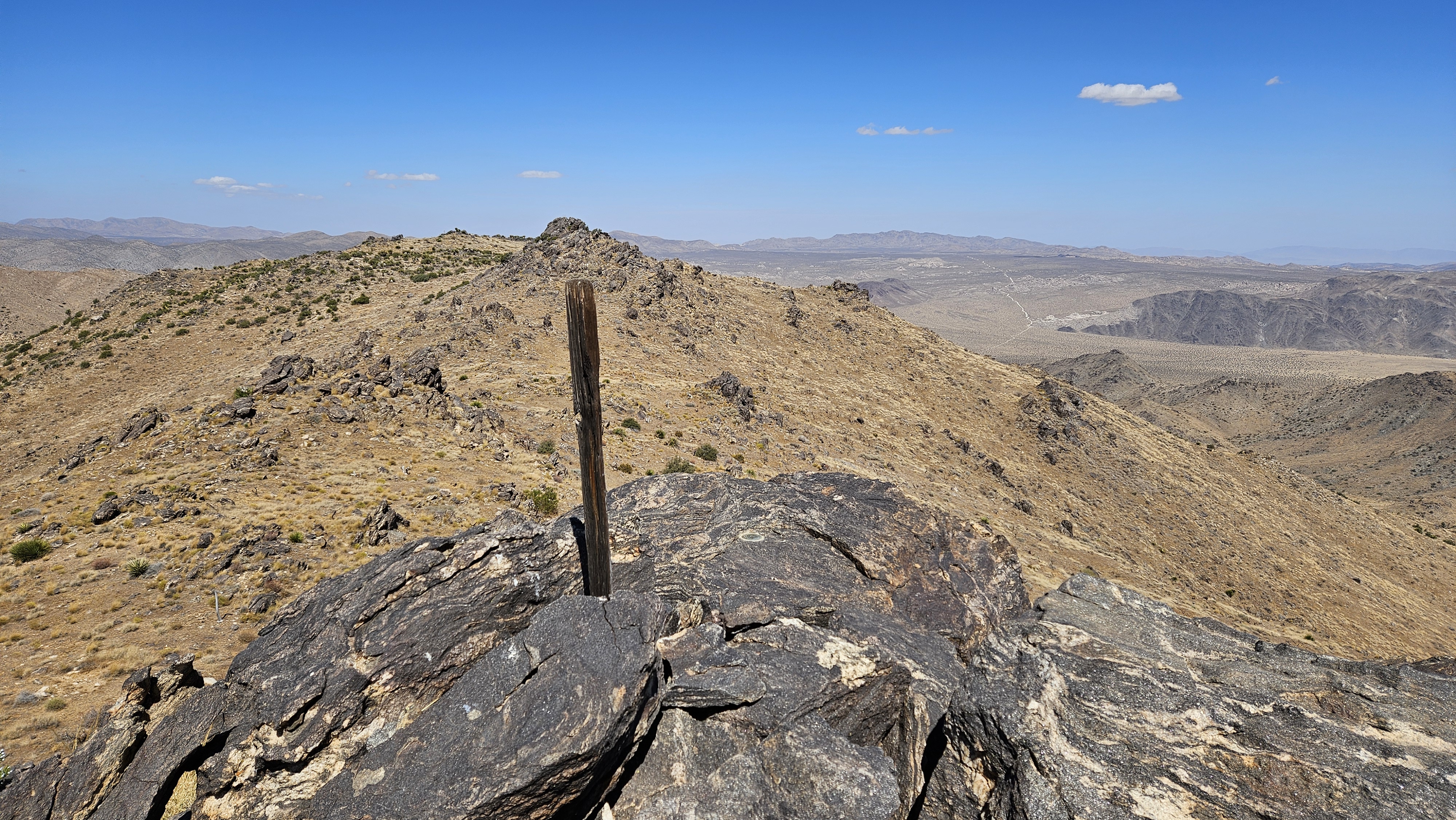

From Bernard, it was hard to tell which distant bump was Little Berdoo. From different angles, various bumps appeared higher than others. It got sorted on the way. After an initial drop, I tried to stick to the ridge line without giving up elevation. It wasn't far away, so I was on Little Berdoo in short order. Views southwest were better from Berdoo as the mountains fell away into foothills. I could see Geoglogy Tour road winding down toward I-10, glad I didn't have to exit that way. I followed a more direct route down and dropped into the canyon. It was easier going downhill. I coasted along the sandy wash and open desert, seeing the blue glow of the truck from a quarter mile away. I was tempted to climb some of the rock piles on the way out, but will plan a separate trip(s) for some rock climbing.


