Hiked: 11/24/2018
Distance: 16.8 miles round trip cross country
Summit Elevation: 4684' (Sawtooth), 4467' (Red Top)
Prominence: 604' (Sawtooth), 667' (Red Top)
Elevation Gain: 4408'
Elevation Gain (in Empire State Buildings): 3.52
Round trip time: 13 hours 15 minutes
Recommended water: 238 oz.
Parking/Fees: Free on North Indian Canyon Road
Difficulty: Very Strenuous
The final two summits I needed on the Sierra Club San Diego Peaks List were Sawtooth Mountains High Point (#31) and Red Top (#42). These are the two most difficult to day hike and I saved them for last. Matt and I met at Indian Gorge road a little after 4 AM and he drove his 4x4 Jeep to the starting point on North Indian Canyon Road. A 4x4 is needed for the large rocks and sand. We were lucky to have a full moon but broke out the headlamps to avoid the cholla land mines. We went over the Tierra Blanca pass and stopped for a break where I had cached some water near the entrance to Canebrake Wash. I added a liter of water from the cache and we started the long, sandy walk toward the ascent gully. Morning light gave Red Top a golden glow. There are at least two old abandoned roads in Canebrake. We started out on the one closest to the Tierra Blanca, but there is another one running closer to the Sawtooth mountains. It is clearly visible in satellite views. After a few miles on the first road, we headed over to the one closer to the Sawtooth mountains. This road went over a small rise before dropping down to the gully between Sawtooth HP and Red Top. We were 6.5 miles from North Indian Canyon road but all the hard work was ahead.
 Full moon start
 Descending the Tierra Blanca pass
 Sheep bones
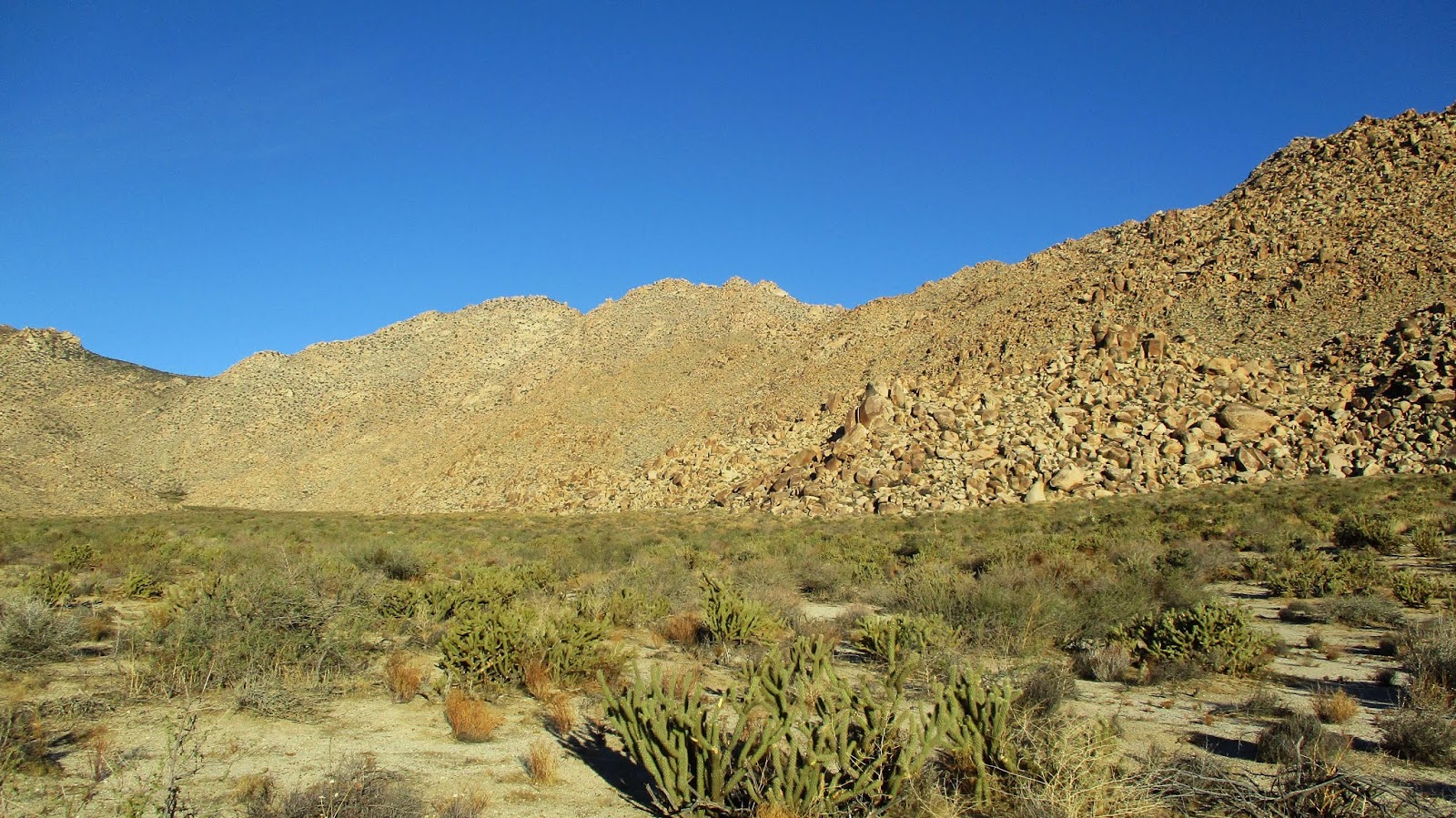
 Red Top from Canebrake Wash
 Sawtooth Mountains High Point
Matt and I each cached a liter of water under a large, prominent boulder at the base of the ascent gully. This was water cache 2. Then, we started up the steep gully, dodging sharps and scrambling over large and small boulders. The ascent was also slowed by sandy patches, gentle on the feet but each step half as effective due to sliding. About half way up, Matt was losing energy. He decided to take a break and eat more calories. We agreed to meet at the top of the gully below Sawtooth HP. I continued up, heading directly at the summit. When I got close to the head wall below the summit, I veered left. This was a mistake and led to a lot of class 3 scrambling to get to the base of the summit. Heading right would have put me on a plateau with a much easier approach. At the base of the south side of the summit, I found a couple of small register booklets in a Knott's Berry Farm glass jar. I signed in then looked for the best way up the summit block. There were two cracks near the register that looked workable, both about 25' going high class 3 to low class 4. I chose the left crack. The rock felt a little crumbly but held. The crux was the start with a good hold on the left and a foot jam on the right. There was a loose rock in the middle but I didn't need it. After the first 10', the rest was exposed but easy. There were awesome views from the top. I took a few photos and a photosphere, then went down to the summit plateau where Matt was just arriving. I waited there while he bagged the summit. With Sawtooth behind us, we prepared for the traverse to Red Top, but we were more than an hour behind schedule.


 Sawtooth summit from the east
 Ascent crack
 Looking down the north side of the summit
 Canebrake Wash, Sombrero Peak distant left, tip of False Sombrero far left
The traverse to Red Top involved side hill work around two major pinnacles. Moving any direction in this terrain is rough sledding. It took us over an hour to descend net 700' to the saddle below Red Top. From there, we were about a half mile and 600' gain from the summit. Matt didn't think he could make it up and down in time to reach Canebrake before dark. Neither of us liked the idea of trying to navigate down the gully from Red Top in the dark. Matt encouraged me to give it a try while he waited at the saddle. I gave myself a short turn around time to allow a buffer of daylight and started toward Red Top. Not far up the gully, I ran into a troublesome grove of trees and brush. Doing the calculus on the terrain cast doubt on my attempt. Deferring to safety, I turned around before my cutoff time. The descent was tricky as we angled back to water cache 2, requiring several course adjustments. It would have been a nightmare in the dark. We picked up our water and shuffled back. Night fell as we reached the pass and we picked our way slowly over it and back to the road. Despite missing Red Top, I was pleased with my performance. I had the right mix of food to stay energized the entire hike. We had plenty of water and only thing we were short on was daylight. The bad news is I failed to bag Red Top, but the good news is that I
get to hike Red Top again.
 On the way to Red Top
 Heading back