Distance: 1 mile round trip on dirt road and cross country
Summit Elevation: 1759'
Prominence: 439'
Elevation Gain: 575'
Elevation Gain (in Empire State Buildings): 0.46
Round trip time: 1 hour
Recommended water: 40 oz.
Parking/Fees: Free on unnamed dirt road
Difficulty: Easy
Fresh off my hike to Alligator, I drove about 60 miles east along I-10 to the next geological oddity near the road: Dome Rock. The official USGS name of this mountain is Sugarloaf Peak, part of the Dome Rock Mountains, but it is locally known (and signed) as Dome Rock. The Dome Rock Mountains run both north and south of I-10 with higher mountains on both sides, but Dome Rock is an interesting and somewhat prominent feature from the road. It is a great mound of dirt capped with a jagged, round dome of volcanic rock. It looks technical from the north, but a class 2 gully cuts the dome from the southeast.

Dome Rock from the road

Serious desert temps

Dome Rock, starting from the east
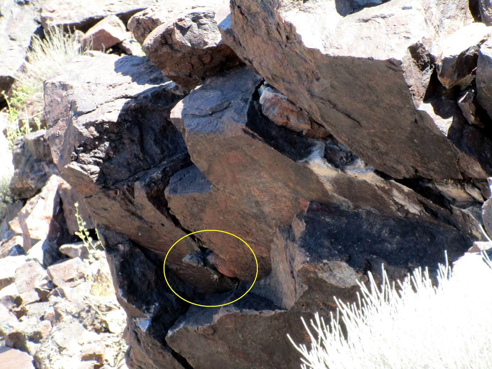
Traveling east on I-10, I took exit 11 on the paved Dome Rock road, then followed unnamed OHV dirt roads and trails to the east side of Dome Rock between it and peak 1911. The roads were not very good, but they also weren't deep sand like around the Alligator. 4x4 was not required, but I recommend high clearance. A sedan might be able to make the trip, if driven slowly. When I reached the starting point, the temp had risen to 100 and it was approaching the hottest part of the day. This trip was expected to take about an hour with some scrambling, and I decided that if I started to overheat, I would turn around. I wasn't sure where the ascent gully was so I headed up the road toward a south side ridge. As I got closer, I spotted the gully east of the ridge, so I left the road and headed toward the gully. Half way up, I found a single boulder large enough to throw some shade and stopped under it to hydrate. My core temp seemed fine, so I continued up. The gully got steeper as I ascended with loose rocks testing my balance. I stopped at the first class 2 section because the rocks were too hot to touch for more than a second or two. I anticipated this and put on gloves before proceeding. The last 100' or so was steep class 2. I made one class 3 move that was not really necessary before topping out. There were a couple of tall rock cairns on the summit and a register in a plastic jar stuffed with loose pieces of paper. I found a blank one to fill out and laughed at some of the other entries. There was no insect swarm to drive me off the summit so I took a little time to enjoy it. The desert views were striking and I was glad I made the effort. While returning, I saw a chuckwalla with a red-orange body on a rock below. We sized each other up, then he ducked between two rocks for cover. He was in an awkward spot, but I did my best to get some good photos of him. Mr. chuckwalla was icing on the cake of an already fun adventure.

A chink in the armor

Lone saguaro guardian, with open arms

Final bit

Cairns on the summit

Random register entry
Wary chuckwalla

Hide and seek

Starting down the gully

No comments:
Post a Comment