Distance: 7.8 miles round trip on dirt road and use trail
Summit Elevation: 2600'
Elevation Gain: 2297'
Elevation Gain (in Empire State Buildings): 1.83
Round trip time: 3 hours 30 minutes
Recommended water: 52 oz.
Parking/Fees: Free on Blackstar Canyon Road
Difficulty: Moderate (ISC-F3C2T4)
Peak 2600 sits between the main and east forks of Baker Canyon in the Santa Ana Mountains. Brad had been to this peak before and agreed to guide me. You can access this area as part of the Irvine Ranch Natural Landmark every couple of months.
The first part of the hike is along a dirt road that parallels Blackstar Canyon Road for a half mile as the road slowly climbs toward the first electrical tower. Views get better with the elevation, first into Limestone Canyon, then Hall and Baker Canyons. We got a good look at the giant cross near Star Benchmark. There is a four way junction at the first tower and we continued straight. The largest single chunk of gain was the climb to 2342', about 600' in a half mile. The rest comes in gentle, rolling angles. Irvine Lake looked full, a complete reversal from late last year when it looked ready to vanish. A little past 2342', we got to the second electrical tower. From there, a use trail leaves the road behind the right side of the tower along the east cliffs. It is not obvious at first, but can be seen by taking a couple of steps into the brush away from the cliff.

Start


Loma Ridge

Cross and Star Benchmark


Some kind of collapsed structure

Greenery, Peak 2342 behind

Climbing to 2342'

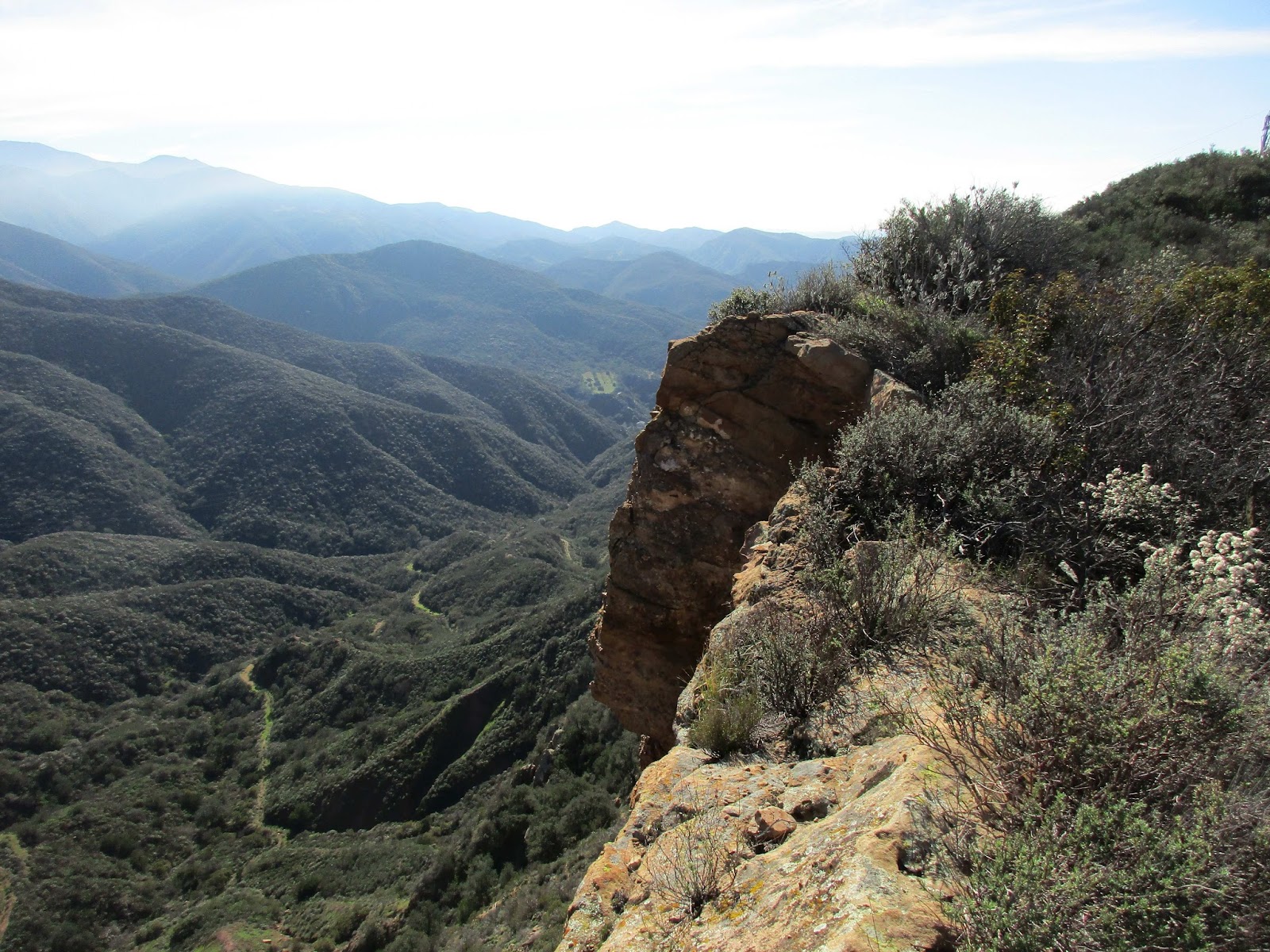
First cliff
The use trail hugs the cliffs, generally staying 2' to 20' from the edge. There are captivating views down the cliff faces as you climb to a local apex at 2473'. On the other side of 2473' was a fixed double rope, maybe 10mm, wrapped around two average sized trees, one living and one dead. Knots were tied expertly every two feet down the length of the rope providing good hand holds. The rope seemed solid, protecting a 10' class 4 section of decaying sandstone. Neither Brad nor I know who placed this rope. Once we were down, the slope dropped to a saddle as the use trail got more congested. Brad was doing some trimming as we went, but the bushwhacking was light in most places. We crested a small bump before reaching the summit of peak 2600, completely covered with brush blocking all views. No marks or register were found on the summit. I pushed out the other side for a great shot of peak 2829 backed by Mt. Baldy and the snowy Angeles National Forest. While the summit was nothing special, the trip out and back was a lot of fun. We used the rope on the return trip and jogged some of the downhills.

Peak 2473

Cliffs on the Baker Canyon side of Peak 2473

Fixed rope, the anchor fine for rappel, not fine for a fall

Brad descending

Looking back at the cliffs, second electrical tower on the left

On the way to Peak 2600

Overgrown summit of Peak 2600

Looking toward Peak 2829 and the snow covered Angeles National Forest

Ascending

Turkey vulture soaring overhead
Some video highlights


The GPS track shows us going over the cliff
Would you like to know more...?
Great report Keith. Funny, I going to head out there myself on sunday before the Superbowl. Glad to know the bushwhacking isn't too bad. I was going to bring some clippers just in case, but it sounds like they're not needed. Thanks for the info!
ReplyDeleteCraig,
DeleteThanks! We almost bumped into each other. It was a cool local hike and nice addition to peakbagger. :)