Monday, April 28, 2014

Cactus to Clouds

HPS Star Emblem Peak
Hiked: 4/27/2014
Distance: 20.3 miles round trip on trail
Summit Elevation: 10834' (Mt. San Jacinto)
Prominence: 8319'
Elevation Gain: 10614'
Elevation Gain (in Empire State Buildings): 8.49
Max Slope: 50.7%
Round trip time: 12 hours 45 minutes
Recommended water: 272 oz.
Parking/Fees: Free parking across from Palm Springs Art Museum, $12 tram ride down
Difficulty: Very Strenuous

Cactus to Clouds is an epic day hike that starts in the desert near sea level behind the Palm Springs Art Museum and ends on top of Mt. San Jacinto at 10834'. Most of the gain (about 8000' of the 10000'+) is done on the Skyline trail that starts behind the museum, though some people start on the Lykken trail that intersects with Skyline low on the ridge. A lot has been written about the Skyline Trail, and Backpacker Magazine ranked the full Cactus to Clouds as the 5th toughest day hike in America (a caveat being hikes with trails). Here is an illuminating paragraph from Hikin' Jim about Skyline:
This is a committed route. What do I mean by "committed?" There is no way to abort a hike once you start. In other words, once you get onto Skyline, you're committed. If you go up, but get too tired to continue, you (in hot weather) can't just head back down. As you head down, the temperature will increase. You're essentially descending into an inferno. From what I've read, this seems to be the pattern for most of the people who have died on Skyline. They started up, got into trouble, headed down into the fiery furnace of the desert, and succumbed to the heat. Again, I'm not trying to scare anyone off who knows what they're doing; I'm just trying to be responsible and present what are the very real objective dangers.
Because the weather is relatively mild in April, it is one of the safest times to attempt Skyline. October is also popular. I began loaded with 100 oz of water and 96 oz of G2 Gatorade. The water only needed to last until I could refill at the ranger station, but it didn't, forcing me to use more gatorade on Skyline than planned. The Gatorade was meant to last the entire hike (it did), though I could have detoured to the Mountain Station store if necessary. I packed extra layers and chemical warmers to deal with the cold at the higher elevations. What I failed to anticipate is how much snow was on the trail from the Long Valley ranger station up. The previous days storm had dumped a few inches of snow around the tram, and as much as 10 inches on the summit (according to the ranger). I had gone without waterproof boots and would pay the price.

I left home just before 1:00 AM for the drive to Palm Springs. I picked Sean up at 2:00 AM and we got on the Skyline trail around 3:15 AM. I parked in the Palm Springs Art Museum parking lot, but found a parking violation warning on my windshield when I returned. Better to park in the Free Parking structure across the street to avoid being towed. The lower parts of the Skyline trail are notoriously fragmented. We got lost multiple times, but every time we did, we went straight up the hill until we intersected the trail again. It was not an ideal strategy, but it worked. We passed the park benches, but missed some of the other landmarks I've seen in trip reports. Palm Springs lit up the night sky and for quite a while, we heard loud rave music coming up from below. Eventually, we learned to follow the white dots painted on rocks to keep us on track. At some point, we spotted a light from Mountain Station that appeared a discouraging distance away. By sunrise, we were at 4000'. It was cold and we welcomed the warmth from the sun.


Start of the Skyline Trail


Palm Springs Art Museum from the start of the trail


Park Benches and North Palm Springs in the background


Rescue Box #1


Distant light from Mountain Station


Dawn


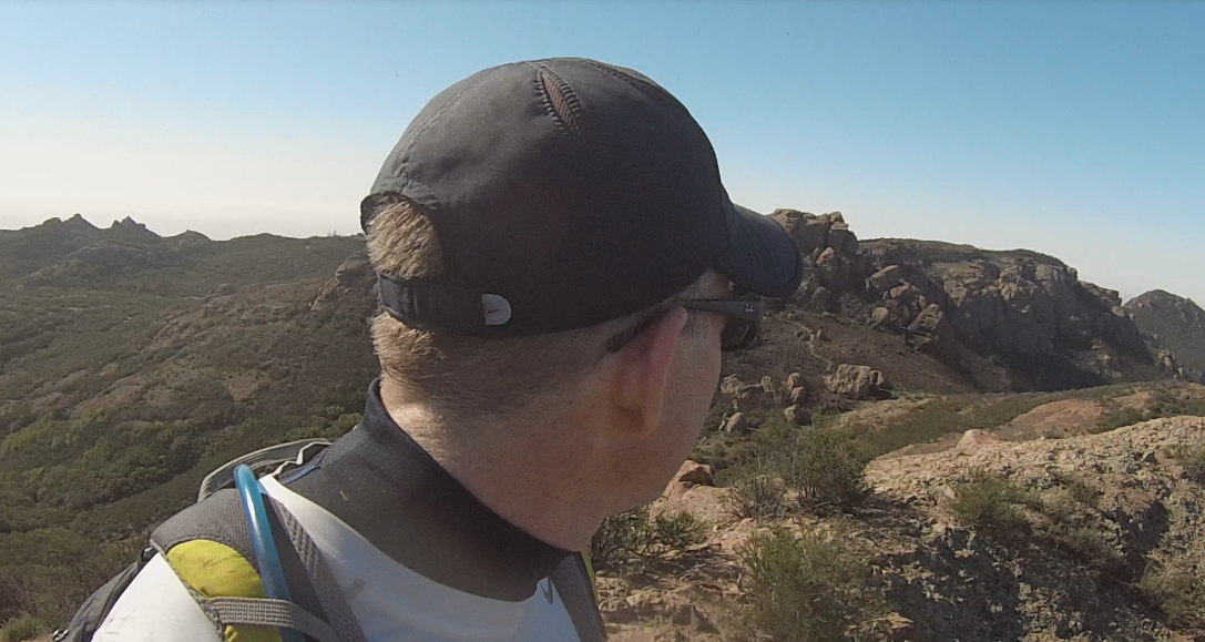
Sean coming up the trail


Sunrise over Palm Springs

We took a break at a clearing around 5300' near the remains of a campfire. We refueled and followed the winding single track trail up. We could barely make out Coffman's Crag, and I could tell the worst of Skyline was reserved for the top. After hitting the manzanita section, the trail went mercilessly up with many fewer switchbacks. After 7000', we started hitting patches of snow, and shortly after Coffman's Crag, light slushy snow covered the trail. It wasn't really a hazard, just messy. We had a good pace going until the last 2000' of Skyline, where I slowed down significantly. We didn't see a single other soul on the Skyline Trail. It took 7 hours to reach the Long Valley ranger station where we got a permit to continue.


Still a long way to Mountain Station


Flowering cactus


Rescue Box #2


Unofficial rescue box (Florian's cache?)


Shadows on the mountain


Snow capped San Gorgonio in the distance


Looking back at Palm Springs from the manzanita section


Striations in the rock


At Coffman's Crag


Sean at Coffman's Crag

The ranger at Long Valley told us conditions were icy near San Jacinto and we shouldn't go without microspikes. Of course, we made the attempt, and the snow was slushy, not icy past Jean Peak. This is where I paid the price for not having waterproof boots. The slush on the trail could not be avoided and eventually my boots and socks were soaked and freezing. I soldiered on to the summit where a half dozen people were shivering from the cold temps and strong wind. Sean and I stayed long enough to take some photos and video, but didn't linger on the windy summit. I was concerned about my freezing feet and sped up my descent. After a mile or two, the energetic descent had restored the blood flow and feeling to my toes and I was no longer concerned about damage. We got back to the Aerial Tramway and bought our tickets down. The Service Desk was nice enough to call a cab for us and it was waiting when we got to the bottom. We left Palm Springs battered and wet, but victorious.


Snow in Long Valley


View from Wellmans Junction


Rushing through the slush


Mt. San Jacinto


Final climb to the Aerial Tramway


Coming down fast from miles above you


Other Trip Reports:
Cactus to Clouds route description (Peaks for Freaks)
Cactus to Clouds to Cactus (Peaks for Freaks)

Would you like to know more...?

Wednesday, April 16, 2014

Exchange Peak, Big Dome, Pop Top, Sandstone Peak

Hiked: 4/16/2014
Distance: 8.3 miles round trip on trail and cross country
Summit Elevation: 2950' (Exchange), 2900' (Big Dome), 2930' (Pop Top), 3111' (Sandstone Peak)
Prominence: 2201' (Sandstone Peak), Others Unknown
Elevation Gain: 2613' (combined)
Elevation Gain (in Empire State Buildings): 2.09
Round trip time: 3 hours 45 minutes
Recommended water: 112 oz.
Parking/Fees: Free at Sandstone Peak trailhead off Yerba Buena
Difficulty: Moderate (combined)

After finishing Mugu Peak, I drove to the Sandstone Peak trailhead off Yerba Buena road, past the Circle X Ranch. In March, 2013, I failed to reach the top of Exchange Peak, and today I was back to right that wrong. I also needed to pick up the other Lower Peak I did not even attempt that day, Big Dome. If you have to revisit an area, there are worse places to go than the Sandstone Peak area, though it is way too far from my home to make it a frequent destination.

I started up the trail, taking a left on the Backbone trail, and passed Sandstone Peak, Boney Peak, and Inspiration Point without hitting any of them. I was focused on Exchange Peak first. When I got past the water tanks, I headed straight for it and found the use trail without any issues this time. Nothing beats good satellite prep. The use trail was narrow and wound around to the west side for an easy class 1 ascent. I found a battered benchmark, but no register anywhere on the long peak. I refueled and went down to the Backbone trail, then Mishe Mockwa trail toward Big Dome.


Sandstone Peak from the parking lot


Coming up on Exchange Peak


Looking down from Exchange Peak summit, Tri-Peaks on the left and Big Dome center


Exchange Peak damaged benchmark, maybe pointing to another benchmark?

The Sierra Club route to Big Dome goes around Tri-Peaks, but it looked closer to go cross country from the Mishe Mokwa trail. I looked for a break in the chaparral along the trail to head toward it. Once off trail, more chaparral appeared in a direct line, so I found a dry creek bed and headed up. It was mostly clear of obstructions, through an occasional yucca or strand of poison oak would temporarily divert me out of the creek. Eventually, I reached a clearing where I could climb to the saddle, then the top of Big Dome. I still had time, so I headed toward the unofficial peak Pop Top, nearby, but across a ravine. I gave up some elevation, then gained it back on the other side of the ravine where a well defined use trail took me to Pop Top in about 15 minutes. From that vantage point, a nice looking use trail heading to Tri-Peaks, the one mentioned in the Sierra Club route, was visible and looked more appealing than going back the way I came. On the other side of Tri-Peaks, I could connect back to the Backbone trail and complete a small loop. There was more evidence of the 2013 Malibu fire around Tri-Peaks. I circled around in front of it and found the trail back, though I passed my junction by a few tenths of a mile. I can't seem to get out of the Sandstone area without making a mistake. With still more time available, I visited Sandstone Peak (my second summit, but first for the day) and signed one of the three registers in the cubby below the monument. I got a few photos from the area high point, then called it a day.


Heading toward Big Dome


Navigating the dry creek bed, trying to find the way up


Looking back after exiting the creek bed


Pop Top from Big Dome summit


Spotting the use trail to Tri-Peaks from Pop Top


Ridge line of cliffs behind Pop Top and Tri-Peaks


Collection of peaks from Sandstone Peak summit


Mugu Peak

Hiked: 4/16/2014
Distance: 2.1 miles round trip on trail
Summit Elevation: 1266'
Prominence: 380'
Elevation Gain: 1250'
Elevation Gain (in Empire State Buildings): 1.00
Round trip time: 1 hour
Recommended water: 24 oz.
Parking/Fees: Free at Chumash trail turnout on PCH
Difficulty: Easy

The Chumash trail leaves from a small turnout off the Pacific Coast Highway in Malibu. With some spirited driving, I arrived in less than two hours and before sunrise. I had planned to start with a nice Malibu sunrise, but started in the dark with only my flashlight, having misplaced my headlamp. The trail gained elevation at a healthy pace and soon I had to stop and shed my top layer. There was evidence of the 2013 Malibu fire from melted piles of cactus and small charred trees. It took me 40 minutes to get to the top, where an American flag and busted ammo box stuffed with registers and loose paper greeted me. The top had been torn off the ammo box and the paper inside was damp. I did my best to tidy it up and replace the lid, but didn't sign it. I took one photo of Malibu lagoon and cursed the marine layer that was blocking what I suspected were fantastic views of the ocean. On the 20 minute descent, I passed a stream of hikers on their way up, some military, some civilians. I was surprised to see the small parking lot completely full when I got back to my car. A full lot before 7 AM? This hike appeared to be wildly popular. I took advantage of my head start on time and drove immediately to the Sandstone Peak Trailhead on Yerba Buena road where I had some unfinished business.


Chumash Trailhead sign


Approaching Mugu Peak


Mugu Peak flag and ammo box register


Malibu Lagoon from Mugu Peak

Friday, April 11, 2014

Mt. Bliss

Hiked: 4/11/2014
Distance: 8.5 miles round trip on dirt road
Summit Elevation: 3720'
Prominence: 520'
Elevation Gain: 2963'
Elevation Gain (in Empire State Buildings): 2.37
Round trip time: 3 hours 30 minutes
Recommended water: 122 oz.
Parking/Fees: Free on Van Tassal Motorway
Difficulty: Moderate

Parking just off the road across from the equestrian center is outside the national forest, so does not require an adventure pass. Mt. Bliss is a dirt road hike, and though the route itself is not inspiring, the stories of a lost DC-9 plane wreck on Mt. Bliss kept my attention in the nearby canyons. Noel and I were going to meet at 6:30 AM to take on Bliss, but due to a last minute change in my daughters Winterguard practice schedule, I had a start an hour earlier. Noel declined to join me at such an ungodly time and said he would meet me on the trail. I ended up starting at 5:10 AM. We met as I was descending at around 3000' and he was approaching the summit.

It was very dark at the start and I unpacked the lights to get going. This is entirely a road hike, except for a short bit of firebreak at the end. The road was well graded and in good shape. No potholes or skull sized rocks to break your stride. There was a lot of heavy construction equipment lining the road, part of some active project. The gain started immediately and there were maybe two places where it leveled out for a while before continuing up.


Early bird gets the caterpillar


Dawn on Van Tassal Motorway


Sunrise

Views along the way and from the top were better than I expected. The summit is smallish and had been bulldozed as part of the wide firebreak. The register was in a plastic coke bottle that had been cut in half. The remains of the original red cans were nearby. I signed the register, which was nearly full, and got a chuckle at Bob Burd's entry complaining of "damn flies". I had covered myself with bug spray before starting up so they weren't much a problem for me, but future hikers take note. The benchmark was placed by the Metropolitan Water District and was stamped simply "Peak". On the way down, I passed 11 work trucks driving up. They were all courteous, slowed down, and waved when they caught sight of me. It was a nice conditioning hike. I can see why this would be tough in the heat of summer being fully exposed to the sun on the south facing road. I was done before the day had a chance to heat up. Although I stopped frequently to gaze into the canyons, I saw no traces of any plane wreckage. It felt odd to be done with a hike at 8:40 AM. I even hit the morning rush hour traffic returning home, but had plenty of time to take my daughter to Winterguard practice.


Approaching Mt. Bliss


Mt. Bliss benchmark stamped "Peak"


Rankin Peak and Monrovia Peak


Mt. Wilson ridgeline


Bob Burd's lament