Friday, April 26, 2013

Mt. Harwood, Thunder Mountain, Register Ridge

Hiked: 4/26/2013
Distance: 9.4 miles round trip on dirt road, trail, and cross country
Summit Elevation: 9552' (Mt. Harwood), 8587' (Thunder Mountain)
Prominence: 152' (Mt. Harwood), 387' (Thunder Mountain)
Elevation Gain: 4120' (combined)
Elevation Gain (in Empire State Buildings): 3.29
Round trip time: 5 hours 20 minutes
Recommended water: 128 oz.
Parking/Fees: Adventure Pass
Difficulty: Strenuous

This was intended to be a standard training hike for Mt. Whitney with a group going in July, but when the group didn't show up, I improvised. Instead of doing the Ski Hut Trail and Devil's Backbone loop, I decided to tackle Register Ridge, a lesser known use trail that heads straight up to Mt. Harwood. Parking was near the Manker Flat Campground. It was 49F at the trail head, but it warmed up as the day unfolded.

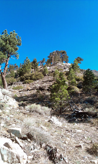
Harwood was my main target today, along with Register Ridge and the Devil's Backbone, which were all new experiences for me. The gain on Register Ridge is less than the Ski Hut trail because it doesn't go all the way to Mt. Baldy. However, it has fewer switchbacks and no level sections. It is up, then up, and more up. I saw the Ski Hut from the Ridge a few times and had perfect views of the Baldy Bowl. Once it intersected with the Devil's Backbone, I continued straight up the summit of Mt. Harwood across the rocky talus. There was no vegetation on top of Harwood, just rocks. There was zero snow anywhere on the trail. I saw one snow patch on the north side of Harwood, but it didn't look like it was going to last long.

Next, I proceeded down the Devil's Backbone trail toward the ski areas. I passed some idle lifts and had enough energy left that I decided to tag Thunder Mountain. When I got to Mt. Baldy Road, I continued up the road and followed it all the way to Thunder. The final climb to Thunder was over another rock field, but not as pleasant as Harwood. Then came my questionable call of the day: to head down Emile's black diamond ski run. It was covered in loose rocks and dirt, the decent angles were uncomfortable, and I ended up "skiing" down scree in many places, sometimes managing a 10 foot slide before taking the next step. I lost 1000' of elevation in about 1/2 a mile. It was slow and miserable, and when I got to the bottom, both boots were filled with pebbles.

The return on the road was uneventful, except for one shortcut below the one running ski lift. I waved at two sets of riders on their way up. They were probably watching to see if I had any mishap navigating the use trail below the lift, but I didn't. I saw no one on Register Ridge, and no one on Thunder Mountain either. I met a few hikers and dogs on the road on the way down.


Start of the Register Ridge Trail, just past the first switchback on the Ski Hut trail


Climbing Register Ridge


Baldy Bowl from Register Ridge


Mt. Baldy from Mt. Harwood summit


Looking down the giant rock field that makes up Mt. Harwood.


Descending the Devil's Backbone trail


Top of the ski lift on Thunder Mountain


Thunder Mountain summit sign


Baldy, Harwood, and Dawson from Thunder Mountain summit. This appears to be the top of Emile's diamond ski run that I descended from Thunder.


Sunday, April 14, 2013

Trabuco Peak

Hiked: 4/14/2013
Distance: 10.9 miles round trip on dirt road and trail
Summit Elevation: 4604'
Prominence: 817'
Elevation Gain: 2230'
Elevation Gain (in Empire State Buildings): 1.78
Round trip time: 4 hours 40 minutes
Recommended water: 80 oz.
Parking/Fees: Adventure Pass
Difficulty: Moderate

Trabuco Peak is the 3rd highest peak in the Santa Ana mountains. Like other Peaks in the range, it straddles the Orange County/Riverside County line. There are multiple routes to it, but all involve the Main Divide Road. If you have a 4x4 vehicle, you can drive up to the point where the firebreak/use trail heads up to the peak. Otherwise, all routes are in the 10 mile range. I approached from the same North Main Divide road trailhead that I used to reach Los Pinos Peak.

My daughter Shelby came along, but this hike was a little long for her taste. Still, she made it to the peak. From the North Main Divide trailhead, the dirt road heads up to the Los Pinos saddle. Then, it descends into a pine forest and wanders up, down, and around various unnamed bumps. For the price of a little elevation gain, you can shortcut parts of the road by going over firebreaks. We took a few of these shortcuts, but got burned on one coming back that didn't reconnect with the road.

On a clear day, there might have been nice views on both sides of the mountains, but the clouds were lower than the road so what we mostly saw was clouds drifting across the road and through the forest like the movie "The Mist". Eventually, we passed the intersection of West Horsetheif Trail coming up from the canyon. Another mile and change gets you to the base of Trabuco Peak, with a firebreak/use trail heading up toward what I call "The One Tree" that adorns the peak proper. The scramble up to the peak has a lot of loose dirt, but is only a few hundred feet above the road.

The peak itself is almost overgrown with six foot high Manzanita and other shrubs. The final use trail is well hidden and spurs sharply left about 50 feet to the benchmark and summit register. I walked right past it at first and found it on the way back. The key is to focus on "The One Tree" and look for the spur when you get near it. There were no views on the peak, none ascending, and none descending other than clouds. After signing the register, we returned along the road. Despite the lack of views, it was an enjoyable scramble to the top with cool weather in the 50s that was never quite cold.

The clouds were low and filled the forest


The firebreak/use trail leading to Trabuco Peak


Shelby resting before heading up to the peak.


The nearly hidden use trail on the left leading to the register, benchmark, and "The One Tree"


Trabuco Peak register and benchmark


Benchmark showing the dividing line between counties


See Also:
Trabuco Peak via West Horsethief Trail

Monday, April 8, 2013

Mt. San Jacinto and Miller Peak

HPS Star Emblem Peak
Hiked: 4/7/2013
Distance: 9.9 miles round trip on trail and cross country
Summit Elevation: 10834' (San Jacinto), 10400' (Miller)
Prominence: 8319' (San Jacinto), 0' (Miller)
Elevation Gain: 2400'
Elevation Gain (in Empire State Buildings): 1.92
Round trip time: 6 hours
Recommended water: 100 oz.
Parking/Fees: $24 Aerial Tram
Difficulty: Moderate

I was planning to hike San Jacinto at the end of April on the Devil's Slide trail, but our family decided to take a trip to Palm Springs during spring break so I got there in early April. Devil's Slide is on the south side of the mountain, an unreasonable trip around, so I asked my wife to drop me off at the tram for my first hike to San Jacinto. Until the day before, I was expecting substantial snow on the mountain, but a helpful post by someone on the San Jacinto forum suggested that I would not need snow shoes, so I left some of my winter gear at home.

I took the first tram up at 8:00 am, sharing it with only 4 other people. I registered at the ranger station for my day hike permit and the ranger told me to expect a slushy hike. Temperature was in the low 50s at Mountain Station and hovered between 50F and 60F all day. I began with 4 layers and ended up with 3 after an hour. This was my first trip to San Jacinto State Park and the pine trees and size of the park were both a little surprising to me. I started hitting small patches of snow before 9000' and it started becoming an issue after Round Valley. The altitude also made me work harder than usual for this amount of climbing. There were knee deep post holes left by other people in many places, but the snow was mostly frozen and firm on the way up, so I only hit one or two spots where I sank up to my knees. Past Wellmans' Divide, I lost and found the trail a few times, eventually heading toward the gully between Jean Peak and San Jacinto to rediscover it.

The short side trip to Miller Peak led to an easy class 2 scramble to the summit plaques. The trail was now mostly clear all the way to the stone cabin near the peak. There were some great views from Miller Peak and it was worth the diversion. When I arrived at the stone cabin, I signed the San Jacinto summit register and marveled at the bunk beds and other random stuff in the cabin. Leaving the cabin, I started the next class 2 boulder scramble to get to San Jacinto Peak. The snow was deep in some places between the boulders making foot placement important, but the climb was not difficult. San Jacinto Peak was an altitude record for me at 10834', a few hundred feet higher than Mt. Baldy. I hope it is a short lived record with San Gorgonio and Mt. Whitney planned for the summer. I took photos and a video on the summit, ate lunch, and was getting ready to head down as two other hikers made it up. They had come from LA and Sacramento and from our conversation, were pretty experienced in the SoCal mountains.

After leaving San Jacinto, I scouted around the first bump on the way to Jean Peak and the snow looked to be more of an obstacle than I wanted to fight, so I continued down. I tried to follow the trail I had lost back to Wellman's Divide, but soon lost it again and ended up heading cross country a few miles, generally following the path of least snow resistance. I intersected the trail again shortly before Round Valley and followed it back to the tram. The cross country short cut reduced the normal round trip distance by a mile.

I tested out several pieces of new gear on this trip. I had some cheap REI gaiters that did a solid job keeping snow out of my boots when landing up to my knees. I had a used 686 snowboard jacket (from Craigslist) that was warm and functional. I had a new Marmot Eiger 36 liter pack that kept the weight balanced, but I wished it had more organization. There are three small zippered areas in the lid, and the rest is one big storage area so I was digging around for stuff more than usual. Finally, I had a Therm-a-rest sit pad that I didn't need because there were plenty of dry boulders to sit on throughout the hike.


Snow capped San Jacinto on the way to the tram


Coffman's Crag from the tram


Boulder paradise in Long Valley


Stream crossing near Long Valley


Plaques on Miller Peak summit


View to the desert from Miller Peak


San Jacinto from Miller Peak


Last sign before San Jacinto Peak, almost buried in snow


Stone cabin near San Jacinto Peak


Inside the stone cabin


San Jacinto Peak


Benchmark


Panorama from San Jacinto Peak


Would you like to know more...?