Distance: 10.8 miles round trip on dirt road and trail
Summit Elevation: 5496'
Prominence: 536'
Elevation Gain: 2528'
Elevation Gain (in Empire State Buildings): 2.02
Round trip time: 4 hours
Recommended water: 96 oz.
Parking/Fees: Adventure Pass
Difficulty: Moderate
Modjeska Peak is the lower hump on "Saddleback" in the Santa Anas and the 2nd highest peak in Orange County after Santiago. It is also free of radio towers and provides much better 360 degree views than Santiago. I approached Modjeska from Maple Springs Road, starting where the road turns to dirt and taking the single track trail on the left of Main Divide Road right after the intersection with Maple Springs and Harding Truck Trail. The trail cuts a fair distance off the round trip compared to the road. I was surprised to find a patch of snow clinging to the trail around 5000', despite the temperature hovering around 56F. The trail intersects the road again near the summit, turn left to continue on the road. After turning left, you can follow the road to the summit or take the ridge immediately on the right. When I first reached the top of the trail, I saw two deer on the road that quickly sprinted up the ridge. I was able to grab a photo before they disappeared.
Rock outcroppings on the peak make for several fine resting spots to take in the scenery and hydrate. I didn't find a USGS benchmark, but there was a geocache and summit log to sign. Instead of returning on the road, I went down the ridge (where I saw the deer) to spice things up. There is a very faint use trail that looks more like an animal trail than human. It is not very steep and navigation was easy. I noticed later on Google Earth imagery that most of the road can be bypassed using fire breaks and use trails. On my next ascent, I'll try to avoid the road as much as possible and see how much distance it saves. Climbing Modjeska was more fun than I expected.


Single track trail shortcut from Main Divide Road just past the intersection with Maple Springs Road

Modjeska dead ahead
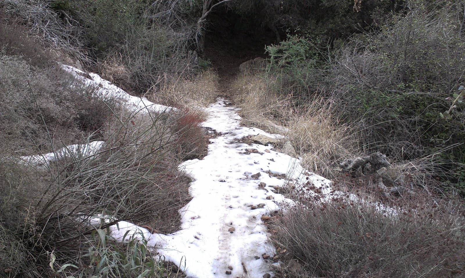
An unexpected patch of snow around 5000', stubbornly hanging on despite it being 56F

Rock formation near the summit

Deer on the ridge

Looking back down the ascent ridge

Modjeska Peak summit looking east

OC Geocache benchmark (non governmental)

Looking northeast down Coldwater Canyon


No comments:
Post a Comment