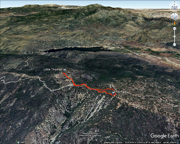
Distance: 2 miles round trip on dirt road and use trail
Summit Elevation: 6825' (Thomas), 6572' (Little Thomas)
Prominence: 1945' (Thomas)
Elevation Gain: 530'
Elevation Gain (in Empire State Buildings): 0.4
Round trip time: 1 hour
Recommended water: 16 oz.
Parking/Fees: Free on Forest Route 6S13
Difficulty: Easy
I drove near Idyllwild to hit two HPS peaks in the area: Thomas Mountain (HPS #128) and Rouse Hill (HPS #265). Both are ostensibly drive ups. From Highway 74, I took Forest Route 6S13 to the junction with Little Thomas Road and parked there. The road was good shape, but high clearance helped in a few spots. It was 0.6 miles round trip to Little Thomas on Little Thomas Road. A small weather station was near the top, but the high point was just off the road in a small pile of boulders. Pine trees blocked views in most directions. No marks and no register. I appreciated the pines, but there wasn't much else to recommend Little Thomas. I returned to the truck and continued past it toward Thomas Mountain. The road made a long switchback before coming back to Thomas, so I started uphill when I was directly below it. It was open country with a bed of pine needles. When I reached the upper road, I saw a Jeep driving down. The summit had a picnic table and fire pit. Like Little Thomas, it was pleasant, but most views were obscured by trees. No marks and no register. I spotted a use trail going down the ridge so I followed it. The trail was in decent shape and was better than my ascent path. Visiting both peaks took an hour. Next up was Rouse Hill.


No comments:
Post a Comment