HPS Star Emblem Peak
Hiked: 9/8/2023
Distance: 15.1 miles round trip on trail and cross country
Summit Elevation: 7339'
Elevation Gain: 4382'
Elevation Gain (in Empire State Buildings): 3.5
Round trip time: 9 hours 30 minutes
Recommended water: 132 oz.
Parking/Fees: Adventure Pass at Humber Park trailhead
Difficulty: Strenuous (route finding)
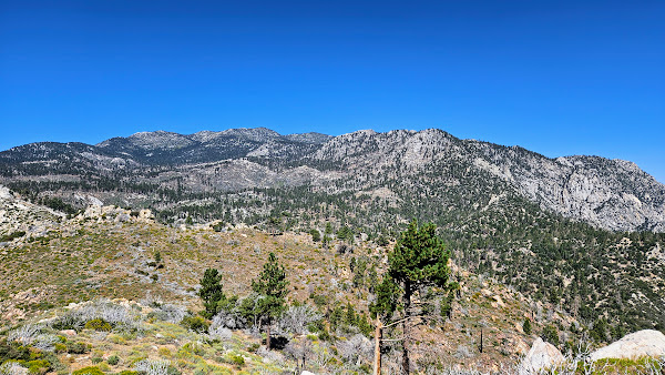
Sam Fink Peak (HPS #104) sits on the desert side of the Desert Divide. It is remote and the only trail that goes near it, the Caramba Trail, is not maintained. Abandoned is a better description since much of it was covered in dead fall, pine cones, and needles. I made it more challenging my overtraining for the second time in two months. Too many laps at the track just before Whitney resulted in a compressed nerve in my right foot. Only painful in a certain position that I avoided with mindful steps. The body just isn't what it used to be.
I started at dawn from Humber Park. It took an hour to get to Saddle Junction where I followed the Willow Trail. The trail goes through a field of ferns before an unsigned junction with a trail going directly south. I passed that and went another half mile where the was another unsigned trail split. A high road and a low road. I took the high road, which was not the best way. I could have stayed on the lower trail longer on a direct path toward Sam Fink. Instead, I left the Willow trail not far past the junction. Initially, it was mostly open country, but soon, I got bogged down in whitethorn and waist high soft plants. I crossed Willow Creek and continued side hilling and dipping in an out of gullies. I found remnants of the Caramba Trail and vaguely followed it with the help of scattered cairns. I ended up doing three creek crossings. The last one was Tahquitz Creek and it was flowing strongly. I'm not sure the others would be flowing in a drought year. There were many route finding problems. I climbed up a very steep slope north of an unnamed bump before I finally got a clear view of Sam Fink, a quarter mile away. It was visible a couple miles back, but I wasn't able to identify it.


I followed a use trail the rest of the way to the summit. A short boulder was the high point and the register cans were just below. There were no marks or other signs of civilization. I was surpised at the great view back to the Desert Divide and the desert communities below. I was prepared to be disappointed with Sam Fink, thinking it might have been added to the emblem list as a navigation test. But it was a fine perch to take in not only the Divide, but the higher peaks around San Jacinto. Having sky blue weather helped. The register was active, with the prior entry from July. I spent about 20 minutes on the summit reading the register and being lazy. When I started back, it seemed like I hit more gain than on the way out. This wasn't true, but I didn't realize at the time how much gain I had given up after Saddle Junction. The split was about 2500' on the way out, 1800' on the way back. I filtered some water at Tahquitz Creek on the return, but ended up not needing it. Coming down the Devils Slide, I met a baby rattlesnake crossing the trail. Not only was it the first rattler I'd ever seen in the San Jacinto wilderness, I think it was the first snake of any kind. Much better that I met it on the trail than earlier when tromping through the brush. I got back to the truck just before 4 PM,
renewing my unofficial Sierra Club "I" rating. Fourty-six down and four HPS emblem peaks remaining.
Sam Fink
Summit
Red Tahquitz
Divide
San Jacinto
Rabbit, Toro, Martinez
Bushwhack back


