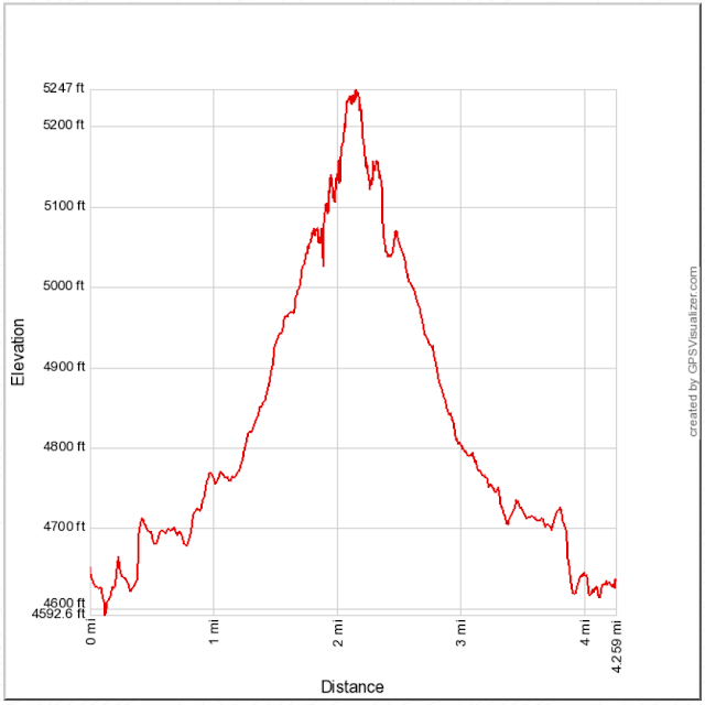
Distance: 6 miles round trip on trail
Summit Elevation: 2703' (North Iron), 2635' (Ramona)
Elevation Gain: 2055'
Elevation Gain (in Empire State Buildings): 1.64
Round trip time: 3 hours 35 minutes
Recommended water: 64 oz.
Parking/Fees: Free at Ellie Lane trailhead
Difficulty: Moderate (class 5 summit on North Iron)
North Iron Mountain in Poway is wedged between Iron Mountain and Woodson Mountain. It is higher than Iron, lower than Woodson, and far more difficult than either, sporting a tricky 50' class 5 summit block. TLDR: About 3 hours of relaxed single track and 20 minutes of abject terror. One of the great things about the Poway area is the cluster of small but interesting peaks and it's only about an hour from my house. I parked at the Ellie Lane trailhead and took the trail that runs between North Iron and Mt. Ellie. It climbs to the saddle where Table Rock marks the beginning of the use trail to North Iron. The use trail is in good shape with almost no bushwhacking.
Show no fear
And you'll be ready
For a new frontier
-- Monster Magnet, God Says No
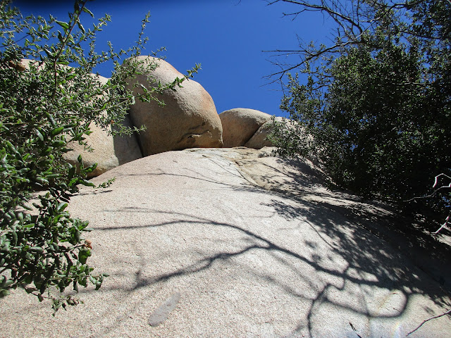
The North Iron summit is made up of several house sized boulders piled on one another. I circled the peak and there were several possibilities for reaching the top. I had spoken to Eric Su about it and he provided valuable beta on a class 5 roped route from the northeast. (Thanks!) Eric's route required lassoing a chicken head with webbing about 12' above a class 3 ledge, then a relatively short ascent from there. Bob Burd's recently discovered unroped class 5 route from the south involved four sections: 1) climbing a tree to get above the high angle rock, 2) a class 3 slab, 3) a class 2 traverse, 4) a class 3+ ascent on the final block. (Thanks!) Lastly, I found a ~5.5 crack system on the north side that looked reasonable if you could get a top rope anchored on the other side. The top of the crack would put you at the traverse on Bob's route, however the slabs were hollow and might break off. I had my rope and gear in the car, but out of laziness decided I would try Bob's route first and if I failed, I would go back and haul the rope up for Eric's route. I packed my rock shoes in and highly recommend them regardless of the route chosen. As Morpheus said, "There is a difference between knowing the path and walking the path."
At the base of the tree below the North Iron summit, I ate some almond butter, put on my rock shoes and started climbing the tree. It was too far away from the rock for me to stem it as Bob had done. I literally went out on a limb, dismounted into a 60 degree crack and used the tree to pull myself on a 2' ledge about 15' above the ground. Even though this was the crux, the next section was not easy. A short friction move got me below the next slab where I briefly considered turning around. Did I really want to do this? After a short internal debate, I decided to continue going up, using an under cling on the top slab. The traverse was easy class 2 as expected along the south side to the base of the final summit block. This was the only section without serious exposure. While climbing over the traverse, my camera fell out of my pocket and tumbled over the precipice. I had dropped it on Peak 3339 only two weeks ago and this time it was finished. I found it later with the battery and memory card half ejected. It was not lost on me that a slip would have left my organs half ejected at the same crash site. I paused at the base of the final block and had another internal debate. There were decent holds on the final block but they weren't jugs. I only had another 20' of exposed class 3+ to gain the summit. My hesitation only lasted a few seconds but it seemed excruciatingly long. I still had my Ricoh Theta S 360 camera and it would have to suffice for the rest of the summit photos. I took a couple of 360s at the base, then started moving up again. The holds were plentiful but required attention. I was somewhat relieved when I topped out, but not exuberant. I knew I had to descend. The summit was larger than expected with plenty of room for several people. I stood and walked around, unable to locate Bob's register placed in April. When I saw the boulder and anchor on Eric's route, I wished I had come up that way so I could rappel down that way. I shook my head, took some 360s on the summit, then steeled myself for the descent. I started down with my left side to the rock. This was a pretty good compromise to maintain stability and still see the holds below me. It was a slow descent off the summit followed by an easy traverse back to the slabs above the tree. I thought getting back into the tree might be difficult, but I was able to walk myself down to a point where I could place my right foot between two branches, then get back on the main limb. A few moves later and I was back on the ground. I found my camera with splayed guts and put it back together. The shutter mechanism was broken. I used my phone to take photos the rest of the trip.
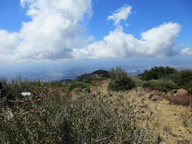
I wasn't in the mood for the mild bushwhack up Mt. Ellie, but I did want to head over to Ramona Overlook Peak. I got back on the trail and followed it up to the point where the trail started to drop. There was a good use trail there heading to Ramona Overlook Peak. The views were awesome in all directions and I appreciated the walk up. I finally started to relax and sat down for lunch. After hanging out a while, I climbed the unnamed peaklet behind Ramona then headed back to the car. For the return trip, I followed the trail south of Mt. Ellie and it eventually curved back to intersect the starting trail. Despite the struggle, I was happy to have some iron back in my diet, even if it was San Diego iron. I was also happy to get the summit block. If I ever climb it again, it will be on Eric's roped route.
A quick look at the other possible routes...
Update: 12/16/2017
I returned with my friend Terry to attempt the roped route. We climbed on the large slanted boulder and spent 45 minutes trying to lasso it. We each tried many times with no luck. I had some webbing attached to the rope. We might have been able to get it with just the rope, but I was concerned the rope might get cut by sharp, unseen edges. The bottom line is we failed on the roped route.
Would you like to know more...?
Other Trip Reports:
North Iron Mountain, Mt. Ellie, Ramona Overlook Peak (Bob Burd)
North Iron Mountain (Peaks for Freaks)


