HPS Star Emblem Peak
Hiked: 6/18/2022
Distance: 12.2 miles round trip on trail and cross country
Summit Elevation: 7294'
Prominence: 2048'
Elevation Gain: 2634'
Elevation Gain (in Empire State Buildings): 1.5
Round trip time: 6 hours 20 minutes
Recommended water: 88 oz.
Parking/Fees: Adventure Pass at Walker Pass Campground
Difficulty: Moderate
Thirty-six hours after Olancha, my calves were still tight, but I had recovered enough for something less challenging. I spent the night in Ridgecrest, so there were plenty of options. Scodie Mountain (HPS #105) was an HPS Star Emblem I didn't know anything about. It's also a P2K with multiple routes. Most people ascend the PCT to a cross-country section, then return down a large gully. I made the gully a game-time decision. When I started Olancha, it was 77F at the trailhead. For Scodie, it was 44F due to a cold front. I drove to Walker Pass Campground and headed south on the PCT.
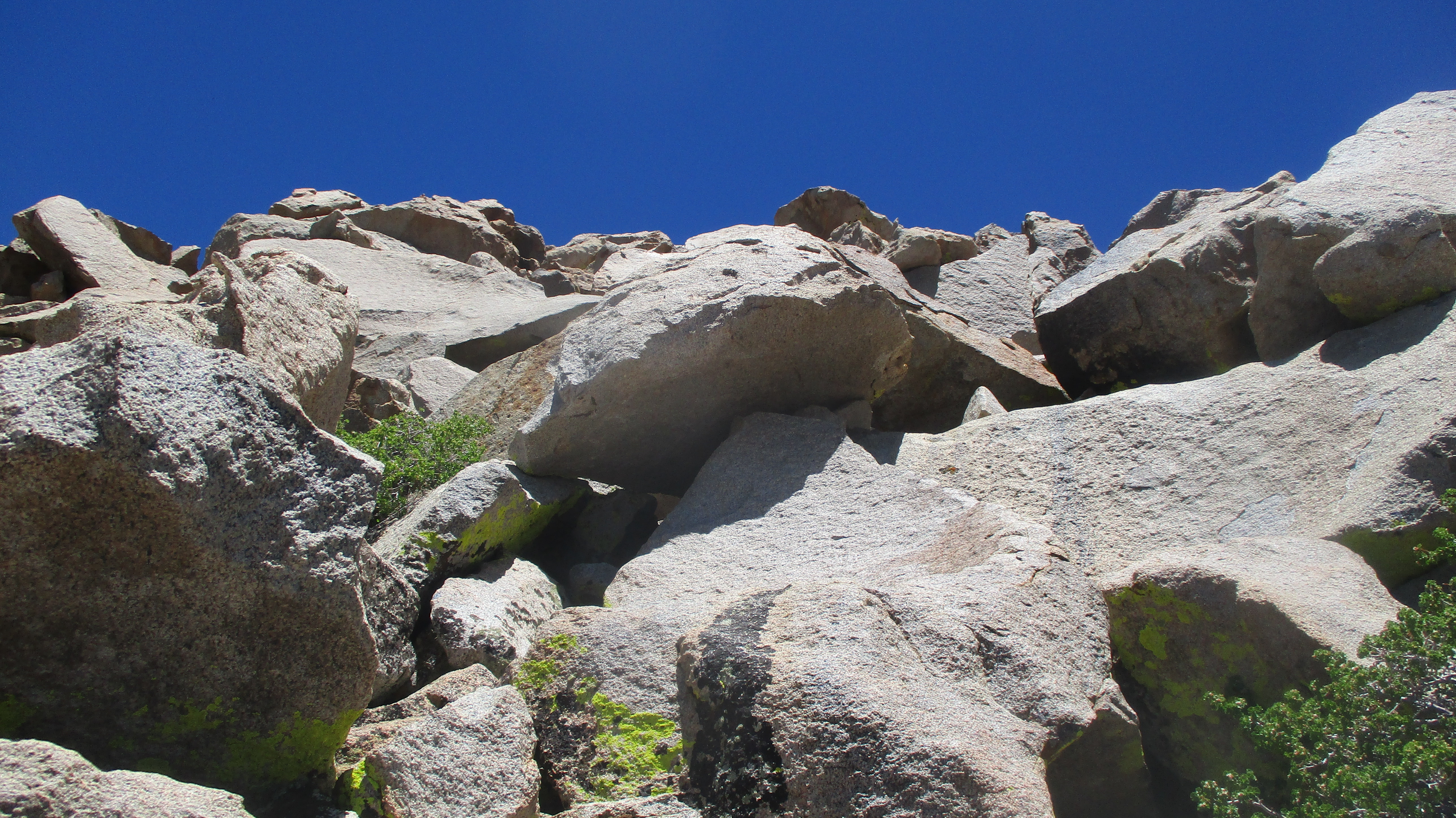
The trail transitioned from desert to pine forest in four and a half miles. The use trail leaving the PCT was evident. After climbing a steep, sandy slope, I saw Scodie another mile and a half away across a forested bowl. The use trail goes over unofficial Peak 7042 with it's own boulder pile. I went to the top of the pile to see if there was a register, but found nothing. Since I was heading east, most of my photos were ruined by light pollution. The trees were 10' to 20' high, so you couldn't see where you were going. The bowl also had small rolling hills that didn't show on a topo map. It would have been tough to navigate the terrain with just a map. It became a GPS exercise, but the trees and brush were not dense, so no bushwhack. I zig-zagged around obstacles and followed the track past several false summits. None of the tall boulder piles turned out to be the summit. The high point was a 12' class 2 boulder. Strong wind gusts (30 mph) hit me near the summit but were not a deterrent to climbing the boulder. An ammo box held the register. I signed in, took a few photos, and then started back the same way. With my craving for adventure still sated, I chose to skip the gully and go back to the PCT. On trail, I could writhe to the mindless groove instead of having to make decisions about obstacles in the gully. I met one couple on the PCT. Most of the thru hikers were well north by now. Back at the truck, I realized I had left my tailgate down and bags unguarded. Despite people milling about, no one disturbed my stuff. Score one for good people!
Scodie from the road
Start of use trail
Scodie summit boulder
Owens Peak to the north
Olancha further north, Langley and Whitney way north
Sierra Peaks Section Emblem Peak
Hiked: 6/16/2022
Distance: 21.6 miles round trip on trail and cross country
Summit Elevation: 12123'
Prominence: 3083'
Elevation Gain: 6410'
Elevation Gain (in Empire State Buildings): 5.1
Round trip time: 14 hours 30 minutes
Recommended water: 224 oz.
Parking/Fees: Free at Sage Flats Trailhead
Difficulty: Very Strenuous
Olancha Peak (SPS #177) is one of only 15 Sierra Peaks Section Emblem Peaks. It
is the King Kong of the southern Sierra, towering over everything 14 miles north
in the range and everything south of it. Leisa was headed for a camping trip in
Yosemite with friends. I prefer not to attempt 10+ hour adventures alone, but
was unable to find a buddy on short notice. I also moved the hike date up one
day due to gale force winds and a 20 degree drop in temps from Thursday to
Friday. I piled into the truck at 1 AM for the 4 hour drive to Sage Flats.
I was the only vehicle in the large parking area. There was a full moon and
enough light for me to get started without a headlamp. It was a warm 77F at the
trailhead. There were four distinct sections of this hike:
Olancha Pass
Summit Meadow
PCT
Olancha West Face
Olancha Pass
When I stepped out of truck, a mosquito bit my hand. Olancha is notorious for mosquitos, but 30 minutes up the trail, I didn't see another one until I got back. Not far from the start, the regular trail winds up the canyon walls on the right (north) while the cow driveway continues straight up the gully to Olancha Pass. Like the name sounds, the cow driveway follows the stream up the gully and is used to drive cattle up to the lush greenery of Summit Meadow. I had read mixed things about the driveway, but decided to take it up. The cow driveway was not clear in the lower half of the gully. I wandered around partial trails and ended up in a side gully where I found some kind of bones, maybe cow? The upper cow driveway was very steep, hard packed mud. It's not great to hike on, but better than ascending soft sand. It would not be fun going down that way. At the top of the pass, I cached a couple bottles of water for the return trip.
Possible cow bone
Upper cow driveway
Round Mountain from Olancha Pass
Summit Meadow
This section was relatively flat, crossing open slopes, then dropping slightly down to the wide, grassy Summit Meadow area. There was a cattle pen and a cowboy camp. Summit Meadow itself was like a miles long golf fairway, devoid of trees. The trail skirts the meadow. I kept expecting to see animals in the meadow, but didn't. The Bear Trap Meadow trail connects from the north and is considered a short cut to the upper PCT. I considered taking it back, depending on my water situation and how I felt. I stuck to the Olancha Pass trail to the PCT. Up to this point, I had seen nobody.
Summit Meadow
Flame Broiler
PCT
I turned north when I hit the PCT. This is a pretty section of trail through scattered pines and boulder piles. I had read in another trip report that there was a stream with possible water at 9700'. At the stream, there were two through hikers getting water. We had a brief chat. They were two of a dozen through hikers I met who recently came from Kennedy Meadows. The stream had a slow but steady flow. I was going to filter some water, but felt I had packed in all I would need. I'm glad I didn't need it because the slow flow turned into a trickle when I crossed the stream on the way down. Better views opened up as the trail skirted the western shoulder of Olancha. Just above 10000', I dropped a second water cache. After 9 miles of hiking, I finally got a view of the summit. I had seen the photos, but it was an intimidating sight in person. I still had another mile before reaching the best spot to leave the trail. Much work ahead.
O-My-Lancha!
Lower slope
Olancha West Face
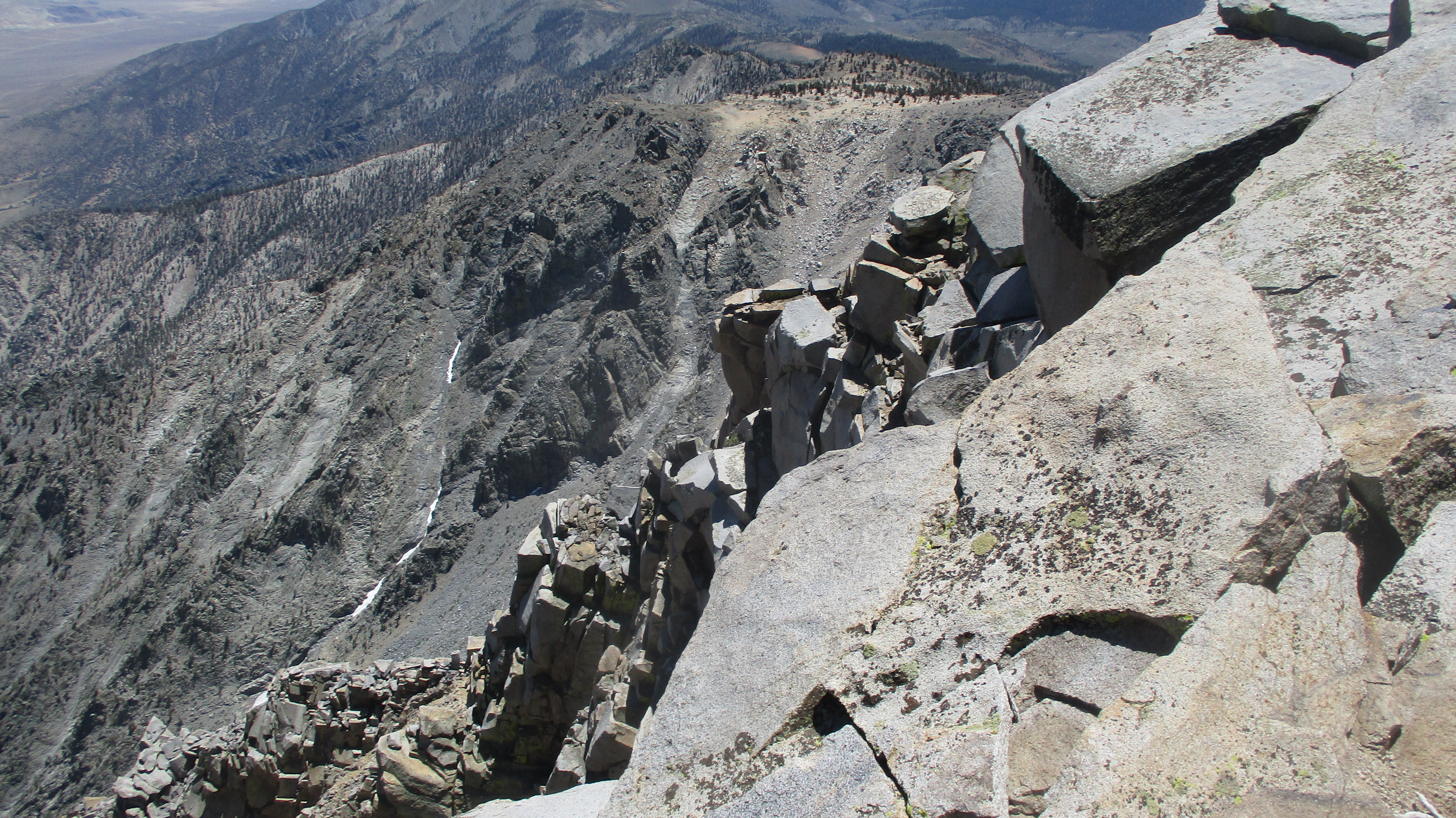
At the high point of the PCT, I left the trail and started up. The slope was still in the tree line and not as vertical as I expected. Steep class 1. I generally aimed Northeast, weaving around trees and ground cover. I spotted cairns in various places, but there was no defined use trail and the cairns were mostly useless. Once I emerged from the tree line, all that remained was boulders, easy class 2. Boulders got larger the higher I went. The route can remain class 2 if you stay far enough north. I wandered a little too far south at the very end and needed some unexposed class 3 to top out. Several small radio towers were on the summit. I found the benchmark and a couple of reference marks. An ammo box held a couple of registers. Olancha sees plenty of visitors. The latest entry was from earlier that day, and I wondered how we missed each other. Views exceeded all expectations. It was thankfully clear enough to see Langley and Whitney. Owens Valley and the Panamint range were east, giant meadows and the interior of the Sierra were west, and south was the lower crest as it melted into the high desert.
It was about 45F on the summit, a sharp contrast from the desert temps at the trailhead. Winds were gusty but not bad. I hung around the summit a while, then started down. I found the class 2 route off the summit and got down quickly. Off the summit, I only had 10 miles back to the truck. I met another half dozen through hikers on the way back. All were friendly. One or two looked beaten up by the gain on the PCT as it entered the higher Sierra. Instead of the cow driveway, I took the trail down. Having been on both, I'd recommend sticking to the well maintained trail both ways. it does add a little distance, but was much more pleasant and had better views. Back in the parking lot, I was still the only vehicle. I was starving as I drove an hour to Ridgecrest, where I planned to spend the night. I was so tired I started seeing things on the side of the road. That's only happened on a two other very long day hikes (Whitney and Rabbit). I slept soundly, probably could have slept soundly on a pile of gravel.
Upper slope
Just before summit
South Sierra Crest
Northeast ridge
Descending
Marmot
Racing the sun, and beat it this time
East side of Olancha from highway 395 (taken next day)
HPS Star Emblem Peak
Hiked: 6/5/2022
Distance: 7.2 miles round trip on dirt road and trail
Summit Elevation: 8831' (Pinos), 8818' (Sawmill)
Prominence: 4800' (Pinos), 418' (Sawmill)
Elevation Gain: 1353'
Elevation Gain (in Empire State Buildings): 1.1
Round trip time: 3 hours 30 minutes
Recommended water: 32 oz.
Parking/Fees: Adventure Pass at Los Pinos Trailhead
Difficulty: Easy
Mount Pinos (HPS #37) is the highest peak in Los Padres National Forest. Despite being a simple stroll down a dirt road, Pinos sports 4800' of prominence as the range high point. Nearby Sawmill Mountain (HPS #38) is a scant 13' lower with 1/10 the prom. Both are HPS Star Emblem Peaks. These mountains ticked off multiple boxes for me. The drive was paved all the way to the Pinos trailhead.
There was some kind of dog training event in the parking lot when we arrived. At least 20 dogs were involved. We didn't engage with the crowd to find out what it was about, just quietly started up the trail. The trailhead was at 8300', the weather cool and sunny. The short hike to Mount Pinos was on dirt road and took about 45 minutes. The benchmark was there but beat up a little. Large solar arrays and a radio tower were the highlights. Views were good in two directions, but relatively flat looking west. We took a few photos, then continued on toward Sawmill.
Random trailside boulder
Mount Pinos
There was a condor viewing area at the start of the single track trail to Sawmill and a few other info plaques. The trail was officially named Tumamait after a Native American storyteller. Though the drop to the saddle between Pinos and Sawmill was less than 500', the trail made wide, shallow switchbacks to reach it. Two short hill sections took use to the top of Sawmill. At the summit was a famous, 10' cairn, exceeding the impressive one on Dawn's Peak. Views in general were better than Mount Pinos. Two other groups were taking a break at the summit. I couldn't find any marks around the summit area. We signed the register before heading back. We passed one of the parties we had seen on Sawmill just after the saddle. I decided to leave the trail to scramble up some class 2 boulders while Leisa continued through the switchbacks. I met her on the trail above saving 5 minutes for the effort. It added a dash of butter to an otherwise plain toast hike. Mount Pinos was the most pleasant and gentle area I've seen in Los Padres.