Distance: 7.5 miles round trip on dirt road, firebreak, and trail
Summit Elevation: 6400' (Bare)
Elevation Gain: 2399'
Elevation Gain (in Empire State Buildings): 1.9
Round trip time: 4 hours
Recommended water: 80 oz.
Parking/Fees: Free on Forest Road 5N04
Difficulty: Moderate
I parked at a wide turnout on Forest Road 5N04 to hike Bare Mountain (HPS #160) and a group of unnamed lower peaks. From the ACH, I turned on to Santa Clara Divide Road, then right on 5N04. All roads were paved, but 5N04 had a few potholes. I parked at an open gate where the road turned to dirt. The reason I parked outside the gate is because people had reported coming back from the hike to find the gate closed and locked. The hike only followed the dirt road about a half mile, and I planned to do a loop and return a different way. I started up the road and met a truck full of bow hunters on their way out. I found a use trail that took me to the big firebreak running all the way to Bare Mountain.


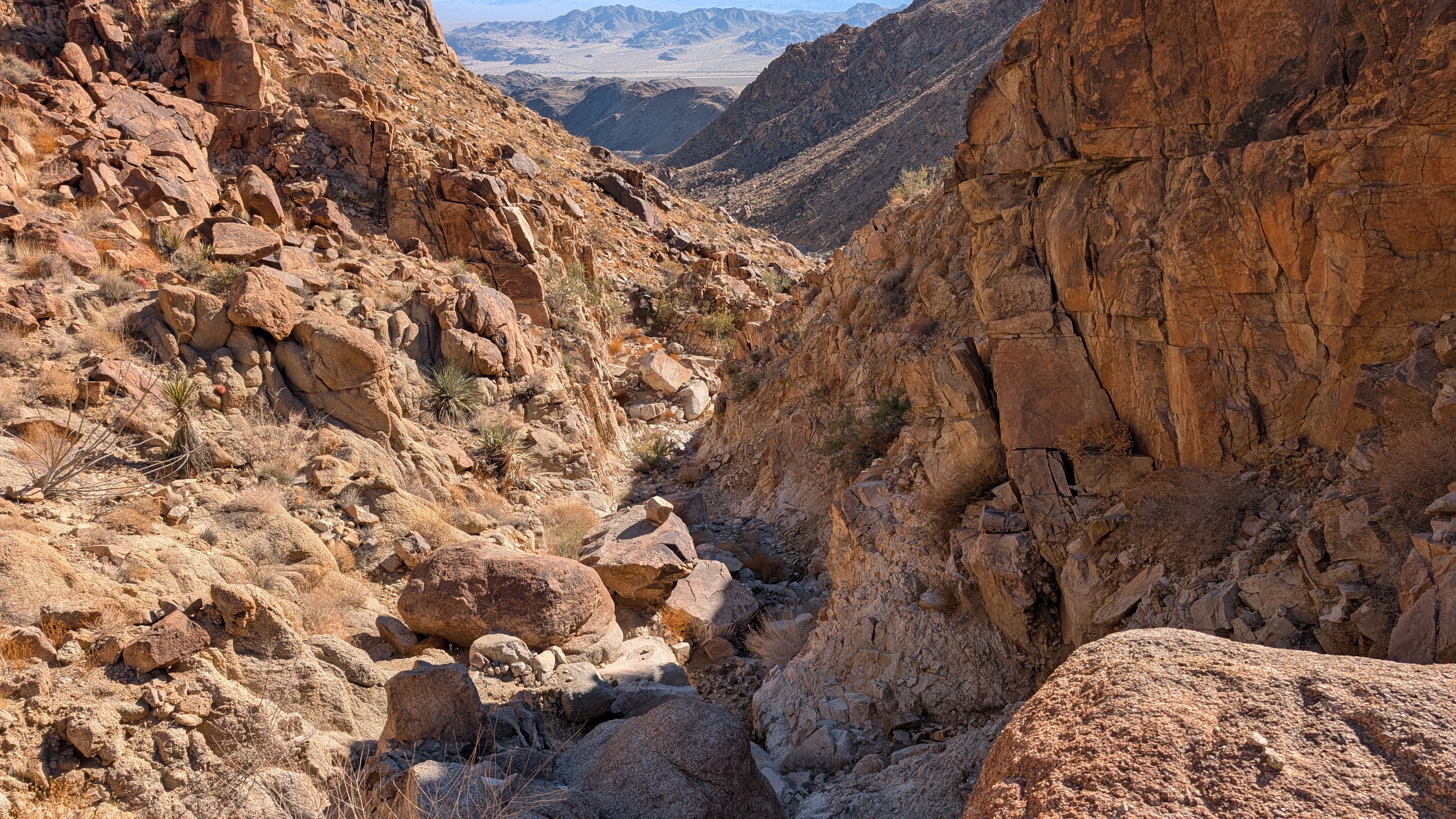
Bare Mountain itself was not visible from the road. My first sight of it was from the false summit I spied from the road. Parts of the ridge were steep, but there were breaks along the way. The Bare register was from 2022 in a white PVC pipe and had a small number of entries for an HPS peak. I could not find any benchmarks. There was an interesting view of the east side of Pacifico and great views of the high desert. Mount Williamson, Pallet, Will Thrall, and Waterman loomed large. Wilson and friends were visible far south. An odd square meter on the summit was fenced with chicken wire. I found nothing of interest inside the wire and left baffled about its purpose. Heading back, I diverted along the firebreak that led to the unnamed peaks. I followed Michael Sullivan's track for this part, expecting firebreaks across all three of the 6000'+ peaks.


It was a steep down and up to P6103. Boot prints provided evidence this path was fairly popular. I found nothing on the summits of any of the peaks. I crossed P6168, noting I was pretty far from Bare Mountain and much closer to Pacifico. It crossed my mind that I could tag Pacifico with extra effort, but I wanted to check out some rock formations later on Santa Clara Divide. The HPS guide said there was a triangle marker on P6168, but I didn't see it. Leaving P6168, I ran into a wall of brush. I had to backtrack and stay high on the ridge where the firebreak was more open. There was a small amount of brush on the ridge to P6068 and several cul-de-sacs of vegetation. Just past P6068, I spotted the PCT about 100' below. It was an easy descent and I cruised back on the PCT. HPS route #1 starts along the trail and goes up a ridge to P6168, but many reports complained about bad brush on that route. Michael Sullivan's route avoids that nastiness. When I got back to the truck, the gate was closed and locked. It was a good call to park at the turnout.