Saturday, March 31, 2018

Above Harding Canyon Falls

Hiked: 3/30/2018
Distance: 8.5 miles round trip on use trail and cross country
Summit Elevation: 2491' (highest point in canyon)
Elevation Gain: 1692'
Elevation Gain (in Empire State Buildings): 1.35
Round trip time: 7 hours
Recommended water: 92 oz.
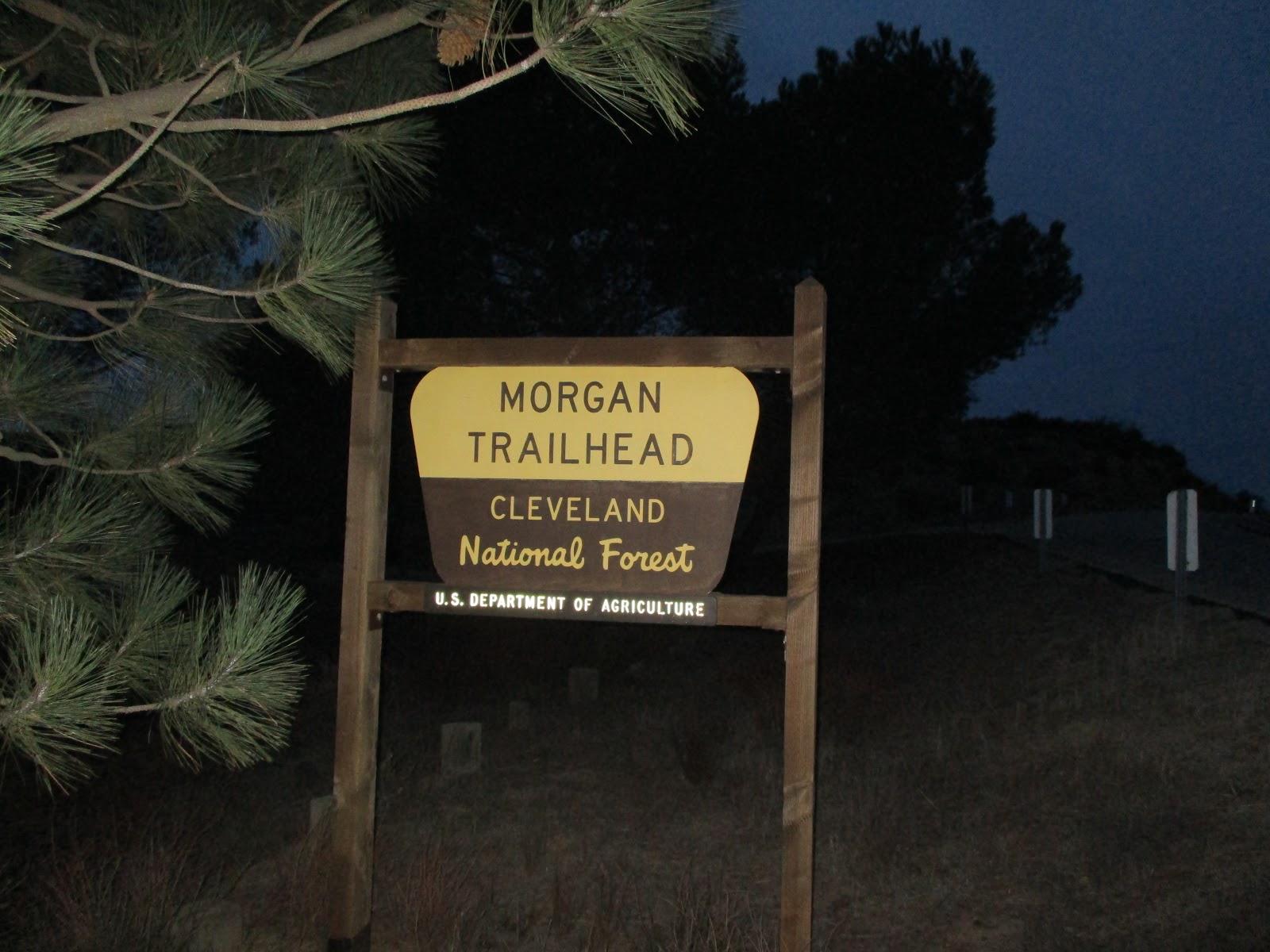
Parking/Fees: Free on Modjeska Canyon Road
Difficulty: Strenuous

Sean, Henry, and I had bigger plans, but were foiled by the USFS closing key roads we needed. Our backup plan was to explore Harding Canyon, and check out what was beyond the main waterfall. I had hiked to the waterfall once. This was a new area for Sean and Henry. This trip was a little more difficult than my first visit because there was a lot more water in the canyon (a good thing). It's a great time to hike Harding Canyon with all the falls flowing. Salamanders and frogs were abundant in and along the many pools. At the main waterfall, we took a break. The water was about knee deep to the base of the left side where it can be climbed. We spent about 20 minutes building a rough rock bridge to the base, then made the class 3 climb. We cleared the 2nd tier and got ready to explore the upper canyon.


One of many small falls and pools


Henry at the main falls


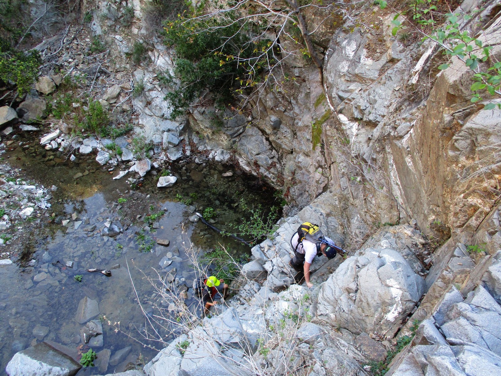
Climbing left of the falls


Above the falls, the canyon was narrower. It started with more rock hopping in the stream. The use trail was gone, the brush grew more troublesome, and the poison oak more abundant. In particular, there were a lot of downed trees, sometimes piled like pick-up sticks from run off. Many of the dead trees were crawling with ants and we had to brush them off frequently. We continued about a third of a mile beyond the main falls. We passed many more small waterfalls and large boulders. It was very nice, but we didn't discover any new spectacular attractions. We stopped at a fall where the scrubby continuation would have been rather unpleasant. On the return trip, Sean and I both found unattached ticks. With a warm afternoon, I expected to meet a snake or two on the way back. Sean was the only one who spotted a snake on the trail, but it slithered off before he got a good photo. I had thought about placing a trailcam in the upper canyon, but the lack of animal trails or signs of anything larger than a lizard dispelled that idea.


Immediately above the main falls


More falls, more pools


Nasty pile of ant-covered trees


Small fall where were turned around


Above Harding Canyon Falls from Keith Winston on Vimeo.


See also:
Harding Canyon Falls

Saturday, March 24, 2018

Where the Wild Things Are v3

Hiked: 3/24/2018
Distance: 1.2 miles round trip on trail
Difficulty: Easy

I took my trailcam out of the deep forest and placed it near a watering hole much closer to home. I plan to put it back in the deep forest next month to get better images of my lion. In the last month, the watering hole attracted a coyote, some ravens, and a bobcat. The camera was discovered by another hiker and his two big black labs, but fortunately he let it be. It is in a moderately trafficked area and there is a risk it may not be there the next time I check.


See Also:
Wild Things v4

Saturday, March 17, 2018

Vallecito Mountains High Point

Hiked: 3/16/2018
Distance: 5.9 miles round trip cross country
Summit Elevation: 3583'
Prominence: 803'
Elevation Gain: 1415'
Elevation Gain (in Empire State Buildings): 1.13
Round trip time: 4 hours 30 minutes
Recommended water: 56 oz.
Parking/Fees: Free on Fish Creek Wash
Difficulty: Moderate

Matt and I met at Scissors Crossing, then drove to Fish Creek Wash and completed the roughly 18 mile jeep trail to Dave McCain Spring, the trailhead for the Vallecito Mountains High Point (SDC #60). Technically, Whale Peak is the highest point in the Vallecito Mountains, while this peak is the high point of the eastern part of the range. The road to the trailhead has large rocks, a couple of tight spaces, and deep sand. 4x4 is strongly recommended, high clearance may not enough. The drive through Fish Creek Wash alone took about 1.5 hours. We started hiking around 7:45 AM in cool weather with a steady 20-25 mph wind. The hike had three distinct phases: boulders, plateau, boulders.

A faint use trail left the parking area over a small saddle and dropped into the dry spring below. We followed the spring a short distance before heading straight up a large wall of boulders. We found a route up that never exceeded class 2. At the top, we started across a large, sandy plateau. Vallecito was not visible from the plateau. Nearby, Peak 3450 looked like the obvious high point, but fell 133' below that honor. The plateau had healthy and abundant vegetation though it was sparse enough to allow easy travel. We found bighorn scat along the way and some bleached bones, but never spotted one of the elusive animals. At the end of the plateau, we stopped for a break at the bottom of the ascent gully. A giant boulder field surrounded Vallecito. There was no use trail, but we stayed slightly right of the ascent gully on the way up. At the false summit, we got our first look at the summit on the other side an 80' dip.


Start, use trail goes over the shallow saddle


First boulder wall


Long plateau, Vallecito HP at the far end, but not visible


In the ascent gully, second boulder wall


First view of Vallecito summit

There was a small camping spot at the saddle below the summit, somewhat protected from the wind. The final scramble was short. At the top, we found a yellow register can with a glass jar inside. We took turns occupying the highest boulder. The best views were east into Borrego Valley. Whale Mountain filled most of the western view. Parts of the Santa Rosa Ridge were visible and snow capped San Jacinto beyond. This summit and route are extremely remote and seldom visited. The register included the front cover of the first register book (and probably first ascent) from February 9, 1980. Because we were exposed to the wind, we didn't stay on top for long. After signing the register, we started back, taking a slightly different descent route. We looked for an easier way around the boulders, but it ended up being about the same difficulty. We crossed the plateau and started down the final boulder wall. We were about 200' north of our ascent route and ran into some larger boulders that forced adjustments to our path. Back at the truck, the adventure wasn't quite over. I made all right turns at each junction in Fish Creek Wash on the way in, so I planned to take all left turns on the way out. This should have worked, but I took a left onto an unmapped and unnamed jeep trail somewhere along the way. I noticed this when the navigation system showed us well north of Fish Creek Wash. The nav system didn't know how to get us back and neither did Google Maps. Matt checked a satellite view of the area on his phone and thought the trail we were on would meet up with Fish Creek Wash so we continued forward. The road was no worse than Fish Creek Wash and after a few miles, it met the main jeep trail. Getting lost on the drive out would have been bad mojo. The upside of the diversion is that we got some bonus scenery shots.


Looking east to Borrego Valley and Salton Sea


North


Matt on the Vallecito summit block


Whale Peak


Original register book cover from 1980


Close encounters with agave and cat's claw,
my legs were only slightly better off due to long pants


Giant boulders on the final descent


Budding cholla on the way out


Scenery on the drive out


"Tiramisu" Rock


Saturday, March 10, 2018

San Mateo Peak and Peak 3064

Hiked: 3/10/2018
Distance: 4.7 miles round trip on trail
Summit Elevation: 3591' (San Mateo), 3064' (Peak 3064)
Elevation Gain: 1164'
Elevation Gain (in Empire State Buildings): 0.93
Round trip time: 2 hours 10 minutes
Recommended water: 24 oz.
Parking/Fees: Adventure Pass at Morgan Trailhead
Difficulty: Easy

This was my second trip to San Mateo Peak. It is on the Sierra Club Lower Peaks list and even though it is short, it is one my favorites in the Santa Ana range. It has great scenery and boulder options along the trail. The first time I did this hike, I started from a closed turnout on South Main Divide Road. This time, I started from the standard Morgan Trailhead. I was not sure an adventure pass was required, but I always display it when in doubt. Not far down the trail, a use trail branches hard left (about 120 degrees). It is a connector to the San Mateo Peak trail. A sign near the start of the connector trail suggests a 5.5 mile round trip loop to the Rancho Capistrano subdivision.

The use trail was green from recent rain and more rain was on the way. It followed Lion Spring until it intersected San Mateo Peak Trail. I poked around in the spring and off trail for awhile assessing possible future trailcam locations. One part of the connector trail was covered with dead trees, but it was easy to bypass. A sign at the junction pointed toward the peak and the first of two plastic dinosaurs was mounted in the same area. At the top of the first hill, I took a side trail to Peak 3064 where a worn flag hung from a pole. The summit of 3064 is a little beyond the flag. I got back on the main trail and made it to the summit quickly. Views east were gratifying with layers of low clouds threatening rain. I signed the register and started back as soon as I felt the first few rain drops. On the way back, I wanted to stop at an intermediate peak with a cluster of boulders but the rain encouraged me to continue down. The rain was light but I was pretty wet by the time I got back to the truck. Fortunately, I had a dry shirt and other shoes to make the drive back comfortable.


First dino and a basketball that was not there last time


Summit of Peak 3064


San Mateo Peak from Peak 3064


See Also:
San Mateo Peak Loop