Distance: 13.3 miles round trip on trail, use trail, and cross country
Summit Elevation: 8000' (Sawtooth), 7429' (Lamont)
Elevation Gain: 4217'
Elevation Gain (in Empire State Buildings): 3.3
Round trip time: 8 hours, 45 minutes
Recommended water: 148 oz.
Parking/Fees: Free on Canebrake Road
Difficulty: Strenuous (combined)
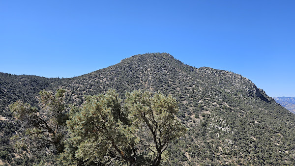
Sawtooth Peak (SPS #243) is in the southern Sierra, a little north of Owens Peak. I drove in on Chimney Basin Road, a smooth dirt road, to where the PCT intersection. There was room on the side of the road for a couple of vehicles, or I would have had to part at Chimney Basic Campground a half mile earlier. The drive from the OC took about 4 hours and it was going to be a long drive home. I took the PCT southeast for about 3 miles until I was south of Sawtooth. Gnats became a problem within the first mile. For most of the hike, I was wearing my bug net. Oddly, the gnats were not an issue on the summits. At a saddle south of Sawtooth, I left the trail through open country up a steep slope. I found a faint use trail part way up. There was a short scramble through white rocks at the top, then the terrain leveled out a bit. I crossed a field before the second steep slope. The second slope gained about 900' and was more forested. I found and lost the use trail multiple times, but upward progress was not too difficult even without the use trail. The solid summit rocks were class 2 from the north or south, class 3 from the west. There were two register books in an ammo box, but I didn't find any benchmarks. The oldest register book was started in 1966 and there were well preserved loose leaf pages that went back to 1957. I did some aerial shots, then spent about 30 minutes reading through the history in the oldest register. The skies were blue, though it was a tad warm. Views were very nice south to Owens, Spanish Needle, and north to Olancha. Langley and Whitney were visible, but mostly gray smears through the haze. The descent was uneventful and I was back on the PCT about 90 minutes faster than expected. With the extra time, I set off for nearby Lamont Benchmark as a bonus.
I didn't have a GPS track for Lamont, but it seemed close and uncomplicated. I took the PCT up a few long switchbacks, then left the trail going northwest. As I gained elevation, I stumbled on some cairns which boosted my confidence. What I thought was the summit was only the first of several false summits. Piles of boulders lined the ridge and I mistakenly climbed a few, then realized they were not the high point. I don't recommend following my track near the stop. Eventually, I reached the end of the ridge and scrambled up to the Lamont Benchmark. The mark was intact and the high point was on a boulder that required an airy step. Views were nice, but not as nice as Sawtooth. I descended to the PCT, then trudged about four miles back to the truck. I was glad I brought a cooler with ice and relished the cold water before starting the drive back. House to house, it was a 17 hour day.


No comments:
Post a Comment