Distance: 13.4 miles round trip on dirt road and firebreak
Summit Elevation: 5790' (Burnt), 5526' (Little Burnt), 5516' (Sawmill), 5201' (Sawtooth)
Prominence: 2450' (Burnt)
Elevation Gain: 3473'
Elevation Gain (in Empire State Buildings): 2.7
Round trip time: 6 hours 30 minutes
Recommended water: 110 oz.
Parking/Fees: Free on Forest Route 7N23
Difficulty: Strenuous (combined)
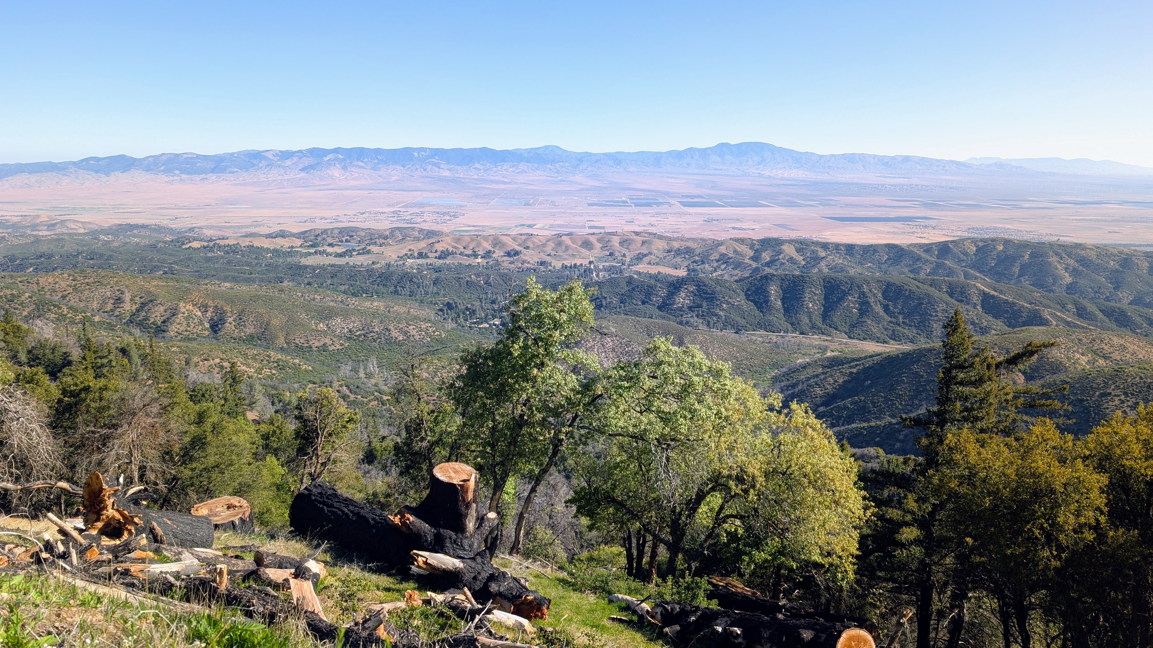
A handful of HPS peaks reside in the northernmost mountains of the Angeles National Forest. My main goals for the day were Burnt Peak (HPS #205) and Sawtooth Mountain (HPS #262). I was prepared for a longer hike if the gate to Forest Route 7N23 was closed, but it was open, allowing time for a couple bonus peaks. I parked at the intersection of 7N23 and Sawmill Mountain Road. The road was smooth and sedan friendly. The PCT also crosses this intersection. First, I headed to Burnt Peak, dirt road all the way. There was another gate on the road to Burnt and I noticed it was unlocked. I could have driven to the top, but I part of my motivation was to log some miles. A few minutes later, a construction worker drove by in an SUV, informing me that a lot of heavy equipment was coming behind him for a project on the Burnt summit. A dozen trucks, including a cement mixer, passed me leaving a dozen dust clouds in their wake. At the summit, I found a strange tower surrounded by what looked like sealed mailboxes. Internet research identified the tower as a Doppler VHF Omnidirectional Range (DVOR) station, part of the FAA's aircraft navigation infrastructure. The central cone and cylinder structure is the main antenna, and the smaller ground-level antennas around it help generate the Doppler frequency shift necessary for precise bearing information. I found no benchmark or register. Nice views from the edges including Cobblestone Mountain in Los Padres.


On the way down from Burnt, I left the road for a short cross country maze of small trees and yucca to Little Burnt Peak. Little Burnt had a register, but no benchmark. I also went up a freshly cut firebreak to Sawmill Mountain. I found a metal post half way up and another one on the summit. No benchmark or register. I continued down the other side to a dirt road that took me back to the truck. Round trip stats for Bunrt, Little Burnt, and Sawmill were 6.1 miles, 1335' gain, 2.5 hours. Most of the gain was ahead on Sawtooth Mountain.


I expected most of the hike to Sawtooth to be on a dirt road. I was half right. The rest was on a wide firebreak about 1.5 miles long across rolling hills. Sawtooth itself was not jagged, but the path to get there was. The road gained a couple hundred feet before the firebreak. The first drop on the fire break was 300', followed by 150' up, then the big 600' drop, then 550' up the final firebreak to the flat summit. Looking up the final firebreak was pretty impressive. Photos don't capture being there. The summit held a register in green cans (unusual) but no benchmark. I went 0 for 4 on benchmarks. The prominence of Burnt was more obvious from Sawtooth, and other views were nice. I took a longer break on Sawtooth before facing more than 1000' of gain on the way back. I found the ups and downs kind of fun, making for a solid workout. Stats for Sawtooth alone were 7.3 miles, 2138' gain, 4 hours.


No comments:
Post a Comment