Hiked: 6/29/2024
Distance: 11.1 miles round trip on trail and use trail
Summit Elevation: 6848' (Antimony), Eagle Rest (6005')
Prominence: 968' (Eagle Rest)
Elevation Gain: 5560'
Elevation Gain (in Empire State Buildings): 4.4
Round trip time: 10 hours
Recommended water: 196 oz.
Parking/Fees: Free on Forest Road 9N29
Difficulty: Strenuous
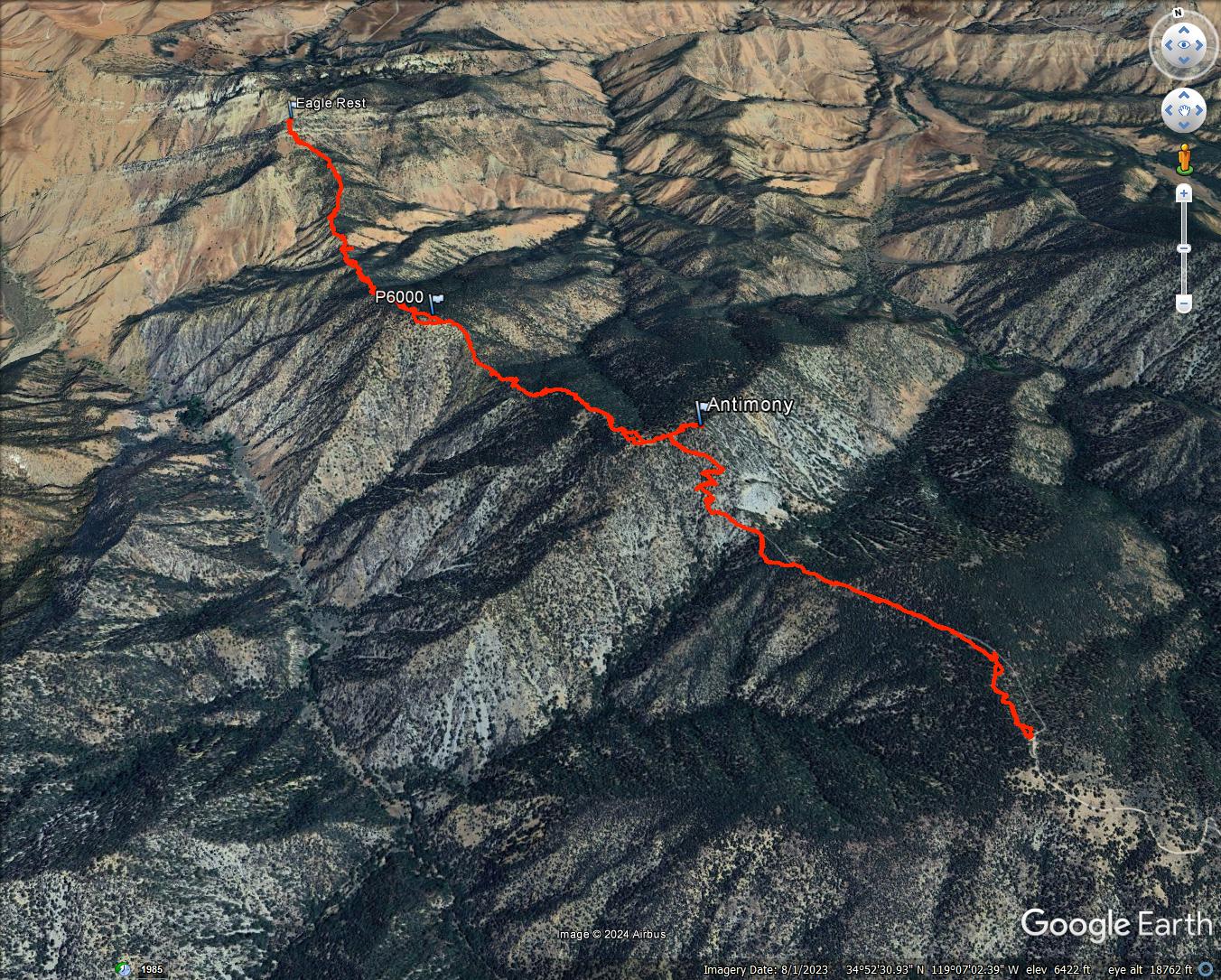
My hiking plans got derailed by flooring contractors going over schedule, forcing me to find a quick replacement. I settled on Antimony (HPS #125) and Eagle Rest (HPS #186) in Los Padres National Forest. I wasn't sure the dirt roads to Tecuya Ridge were driveable, and if not, I'd have to skip Eagle Rest. The two roads needed to reach Tecuya Ridge were 9N22 and 9N19. The first 1.4 miles of 9N22 were deeply rutted, 4x4 recommended. By contrast, 9N19 was mostly smooth and in good shape all the way to the turnaround. The route to Eagle Rest was a major roller coaster. After going over Antimony, there was a drop to a saddle, then over P6000, then drop to another saddle, then up to Eagle Rest. Like many parts of Los Padres, this area was hot and dry. I should have known better than to attempt it during the summer. Worse, I underestimated the amount of water needed, leading to a sufferfest on the way back. (note: recommended water is 48 oz more than I brought)
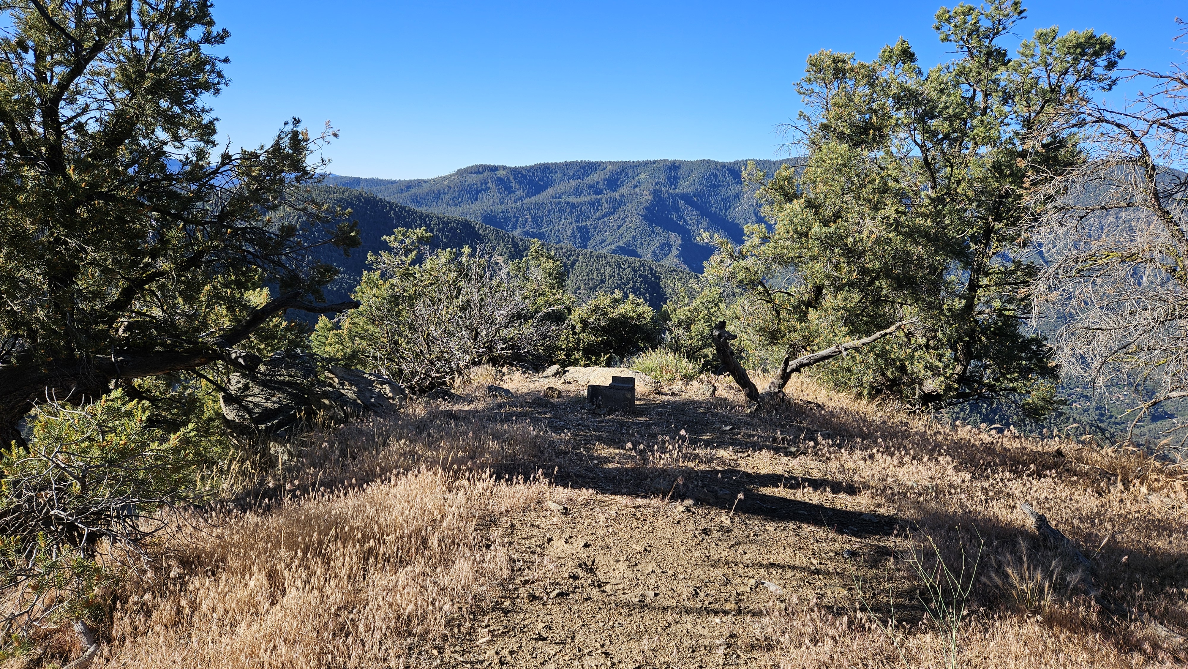
The trail to Antimony was an abandoned dirt road, then became a single track near the saddle. Antimony had a beautiful southern rock face. The trail switchbacked up the south side and was in good shape. This side of the mountain was shaded early. The trail reached a clearing, then I followed a use trail to the summit. Half of the views were blocked by trees, but I had a clear view back to Tecuya. I found the register in a broken cement block. The benchmark was oddly unstamped. I left the summit and continued on use trail down the northeast ridge toward P6000. I had route finding issues on the lower section where the use trail either faded away or went directly through brush. The climb to P6000 was easy. The summit was a flat clearing with no views. No register and no marks. I took a short break, then jumped back on the use trail down the north ridge of P6000. I ran into brush problems on this ridge, leading to a meandering, dusty descent. This ridge was the crux of the hike as I weaved and bashed my way through. It cost me precious time and energy. As I dropped off P6000, the view to Eagle Rest grew. It looked intimidating and that feeling grew in proportion as it got closer.

The thin connector to the south ridge of Eagle Rest was a waist high field of amber grass. The kind that embed foxtails in your clothes. This variety was pernicious, not only filling my socks with annoying barbs, but also my pants. I paused as needed to remove the worst offenders. The south ridge of Eagle Rest also had route finding problems, but the trail was more visible and often marked with cairns. Some class 3 was needed to get past the lower cliff band. As I reached the upper band, just below the summit, I took a sip from my bladder and realized it was almost empty. I had used 3/4 of my water already. I was only 5 minutes from the summit, so it didn't make sense to turn around without getting it. I dropped my pack and pole, then scrambled up to the summit. The highest block was about 12', surmounted with a friction move. I stood on the summit block and snapped some quick photos. The register was below the summit and full of insects that I promptly cleaned out. I found no marks. My eyes drifted to the way back. I faced three big uphill efforts. Even David Stillman opted not to return this way.


I dreaded the brush dance as I started up the ridge to P6000. I made fewer mistakes, but still had my share of kicking, ducking, and bashing. I made it over P6000 and descended to the saddle before Antimony without a rest. The ridge to Antimony was the longest of the three, 1200' of up. I was forced to take many breaks wherever I could find shade. I finally topped out on Antimony with a little less than half a liter of water left. The view back to Tecuya was distorted with late afternoon heat shimmer. The sun was a lump of coal and the pine trees were on fire (figuratively). I made it down the south side of Antimony and started slowly up the trail. I took my final sips with a quarter mile to go. Salvation awaited in the truck in the form of extra water and A/C. Despite the difficulty, this was sightly country. It just would have been more pleasant in another season. Pleasantly surprised that Eagle Rest pushed my P-index to 200.
The way out, plus 700' gain on the other side of Antimony
Hitchhiking branch I ripped from a tree
Foxtails. There was no saving the socks.
Other trip reports:
Antimony, Eagle Rest, and San Emigdio Canyon (David Stillman)
Antimony and Eagle Rest (Shirt and Tie Adventures)