Saturday, April 6, 2024

Pinnacles High Peaks Loop and Balconies Cave

Hiked: 4/3/2024
Distance: 9.1 miles round trip on trail
Summit Elevation: 2600'
Elevation Gain: 2100'
Elevation Gain (in Empire State Buildings): 1.7
Round trip time: 5 hours
Recommended water: 72 oz.
Parking/Fees: $35 National Parks Fee (or annual pass)
Difficulty: Moderate

On our third day in Pinnacles, Leisa and I planned a counterclockwise loop along the High Peaks trail, back through the Balconies Cave and Old Pinnacles trail. We started at the Old Pinnacles trailhead, then east on the High Peaks trail. After we reached the ridge line, the Tunnel Trail split right, but we continued on High Peaks. There is a scramble section on this trail going half way up a major pinnacle where steps have been cut into the rock. Railings were also installed, so nothing was difficult. We climbed rock ladders and skirted ledges with railings.


The trail goes through the gap in this pinnacle


Coming down from the steep and narrow section, we met a group of California condors in the middle of the trail. They stopped traffic in both directions. We saw five rare condors up close and spent about 10 minutes just watching them wander around and interact. I learned that condors don't make cawing sounds like other birds. They grunt and hiss. When they spread their wings or flew, you really got a sense of their size. They are still extremely endangered so it was probably a once in a lifetime encounter. Most had tags and the Pinnacles web site has a bio for each tagged bird. We took the Juniper Canyon trail north to the Balconies trail and took a break. The cave was not far from the junction so we prepped our headlamps.

The Balconies Cave has a narrow entrance and we were shin deep in col, running water again. The cave had traffic going both directions. White arrows painted on the rocks pointed the way through. We ran into a group of three women (grandma, daughter and granddaughter) all trying to navigate through with a single flashlight. They struggled to stay close enough to see where to go and also were not good at following the arrows. I grew frustrated and semi-scolded the grandma (she was my age) for not having her own light source. Lucky for them, the cave was only about 500' long. It had a single waterfall inside near the end. After leaving the cave, you hike through a creek before the trail starts up again. We completed our loop, then packed up and started home. We had the camp site for one more night, but rain was forecast for the morning and we didn't want to be packing up in the weather. Pinnacles is the newest national park and small, but didn't do any rock climbing so there is plenty more to explore.


The cave GPS anamoly was removed from the elevation gain

Thursday, April 4, 2024

North Chalone Peak

Hiked: 4/2/2024
Distance: 8.4 miles round trip on trail
Summit Elevation: 3308'
Elevation Gain: 2285'
Elevation Gain (in Empire State Buildings): 1.8
Round trip time: 4 hours 50 minutes
Recommended water: 72 oz.
Parking/Fees: $35 National Parks Fee (or annual pass)
Difficulty: Moderate

North Chalone is the highest peak in Pinnacles National Park. Leisa and I started at the Moses Spring parking lot. There were only about ten parking spots so it's worth starting early if you want to park there. Otherwise, it adds an additional 0.3 miles each way to start from the Bear Gulch parking lot. We took the rim trail to the reservoir, then crossed it to continue on the trail. A small section of trail was underwater around the reservoir, but several climber trails were available as a bypass. After that, it was steady climb with long switchbacks through forest and giant rocks. Half way up, we could make out the fire lookout atop North Chalone. At about 3.5 miles, the trail met a fence at the intersection of a dirt road to the summit. We had to climb a stile to get over the fence. The road adds a final 300' of gain along with a locked gate that required a second stile climb. The tower on the summit was locked and unmanned. I found the benchmark and a reference mark, but no register. Just below the summit were some toilets with their doors bolted open. I guessed they forced them open for ventilation. We rested on top for a while and ate a leisurely lunch. We had nice views of the pinnacle formations, but also the farmland between Chalone and the coastal mountains. There was a maintained trail to lower South Chalone (3264') that left near the gate, but we didn't have enough interest to muster the effort for the three extra miles to tag it. We met a few other parties on the way up or down, but traffic was light compared to the rest of the park.

Reservoir


First sight of North Chalone

High Peaks area


Leisa with South Chalone in the background


Monday, April 1, 2024

Bear Gulch Cave

Hiked: 4/1/2024
Distance: 1.8 miles round trip on trail
Summit Elevation: 1600' (Upper cave)
Elevation Gain: 300'
Elevation Gain (in Empire State Buildings): 1.8
Round trip time: 1 hour
Recommended water: 16 oz.
Parking/Fees: $35 National Parks Fee (or annual pass)
Difficulty: Easy

We arrived at Pinnacles NP in the afternoon and it was 3 PM by the time we got camp set up. Bear Gulch Cave was short so we decided to give it a day in court. Parking was limited at the Moses Spring trailhead, so we had to park at Bear Gulch day use area. That added 0.3 miles each way. The caves are gated and open based on conditions and bat nesting season. The sign at the entrance said you needed a flashlight. We both had headlamps and I always carry a second light source (plus a phone). Just past the gate, we got into cold shin deep water. A storm had passed through leaving the creeks up and water flowing in the caves. The cave system was not all underground. We went through a dark section, then emerged from some boulders, then went back into the dark. There was some class 2 moving over and under some boulders and the rocks and walls were wet. Railings were added for some steep sections. Several underground waterfalls in the cave added to the atmosphere. We exited near the Bear Gulch Reservoir, then took the rim trail back. It was a fun start to our three day trip.

Friday, March 29, 2024

Middle Ysidro and Hobs Knobs

Hiked: 3/27/2024
Distance: 11 miles round trip cross country
Summit Elevation: 5855'
Elevation Gain: 4211'
Elevation Gain (in Empire State Buildings): 3.3
Round trip time: 11 hours
Recommended water: 160 oz.
Parking/Fees: Free on Highway S2
Difficulty: Very Strenuous (route finding, brush)


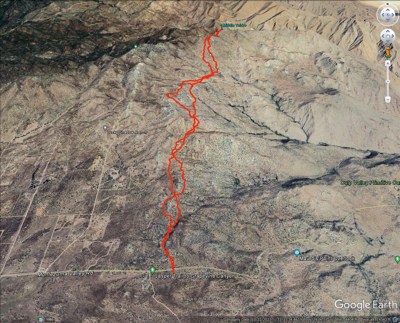
Middle Ysidro is an unofficial peak in the center of the San Ysidro mountain range. It is extremely remote and not on any list. Only a handful of people have climbed it. The previous week, I discovered the Cherry Canyon parking spot covered with private property and no trespassing signs. I updated my route plan starting from Highway S2, longer and with a more difficult approach. Sean Green joined me for the adventure. We started at a small turnout on S2 just past the Anza-Borrego sign. After a wet winter and recent rain, the brush was thicker than usual. On the plus side, the ground was soft but stable.

We made our way past the Bonnie and Clyde benchmarks, then spent a couple miles side-hilling around White BM. As a bonus, I wanted to check out some granite formations that caught my attention on a previous trip. There were four towers (30'-70') on a shelf above the drainage that leads to Hob BM. I called these Hobs Knobs #1-#4. They are nearly in a direct line between The Thimble and Goat BM. Sean waited patiently for me to explore a couple of them. Number 4 was the closest and I found an easy class 2 ledge to the top. Next, I checked out Number 1 to the east. I saw a good class 3 line using ledges and slabs. I saved Number 2 and 3 for a future trip. We crossed the drainage and started up the ridge toward Hob. It would have been easier if we had followed the major gully east of Hob since it had less brush. After reaching the ridge line, we got a look at Middle Ysidro across a brushy saddle.

Clyde Benchmark in the background


Coming up on Hobs Knobs

Knob #1

You can barely see me on Knob #1 (back)


Half way up the ridge


At the base of Middle Ysidro

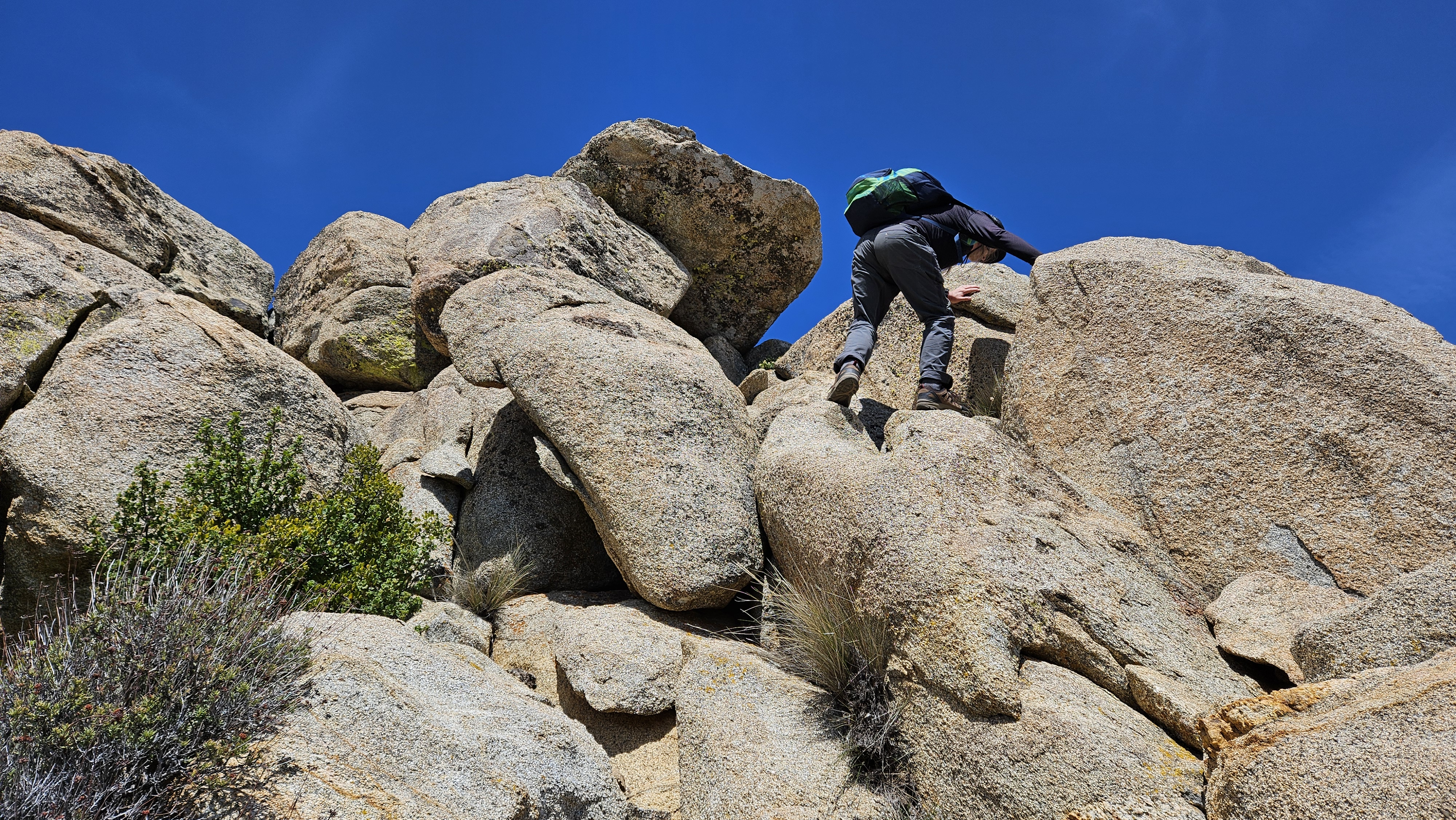
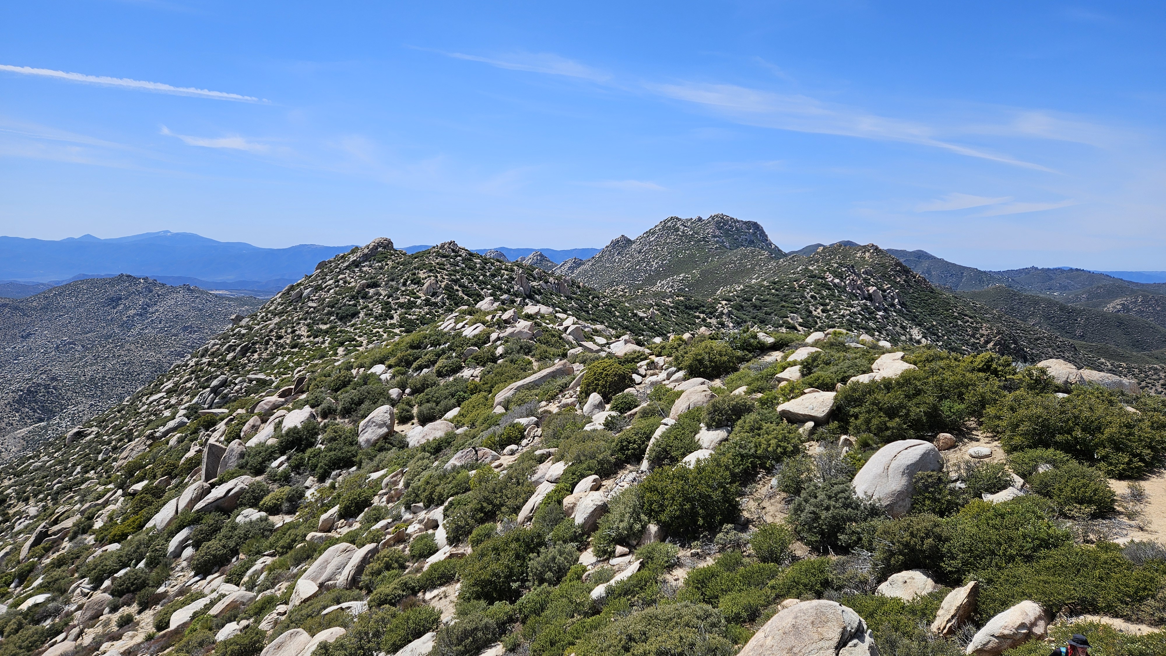
We worked our way to Middle Ysidro, then Sean led the route up some boulders to avoid the worst vegetation. The highest point was northeast of the false summit. The high point was a boulder requiring a single class 3 mantle. There were no marks and no register. Views from the middle of the range were striking. It took us six hours to reach Middle Ysidro. I had planned an eight hour round trip, so water and food were going to be a problem. On the way back, Sean collected some emergency water from a small snow patch and from a puddle on top of a boulder. We descended the gully and made better time. Instead of going back through Hobs Knobs, we followed the drainage, trading extra steps for an easier grade. We took frequent breaks in the shade on the way back. I rationed both food and water. Sean treated the murky water he collected with purification pills and drank up. I drank some of the snow melt, but was not keen on the boulder water. Sean's route finding was key in certain places and I don't think I would have completed this hike without his help. When we reached the truck, I guzzled the water I had, but was very dehydrated. We stopped at the Pala mini-mart on the way back and I loaded up on ice cold drinks. After downing a gatorade, I was right as rain. I took 112 oz of water (3.3L), but needed another 48 oz, reflected in my recommended water stat. Caching some along the way would be a good idea. I underestimated the effort required for Middle Ysidro. My ankle was sore, but with minimal swelling and no lingering pain. The ankle appears to be back in working order.

Taking the boulders to avoid brush


Sean on the Middle Ysidro summit block

The amazing Ysidro ridge

Rest stop on the way back


Heading back, down to the last bottle of water


Friday, March 15, 2024

Chemehuevi Peak

Hiked: 3/13/2024
Distance: 8 miles round trip cross country
Summit Elevation: 3694'
Prominence: 1774'
Elevation Gain: 2079'
Elevation Gain (in Empire State Buildings): 1.6
Round trip time: 6 hours
Recommended water: 96 oz.
Parking/Fees: Free on Hightower Road (BLM NS056)
Difficulty: Moderate

Chemehuevi Peak (DPS #89) is an eastern Mojave peak with a view to Lake Havesu. My physical therapist told me to push the ankle this week. Boulders, scree, and scrambling on Chemehuevi met that challenge. From highway 95, I took the dirt Hightower Road to the approach wash. The road was in great shape with no ruts or deep sand. I started up the wash at 8:30 AM. In a little over two miles, I reached the main gully on the left. There were several boulder and brush choked channels at the base of the gully. I trended left and stumbled on a faded use trail. The trail was faint but useful to bypass some obstacles. The gully was mostly class 2.


Start

Entering the major gully on the left side


Looking back down the gully

When I exited the gully, I turned toward the summit. There was a steep ravine cut into the cliff wall, but I wasn't sure it was the easiest route. I was tempted to head to the ridge line, but I saw cairns leading into the ravine. When I got into the wedge, some class 3 was unavoidable. Reviewing the track after, I might have done better by moving left a litte. The rock and holds were solid and there was no serious exposure. I emerged from the ravine with the summit in view and was immediately blasted by strong winds. A simple ridge walk got me to the top. The register was new, placed in January, 2024 and nestled in a glass jar. I signed in and was mildy amused by a sticker left behind by Clint Baechle: Hiking Metal Maniac - Death to False Summits. Views were strong in all directions, but haze from high clouds blurred some of the distant attractions like Lake Havasu. I had hauled the drone up but was concerned about high winds, especially the gusts that felt above 40mph. I decided to try flying at least one helix, but as soon as I launched, I got a red warning on the controller that the winds were too much and it could not navigate home by itself. The warning said to manually land the drone immediately. I tried to bring it back, but every time it was above me for landing, a gust of wind blew it 15-20' away, where it would pitch wildly at 45 degree angles trying to right itself. On the third try, I got it within grasping distance. As soon as it cut rotors, another gust grabbed it and slid it along the summit until it hit a rock. It didn't look too damaged, but I would have to test it at home to see if it was still in working order. My ankle was doing OK, but I dreaded the down climb. I took a preventative aspirin before starting back. The scramble bits were fine since I could control my weight and foot placements. What sucked was the scree, talus, and slippery surfaces. Some of those slips put pressure on the ankle at all kinds of weird angles. Honestly, it was probably good therapy, like the bosu tricks in PT. I got back to the truck with only minor pain and swelling. At 10 weeks, I still feel 20% slower than normal and a long way from fully recovered.


Narrow ravine ahead

Summit


Lake Havasu in the distance behind of the mountains

Desperately trying to land the drone


Back down the gully

Final look back