Friday, November 11, 2022

Monserate Mountain

Hiked: 11/11/2022
Distance: 3.3 miles round trip on trail
Summit Elevation: 1567'
Prominence: 607'
Elevation Gain: 1260'
Elevation Gain (in Empire State Buildings): 1.0
Round trip time: 1 hour 20 minutes
Recommended water: 16 oz.
Parking/Fees: Free on Horse Ranch Road
Difficulty: Easy

I had been saving Monserate Mountain in northern San Diego County as a possible bonus peak coming back from Anza-Borrego, but I never found the right time to do it. I planned to do the long loop over Monserate, hitting the lesser, provisional peaks along the way. It was a short drive (based on my recent history) to the gravel parking area at the trailhead. There were 20 other cars there and 4 doggos. I packed ultra-lite and began an earnest clip up the moderately sloped trail. The lower section was rocky but it smoothed out toward the top. There was a memorial bench about half way up. Near the top, I took a 200' use trail to Little Red Hill (1530'), one of the lessers. A small pile of boulders made up the summit. I immediately returned to the main trail and continued to the top of Monserate. There were a couple of other parties on top. A large metal box held multiple registers and I took a photo of the benchmark. The Fallbrook Fire Department climbs this mountain every 9/11 as a tribute to the victims of that day. One of the books in the metal box was a print out of all the names. A nice tradition. When I got back to the loop trail, I spotted an orange sign stating the other part of the trail was under construction until December 2022. My desire to get the other lesser peaks was no match for my rule following nature. I continued down to the truck. It was a short day, but enough to feel like I got a little cardio done.


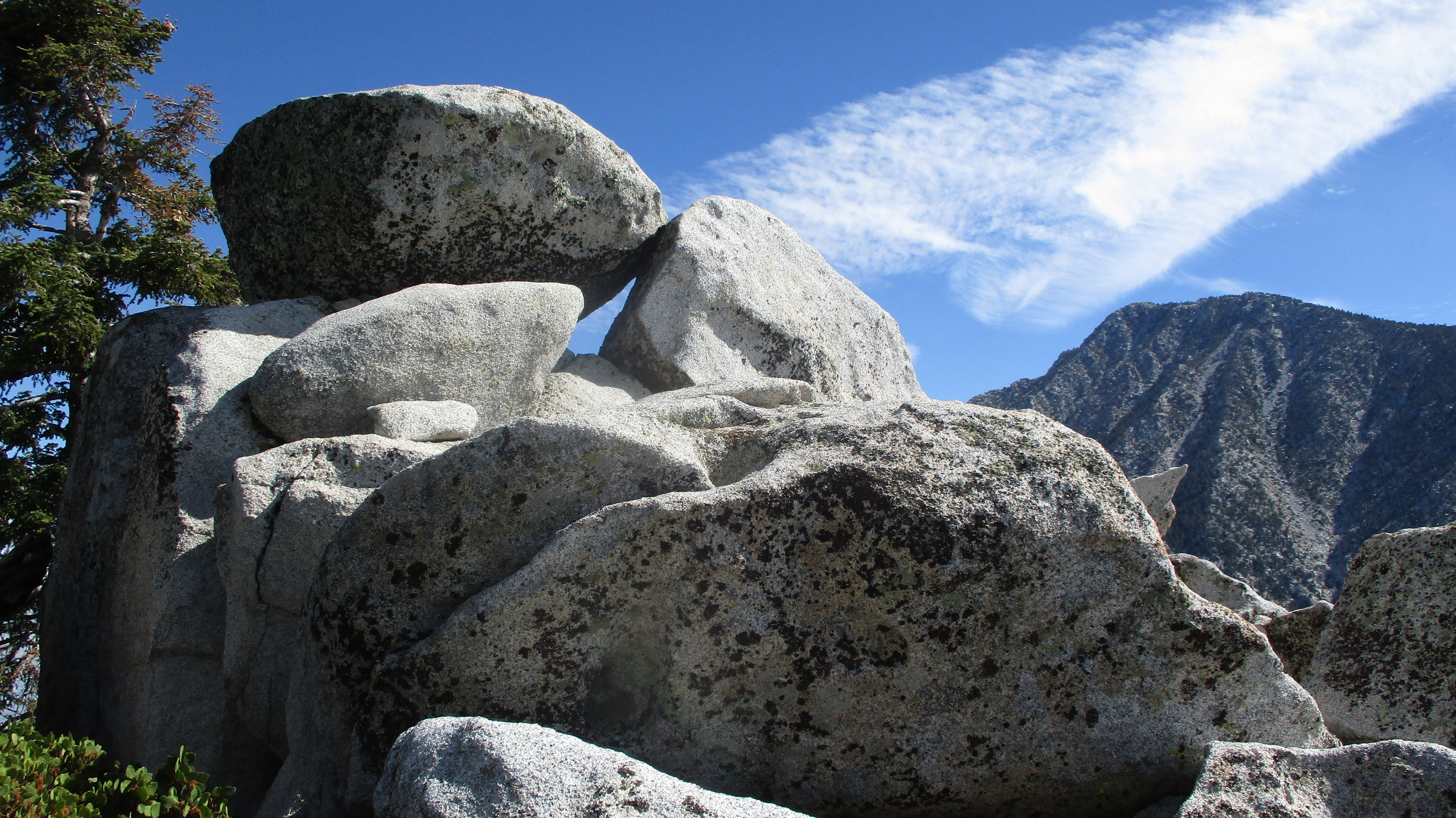
Monserate from Little Red Hill


Snowy Gorgonio in the distance


Sunday, November 6, 2022

Mount Lawlor and Barley Flats

Hiked: 11/4/2022
Distance: 10 miles round trip on trail and cross country
Summit Elevation: 5957' (Lawlor), 5626' (Barley)
Prominence: 757' (Lawlor)
Elevation Gain: 2464'
Elevation Gain (in Empire State Buildings): 2.0
Round trip time: 5 hours 15 minutes
Recommended water: 72 oz.
Parking/Fees: Adventure Pass at Red Box Gap
Difficulty: Moderate (combined)

Until the night before, my plan was to attempt Lizard Head in Santa Barbara County. But the 9 hour round trip drive for the somewhat plain looking peak made me look for something closer. My friend Madison wrote a glowing review of Mount Lawlor (HPS #190) and it's one I hadn't hiked. I got a late start and made it to Red Box Gap around 9:30 AM. The air was cool and crisp. I started up the Strawberry Peak trail and soon passed under the infamous south face firebreak. I continued on toward the Strawberry-Lawlor saddle, meeting several parties on their way back. The west ridge had a nice use trail and one short section of class 2. Some of the granite had a black and white marbley look. On the summit, I found neither marks nor register. There was a wooden pole and dozer tracks. I snapped a few photos, then started down the east firebreak toward Barley Flats.

South face firebreak

Strawberry before the saddle

West ridge to Lawlor

Mount Wilson and Occidental from Lawlor

North to Granite Mountain from Lawlor

The firebreak was overgrown in spots, but easy to follow. Some gutsy dozer operator drove up the ridge at high angles to clear it. A faint use trail came and went. Just after the firebreak met a dirt road, I stayed left onto another overgrown firebreak to reach the Barley Flats High Point. A poor use trail cut through grass and dead vegetation leading to the water tower. There wasn't much of a view. Also no marks and no register. I returned to the road and continued up toward Barley Flats. A paved road leading up was gated, locked, and signed. I expected it to be an abandoned military site, but the cabin was occupied by at least two people I heard talking. I followed an ungated road around the back, then some animal trails up to the heliport. The heliport sat a little higher than the cabin so I don't think I was noticied. I got a photo of the large LA Sheriff rescue helicopter, then started back.

East firebreak and Barley Flats at the end


Barley Flats high point


I took the dirt road back, not knowing a section of it was feral. Instead of a boring road walk, I got more than a mile of washouts, rock slides, yucca, buckthorn, and deadfall. Some of the yucca had been cut back, so other people had been using the abandoned road. For one of the washouts, I had to down climb about 10' into a gully, then back out. It was actually kinda fun. It intersected the Strawberry Trail at a major switchback, then it was a short hike to Red Box.

Lawlor (left) and Strawberry (right) on the way back

Feral road


Big washout


Sunday, October 30, 2022

Indianhead via North Ridge

Hiked: 10/28/2022 (x2)
Distance: 6.7 miles round trip on trail and cross country
Summit Elevation: 3960'
Prominence: 760'
Elevation Gain: 3300'
Elevation Gain (in Empire State Buildings): 2.6
Round trip time: 6 hours 45 minutes
Recommended water: 88 oz.
Parking/Fees: Free at Borrego Springs Road and Henderson Canyon Road
Difficulty: Strenuous

This was my second summit of Indianhead, a desert classic in Borrego Springs. My first trip was in 2013 following DPS route B, up Palm Canyon then back along the southwest ridge. This time I tried the north ridge. I drove to the intersection of Borrego Springs and Henderson Canyon, then followed the dirt road past the Jeep statue as far north as it went. From the turnaronud, the summit wasn't visible. I followed a use trail up a wash toward Henderson Canyon. It was sandy and flat as I made my way north. When the trail faded, I continued until I reached the alluvial fan from Henderson Canyon. Approaching the main gully, I noticed some bones of a bighorn scattered around. A brief search revealed an intact skull, a spine, and a couple of legs with flesh still clinging above the hoof. The kill didn't look recent. Just right of the gully, I started climbing in the shade of the mountain. The ground was littered with large boulders, low vegetation, and a surprising amount of grass. The north side must retain water long enough for the slopes to be grassy instead of barren like the south side. This helped with traction as it grew increasingly steep.


Bighorn skull and leg


Summit ahead

Indianhead had mutiple sub-ridges extending north. Some were more rugged than others. The route crossed some of the minor ridges to avoid the worst terrain. There was a lot of low level scrambling, but only a couple of moves I'd consider class 3. The slope continued to get steeper near the top and some of the boulders grew to the size of shipping containers. At the top of the ridge, I only had a short walk to the summit. Multiple registers filled a plastic container. I signed the newest one, the previous entry from March. After taking some photos/videos, I headed for the south summit, a prow jutting into space. I had not visited it on my first trip. A faint use trail traced the bottom of the angled slabs and it was easy to get to the high point. It had a dramatic precipice and view. I returned to the main summit for food, then packed up and started down. After navigating the steep slopes down, I was about a mile from the truck when a rock in the flat wash broke loose from the sand and dropped me. I hyperextended my right thumb when I hit, leaving some swelling and a pretty purple ring around it. Bad luck on the mellowest part of the hike. While there is no easy way to the top of Indianhead, the north ridge seemed easier than DPS route B. Part of that impression might be due to having more experience now, but the grass on the north side really helps with traction. The north ridge also provides shade in the morning, so it requires less water. Indianhead remains one of my favorite desert peaks.


South summit

San Ysidro East across Palm Canyon


Looking north

Henderson Canyon below

Indianhead behind the dragon


See Also:
Indianhead via DPS Route B
Indian via East Ridge

Sunday, October 23, 2022

Castle Rocks and CT Overlook

Hiked: 10/21/2022
Distance: 4.4 miles round trip on trail and cross country
Summit Elevation: 8600' (Castle), 8480' (CT)
Elevation Gain: 1440'
Elevation Gain (in Empire State Buildings): 1.1
Round trip time: 3 hours 15 minutes
Recommended water: 32 oz.
Parking/Fees: Free at Fuller Ridge Trailhead
Difficulty: Moderate (combined, scramble, route finding)

Castle Rocks (HPS #43) is not an HPS Emblem, but I think it should be. CT Overlook is an unoffical Peakbagger peak but worth the short hike from Castle Rocks. The hike starts at the Fuller Ridge trailhead. From highway 243, I drove 7 miles on dirt road 4S01 (aka Black Mountain Road). There were a few sections with deep ruts so high clearance was needed. I didn't see any sedans that made it as far as Black Mountain. I started south on the PCT shaded by the ridge. There was a fair bit of deadfall across the trail. After about 1.6 miles, I saw some cairns marking a use trail up. I followed it a short distance before it disappeared and I just went up to the ridge. The giant boulders on the ridge were difficult to navigate so I retreated below the ridge on the north side until I was near the summit. There, I found the use trail again. The register was in a plastic jar just below the summit block. I did not find any marks. The summit boulder itself was class 3 and had a pretty big drop on the other side. The official HPS Guide lists the hike as class 1 easy, but that's a sandbag. Although the stats weren't big, it was not in the same category as hikes with a maintained trail. IMO, the close up view of the north face of San Jacinto should have earned Castle Rocks an emblem. It was better than half a dozen that did make the list.


This sign had fallen down, I propped it back up

Crawled under this


Tangled in boudlers before dropping below the ridge

Summit blocks


After some drone shots on Castle Rocks, I descended just below the ridge again to make my way over to CT Overlook. I don't know the origin story for the name, but it looked impressive. I reached the summit after some class 3, but there might have been an easier way up. The summit was a collection of vertically stacked slabs. The formation reminded me of Marion Mountain. I found no marks or register. While the views were not as sublime as Castle Rocks, they were still great. I started down toward the PCT through some light brush. I was startled to hear what sounded like branches cracking and a huffing noise that sounded like a bear. The sound was down slope a couple hundred feet. I yelled out "hey bear" a few times, then continued down slowly, but never saw any sign of one. Could have been my imagination. The rest of the return trip was uneventful.

CT Overlook


Looking back at Castle Rocks

Descending CT Overlook