Thursday, July 8, 2021

Mauna Kea, HI

State High Point
Hiked: 7/5/2021
Distance: Drive up
Summit Elevation: 13796'
Prominence: 13796'
Elevation Gain: 0'
Elevation Gain (in Empire State Buildings): 0
Round trip time: 7 hours
Recommended water: 32 oz.
Parking/Fees: $209/person by SuperVacation Hawaii Tours
Difficulty: Easy

Mauna Kea is a massive shield volcano, the Hawaii state high point, and also the 2nd most prominent peak in the United States after Denali. Part of the mountain trivia is the base starts over 16000' below the ocean, so it would be higher than Everest if measured from the base. Leisa and I booked a stargazing tour on Mauna Kea, often listed as one of the must dos on the Big Island. Our tour operator was SuperVacation Hawaii. Our group was about 30 people split between two large 4x4 vans. After picking us up, we rode to the Mauna Kea visitor center at 9200'. We stopped there for 45 minutes to allow people to acclimatize before heading to the summit. We couldn't go inside the visitor center because there was a 5.5 earthquake earlier in the day that knocked out their power. We had packed sandwiches and guzzled water during the wait.

Above the visitor center, the paved road ends and a somewhat rough dirt road begins. The road switchbacks up to about 12500' then it becomes paved again. The story we were told is that the upper road was paved to reduce dust in the air that interferes with the array of astronomical telescopes on the summit. There are no fewer than 10 high powered telescopes on top. Some run by universities, some by NASA. The one owned by CalTech is being dismantled. With so little light polution, it is an ideal location for telescopes. We arrived about 30 minutes before sunset which made for some great photos. It was 85F on the beach and 39F on Mauna Kea. We could feel the thin air, but didn't develop any AMS symptoms. This set Leisa's high point record. I was a little surprised that no one in our group got sick.

The true summit is on a section of the rim about 50' higher than the paved part of the rim. We we warned by the tour operator that it was illegal to visit the sacred true summit and that it carried a hefty fine. There were about 100 people on the summit including the people from our tour, but the summit was vast and not crowded. There was also a sign that requested visitors not touch the summit. To be honest, if we had driven up ourselves and were not part of a group, I would have made the short walk to the true summit. We were only on top for about 45 minutes before we descended to 12300'. We pulled onto a spur road and set up a high powered telescope for stargazing. The operator was knowledgeable about all the constellations and we got close up looks at Venus, the Jewel Box Galaxy, and Alpha Centauri. It was pretty spectacular.

Mauna Kea from our resort, about 45 miles away


Shadow and true summit right


Haleakala above the clouds at 10023' on Maui

A few stars were out

After we got back, I did some research on the summit and found mixed results about it being considered sacred by the locals. Lake Wai'au is a small lake just below the summit, and it is considered sacred. The locals throw umbilical cords into it so their babies gain the strength of the mountain (tip to not drink from it). I could not find anything about a fine for visiting the summit from either the state or national park service. Maybe the fine only applies to tour operators. We were told not to visit by the operator and the peer pressure worked.

Green Sea Turtles

This is a collection of photos and videos of the green sea turtles we encountered near Anaehoʻomalu Beach on the Big Island, HI. We stayed at the Lava Lava Beach Club and there was a semi-remote strip of beach about 500' south where sea turtles could be found every day. Sometimes they were basking on the sand, sometimes swimming near shore. They evoke the same kind of wonder and awe as bears, cougars, bobcats, and bighorn sheep. It's turtles all the way down.


Waipi'o Valley Black Sand Beach

Hiked: 7/3/2021
Distance: 3.4 miles round trip on paved and dirt roads
Summit Elevation: 914' (at trailhead)
Elevation Gain: 998'
Elevation Gain (in Empire State Buildings): 0.8
Round trip time: 1 hours 50 minutes
Recommended water: 32 oz.
Parking/Fees: Free at Waipi'o Valley Lookout
Difficulty: Easy

Waipi'o Valley is a secluded area on the north shore of the Big Island, HI. The valley shore has a black sand beach and the valley itself is rumored to harbor wild horses. Most tourists take the 100' walkway to the lookout, then move on. A steep paved road drops into the valley where dirt roads take over. Tours are available (fully booked when we checked) or you can drive in with a rented 4x4 (which we did not have). After viewing the lookout, we decided to hike down to the black sand beach.

The paved road has a grade of 25 degrees. It drops almost 1000' in less than a mile, ending at the fork of two dirt roads. The road to the right cuts back sharply under the cliff and was not visible from above. Along this road is a burial memorial that we avoided out of respect. The road ends at a campground next to the black sand beach. There were two vehicles in the area, but we had the beach to ourselves. The decomposed lava rock sand was like charcoal dust, darker than it appears in photos. There were warning signs about the undertow so we just enjoyed ankle deep nearshore water.


Burial memorial


Thursday, June 24, 2021

Santa Paula Peak

Hiked: 6/23/2021
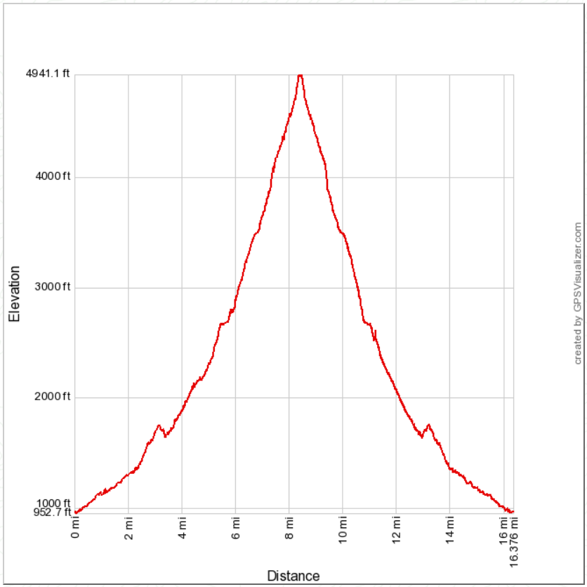
Distance: 16.4 miles round trip on trail and cross country
Summit Elevation: 4957'
Prominence: 637'
Elevation Gain: 4681'
Elevation Gain (in Empire State Buildings): 3.8
Round trip time: 10 hours 30 minutes
Recommended water: 204 oz.
Parking/Fees: Free at Santa Paula Canyon Trailhead on Ojai Road
Difficulty: Strenuous

Santa Paula Peak (LPC #1) has been suspended from the Sierra Club Lower Peaks List for years. The main route went through farmland on private property and was shut down, allegedly as a health safety precaution. The alternate route was challenging, along the Santa Paula Creek East Fork, using an abandoned trail from the canyon to Santa Paula Peak. While it remains officially suspended, Peakbagger re-listed it, which was enough motivation for me to make the attempt.

My first attempt was on 5/28 and I forgot to load a GPS track, resulting in multiple navigation errors. I ran out of time and water the first time, turning back 500' below the summit -- farther away than it sounds. I learned from the first attempt and came back with multiple GPS tracks and hard won knowledge of most of the route. Navigation was difficult even with a GPS. There are three distinct sections of this hike. The first is an easy 3.5 miles and 700' climb to Big Cone Campground on a well maintained trail. There are several stream crossings along the way with plenty of shade until you leave the canyon. I dropped a water cache at Big Cone and continued up the East Fork of Santa Paula Creek.


Big Cone campground

Looking toward the punchbowls

The second section was the East Fork of Santa Paula Creek, roughly 3 miles and 1400' of wild canyon with an occasional use trail. While marked with ribbons and infrequent cairns, it was still easy to get off track. Parts of the East Fork can be difficult if you lose the use trail. Half a mile past the campground, I startled a bear bathing in one of the pools. The creek was noisy so it probably didn't hear me until I was close. It scampered up a gully, turning to watch me a few times before disappearing behind a boulder. I was glad it didn't run directly up canyon. At one mile past the camp, I ran into a lot of deadfall. Further up, light scrambling blended with bushwhacking was needed. There might be three ways to get around an obstable and it was important to choose the one that required the least energy. The reason is once you exit the canyon, you still have 2000' of gain to go. Every step got harder.


Deadfall obstructions


The last section goes from the upper canyon to Santa Paula Peak. The lower part of the unmaintained trail was criss-crossed with animal trails that were just as viable. There was also some ribbon branching away from the main trail; one branch is supposed to go to Cienega Campground. I followed some short switchbacks and two long ones, avoiding more deadfall and poison oak. The most recent reports described a long stretch of the upper trail as completely washed out. The Peakbagger report from Richard Luher mentioned a cross country shortcut he took to bypass the washout on the way down. I decided to take his shortcut both up and down. It was 300' up a 45 degree talus slope. With aid from a few trees, I bear crawled up the slope until I met the trail again. Since I didn't see the washed out part of the trail, I don't know if it was a good decision. I continued along the upper trail through dense and flowering poodle dog with unavoidable contact. Soon, I emerged at the north saddle with fantastic views. The trail wound around the east side of the mountain and climbed the east ridge. I had chosen the coolest day in the last two weeks for this attempt but still started to foam in the heat. The summit had the foundation of an old lookout tower. I found the slightly battered benchmark intact, and also an unexpected memorial to someone named Ned Treuenfels. Didn't find a register. The payoff in scenery was worth the struggle. I looked down over Camarillo and Oxnard to the Pacific Ocean. Santa Paula Canyon was far below. The inner sanctum of the Los Padres was spread out to the north. I spent 20 minutes enjoying the summit before starting the descent. It was six hours up, four and a half down. The scabs and bruises will go away. The memories won't.
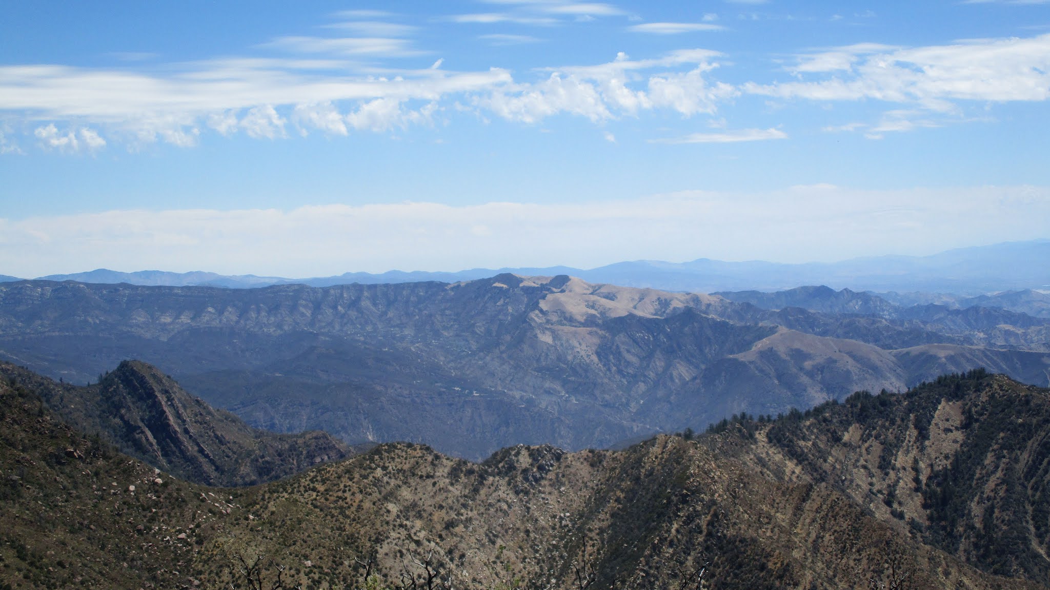
First clear view of Santa Paula


Deadfall over the trail

Talus slope shortcut, photo doesn't capture the steepness

Nearing the summit


Santa Paula Ridge, East Fork to the right


Topa Topa Bluff, Cream Puff, Hines on the right


Would you like to know more...?

Saturday, June 19, 2021

Mount San Antonio via Devils Backbone

HPS Star Emblem Peak
Hiked: 6/19/2021
Distance: 6.5 miles round trip on trail
Summit Elevation: 10064' (3067m)
Prominence: 6224'
Elevation Gain: 2300'
Elevation Gain (in Empire State Buildings): 1.8
Round trip time: 4 hours
Recommended water: 68 oz.
Parking/Fees: Adventure Pass, Lift tickets $25/person round trip
Difficulty: Moderate

Leisa and I continued altitude training by taking the Devils Backbone trail to top of Mount San Antonio (Baldy). This was Leisa's first time on the mountain. This would be my fifth time to summit and third different route. To save time, we rode the Sugarpine Ski Lifts to the notch and started from there. I had never been on the lifts before and I must admit it was more pleasant than walking the road. It was about 8:20 AM when we left the notch. There were several parties on the trail going up and down, but it was less crowded than Baden-Powell the prior weekend.


After an initial steep climb, the trail eased up before getting steep again below Mount Harwood. As we skirted Harwood, a lone hiker reached the top of Register Ridge and merged onto the Backbone trail just ahead of us. The final ascent from Harwood was also steep and multiple parties were sputtering up the trail. We weren't moving fast, but we made steady progress. When we arrived on the summit, there were at least 50 people milling about, maybe more. This was the most crowded I had seen the summit, but everyone was spread out and seemed to be enjoying themselves. We found a patch of gravel to rest on and I even took a catnap. Neither of us felt any symptoms of AMS so mission accomplished. We took a leisurely stroll back to the notch. We went into the restaurant looking for cold drinks but the line was too long.

Winter time death chute


Summit!

Baden-Powell in the distance

Starting down