Friday, November 27, 2020

San Marcos Peak and Double Peak

Hiked: 11/27/2020
Distance: 7 miles round trip on trail
Summit Elevation: 1220' (San Marcos), 1646' (Double)
Prominence: 464' (Double)
Elevation Gain: 1455'
Elevation Gain (in Empire State Buildings): 1.1
Round trip time: 2 hours 45 minutes
Recommended water: 32 oz.
Parking/Fees: Free at Lakeview Park
Difficulty: Easy

Leisa and I drove to San Marcos to work off some turkey and apple pie. We followed a peakbagger track from TJ Kodras for a loop picking up San Marcos Peak and Double Peak. We masked up and started west toward San Marcos Peak. The route winds through some residential neighborhoods and I recommend following a GPS track to navigate through the streets in this section. After some paved road hiking, we made a sharp climb up to the towers on San Marcos Peak. The views opened up as we climbed and I was surprised with a clear view of the Pacific Ocean. I thought we were too far inland to see the ocean. The summit of San Marcos is enclosed in a barbed wire fence so we could only get as close as the fence. After a few minutes looking around, we continued along the ridge, then dropped 100' to a saddle. The wide trail follows the road to the top of Double Peak, but we took the steep dirt trail shortcut. On top is a telescope, some tables, and restrooms. A small crowd was milling around. We took a short break, then dropped off the other side, following a dirt single track back to the wide official trail, then back to the truck. It was a nice 7 mile loop with a little more gain than I expected.


San Marcos Peak

Double in the distance


Dirt shortcut to Double

Pacific Ocean

Leisa on Double Peak


Saturday, November 21, 2020

San Rafael Peak

Hiked: 11/20/2020
Distance: 11.5 miles round trip on trail and cross country
Summit Elevation: 6666'
Prominence: 760'
Elevation Gain: 3124'
Elevation Gain (in Empire State Buildings): 2.5
Round trip time: 6 hours 20 minutes
Recommended water: 80 oz.
Parking/Fees: Adventure Pass at Johnston Ridge Trailhead
Difficulty: Moderate

Madison and I drove separately down 10 miles of dirt road on Grade Valley (7N03) to reach the Johnston Ridge Trailhead. Our goal was San Rafael Peak (HPS #144). San Rafael lies in the Sespe Wilderness, deep in the heart of Los Padres National Forest. Several peaks in Los Padres require a long drive to reach the starting point and this was one of them. The drive was complicated by dozens of free roaming cattle on the road. Occasionally, one of the bulls would stop and challenge our vehicles, backing down after an insistent honk.

We set out just before 8 AM on the east bound trail under cool and partly cloudy skies. We crossed Piru Creek and walked through a stand of tall pines before reaching the Little Matau junction. It's nice country, and a welcome change from my desert heavy winter agenda. At the 5729' saddle, we left the trail for the cross country ridge traverse. As we ascended the first of several major bumps, we caught our first glimpse of San Rafael Peak. The second bump has a single cut path through the buckthorn. On the third bump, we followed animal trails too low on the left side and had to climb a very steep slope to right ourselves. The ridge gets a little tricky in places where you head away from the destination to stay on track. The final 300' gain to the summit seemed to go slowly. Views at the top were simply fantastic. Cobblestone is directly east. Topatopa, Alamo, and Thorn Point are nearby. Mt. Pinos was visible far away. We signed the register, noting the oldest entry going back to 1974(!). We took a decent break on the summit even though we were harassed by bees.


Mutau Creek crossing

Looking back at Mutau Flat

Leaving the trail for the ridge


Summit with Cobblestone behind


The way back added some gain as we continued the up and down over the bumps. While descending the final bump before reaching the trail again, we lost the use trail and thrashed through some brush. The Sierra Club lists the navigation as difficult, but I think we handled it pretty well. We thought about picking up Lockwood Peak after we got back, but the short day meant part of it would have to be done in the dark. We decided to leave it for another day. We didn't see any other people all day. I packed out a balloon with a fuzzy pink boa. Madison packed out another balloon, bottles, cans and used tissue. San Rafael was my 300th official Sierra Club peak. It was a fun outing worth the long drive.

The way back


Balloon with boa


Other Reports:
San Rafael Peak (Wild Southland)
San Rafael Peak (David Stillman)

Tuesday, November 10, 2020

Lost Benchmark

Hiked: 11/6/2020
Distance: 2.4 miles round trip cross country
Summit Elevation: 865'
Elevation Gain: 250'
Elevation Gain (in Empire State Buildings): 0.2
Round trip time: 1 hour 10 minutes
Recommended water: 16 oz.
Parking/Fees: Free on Vallecito Wash
Difficulty: Easy

The Arroyo Tapiado mud caves only took a couple of hours to explore, leaving me time to pick up Lost Benchmark. I drove south on Vallecito Wash to the next Jeep trail intersection, then parked and started across open desert toward Lost. In the distance were a few small hills, but the benchmark wasn't visible from the parking spot. In 20 minutes, I reached the first hills but had to rely on GPS to pinpoint the destination. At the summit, I found a CA Beaches and Parks benchmark and a fallen post with wire. I wasn't expecting a register and didn't find one. The view was into rougher badlands, but I can't really recommend a visit to Lost BM unless you have similarly low standards.


Saturday, November 7, 2020

Arroyo Tapiado Mud Caves

Hiked: 11/6/2020
Distance: 2 miles round trip cross country
Summit Elevation: 800'
Elevation Gain: 0'
Elevation Gain (in Empire State Buildings): 0
Round trip time: 2 hours
Recommended water: 16 oz.
Parking/Fees: Free on Arroyo Tapiado Jeep Trail
Difficulty: Easy

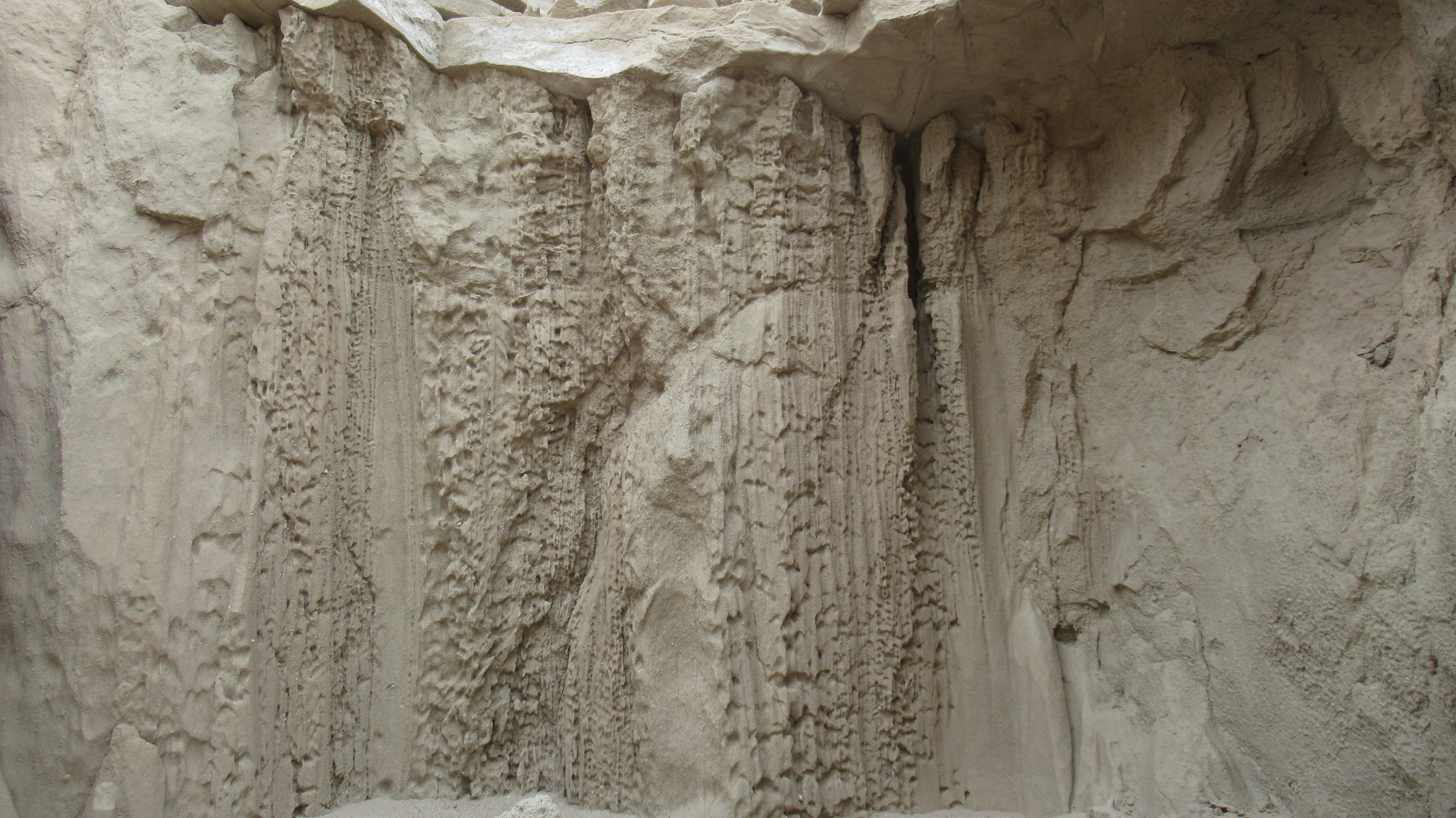
The Arroyo Tapidado mud caves are a unique geologic feature in the southern part of the Anza-Borrego Desert. Water carves slot canyons and caves out of mud that hardens between rains into phatasmagoric shapes. To get there, take highway S2 south and go east on Vallecito Wash, then make a sharp left turn in about 3 miles on Arroyo Tapiado Jeep Trail. From there, it's another 2 miles. 4x4 not needed. Once I arrived, I picked promising looking caves or slots and explored. Only two out of five tries led to long caves or slots. There are probably better caves I missed. The signs warn against exploring, calling the caves "mysterious and dangerous". The primary danger is walking on top of the mud and falling into a pocket or chute. A secondary danger is having an unstable roof or wall collapse on you. I found plenty of cave ins in the area.
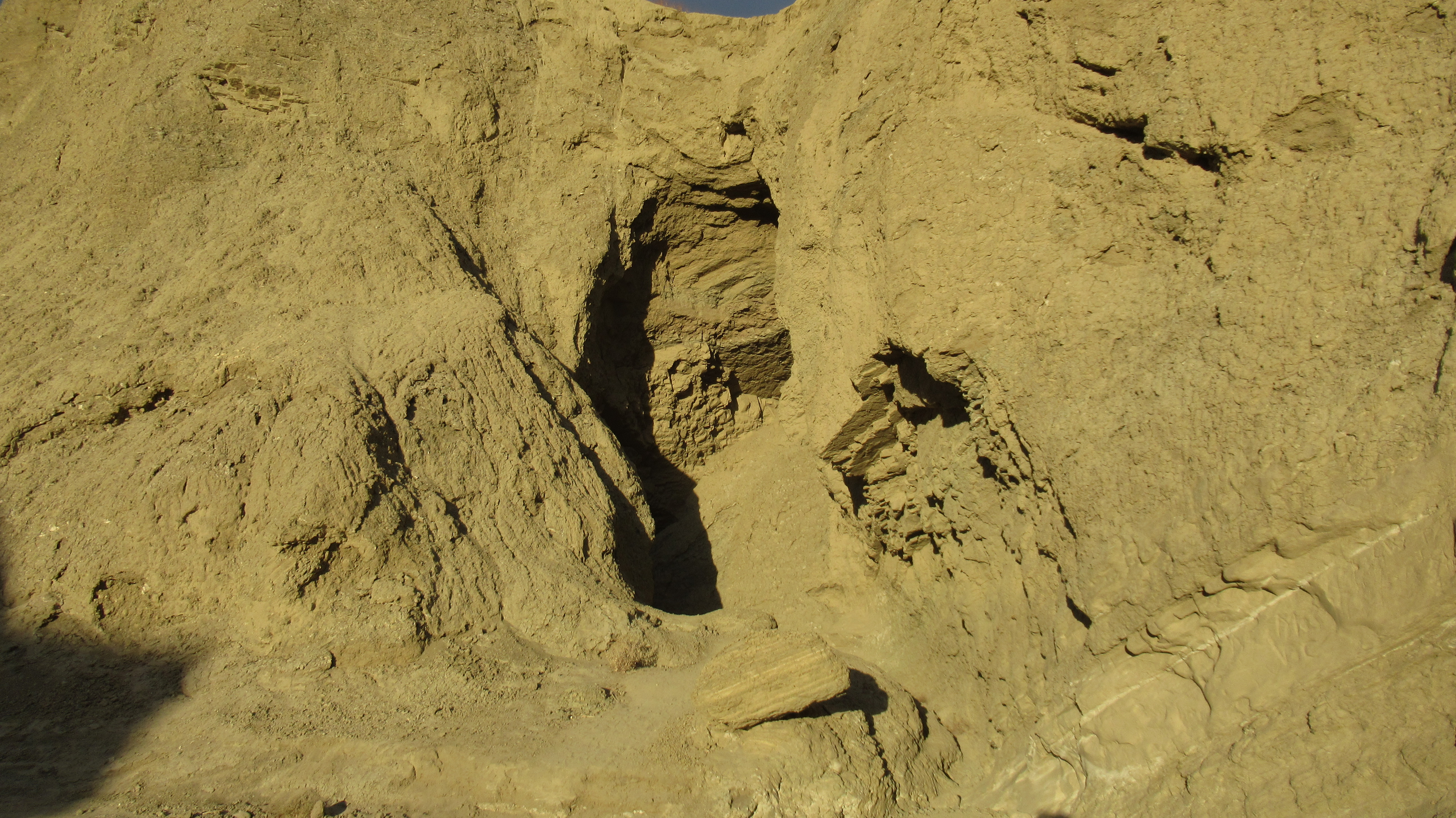
Cave #1 started with a large opening that became a winding slot canyon leading through several tunnels and rooms. A couple had skylights, but none were long enough to require a flashlight. Some parts were narrow but it was an easy hike that eventually exited into badlands.


Entrance to cave #1


Cave #2 had a partially collapsed overhanging wall, mud chockstones, and required crawling in two spots. It was a little more difficult than the first one, but also more interesting. No one else was visiting the caves except one car camper in a Jeep.

Entrance to cave #2


Heart of mud


Saturday, October 24, 2020

Eagle Mountain

Hiked: 10/23/2020
Distance: 10.4 miles round trip cross country
Summit Elevation: 5350'
Prominence: 2230'
Elevation Gain: 2541'
Elevation Gain (in Empire State Buildings): 2.0
Round trip time: 7 hours
Recommended water: 148 oz.
Parking/Fees: $35 National Park Fee (1 car for 1 week)
Difficulty: Strenuous (cross country/route finding)

Eagle Mountain (DPS #62) is a prominent high point in the southern part of Joshua Tree. It is remote and the hike is completely cross country. I started just before sunrise, heading almost directly east from the Cottonwood Campground. The first couple of miles were easy, open desert. Sunlight brightened the landscape behind me, but was blocked by the mountains I was approaching. Most of the ascent was done in shade. I looked for the ascent gully as I got closer and noticed the giant boulder piles in the way. The gully was farther north than I expected and I had to escape the boulder piles to get there. It would have worked better to travel north of the obstacles for a clear shot at the gully. For a brief moment, I considered heading straight up one of nastier looking slopes, but once I got into the standard ascent gully, I was glad I didn't. The gully was fun class 2 and I made quick progress. I took one break about half way up to load up on calories, then completed the 1500' gully. Coming out of it, I broke into sunlight and realized I had another 3/4 mile to the summit.


Monument Mountain distant left


Start of the ascent gully


Eagle across the valley

The path to the summit involved dropping into a shallow valley and navigating through more large boulders. The way was marked by occasional cairns and a use trail was visible in some places. Climbing out of the valley put me on a false summit and there was still a final bit of up. I arrived to fantastic views, especially south where the geology rose like the exposed bones of the earth. I found the benchmark, one reference mark, and a slew of registers dating back to 1994. Since it was on the DPS list, it was fairly popular among a certain crowd. It certainly wasn't popular this day as I was the only human anywhere near the mountain. I only rested long enough to complete my summit rituals. I started back and took a couple of minutes to climb an obvious boulder pile in the valley topped with a round boulder. When I got to the top of the gully, I got too close to a yucca and suffered a nice bleed. It wasn't as bad as it looked, but was bad enough that I had to stop and treat it before continuing down. While it was less work to descend the gully, it wasn't much faster, having to account for loose rocks and dirt. I stayed in gully until I was north of the big obstacles I ran into on the approach. It was a solid day in the desert.


Looking east

Looking south


Got too close to a yucca, it's a bleeder!

Starting down the gully

An unusual dry fall


Final look back