Here are a few stills:
Friday, November 30, 2018
Wild Things San Gabriels v2
Continuing my quest for black bears. I moved the camera further upstream from the original location and anchored it to a rock near a larger watering hole. There appeared to be a clear animal path above the water and below the tree. I placed it on 11/4 at noon and 4 hours later, the spot was visited by a momma bear, who bumped the camera, miraculously, into a better position. For the following two weeks, several bears and a cub passed by. If you look at the ears, there appear to be two adult bears and one cub. Also captured was a bobcat, a fox, and a buck. The camera also had about 500 videos of mule deer and mule deer butts. Very popular place for the deer. On 11/22, one of the bears lingered for a long sniffing session and left the camera face up which was the end of the videos. The camera was lucky to survive the bears and a couple of storms. It was dripping wet when I picked it up, but the SD card was dry. This run was a big success. Props to Sean for suggesting this remote canyon.
Here are a few stills:
Sunday, November 25, 2018
Sawtooth Mountains HP and Red Top (attempt)
Hiked: 11/24/2018
Distance: 16.8 miles round trip cross country
Summit Elevation: 4684' (Sawtooth), 4467' (Red Top)
Prominence: 604' (Sawtooth), 667' (Red Top)
Elevation Gain: 4408'
Elevation Gain (in Empire State Buildings): 3.52
Round trip time: 13 hours 15 minutes
Recommended water: 238 oz.
Parking/Fees: Free on North Indian Canyon Road
Difficulty: Very Strenuous
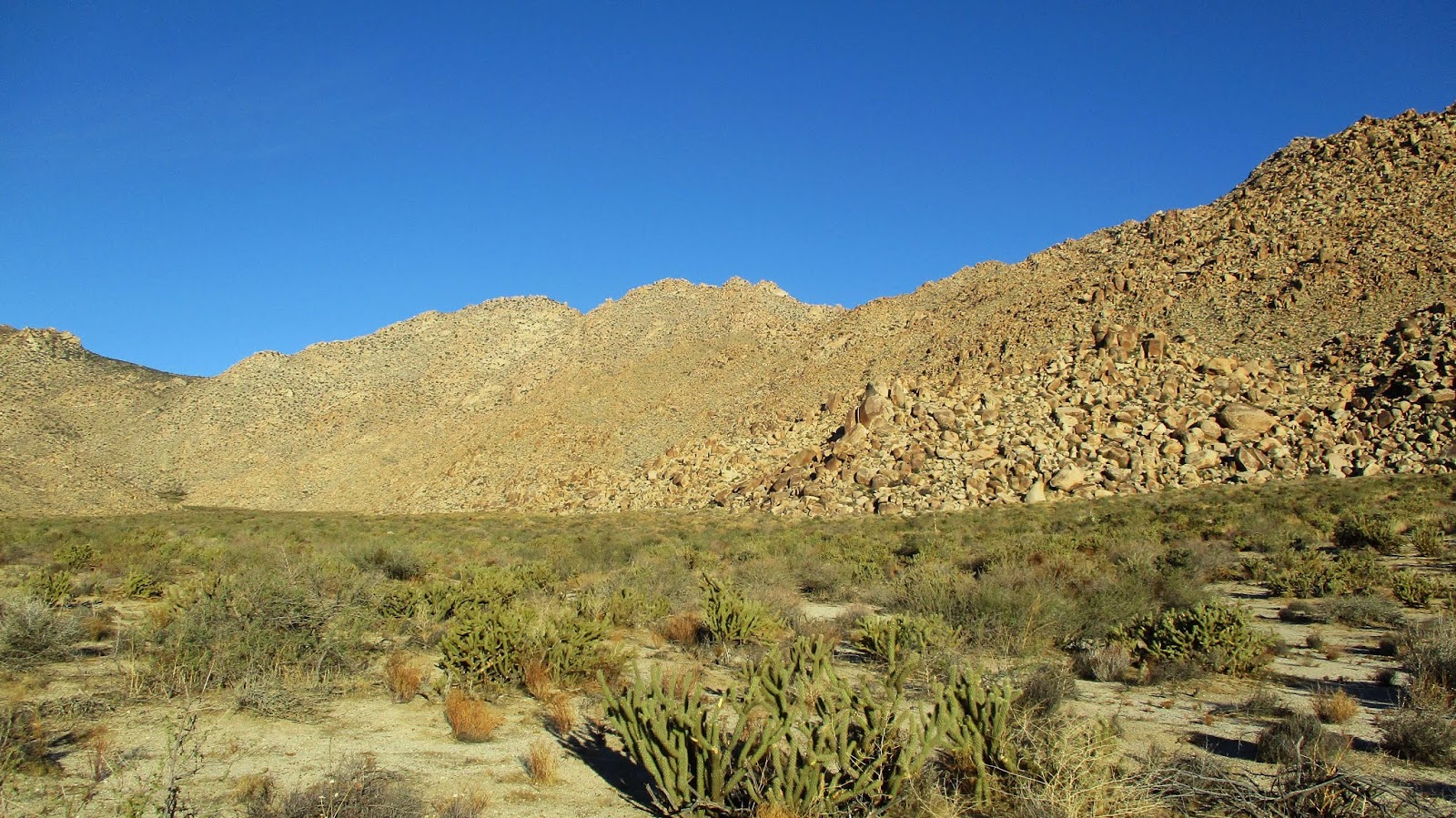
The final two summits I needed on the Sierra Club San Diego Peaks List were Sawtooth Mountains High Point (#31) and Red Top (#42). These are the two most difficult to day hike and I saved them for last. Matt and I met at Indian Gorge road a little after 4 AM and he drove his 4x4 Jeep to the starting point on North Indian Canyon Road. A 4x4 is needed for the large rocks and sand. We were lucky to have a full moon but broke out the headlamps to avoid the cholla land mines. We went over the Tierra Blanca pass and stopped for a break where I had cached some water near the entrance to Canebrake Wash. I added a liter of water from the cache and we started the long, sandy walk toward the ascent gully. Morning light gave Red Top a golden glow. There are at least two old abandoned roads in Canebrake. We started out on the one closest to the Tierra Blanca, but there is another one running closer to the Sawtooth mountains. It is clearly visible in satellite views. After a few miles on the first road, we headed over to the one closer to the Sawtooth mountains. This road went over a small rise before dropping down to the gully between Sawtooth HP and Red Top. We were 6.5 miles from North Indian Canyon road but all the hard work was ahead.
Matt and I each cached a liter of water under a large, prominent boulder at the base of the ascent gully. This was water cache 2. Then, we started up the steep gully, dodging sharps and scrambling over large and small boulders. The ascent was also slowed by sandy patches, gentle on the feet but each step half as effective due to sliding. About half way up, Matt was losing energy. He decided to take a break and eat more calories. We agreed to meet at the top of the gully below Sawtooth HP. I continued up, heading directly at the summit. When I got close to the head wall below the summit, I veered left. This was a mistake and led to a lot of class 3 scrambling to get to the base of the summit. Heading right would have put me on a plateau with a much easier approach. At the base of the south side of the summit, I found a couple of small register booklets in a Knott's Berry Farm glass jar. I signed in then looked for the best way up the summit block. There were two cracks near the register that looked workable, both about 25' going high class 3 to low class 4. I chose the left crack. The rock felt a little crumbly but held. The crux was the start with a good hold on the left and a foot jam on the right. There was a loose rock in the middle but I didn't need it. After the first 10', the rest was exposed but easy. There were awesome views from the top. I took a few photos and a photosphere, then went down to the summit plateau where Matt was just arriving. I waited there while he bagged the summit. With Sawtooth behind us, we prepared for the traverse to Red Top, but we were more than an hour behind schedule.
The traverse to Red Top involved side hill work around two major pinnacles. Moving any direction in this terrain is rough sledding. It took us over an hour to descend net 700' to the saddle below Red Top. From there, we were about a half mile and 600' gain from the summit. Matt didn't think he could make it up and down in time to reach Canebrake before dark. Neither of us liked the idea of trying to navigate down the gully from Red Top in the dark. Matt encouraged me to give it a try while he waited at the saddle. I gave myself a short turn around time to allow a buffer of daylight and started toward Red Top. Not far up the gully, I ran into a troublesome grove of trees and brush. Doing the calculus on the terrain cast doubt on my attempt. Deferring to safety, I turned around before my cutoff time. The descent was tricky as we angled back to water cache 2, requiring several course adjustments. It would have been a nightmare in the dark. We picked up our water and shuffled back. Night fell as we reached the pass and we picked our way slowly over it and back to the road. Despite missing Red Top, I was pleased with my performance. I had the right mix of food to stay energized the entire hike. We had plenty of water and only thing we were short on was daylight. The bad news is I failed to bag Red Top, but the good news is that I get to hike Red Top again.
Distance: 16.8 miles round trip cross country
Summit Elevation: 4684' (Sawtooth), 4467' (Red Top)
Prominence: 604' (Sawtooth), 667' (Red Top)
Elevation Gain: 4408'
Elevation Gain (in Empire State Buildings): 3.52
Round trip time: 13 hours 15 minutes
Recommended water: 238 oz.
Parking/Fees: Free on North Indian Canyon Road
Difficulty: Very Strenuous
The final two summits I needed on the Sierra Club San Diego Peaks List were Sawtooth Mountains High Point (#31) and Red Top (#42). These are the two most difficult to day hike and I saved them for last. Matt and I met at Indian Gorge road a little after 4 AM and he drove his 4x4 Jeep to the starting point on North Indian Canyon Road. A 4x4 is needed for the large rocks and sand. We were lucky to have a full moon but broke out the headlamps to avoid the cholla land mines. We went over the Tierra Blanca pass and stopped for a break where I had cached some water near the entrance to Canebrake Wash. I added a liter of water from the cache and we started the long, sandy walk toward the ascent gully. Morning light gave Red Top a golden glow. There are at least two old abandoned roads in Canebrake. We started out on the one closest to the Tierra Blanca, but there is another one running closer to the Sawtooth mountains. It is clearly visible in satellite views. After a few miles on the first road, we headed over to the one closer to the Sawtooth mountains. This road went over a small rise before dropping down to the gully between Sawtooth HP and Red Top. We were 6.5 miles from North Indian Canyon road but all the hard work was ahead.
Matt and I each cached a liter of water under a large, prominent boulder at the base of the ascent gully. This was water cache 2. Then, we started up the steep gully, dodging sharps and scrambling over large and small boulders. The ascent was also slowed by sandy patches, gentle on the feet but each step half as effective due to sliding. About half way up, Matt was losing energy. He decided to take a break and eat more calories. We agreed to meet at the top of the gully below Sawtooth HP. I continued up, heading directly at the summit. When I got close to the head wall below the summit, I veered left. This was a mistake and led to a lot of class 3 scrambling to get to the base of the summit. Heading right would have put me on a plateau with a much easier approach. At the base of the south side of the summit, I found a couple of small register booklets in a Knott's Berry Farm glass jar. I signed in then looked for the best way up the summit block. There were two cracks near the register that looked workable, both about 25' going high class 3 to low class 4. I chose the left crack. The rock felt a little crumbly but held. The crux was the start with a good hold on the left and a foot jam on the right. There was a loose rock in the middle but I didn't need it. After the first 10', the rest was exposed but easy. There were awesome views from the top. I took a few photos and a photosphere, then went down to the summit plateau where Matt was just arriving. I waited there while he bagged the summit. With Sawtooth behind us, we prepared for the traverse to Red Top, but we were more than an hour behind schedule.
The traverse to Red Top involved side hill work around two major pinnacles. Moving any direction in this terrain is rough sledding. It took us over an hour to descend net 700' to the saddle below Red Top. From there, we were about a half mile and 600' gain from the summit. Matt didn't think he could make it up and down in time to reach Canebrake before dark. Neither of us liked the idea of trying to navigate down the gully from Red Top in the dark. Matt encouraged me to give it a try while he waited at the saddle. I gave myself a short turn around time to allow a buffer of daylight and started toward Red Top. Not far up the gully, I ran into a troublesome grove of trees and brush. Doing the calculus on the terrain cast doubt on my attempt. Deferring to safety, I turned around before my cutoff time. The descent was tricky as we angled back to water cache 2, requiring several course adjustments. It would have been a nightmare in the dark. We picked up our water and shuffled back. Night fell as we reached the pass and we picked our way slowly over it and back to the road. Despite missing Red Top, I was pleased with my performance. I had the right mix of food to stay energized the entire hike. We had plenty of water and only thing we were short on was daylight. The bad news is I failed to bag Red Top, but the good news is that I get to hike Red Top again.
Monday, November 19, 2018
Prom 2674
Hiked: 11/18/2018
Distance: 5.7 miles round trip cross country
Summit Elevation: 2674'
Prominence: 328'
Elevation Gain: 1400'
Elevation Gain (in Empire State Buildings): 1.12
Round trip time: 3 hours
Recommended water: 48 oz.
Parking/Fees: Free on North Indian Canyon Road
Difficulty: Easy
Prom 2674 (an odd name vs. Peak 2674, maybe prominence 2674?) is a small peak in the Tierra Blanca mountains. This was a short side trip on a hike whose main purpose was to cache water for an attempt on the Sawtooth Mountains High Point and Red Top. This peak would have been about 2.6 miles round trip if I had gone directly to it. I parked just off North Indian Canyon Road with a clear path to the pass over the Tierra Blanca Mountains. I had drawn up a route on Caltopo in case I had the time and desire to make the side trip. After hiking over the pass, I continued to Canebrake Wash and cached 128 oz. of water. At the top of the pass on the way back, I stopped to check the time and take a closer look at the ridge up to 2674. I had time so I headed up the short ridge to Prom 2674, only 0.3 miles from the pass. The summit had a pair of class 2 summit boulders. I looked around for a benchmark and/or register without luck. Honestly, I wasn't expecting to find anything at this obscure X-mark on the USGS topo. The views were pretty good, and it was high enough to see Sawtooth HP over Red Top. Not bad for a bonus. I should note that I got hit with cholla in the gully south of the pass, twice on the way up and twice on the way down. It is seriously choked with cholla. These hits were not from being tired and careless. I was alert and careful but still got nailed.
Distance: 5.7 miles round trip cross country
Summit Elevation: 2674'
Prominence: 328'
Elevation Gain: 1400'
Elevation Gain (in Empire State Buildings): 1.12
Round trip time: 3 hours
Recommended water: 48 oz.
Parking/Fees: Free on North Indian Canyon Road
Difficulty: Easy
Prom 2674 (an odd name vs. Peak 2674, maybe prominence 2674?) is a small peak in the Tierra Blanca mountains. This was a short side trip on a hike whose main purpose was to cache water for an attempt on the Sawtooth Mountains High Point and Red Top. This peak would have been about 2.6 miles round trip if I had gone directly to it. I parked just off North Indian Canyon Road with a clear path to the pass over the Tierra Blanca Mountains. I had drawn up a route on Caltopo in case I had the time and desire to make the side trip. After hiking over the pass, I continued to Canebrake Wash and cached 128 oz. of water. At the top of the pass on the way back, I stopped to check the time and take a closer look at the ridge up to 2674. I had time so I headed up the short ridge to Prom 2674, only 0.3 miles from the pass. The summit had a pair of class 2 summit boulders. I looked around for a benchmark and/or register without luck. Honestly, I wasn't expecting to find anything at this obscure X-mark on the USGS topo. The views were pretty good, and it was high enough to see Sawtooth HP over Red Top. Not bad for a bonus. I should note that I got hit with cholla in the gully south of the pass, twice on the way up and twice on the way down. It is seriously choked with cholla. These hits were not from being tired and careless. I was alert and careful but still got nailed.
Sunday, November 11, 2018
Tonto Natural Bridge, AZ
Hiked: 11/11/2018
Distance: 2 miles round trip on trail (combined)
Summit Elevation: 4530'
Elevation Gain: 450'
Elevation Gain (in Empire State Buildings): 0.36
Round trip time: 1 hour
Recommended water: 16 oz.
Parking/Fees: $7/adult, $4/child Arizona State Parks
Difficulty: Easy
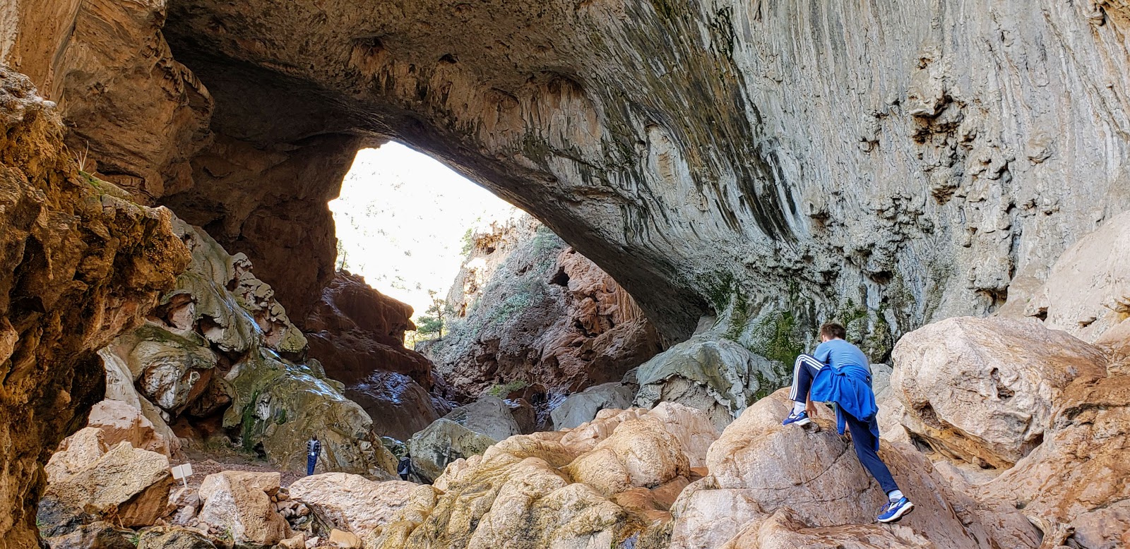
Tonto Natural Bridge is an Arizona State Park near Pine, AZ. There are a number of trails that lead to viewpoints and down to the entry on both sides of the giant oval tunnel under the bridge. All four viewpoints are above the feature but much better views are available below. At first, we took the trail down from viewpoints #3 and #4. We scrambled over very slick rocks to the center of the tunnel where water dripped steadily from above. Then, we went to the other side of the parking lot for viewpoints #1 and #2. The Anna Mae trail heads down to the other side of the tunnel where the views were even better. Also, the rocks on that side were less slick. Then, we continued upstream on the Pine Creek trail, which was fun and undeveloped in parts, eventually climbing back out to the parking lot. I highly recommend the loop down Anna Mae to the natural bridge and back on Pine Creek trail or reverse. Skip the very short Waterfall Trail. It led to a moss covered wall with water trickling over it, not even worthy of a photo. The Tonto Natural Bridge is a fun area, but the entrance fees are steep. We shelled out $25 for our family of four.
Distance: 2 miles round trip on trail (combined)
Summit Elevation: 4530'
Elevation Gain: 450'
Elevation Gain (in Empire State Buildings): 0.36
Round trip time: 1 hour
Recommended water: 16 oz.
Parking/Fees: $7/adult, $4/child Arizona State Parks
Difficulty: Easy
Tonto Natural Bridge is an Arizona State Park near Pine, AZ. There are a number of trails that lead to viewpoints and down to the entry on both sides of the giant oval tunnel under the bridge. All four viewpoints are above the feature but much better views are available below. At first, we took the trail down from viewpoints #3 and #4. We scrambled over very slick rocks to the center of the tunnel where water dripped steadily from above. Then, we went to the other side of the parking lot for viewpoints #1 and #2. The Anna Mae trail heads down to the other side of the tunnel where the views were even better. Also, the rocks on that side were less slick. Then, we continued upstream on the Pine Creek trail, which was fun and undeveloped in parts, eventually climbing back out to the parking lot. I highly recommend the loop down Anna Mae to the natural bridge and back on Pine Creek trail or reverse. Skip the very short Waterfall Trail. It led to a moss covered wall with water trickling over it, not even worthy of a photo. The Tonto Natural Bridge is a fun area, but the entrance fees are steep. We shelled out $25 for our family of four.
Friday, November 9, 2018
Wildomar Peak
Hiked: 10/27/2018
Distance: 1.3 miles round trip on dirt road
Summit Elevation: 2432'
Prominence: 992'
Elevation Gain: 277'
Elevation Gain (in Empire State Buildings): 0.22
Round trip time: 35 minutes
Recommended water: 0 oz.
Parking/Fees: Free on Crooked Arrow Drive
Difficulty: Easy
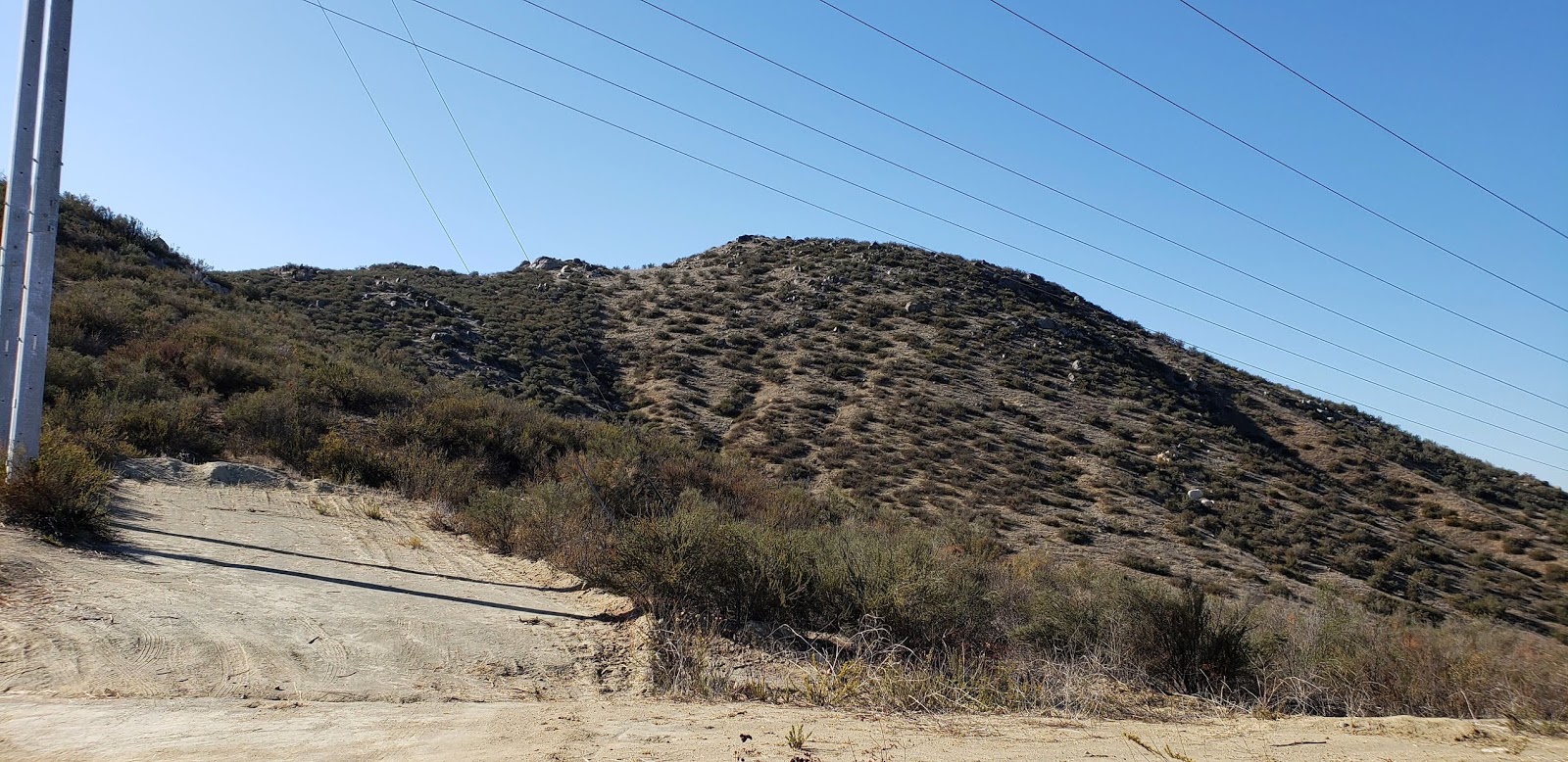
There are several prominent peaks around the Lake Elsinore area. I usually have bigger fish to fry, but these are a nice fallback when my schedule only allows a short trip. After checking on my Santa Ana trailcam, which was a complete bust, I drove to Crooked Arrow Drive and stopped at a closed gate. To get there from Mission Trail, take Lemon east until it turns into Lost Road (a dirt road), then turn right on the short Navajo Springs connector to Crooked Arrow. The road weaves through horse ranches and was rutted in a few spots, but careful driving should allow almost any vehicle to make it up. There was a truck trail around the gate so anyone willing to engage in adventurous driving could drive right to the top. It was a very short hike to the summit where I found the benchmark and a flag mounted west of and just below the summit. There were great views toward the Santa Anas and Lake Elsinore, as well as east to San Jacinto and San Gorgonio. After enjoying the views, I headed back and in a few minutes was down without breaking a sweat.
Distance: 1.3 miles round trip on dirt road
Summit Elevation: 2432'
Prominence: 992'
Elevation Gain: 277'
Elevation Gain (in Empire State Buildings): 0.22
Round trip time: 35 minutes
Recommended water: 0 oz.
Parking/Fees: Free on Crooked Arrow Drive
Difficulty: Easy
There are several prominent peaks around the Lake Elsinore area. I usually have bigger fish to fry, but these are a nice fallback when my schedule only allows a short trip. After checking on my Santa Ana trailcam, which was a complete bust, I drove to Crooked Arrow Drive and stopped at a closed gate. To get there from Mission Trail, take Lemon east until it turns into Lost Road (a dirt road), then turn right on the short Navajo Springs connector to Crooked Arrow. The road weaves through horse ranches and was rutted in a few spots, but careful driving should allow almost any vehicle to make it up. There was a truck trail around the gate so anyone willing to engage in adventurous driving could drive right to the top. It was a very short hike to the summit where I found the benchmark and a flag mounted west of and just below the summit. There were great views toward the Santa Anas and Lake Elsinore, as well as east to San Jacinto and San Gorgonio. After enjoying the views, I headed back and in a few minutes was down without breaking a sweat.
Sunday, October 28, 2018
Collins BM, Knob BM, and Peak 4695
Hiked: 10/27/2018
Distance: 14.3 miles round trip on dirt road and cross country
Summit Elevation: 4695' (Peak 4695), 4559' (Collins), 3431' (Knob)
Elevation Gain: 4313'
Elevation Gain (in Empire State Buildings): 3.45
Round trip time: 12 hours 15 minutes
Recommended water: 184 oz.
Parking/Fees: Free on Lost Valley Road
Difficulty: Strenuous
The weather cooled down enough to get back to work on the San Diego Peaks List. Collins (#39) and Knob (#65) were the goals today, with a bonus of Peak 4596 approaching from the west. The hike started at a locked gate and followed a dirt road that goes through Schoepe Scout Reservation land before reaching the cross country jump off point. I contacted the Boy Scouts via email on the web site and received permission to hike through this weekend. The ranger was kind enough to offer to cache some water for me along the road, but I declined since most of the hike was off trail. Camp was not in session this particular weekend. Lost Valley road was in good shape and neither 4x4 nor high clearance were needed. We drove past half a dozen deer hunters on the road, parked in various places.
Sean and I parked outside the gate of the BSA road just after dawn. It was cool in the morning with temps expected to range from the mid-50s to mid-80s. We started higher than our destinations, meaning a lot of uphill on the way back. I had loaded Greg Gerlach's GPS track. After a mile plus of descending the road, we headed left into the light brush behind a large boulder. The terrain was a confusing mix of washes, low bumps, and brush with occasional small trees. It was very similar to the terrain around Pike, Cody, and Norte. Pike was a constant visible landmark to the south. We generally stuck to the track, ducking in and out of washes. There was enough space between the bushes that you could usually avoid them, though we both got a few scrapes from small trees. We found the cut sections of brush that Ben Baumann described, an obvious firebreak from days gone by. We cached some water about a half mile before the loop split on a hill with a prominent boulder. The split point was the saddle below Peak 4695. As we got close to the saddle, we veered more directly to the summit. Though the register was placed in 1979, it still had very few signatures. It is on the way to Collins from the west, but would require extra effort from the east. This was our first view of Collins. We took a short break on 4695 before packing up and heading down the ridge.
We continued on the ridge from Peak 4695 to Collins. It didn't look as intimidating from this side. There were several drops along the ridge with a couple of steep ascents to reach the summit. The summit boulder pile was easy class 3 and the register was in a white tube at the bottom. We signed in and Sean found a shady spot to relax and eat. We talked about the big 1400' drop to Knob. Sean wasn't feeling it and decided to head back and wait for me at the water cache. I was feeling pretty well and didn't want to make another trip just for Knob. Sean asked how long I thought it would take me to get Knob. I guessed 2.5 hours which would have put me at the cache around 2:00 PM. That turned out to be optimistic.
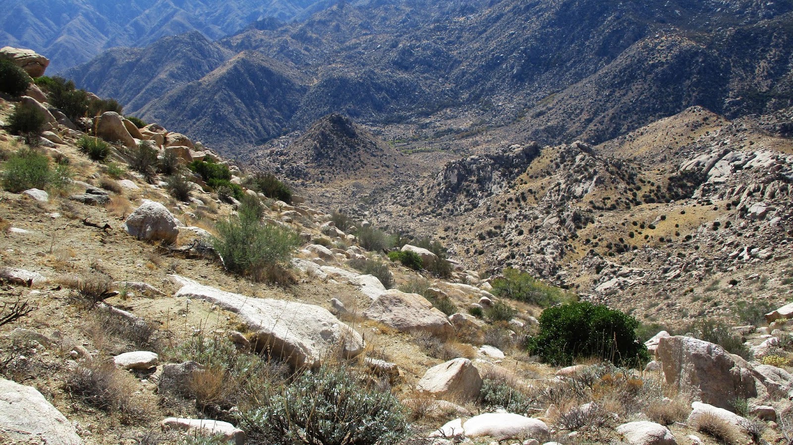
I started down Collins to the steep west gully. Knob was sitting far below but didn't look too far. The descent was sandy but not bad. There were a few cairns around and a partial use trail came and went. When I got to the bottom, I began to cross the feeder wash to Sheep Canyon. I found a bundle of black tubing near the wash, often used in illegal grow operations. This seemed like a particularly difficult spot for a grow operation and there were no other signs of activity. I started directly up Knob, choosing some unnecessary class 3 instead of contouring all the way around to keep it class 2. Knob was a cool summit and the views all around were great. Collins looked immense from below. I had expended too much energy climbing Knob and my heart rate was racing around 160. I rested until it came down and tried to eat the unappealing food I had left. My food choices need be re-engineered. I had enough water to make it to the cache, so I ate some raisins and lifesavers and got on my way. I crossed the wash again heading toward the saddle below 4695. Without enough food, I found myself sluggish. Every couple of hundred feet of gain spiked my heart rate. This forced frequent stops to let my heart calm down. The terrain on the way back from Knob was mentally draining, mainly side hilling above the canyons and around massive rock structures. It was clear that I going to be late to the cache. After passing the saddle, I took a direct route to the cache, ending above the boulder and slightly higher than the cache. I didn't see Sean and yelled out for him. Nothing. I dropped down to the cache to retrieve my water and found a note. He had waited until 3:20 PM but was worried about making it out before the sun went down since he was without a working headlamp. It was about 4:00 PM. He had left me some almonds and an extra bottle of water. While he was probably concerned about me, I was also concerned about him being able to find his way out and back to the road. He mentioned earlier that he could work with the landmarks like Pike to keep him going the right direction. However, the right direction and a safe direction were two different things.
Getting back to the water cache gave me a mental boost. I shuffled up and down the bumps on the way back, mostly up. Following the path back was relatively easy with the GPS. I was checking the sand to see if Sean's footprints were there heading back. I spotted them in a couple of key washes, but not others. Still, it was encouraging to see he was making progress and not lost. I stopped and loaded batteries into my headlamp and fired it up at dusk. I didn't want to spend a lot of time in the brush while it was dark. As the last light faded, I saw the telephone poles on the road and heard Sean calling out. I answered and in 15 minutes, I was out. We exchanged stories of the return and walked the road back to the car. Sean had formulated several different rescue plans in case I never showed up. If Sean wasn't there, my plan was to wait a while on the road before activating my emergency beacon. Fortunately, none of our contingencies were needed. I was glad to have Collins and Knob in the bag, but my lasting memory will be the slow, painful, slog out from Knob. On the drive home, we stopped at 5 Guys and loaded up on burgers and fries. They served us despite our ground in dirt and caked blood.
Distance: 14.3 miles round trip on dirt road and cross country
Summit Elevation: 4695' (Peak 4695), 4559' (Collins), 3431' (Knob)
Elevation Gain: 4313'
Elevation Gain (in Empire State Buildings): 3.45
Round trip time: 12 hours 15 minutes
Recommended water: 184 oz.
Parking/Fees: Free on Lost Valley Road
Difficulty: Strenuous
The weather cooled down enough to get back to work on the San Diego Peaks List. Collins (#39) and Knob (#65) were the goals today, with a bonus of Peak 4596 approaching from the west. The hike started at a locked gate and followed a dirt road that goes through Schoepe Scout Reservation land before reaching the cross country jump off point. I contacted the Boy Scouts via email on the web site and received permission to hike through this weekend. The ranger was kind enough to offer to cache some water for me along the road, but I declined since most of the hike was off trail. Camp was not in session this particular weekend. Lost Valley road was in good shape and neither 4x4 nor high clearance were needed. We drove past half a dozen deer hunters on the road, parked in various places.
Sean and I parked outside the gate of the BSA road just after dawn. It was cool in the morning with temps expected to range from the mid-50s to mid-80s. We started higher than our destinations, meaning a lot of uphill on the way back. I had loaded Greg Gerlach's GPS track. After a mile plus of descending the road, we headed left into the light brush behind a large boulder. The terrain was a confusing mix of washes, low bumps, and brush with occasional small trees. It was very similar to the terrain around Pike, Cody, and Norte. Pike was a constant visible landmark to the south. We generally stuck to the track, ducking in and out of washes. There was enough space between the bushes that you could usually avoid them, though we both got a few scrapes from small trees. We found the cut sections of brush that Ben Baumann described, an obvious firebreak from days gone by. We cached some water about a half mile before the loop split on a hill with a prominent boulder. The split point was the saddle below Peak 4695. As we got close to the saddle, we veered more directly to the summit. Though the register was placed in 1979, it still had very few signatures. It is on the way to Collins from the west, but would require extra effort from the east. This was our first view of Collins. We took a short break on 4695 before packing up and heading down the ridge.
We continued on the ridge from Peak 4695 to Collins. It didn't look as intimidating from this side. There were several drops along the ridge with a couple of steep ascents to reach the summit. The summit boulder pile was easy class 3 and the register was in a white tube at the bottom. We signed in and Sean found a shady spot to relax and eat. We talked about the big 1400' drop to Knob. Sean wasn't feeling it and decided to head back and wait for me at the water cache. I was feeling pretty well and didn't want to make another trip just for Knob. Sean asked how long I thought it would take me to get Knob. I guessed 2.5 hours which would have put me at the cache around 2:00 PM. That turned out to be optimistic.
I started down Collins to the steep west gully. Knob was sitting far below but didn't look too far. The descent was sandy but not bad. There were a few cairns around and a partial use trail came and went. When I got to the bottom, I began to cross the feeder wash to Sheep Canyon. I found a bundle of black tubing near the wash, often used in illegal grow operations. This seemed like a particularly difficult spot for a grow operation and there were no other signs of activity. I started directly up Knob, choosing some unnecessary class 3 instead of contouring all the way around to keep it class 2. Knob was a cool summit and the views all around were great. Collins looked immense from below. I had expended too much energy climbing Knob and my heart rate was racing around 160. I rested until it came down and tried to eat the unappealing food I had left. My food choices need be re-engineered. I had enough water to make it to the cache, so I ate some raisins and lifesavers and got on my way. I crossed the wash again heading toward the saddle below 4695. Without enough food, I found myself sluggish. Every couple of hundred feet of gain spiked my heart rate. This forced frequent stops to let my heart calm down. The terrain on the way back from Knob was mentally draining, mainly side hilling above the canyons and around massive rock structures. It was clear that I going to be late to the cache. After passing the saddle, I took a direct route to the cache, ending above the boulder and slightly higher than the cache. I didn't see Sean and yelled out for him. Nothing. I dropped down to the cache to retrieve my water and found a note. He had waited until 3:20 PM but was worried about making it out before the sun went down since he was without a working headlamp. It was about 4:00 PM. He had left me some almonds and an extra bottle of water. While he was probably concerned about me, I was also concerned about him being able to find his way out and back to the road. He mentioned earlier that he could work with the landmarks like Pike to keep him going the right direction. However, the right direction and a safe direction were two different things.
Getting back to the water cache gave me a mental boost. I shuffled up and down the bumps on the way back, mostly up. Following the path back was relatively easy with the GPS. I was checking the sand to see if Sean's footprints were there heading back. I spotted them in a couple of key washes, but not others. Still, it was encouraging to see he was making progress and not lost. I stopped and loaded batteries into my headlamp and fired it up at dusk. I didn't want to spend a lot of time in the brush while it was dark. As the last light faded, I saw the telephone poles on the road and heard Sean calling out. I answered and in 15 minutes, I was out. We exchanged stories of the return and walked the road back to the car. Sean had formulated several different rescue plans in case I never showed up. If Sean wasn't there, my plan was to wait a while on the road before activating my emergency beacon. Fortunately, none of our contingencies were needed. I was glad to have Collins and Knob in the bag, but my lasting memory will be the slow, painful, slog out from Knob. On the drive home, we stopped at 5 Guys and loaded up on burgers and fries. They served us despite our ground in dirt and caked blood.
Subscribe to:
Posts (Atom)