Hiked: 4/2/2017
Distance: 4.3 miles round trip on trail
Summit Elevation: 2624'
Elevation Gain: 1890'
Elevation Gain (in Empire State Buildings): 1.51
Round trip time: 2 hours 30 minutes
Recommended water: 52 oz.
Parking/Fees: $10 day use fee at Cerro Alto Campground
Difficulty: Easy
Cerro Alto is north of San Luis Obispo, and the northernmost peak on the Sierra Club Lower Peak List. Unlike most SoCal national forest areas, the Adventure Pass is no good here. As of May 1, 2016, the day use fee for parking at the Cerro Alto Trailhead is $10 per vehicle. I coughed up the cash in a self service envelope and dropped it off. There is a short route (Bridge Trail) and long route (Cerro Alto trail). Since we had another peak to squeeze in, Adam and I aimed for the shorter route that crosses a wooden bridge over a stream at the start. The trail wastes no time gaining elevation and soon you have great views looking down into the valley below. It was a minor grind to the unsigned junction with the longer Cerro Alto trail. We turned right to continue up and soon hit another unsigned junction, making an error by turning right again. We gained a few hundred feet before realizing we were not heading toward Cerro Alto. We briefly considered trying a cross country shortcut but the chaparral was thick. Later, I found out we could have continued and circled back on another trail. Instead, we saw another party coming down the Cerro Alto trail so we reversed course and went the other way. The diversion distorted the stats a little. A short section of trail later, we found a sign indicating Cerro Alto was 1.2 miles away. More grinding got us to the final junction, this one also with a helpful sign pointing us the right direction for the final quarter mile. Cerro Alto offered great 360 views of the green landscape. There used to be a fire lookout on the summit, but no trace remained of it. We had hoped to see Morro Rock from the summit, but the marine layer had not burned off completely and was still covering the coastline. We talked to some friendly locals at the top and rested a little before heading back. Finally, we drove south toward Valencia Peak, the final mountain of the day.
Start of the bridge trail
The first sign of a sign, after we made a wrong turn
Hiked: 4/2/2017
Distance: 3.9 miles round trip on trail and use trail
Summit Elevation: 1546'
Prominence: 1086'
Elevation Gain: 1210'
Elevation Gain (in Empire State Buildings): 0.96
Round trip time: 3 hours 30 minutes
Recommended water: 42 oz.
Parking/Fees: Free at Highland Drive
Difficulty: Moderate (Class 5.6 summit block)
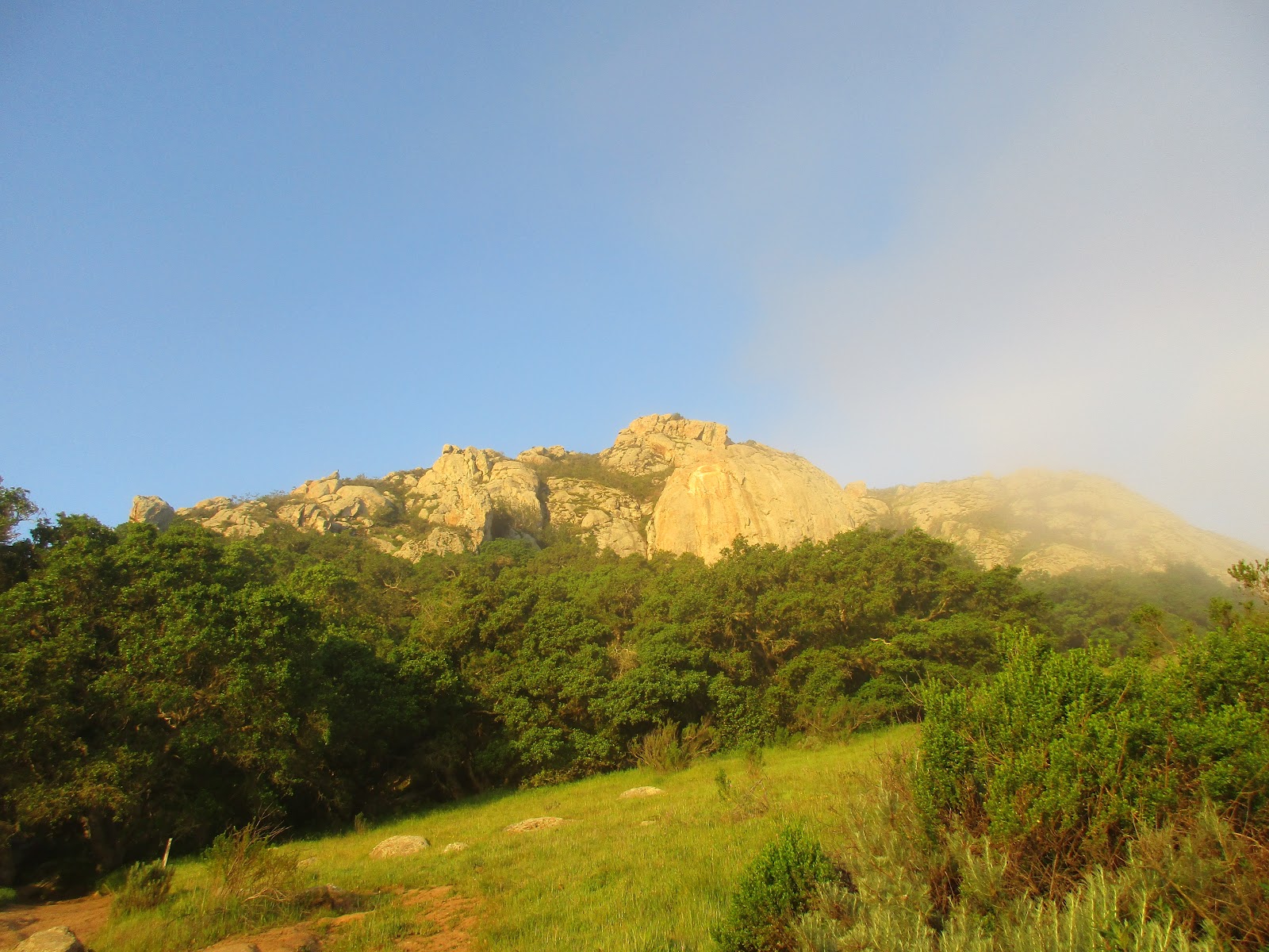
Bishop Peak was the first stop on what turned out to be a 19.5 hour marathon day (counting drive time) to hit three peaks on the Lower Peaks List in the San Luis Obispo area. The official Sierra Club guide for Bishop Peak recommends stopping at the class 3 east summit, which offers fantastic views. It also specifically recommends against climbing the class 5.6 summit block: Do not attempt to climb to the actual high point. Of course, I wanted to climb both, but needed a climbing partner. Adam Walker (gimpilator) graciously agreed to climb with me and we started early to avoid LA and Santa Barbara traffic. At 4+ hours one way, this was my longest day hike drive to date.
We arrived about 7:00 AM and started up the trail into a thick marine layer that mostly burned off later in the day. The popular east summit was visible through the trees and fog. It was a short hike through a forested area with plenty of poison oak along the sides of the trail. A few long switchbacks later, we were at a bench with "End of Trail" etched into it, just below the east summit. A memorial plaque was mounted on a boulder there. Unfortunately, a number of people had been hurt or worse on Bishop Peak. We continued on, completing the fun class 3 scramble to the east summit. Sunlight reflected off the marine layer creating a sureal setting. From there, we got a good view of the true summit not far away. There was no benchmark or register at either summit.
Bishop Peak through the trees near the start
End of the trail bench and lower east summit
Memorial plaque, falling deaths are not uncommon on Bishop
Looking over the marine layer from the east summit
Looking at the true summit from the east summit
Adam (right) on the east summit
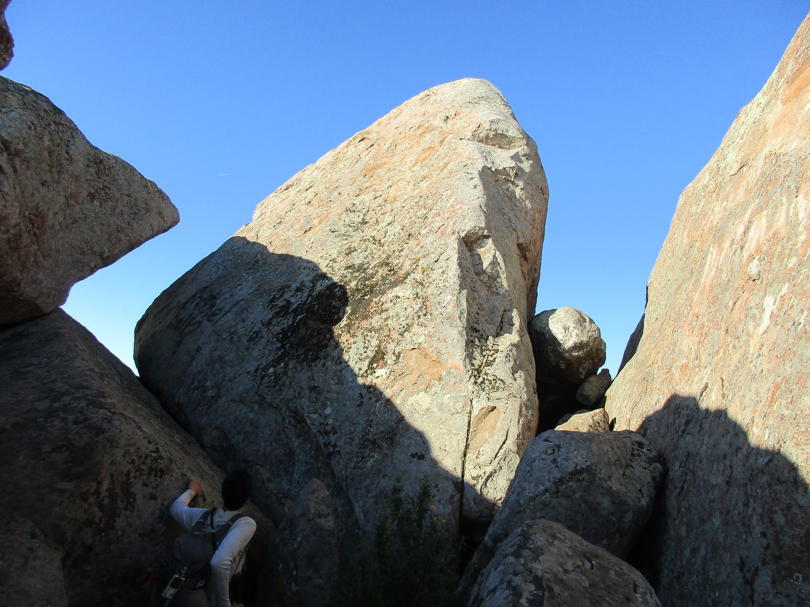
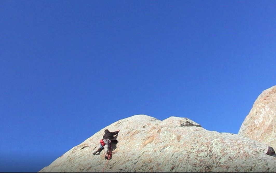
We followed a good use trail around some large boulders and more poison oak to the base of the 35' summit block. The miter shaped block was apparently the inspiration of the name "Bishop Peak". Adam was by far a stronger climber and agreed to lead the 4-bolt sport route up the block. We unpacked the rope, got our harnesses and rock shoes on, and geared up. Adam did not bring a helmet on this trip, but I brought mine. We spent some time double checking each other's knots and gear, and I made a few adjustments. The rope was flaked out on the boulder behind me. I sat down and braced my feet against the bottom of the summit block for belay. The first bolt was about 10' up. Adam made a couple of moves and placed the first quickdraw. The second bolt was only 5' above the first, and the final two were spaced more evenly. At the last bolt, Adam moved left, finding better holds that way instead of straight up. Once on top, he built an anchor and clipped himself in place to belay me from above. It was my turn to climb. I shouted "On belay", Adam answered "belay on" and I took my first tentative step onto the rock. As the second climber, I had an additional responsibility to clean the route on the way. I had to remove the quickdraws on each bolt as I passed it. Still a novice climber, the holds looked tiny to me. Many were quarter or half inch flakes or small indentations. I was laser focused on finding the next hold, or the next step, and made a common beginner mistake of climbing past the first bolt. I had to stop, reach down, remove the quickdraw and place it on my harness. Facing the rock again, I reached a solid one inch hold about half way up. I didn't bother to look down once, concerned only about moving up. At the third bolt, I repeated my earlier mistake of climbing past it. I didn't feel stable reaching down to get it, but I managed to clean it without falling. At the fourth bolt, I made the same traverse left as Adam on a series of small ledges. From there, I was able to grab the top and make a final step up to the summit. The top of the block only has room for about three people. It was only a mid-fifth class slab, but was the most difficult climb I had ever attempted. It was a rush to stand on the true summit. At least a dozen other hikers were milling around the lower east summit, but no one ventured near us. After brief congratulations, we sat back and took a few photos, enjoying the moment. There were two bolts at the top with quicklinks. We attached a piece of webbing and rigged the rope for rappel. I was the first to head down, while Adam snapped some nice photos of my descent. When I was down, Adam collected the anchor gear and came down. While I was removing gear, I dropped my belay device and it skittered under the summit boulder into a crack. Exploring below revealed a small cave between the giant boulders. Adam retrieved the device, then I crawled out to the end of the cave for a look. Bishop had the most interesting and fun summit of any on the Lower Peaks List. We packed up and returned to the car with the hardest peak of the day in the bag. Next up was Cerro Alto.
Adam sizing up the true summit on Bishop Peak
Gnar
Adam leading near the 4th bolt
Adam took this shot looking down from the top
At the second bolt
Adam and I standing on the summit
Looking down at the lower east summit
Getting ready to rappel
Descent
Adam getting ready to rappel
Cave under the summit block
Hikers on the east summit from the cave outcrop
Looking out from the outcrop
Other reports: Adam's report (scroll toward the bottom of the post)
Hiked: 3/24/2017
Distance: 2.6 miles round trip on trail and use trail
Summit Elevation: 1180'
Elevation Gain: 688'
Elevation Gain (in Empire State Buildings): 0.55
Round trip time: 40 minutes
Recommended water: 0 oz.
Parking/Fees: Free at Serrano Park
Difficulty: Easy
Peralta Hills is in the City of Anaheim, more commonly known as Anaheim Hills. The high point is a minor peak, but has been visited by a number of people with higher standards than me. It was also close enough for lunchbagging, a peak I can summit on a work day lunch break. Others had climbed Peralta Hills from the north starting at E Twin Circle. I wanted to make a longer cardio effort from the south so I parked at Serrano Park. The park has nice restroom facilities and there was only one other visitor walking their dog when I arrived. After studying the topo, I also wanted to look for the "Olive 1" benchmark, just south of a water tower along the ridge.
From the parking lot, I headed west (left) carrying only my phone, looking for a use trail toward the electrical tower. The trail was completely overgrown with spring vegetation. I circled around, eventually heading up into the healthy undergrowth of soft plants before hitting a service road leading to the tower. I followed the partially overgrown service road all the way to the ridge where the road was clear, turned east and jogged to the small bump leading to the high point. The hills were bright with yellow and purple flowers. Then I reversed course and jogged west to the water tower, following a use trail through tall weeds to the south side looking for Olive 1. I found a damaged marker that might have been the Olive 1 benchmark. I decided to try to make a loop out of the trip by descending the east side service road so I passed below the high point again on the way down. When I reached the point above the park, I could have dropped down a steep slope, but I thought the service road would meet the road leading to park shortly. I continued down the road but it led behind a row of houses with no outlet. Not seeing a way out, I went back up the service road and followed a concrete drainage channel back to the road. On the way back, a bee landed in my hair and I brushed it out. But it harassed me all the way back to the park where I ended its tormented existence with my towel.
Starting in the park, high point not visible
Field of flowers heading to the electrical tower
High point ahead
Looking down toward the Park
Use trail to Olive 1 benchmark
Probable remains of the Olive 1 benchmark
Looking back at Peralta Hills high point descending the east service road
El Montanon (LPC #75) is not the highest point on Santa Cruz Island, but it is the highest point on the public part of the island. The eastern 2/3 of the island is a private preserve. After rained out trips in December and February, I boarded the 9:00 AM boat with a posse from work (Rod, Veronica, Noel and Geoff). The rain delays actually worked in my favor leaving the island thriving and green. We headed for Scorpion Anchorage from Ventura Harbor. The return trip was set at 4:00 PM, leaving us a plenty of slack time for the 9.3 mile round trip. On the ride over, the boat stopped for a few minutes to check out a humpback whale that made a brief appearance. With that delay, and because we had to endure a lecture from the local USFS park ranger before hiking, we started about 45 minutes later than planned. Island Packers asked everyone to be back at the dock at 3:30 PM and with the late start, much of our slack time was gone. To make things even more interesting, Rod was nursing a bone bruise on his heel and was not sure he could make the entire trip.
Noel and Geoff each brought coolers of beverages and stowed them in free lockers near the restrooms. Finally, we took off up Smugglers Road. The whole island was green and blooming instead of the expected 50 shades of brown. The trail was smooth at the start. I had hoped we would see an island fox (only found on the channel islands) and that happened almost immediately. The island fox population has grown so much that it was removed from the endangered species list. We ended the day with 5 fox sightings. The marine layer rose hundreds feet above the ocean and after the initial views over the cliffs, we lost sight of the the ocean for the rest of the hike. In about two miles of steady but mild climbing, we reached the junction of the Scorpion Loop trail and turned south toward the El Montanon ridge line. A rusty, abandoned oil derrick was just off trail after the junction. Past the derrick, the trail to the saddle on the ridge line was a little rougher with plenty of large rocks to kick.
Leaving Ventura Harbor
Humpback Whale
Scorpion Anchorage
Heading toward the visitor's center
First island fox sighting
The tip of Summit Peak on Anacapa Island poking through the marine layer
Looking past the oil derrick toward El Montanon
Looking back, oil derrick on the right
Second fox sighting
From the saddle, the trail skirts around High Mount Benchmark on the east side. I left the trail and went directly up the obstacle free ridge to High Mount benchmark. A couple of tall wooden poles and a benchmark were at the summit. Views were great in every direction, including Devil's Peak and the rest of Santa Cruz Island. The marine layer covered the ocean and only the highest point on Anacapa Island poked out above it. From there, it was less than a mile of clean ridge line to El Montanon. A solar powered radio tower was at the summit along with the register and benchmark (stamped HIGH). Noel and I arrived first at the summit. We were not sure if the next bump on the ridge was higher, so we made the 5 minute trip over there finding only a short metal pole. Whether it was higher or not, the second point is the one marked as 1808' on the topo map. We returned to the summit area with the radio tower and met up with everyone else for a few photos. Rod had been able to gut it out and made it to the top, moving slower than his usual pace. Despite the packed boat on the way over, only two other hikers made the trek to El Montanon. We had planned on a lunch break at the top, but decided to head back and not take any chances with the time.
Approaching the saddle and High Mount Benchmark
Looking west to the rest of Santa Cruz Island from High Mount Benchmark
The ridge to El Montanon
Radio tower
Rod coming over the last bump
Looking northeast back toward Scorpion
El Montanon benchmark stamped "High" in 1951
Work posse on the summit
Below the oil derrick, we returned on the other half of the Scorpion Loop trail. Again, the green fields and exploding flowers caught us off guard. We passed a couple of busy campgrounds on the way. It was an ideal time to be on the island. We got back with about 30 minutes to spare and spent most of it imbibing from the coolers. Two more island foxes wandered by, probably looking for hand outs. As we lined up to board the return boat, we spotted a dead or sleeping sea lion on the rocks below the dock. Noel didn't think it was dead, but the sea lion remained motionless and oblivious to the crowds (and the flies). Either way, it didn't dampen our spirits on a trip that exceeded expectations.
Returning on the other half of the Scorpion Loop trail