Saturday, May 7, 2016

Burbank Peak, Cahuenga Peak, Mt. Lee, Mt. Chapel via Wonderview Trail

Hiked: 5/7/2016
Distance: 5.2 miles round trip on road and trail
Summit Elevation: 1680' (Burbank), 1820' (Cahuenga), 1680' (Lee), 1600' (Chapel)
Elevation Gain: 1775'
Elevation Gain (in Empire State Buildings): 1.42
Round trip time: 2 hours 30 minutes
Recommended water: 24 oz.
Parking/Fees: Free on Lake Hollywood Drive
Difficulty: Easy

Leisa joined me for a trip to the Hollywood sign and a few Griffith Park peaks. It was also a training hike for bigger things this summer. My previous hike in Griffith Park started in Brush Canyon. This time, we started from the west, parking on Lake Hollywood Drive and walking up the road to the Wonderview Trail. It was lightly raining as we went up the short, steep ascent to the unofficial Burbank Peak and Wisdom Tree, a lonely tree that gets a lot of local attention. The rain actually kept the temperature and dust down, ending in a net positive. A few people were milling around the tree and we took the requisite photo op. A cairn garden was set up nearby.

We didn't loiter, but headed out for Cahuenga. Another 15 minutes and we were there. The low clouds started to clear up a little bit, but most of Glendale, Burbank, Hollywood, and LA were hazy. The next stop was Mt. Lee and the Hollywood sign. Leisa managed to get a pano of it without the crowd in the way, which was certainly diminished by the weather. Again, we didn't hang around long, but followed the road down the north side of Mt. Lee to a saddle where we caught a ridge trail up to Mt. Chapel.


Yes, you can access the Hollywood sign this way -- after climbing over Cahuenga Peak


Cahuenga in the low clouds


Wisdom tree on Burbank Peak


Cairn garden


Cahuenga and Mt. Lee


Iconic sign

It was a fun little side trip to Mt. Chapel. There was a benchmark set by the City of LA on top, beaten to the point it was hard to read. I could make out "Burbank L8" stamped in the mark after blowing up the photo at home. We took a short break on Chapel to rest and look around. Some annoying bugs pushed us to head back and we returned back up and over Cahuenga. We started to descend the Tree of Life trail that curled around Burbank Peak, but I was operating from my memory of a satellite view the day before and not sure if we were on the right trail. Not too far down, we found another artsy cairn set up, but decided to head back down the way we came up. Compared to the Brush Canyon dirt roads, the Wonderview Trail was a much more pleasant way to get to the Hollywood sign.


Mt. Chapel from the road below Mt. Lee


Mt. Chapel's battered benchmark


Looking back from Mt. Chapel


Leisa on Mt. Chapel


Rock art on the Tree of Life trail, Wisdom Tree in the background


See also: Cahuenga Peak, Mt. Lee, Mt. Hollywood

Sunday, May 1, 2016

Army BM, Pike BM Summit, Pike BM

Hiked: 4/29/2016
Distance: 4.9 miles round trip cross country
Summit Elevation: 5491' (Army), 5640' (Pike BM Summit), 5571' (Pike BM)
Elevation Gain: 1700'
Elevation Gain (in Empire State Buildings): 1.36
Round trip time: 3 hours 15 minutes
Recommended water: 54 oz.
Parking/Fees: $10 Los Coyotes Reservation Day Hike Fee
Difficulty: Moderate

Pike BM was the one SDC peak we missed when hiking to the Palm Mesa high point. After visiting Ghost Mountain, I wanted to get Pike, which was sort of on the way home. I drove through the Los Coyotes Reservation back to the same starting point on Camino San Ignacio Road. This time, I went up the main wash until I reached what I call Burd's Pinnacle. [I checked with Bob to make sure he didn't object to the name.] The pinnacle stands at the high point of the wash before it descends into the North Fork of Borrego Palm Canyon. Bob Burd climbed it on his trip in 2010, and I thought I would give it a go, even though I hadn't planned on it. Looking at the route options, they all looked class 4 or higher to me. I went up along the right side, from the point of view of the camera, using a crack between two negative angle boulders. Spicy. The next challenge was to find Army BM (an unofficial peak) along the ridge leading to Pike BM Summit. There were at least three possible high points before Pike. The first one turned out to be Army BM, and involved some unexpected class 3. I didn't find a benchmark or register, so I continued to the next high point requiring more class 3, and more for the one after that. I figured my bases were covered and that one of the points I climbed was Army.


Main wash


Burd's Pinnacle


On Burd's Pinnacle


String of high points along the ridge to Pike, Army BM is the first one


Approaching Army BM


One of the other high points on the ridge to Pike

Pike BM Summit was more obvious and clearly the highest point. Eventually, I got there and found the register. There weren't very many signatures. Sadly, there was no pen or pencil in the register and I didn't have one with me so I couldn't add my own signature. I took some time to relax and enjoy the big views. I also emptied sand and pebbles out of my boots. As I started the descent toward Pike BM (a separate and lower point from the Pike BM Summit), I startled two mule deer who quickly bounced out of view. There was a wooden marker at the Pike BM, but I couldn't find the register or a benchmark. All the ridge scrambling had taken time, so I gave up on the idea of going back across the ridge to find Dry BM. Instead, I descended the gully down to Palm Canyon. I saw one of the deer I startled earlier heading up Cody BM across the canyon. They sure don't have any problems moving around in this terrain. I stayed in the canyon all the way out.


Pike BM Summit


Eric Su's entry


Deer below Pike BM


Pike BM marker


Descending the gully to the canyon, Cody BM ahead


Deer heading up Cody BM


Looking back up at Pike and Pike Summit


Returning along the main wash


Saturday, April 30, 2016

Ghost Mountain and Quake Benchmark

Hiked: 4/29/2016
Distance: 4.2 miles round trip on trail and cross country
Summit Elevation: 3400' (Ghost), 3164' (Quake)
Prominence: 380' (Ghost), 364' (Quake)
Elevation Gain: 900'
Elevation Gain (in Empire State Buildings): 0.72
Round trip time: 2 hours 30 minutes
Recommended water: 32 oz.
Parking/Fees: Free at Marshal South Home Trailhead
Difficulty: Easy

Ghost Mountain is on the Sierra Club San Diego Peaks List, and was recently added to the Lower Peaks in lieu of Santa Paula Peak. Santa Paula was removed because the main trail is on private land and no longer open to the public. This is the second major change to the list in as many years. Bedford Peak was also suspended from the list due to the trailhead being within a fire closure area. Getting back to Ghost, it is also the site of the Marshal South Home ruins. The summit is about another half mile past the ruins and has no trail. The roughly three miles of dirt road to the trailhead can be driven in a low clearance vehicle.

Because of the heavy concentration of cholla cactus, the going was slow once I got past the ruins. Beyond the ruins, Ghost is a long, flat mountain, ending in a simple class 2 boulder. There was a new Lower Peaks register on top. I did't see a benchmark. The view from Ghost is remarkable, with hulking Granite Mountain to the north and hulking Whale Peak to the east. You also get a good look at the Santa Rosa range, from Toro to Villager. It's worth the low price of admission. I returned to the car with zero cholla strikes and got ready to head for Quake BM. The round trip for Ghost by itself was 2.5 miles.


Start of the trail


Marshal South ruins


More ruins


Sharps


Ghost Mountain summit block


New Lower Peaks register box


Quake BM below casting the shadow, Granite Mountain looming in the distance

Photosphere from Ghost Mountain summit

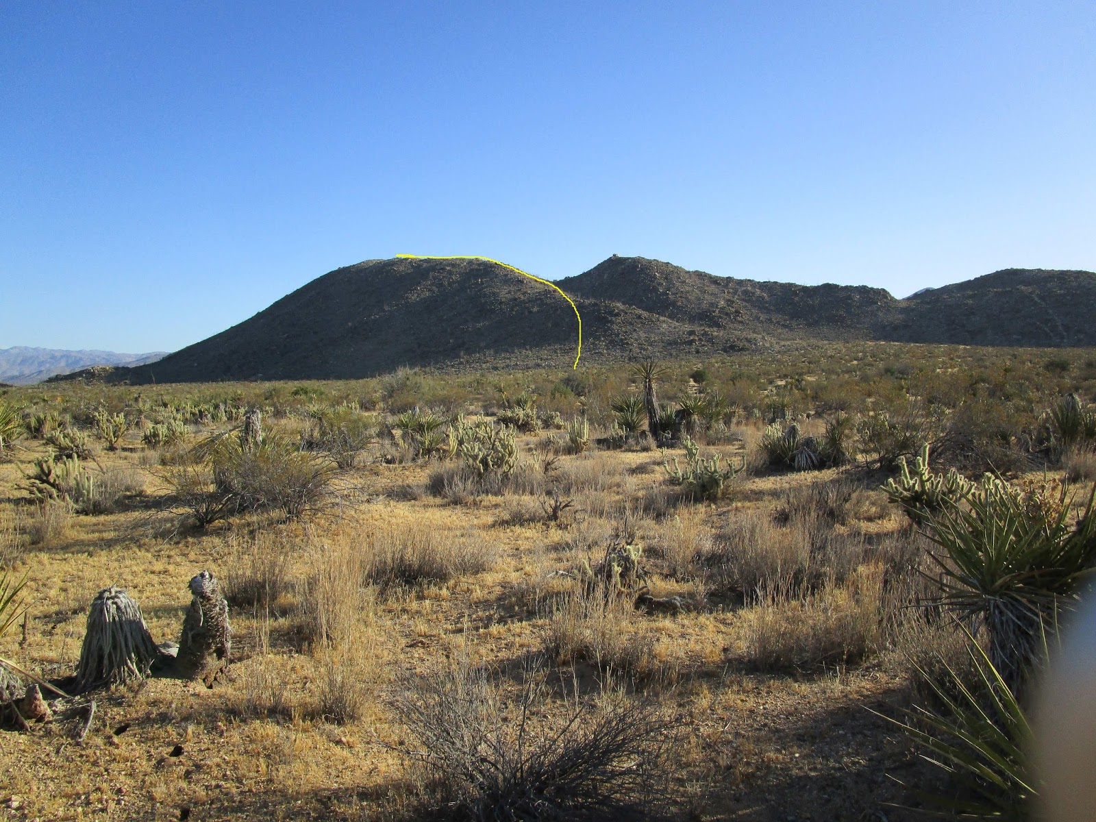
Because Ghost was so short, I searched the map for another nearby peak and decided to add Quake Benchmark. It was close enough that I just left my truck where it was and headed for it directly, not bothering with the road. The flat desert was mostly open with no real obstacles. I aimed for the nearest ridge line and had to slow down again when I started up due to the cholla. The cholla was thick on both peaks. When I got to the top, I had to visit three points to make sure I found the high point. I also spelled out my wife's initials in rock, claiming it on her behalf. There was no register or benchmark that I found. Careful steps got me down with no hits from cholla. I ended up not using the pliers I brought for cactus needle extraction. After that, I drove off to finish my business with Pike BM -- the one I missed doing Palm Mesa.


Ascent path on Quake BM


A blooming ocotillo at a cholla party


Quake BM summit with Ghost Mountain in the background


My wife's initials


Monday, April 18, 2016

Iron Mountain #3, Monte Cristo, Round Top, Granite, Rabbit

Hiked: 4/17/2016
Distance: 10.5 miles round trip on dirt road, firebreak, and use trail
Summit Elevation: 4275' (Monte Cristo), 5040' (Iron #3), 6316' (Round Top), 6600' (Granite), 5307' (Rabbit)
Prominence: 320' (Iron #3), 400' (Granite)
Elevation Gain: 4175'
Elevation Gain (in Empire State Buildings): 3.34
Round trip time: 6 hours 30 minutes
Recommended water: 128 oz.
Parking/Fees: Adventure Pass
Difficulty: Strenuous (combined)

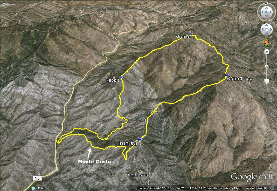
Madison and I had been talking about this one for months and we finally worked out our schedules to make it happen. I was stoked to climb the third and final Iron Mountain in the San Gabriels. Alone, it was the easiest of the three, but the loop over 5 peaks was a substantial piece of work. Here is Madison's report. We got started around 7 AM with near perfect weather. This was our itinerary:

1. Monte Cristo (unofficial)
2. Iron Mountain #3 (HPS)
3. Round Top (HPS)
4. Granite (HPS)
5. Rabbit (HPS)

The loop can be done in either direction. We parked just off the road above Monte Cristo Campground and went down to the dirt road on the left. Campers in hammocks were motionless and asleep as we started up a drainage just before the gate. It wasn't a trail, but it allowed us to get on the ridge to Monte Cristo. We found a use trail on the ridge and followed it up. We didn't find anything at the high point on Monte Cristo, so we continued on toward Iron #3. The ridge intersected a dirt road below Iron. We turned right and caught the next ridge at a bend. We made quick work of Iron #3 and appreciated the views of the back side of the entire front range. In particular, the north face of Strawberry Peak was impressive. No benchmark was found on Iron but there was a register. Unfortunately, it was soaked and unreadable. Completely ruined.


Monte Cristo campground


We went up the drainage on the right, came back along the road


Looking down on the campground, the shadow of Iron #3 on the left


Heading up Monte Cristo, Round Top distant left


Strawberry Peak and Josephine Peak from Monte Cristo


On the Iron #3 ridge


The ruined Iron #3 register

The next peak in the loop was Round Top at 6316'. You drop about 300' a saddle, then begin the 1600' climb, going over three false summits along the way. This is the crux of the loop in this direction. There was a surprisingly good use trail up the steepest part. When we reached the top, a sustained 30-40 mph wind blasted us. It nearly blew my hat away, eventually forcing me to reverse it. There was a triangle post just below the summit and a small cairn. No benchmark or register. We took a break on Round Top to refuel and rest up for the next leg to Granite, the highest point in the loop. We followed the road down from Round Top and more than half way up Granite before we left it to find the summit. Granite had a large summit area with various boulder formations and burnt trees. We wandered around a bit before finding the highest point, a 10' boulder with the register underneath. The wind was relentless, turning a pleasantly cool morning into a cold one. We took shelter on the opposite side of some boulders to finish our lunch. The Granite register was also very wet and we were unable to sign it. Our subsequent hunt for a Granite Mountain benchmark came up empty. We packed up and started down the long Granite ridge toward Rabbit.


Round Top (right) and Granite Mountain (left) from Iron #3


Madison starting the climb up to Round Top, Iron #3 in the background


After several false summits, the final approach to Round Top


Leaving Round Top on the way to Granite


Looking north from the Granite summit


On the smallish Granite summit boulder


Burned forest on top of Granite

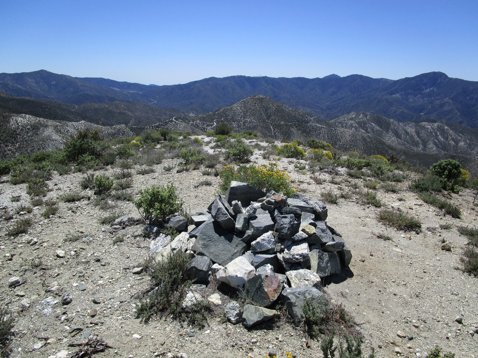
When we got below Granite, we got a break from the wind. There were interesting rock formations along the way and an abundance of yucca. After a long descent, we hit the saddle below Rabbit and began our last climb, a couple of hundred feet to the Rabbit summit. There was large cairn there, no benchmark, and a dry register. We were able to sign in for the first time. Dropping down from Rabbit, we met three other hikers who were starting the loop in the opposite direction. Doing the loop that way gets all of the gain over at once, but seems somewhat more difficult. We had a short visit and went our separate ways. Soon enough, we hit a dirt road cutting across Rabbit. After a brief discussion, we decided to take a shortcut down a ridge below electrical towers. It probably saved us a half mile or so. We didn't consider going further down the ridge, but it proved a better shortcut when we saw where it met the road. It was an easy stroll back to the campground and we were satisfied with the multiple summits of the day.


Descending from Granite


Approaching Rabbit


Rabbit summit, Iron #3 in the background


We found two of these strange white marks, one on each side of Rabbit.
They were in areas too small for helicopters.


Shortcut below Rabbit