Hiked: 11/2/2014
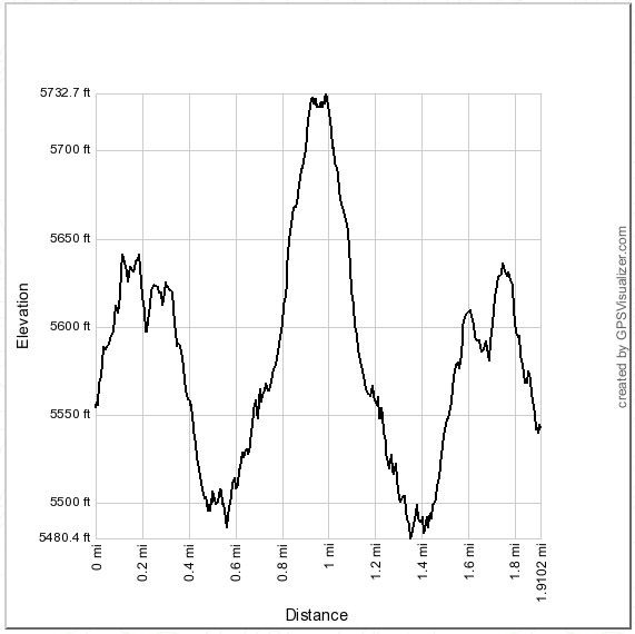
Distance: 1.9 miles round trip on use trail
Summit Elevation: 5732'
Prominence: 612'
Elevation Gain: 550'
Elevation Gain (in Empire State Buildings): 0.44
Round trip time: 1 hour 20 minutes
Recommended water: 24 oz.
Parking/Fees: Adventure Pass on Mt. Wilson Road turnout
Difficulty: Easy
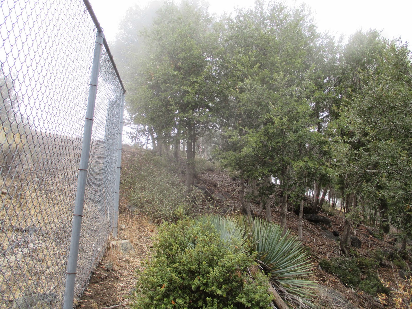
After Newcomb, I drove to a turnout near the KCBS TV towers for a quick hike up to Occidental Peak. Occidental is an HPS peak, but not much of a challenge, being only a short distance from Mt. Wilson. Still, it would extend my workout from Newcomb a little. I went up an embankment, then followed the fence line up to the heliport. On the other side of the heliport is a use trail that sidehills along the north side of the ridge a few hundred feet above the road. A fall on the wrong side of the trail could end in a long and unpleasant tumble, but the trail is in good shape, making that unlikely. Some minor ups and downs eventually lead to the summit, mostly surrounded by trees. In the few angles where good views might have been, I saw only dense cloud cover. A new register book had been placed in July, 2014, so it was rather sparse. I autographed it and lamented the clouds before heading down.
Sunday, November 2, 2014
Newcomb Peak
Hiked: 11/2/2014
Distance: 9.3 miles round trip on trail
Summit Elevation: 4166'
Prominence: Unknown
Elevation Gain: 2025'
Elevation Gain (in Empire State Buildings): 1.62
Round trip time: 3 hours 45 minutes
Recommended water: 84 oz.
Parking/Fees: Free at Mt. Wilson parking lot
Difficulty: Moderate
Newcomb Peak is pretty deep in the front range San Gabriels, sitting above Santa Anita Canyon. It is #26 on the Lower Peaks List. The most common route starts at Chantry Flats and winds up the canyon. I followed the Rim Trail from Mt. Wilson, giving up 1700'+ on the way down and gaining it on the way back. It was a crispy 39F when I started and the temp never rose above 52F. The main gate was closed at 8:00 AM so I climbed the fence to get started. The Rim Trail parallels the ridge, staying a little below the top on the north side. This kept the trail shady and cool all the way to Newcomb Pass. It is a narrow single track trail hugging the side of the ridge providing a fun forest romp. A couple of miles down the trail, I saw four mule deer part way down a gully. As soon as they saw me, the took off down the gully and within seconds were out of sight. No chance for photos. When I got to Newcomb Pass, I found a camp of hunters decked out in camo. Maybe that's why the deer were so skittish. I waved, but didn't stop to engage them. A little ways past the pass, I hit Redbox-Rincon Road and after a short section, was at the use trail heading up Newcomb.
Newcomb Peak turned out to be a minor bump rising slightly higher than others in the vicinity. There were some Environmentally Sensitive Area signs scattered around the peak, but it was unclear if the off-limits areas were off the use trail or included the use trail. I proceeded to the summit, sitting below the giant electrical tower at the top. I checked the register and signed in, noting that it was relatively new. It was placed in February, 2012 and there had only been a dozen parties sign in since then. It is not a very popular destination, and I can see why unless you were chasing the Lower Peaks List like me. Views from the top were minimal. Brush blocked the view in several directions and the electrical tower blocked even more. There were much better views along Redbox-Rincon Road. I met a nice gent named Doug along the trail. He stopped at the pass and had a conversation with the hunters. Apparently, they were not having much luck. Maybe their luck changed as I headed back since I heard steady, repeated gunfire in the distance. I passed a few other hikers coming down as I was heading up. Mt. Wilson was blanketed in clouds when I got back. Visibility was down to about 100'. I packed up and headed to the other side of Wilson for a run at Occidental Peak.
Distance: 9.3 miles round trip on trail
Summit Elevation: 4166'
Prominence: Unknown
Elevation Gain: 2025'
Elevation Gain (in Empire State Buildings): 1.62
Round trip time: 3 hours 45 minutes
Recommended water: 84 oz.
Parking/Fees: Free at Mt. Wilson parking lot
Difficulty: Moderate
Newcomb Peak is pretty deep in the front range San Gabriels, sitting above Santa Anita Canyon. It is #26 on the Lower Peaks List. The most common route starts at Chantry Flats and winds up the canyon. I followed the Rim Trail from Mt. Wilson, giving up 1700'+ on the way down and gaining it on the way back. It was a crispy 39F when I started and the temp never rose above 52F. The main gate was closed at 8:00 AM so I climbed the fence to get started. The Rim Trail parallels the ridge, staying a little below the top on the north side. This kept the trail shady and cool all the way to Newcomb Pass. It is a narrow single track trail hugging the side of the ridge providing a fun forest romp. A couple of miles down the trail, I saw four mule deer part way down a gully. As soon as they saw me, the took off down the gully and within seconds were out of sight. No chance for photos. When I got to Newcomb Pass, I found a camp of hunters decked out in camo. Maybe that's why the deer were so skittish. I waved, but didn't stop to engage them. A little ways past the pass, I hit Redbox-Rincon Road and after a short section, was at the use trail heading up Newcomb.
Newcomb Peak turned out to be a minor bump rising slightly higher than others in the vicinity. There were some Environmentally Sensitive Area signs scattered around the peak, but it was unclear if the off-limits areas were off the use trail or included the use trail. I proceeded to the summit, sitting below the giant electrical tower at the top. I checked the register and signed in, noting that it was relatively new. It was placed in February, 2012 and there had only been a dozen parties sign in since then. It is not a very popular destination, and I can see why unless you were chasing the Lower Peaks List like me. Views from the top were minimal. Brush blocked the view in several directions and the electrical tower blocked even more. There were much better views along Redbox-Rincon Road. I met a nice gent named Doug along the trail. He stopped at the pass and had a conversation with the hunters. Apparently, they were not having much luck. Maybe their luck changed as I headed back since I heard steady, repeated gunfire in the distance. I passed a few other hikers coming down as I was heading up. Mt. Wilson was blanketed in clouds when I got back. Visibility was down to about 100'. I packed up and headed to the other side of Wilson for a run at Occidental Peak.
Sunday, October 26, 2014
Tombstone Peak
Hiked: 10/26/2014
Distance: 1.9 miles round trip on use trail
Summit Elevation: 1719'
Prominence: Unknown
Elevation Gain: 900'
Elevation Gain (in Empire State Buildings): 0.72
Round trip time: 1 hour 15 minutes
Recommended water: 16 oz.
Parking/Fees: Free on Lake Wohlford Road
Difficulty: Easy
Tombstone is small peak just north of Escondido, CA, and one of three small peaks near Bottle Peak. I was on my way to Poway to pick up a phone I had lost the previous weekend, and wanted to climb something along the way. Like my trip to Bottle Peak, this was a quick side trip without time to grab the other nearby small peaks. Tombstone Peak only received a USGS name in 2010.
You can park in a small turnout on the northwest side (left) of Lake Wohlford Road, about half a mile up the road heading toward Lake Wohlford. The use trail starts a little further up on the other side through a hole in the fence, and cuts back in the opposite direction of the road. It is a steep climb most of the way, with parts of the trail looking like a drainage ditch, then it levels out a little toward the end. The use trail goes to within about 50' of the summit block, and some light bushwhacking will get you the rest of the way. The easiest way to climb the 25' summit block is a class 3 route from the southwest side. I started up an easy crack at the bottom, then a flake on the right helped me get to the top of the second crack, and it was an easy scramble from there. The top only has room for one person at a time which worked out fine since I was solo today. There are good views of Dixon Lake, Lake Wohlford, Bottle Peak, and Escondido. When I got to the top, I realized I had left my camera at the bottom with my pack, so I climbed down and up a second time to get some photos from the summit. Unlike the other nearby peaks, the Tombstone summit was free of graffiti. It was a short, but fun packed hike!
Distance: 1.9 miles round trip on use trail
Summit Elevation: 1719'
Prominence: Unknown
Elevation Gain: 900'
Elevation Gain (in Empire State Buildings): 0.72
Round trip time: 1 hour 15 minutes
Recommended water: 16 oz.
Parking/Fees: Free on Lake Wohlford Road
Difficulty: Easy
Tombstone is small peak just north of Escondido, CA, and one of three small peaks near Bottle Peak. I was on my way to Poway to pick up a phone I had lost the previous weekend, and wanted to climb something along the way. Like my trip to Bottle Peak, this was a quick side trip without time to grab the other nearby small peaks. Tombstone Peak only received a USGS name in 2010.
You can park in a small turnout on the northwest side (left) of Lake Wohlford Road, about half a mile up the road heading toward Lake Wohlford. The use trail starts a little further up on the other side through a hole in the fence, and cuts back in the opposite direction of the road. It is a steep climb most of the way, with parts of the trail looking like a drainage ditch, then it levels out a little toward the end. The use trail goes to within about 50' of the summit block, and some light bushwhacking will get you the rest of the way. The easiest way to climb the 25' summit block is a class 3 route from the southwest side. I started up an easy crack at the bottom, then a flake on the right helped me get to the top of the second crack, and it was an easy scramble from there. The top only has room for one person at a time which worked out fine since I was solo today. There are good views of Dixon Lake, Lake Wohlford, Bottle Peak, and Escondido. When I got to the top, I realized I had left my camera at the bottom with my pack, so I climbed down and up a second time to get some photos from the summit. Unlike the other nearby peaks, the Tombstone summit was free of graffiti. It was a short, but fun packed hike!
Friday, October 17, 2014
Dobbs Peak, East Dobbs, and Peak 9782
Hiked: 10/17/2014
Distance: 11.7 miles round trip on trail and cross country
Summit Elevation: 10459' (Dobbs), 10520' (East Dobbs), 9782' (Peak 9782)
Prominence: 59' (Dobbs), 40' (East Dobbs), 100' (Peak 9782)
Elevation Gain: 4780'
Elevation Gain (in Empire State Buildings): 3.82
Round trip time: 8 hours
Recommended water: 184 oz.
Parking/Fees: Adventure Pass
Difficulty: Strenuous
The west ridge approach to Dobbs Peak is a substantial cross country trek starting at the Vivian Creek trailhead. We planned a loop over Dobbs, East Dobbs, and Peak 9782. Sean and I met up shortly after the gate opened and started up the Vivian Creek trail. Memories of our recent trip to Galena returned as we crossed Mill Creek. After climbing a steep section of the Vivian Creek Trail up to the first camp, we left the trail, crossed the creek and began heading toward the west ridge. Pretty soon, we found a faint use trail and followed it. The beginning of the ridge is moderate, with better views opening up as you ascend. We stopped for a brief break around 8300', just below the steepest section. It was shady and quite cold in the morning hours, but there was no wind to make the cold miserable. The last mile gained around 2000' and was a hard slog as the air got thinner. The very wide, rounded summit of Dobbs did not sport a challenging summit block, merely a pile of rocks slighter higher than other nearby piles. The best views were had on the ascent, since the summit area was surrounded by trees. We signed the summit register dutifully and took another food break.
Next we were off for East Dobbs (also called Little Dobbs) which is slightly higher than Dobbs itself. Most of the gain for the day was behind us and the trip to East Dobbs was easy. It has a unique register with a tattered red binding. The first entry went back to 1977, but all the entries still fit into this one book. Views were a little better from East Dobbs, but it was still surrounded by the other taller peaks to the north. Lastly, we started descending toward High Creek Camp and Peak 9782. Following the ridge line down to the saddle required more scrambling than we had to do on the way up. Sean was the master route finder, getting us around patches of manzanita and steep drops on both sides. Soon, we were at the saddle and dropped our packs before climbing the hundred feet of gain up to 9782. There were interesting trees on 9782, but we found no benchmark or register. We were hoping for a good view of the Mill Creek Jumpoff but were disappointed when it remained blocked by an intervening ridge.
Returning to the saddle, we picked up our packs and started the steep descent to High Creek Camp. We stopped at the creek to refill a couple of water bottles, then made good time down the Vivian Creek Trail. Just below Halfway Camp, Sean spotted a large buck just off the trail. He was as curious about us as we were about him. After a couple minutes of staring each other down, he moved off at a leisurely pace. We made it back to the cars in just under 8 hours. It was a pretty tough, satisfying, hike and another great day in the mountains.
Distance: 11.7 miles round trip on trail and cross country
Summit Elevation: 10459' (Dobbs), 10520' (East Dobbs), 9782' (Peak 9782)
Prominence: 59' (Dobbs), 40' (East Dobbs), 100' (Peak 9782)
Elevation Gain: 4780'
Elevation Gain (in Empire State Buildings): 3.82
Round trip time: 8 hours
Recommended water: 184 oz.
Parking/Fees: Adventure Pass
Difficulty: Strenuous
The west ridge approach to Dobbs Peak is a substantial cross country trek starting at the Vivian Creek trailhead. We planned a loop over Dobbs, East Dobbs, and Peak 9782. Sean and I met up shortly after the gate opened and started up the Vivian Creek trail. Memories of our recent trip to Galena returned as we crossed Mill Creek. After climbing a steep section of the Vivian Creek Trail up to the first camp, we left the trail, crossed the creek and began heading toward the west ridge. Pretty soon, we found a faint use trail and followed it. The beginning of the ridge is moderate, with better views opening up as you ascend. We stopped for a brief break around 8300', just below the steepest section. It was shady and quite cold in the morning hours, but there was no wind to make the cold miserable. The last mile gained around 2000' and was a hard slog as the air got thinner. The very wide, rounded summit of Dobbs did not sport a challenging summit block, merely a pile of rocks slighter higher than other nearby piles. The best views were had on the ascent, since the summit area was surrounded by trees. We signed the summit register dutifully and took another food break.
Next we were off for East Dobbs (also called Little Dobbs) which is slightly higher than Dobbs itself. Most of the gain for the day was behind us and the trip to East Dobbs was easy. It has a unique register with a tattered red binding. The first entry went back to 1977, but all the entries still fit into this one book. Views were a little better from East Dobbs, but it was still surrounded by the other taller peaks to the north. Lastly, we started descending toward High Creek Camp and Peak 9782. Following the ridge line down to the saddle required more scrambling than we had to do on the way up. Sean was the master route finder, getting us around patches of manzanita and steep drops on both sides. Soon, we were at the saddle and dropped our packs before climbing the hundred feet of gain up to 9782. There were interesting trees on 9782, but we found no benchmark or register. We were hoping for a good view of the Mill Creek Jumpoff but were disappointed when it remained blocked by an intervening ridge.
Returning to the saddle, we picked up our packs and started the steep descent to High Creek Camp. We stopped at the creek to refill a couple of water bottles, then made good time down the Vivian Creek Trail. Just below Halfway Camp, Sean spotted a large buck just off the trail. He was as curious about us as we were about him. After a couple minutes of staring each other down, he moved off at a leisurely pace. We made it back to the cars in just under 8 hours. It was a pretty tough, satisfying, hike and another great day in the mountains.
Subscribe to:
Posts (Atom)