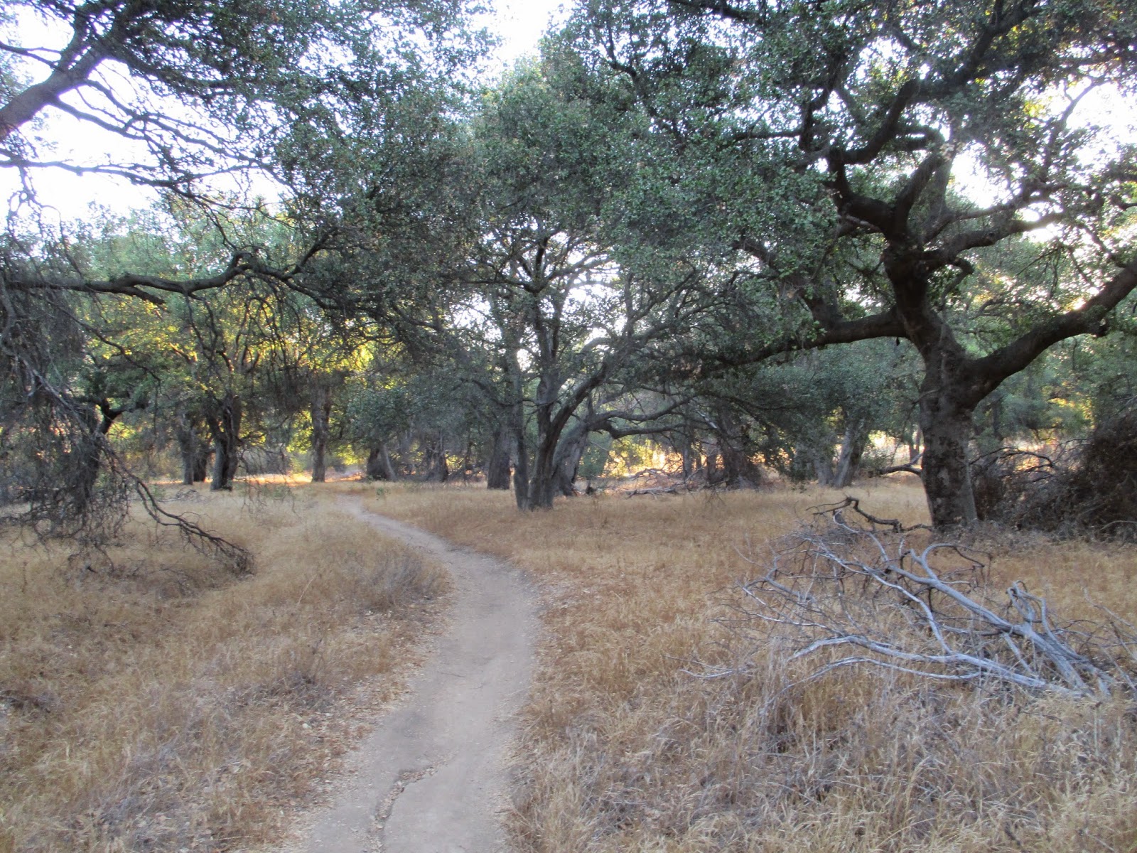
Hiked: 9/5/2014
Distance: 7.2 miles round trip on trail
Summit Elevation: 2126'
Prominence: 627'
Elevation Gain: 1000'
Elevation Gain (in Empire State Buildings): 0.80
Round trip time: 2 hours 30 minutes
Recommended water: 48 oz.
Parking/Fees: Free at the end of Reseda Blvd. (or $5 if free parking spots taken)
Difficulty: Easy
For the second part of my Lower Peak double header, I made the 40 minute drive from Simi Peak to the south side of the 101 on Reseda Blvd. I hit the rush hour traffic as half asleep yuppies made their morning commutes in metal coffins (like I do most days). As you near the end of Reseda, you pass a few gated million dollar communities like the Silver Hawk Estates with giant fountains at the entrance spraying 30' up in the middle of a multi-year drought. Nice. I was surprised at the available parking. There was plenty of free parking and only one paid parking spot was being used. You hike an extra 0.2 miles from free parking, where I started.
There were a handful of hikers and mountain bikers on the trail, but none had Temescal Peak as their destination. I cruised up Mulholland, then Temescal Ridge. There was not much to get excited about for most of the hike along the wide smooth roads. After the restroom on the trail, I passed a giant sandstone conglomerate formation. I considered stopping to explore it, but decided to save my time for potential traffic problems on the way home. Eventually, I hit the backbone trail that goes all the way to Sandstone Peak and beyond. After a very short distance, I hit the use trail on the left and the final 100' gain to the summit. There was no register, but a USGS benchmark reading "Divide". I will have to do research to find out when it was officially named Temescal. From the summit, the views were not bad. The haze prevented me from seeing the ocean, but much of the Santa Monica mountain range was visible. I took a very short break to shuffle my water bottles and made the unexciting trip back to the car. I got lucky with the traffic driving home, making it back a full hour faster than planned.
Friday, September 5, 2014
Simi Peak
Hiked: 9/5/2014
Distance: 5 miles round trip on trail
Summit Elevation: 2403'
Prominence: 816'
Elevation Gain: 1530'
Elevation Gain (in Empire State Buildings): 1.22
Round trip time: 1 hour 30 minutes
Recommended water: 32 oz.
Parking/Fees: Free on King James Court
Difficulty: Easy
Simi Peak is the high point in the Simi Hills, part of the Santa Susana Mountains north of Agoura Hills. I drove up Lindero Canyon Road from the 101 and parked in the cul-de-sac on King James Court. This is one of the trailheads for Simi Peak, signed as "China Flat Trail Head". With two shorter hikes planned for the day and no cross country travel, I brought my light pack and trail runners. I also left behind some unnecessary gear. I had pre-taped a few toes in anticipation of jogging some downhills.
The trail starts up a wide, dirt road, then eventually narrows to a single track. Views are pretty good from the start, looking down into the Simi Valley. After reaching the ridge, you descend a couple of hundred feet down to what I think is China Flat, a wide grassy meadow with large deciduous trees. I really enjoyed the beauty and tranquility of the area. Past the meadow, the trail climbs again, winding around Simi Peak then coming back for the final ascent. For a relatively small amount of work, you are rewarded with stunning 360 views. The low, early morning clouds making islands out of the surrounding hills. I didn't find the benchmark that I know exists, but there was a new register book in two large ziplock bags only dating back to July, 2014. I autographed the book and jogged about half way back to the car.
Distance: 5 miles round trip on trail
Summit Elevation: 2403'
Prominence: 816'
Elevation Gain: 1530'
Elevation Gain (in Empire State Buildings): 1.22
Round trip time: 1 hour 30 minutes
Recommended water: 32 oz.
Parking/Fees: Free on King James Court
Difficulty: Easy
Simi Peak is the high point in the Simi Hills, part of the Santa Susana Mountains north of Agoura Hills. I drove up Lindero Canyon Road from the 101 and parked in the cul-de-sac on King James Court. This is one of the trailheads for Simi Peak, signed as "China Flat Trail Head". With two shorter hikes planned for the day and no cross country travel, I brought my light pack and trail runners. I also left behind some unnecessary gear. I had pre-taped a few toes in anticipation of jogging some downhills.
The trail starts up a wide, dirt road, then eventually narrows to a single track. Views are pretty good from the start, looking down into the Simi Valley. After reaching the ridge, you descend a couple of hundred feet down to what I think is China Flat, a wide grassy meadow with large deciduous trees. I really enjoyed the beauty and tranquility of the area. Past the meadow, the trail climbs again, winding around Simi Peak then coming back for the final ascent. For a relatively small amount of work, you are rewarded with stunning 360 views. The low, early morning clouds making islands out of the surrounding hills. I didn't find the benchmark that I know exists, but there was a new register book in two large ziplock bags only dating back to July, 2014. I autographed the book and jogged about half way back to the car.
Monday, September 1, 2014
Pinyon Ridge and Wilson BM
Hiked: 9/1/2014
Distance: 11.8 miles round trip on trail and cross country
Summit Elevation: 4614' (Pinyon), 4573' (Wilson)
Prominence: 674' (Pinyon)
Elevation Gain: 1920' (combined)
Elevation Gain (in Empire State Buildings): 1.53
Round trip time: 4 hours 30 minutes
Recommended water: 136 oz.
Parking/Fees: Free at Wilson Trailhead (I didn't get to the trailhead)
Difficulty: Moderate
Back to the Anza-Borrego Desert for two peaks on the San Diego Sierra Club Peaks list, with Wilson Benchmark also on the Lower Peaks list. A 3 for 2 deal. I usually dread the long drive to Anza-Borrego, but I'm always glad I made the trip. I wanted to get back in the early afternoon and also wanted to avoid the late summer desert heat, so I left the house at 3:30 AM for the 105 mile one way drive. The trailhead is a little south of S-22 not far from the start of the departure point to The Thimble and San Ysidro. I used the official LPC directions, but it was not easy to find. Even if you find it, you may not be able to drive down it too far in a low clearance vehicle. I never got past the finding part.
On the way back, I realized the trick to getting on the correct dirt road is to turn left at the first chance from Wilson Road, then a quick right to get on the parallel dirt road. In the dark, I missed the turn and tried to turn left at the next intersection and the road was too rough for my car. I tried again at the next intersection, Camel Rock Road, and it ended abruptly. I wasted a good 20 minutes trying to find the way over, finally giving up and pulling off Wilson Road a little past Camel Rock. I decided to just eat the extra mileage and gain. I quickly went cross country toward the trailhead. I found the cross country pretty easy since the vegetation had still not grown back from a previous fire. After a mile or so, I found a road and eventually intersected the Wilson Trail, having missed the official trailhead somewhere. On trail, I moved faster, keeping a good pace to try to make up for the extra distance. As soon as the Pinyon Ridge high point was in view, I left the trail and headed directly for it. There was some class 2 scrambling and the summit was an easy 20' class 3 block. On top, I found and signed the register, noting that only 4 other parties had visited in 2014. The sun was up and views in all directions were great. I could see the Wilson BM only a mile and change to the east. After a short rest, I headed northeast to intersect the Wilson Trail again.
I followed it until I got close, then headed straight up Wilson. My angle from the trail was misleading and I didn't end up near the high point, having to veer north until I found the cairn, benchmark, and register. There were two register books, one going back to 1993 and most recent one starting in 2004. Wilson appeared to have more visitors than Pinyon, at least in 2014. The views from Wilson were very similar to Pinyon, but with burnt trees and vegetation. I did zoom in on The Thimble and San Ysidro, evoking memories of my trip there.
On the way back, it occurred to me that I had not seen much wildlife. Shortly after that thought, I startled a couple of huge jack rabbits, and ran into a beautiful copper-brown coyote coming the other way along the road. Unfortunately, they were all too fast for my camera. When I got back to the car, I had a business card from a San Diego County Sheriff's deputy under my windshield wiper with a warning about where I had parked. I was only about 30' off the Wilson Road, but someone had called the Sheriff to complain that I was on private property and blocking the very overgrown side road. I found that claim dubious since I had seen exactly zero other cars on any of the dirt roads and zero other humans. Still, I recommend not parking where I did (see the GPS track) or you might get the same warning. Based on the tone of the written warning, the deputy may have been annoyed to get this particular call. Anyway, this was my second run in with local law enforcement this year. Not a trend I want to continue!

Track profile is only 90% complete. I forgot to reset the track until I was a mile in to the hike,
so the total distance from my Wilson Road parking spot was closer to 11.8 miles
Distance: 11.8 miles round trip on trail and cross country
Summit Elevation: 4614' (Pinyon), 4573' (Wilson)
Prominence: 674' (Pinyon)
Elevation Gain: 1920' (combined)
Elevation Gain (in Empire State Buildings): 1.53
Round trip time: 4 hours 30 minutes
Recommended water: 136 oz.
Parking/Fees: Free at Wilson Trailhead (I didn't get to the trailhead)
Difficulty: Moderate
Back to the Anza-Borrego Desert for two peaks on the San Diego Sierra Club Peaks list, with Wilson Benchmark also on the Lower Peaks list. A 3 for 2 deal. I usually dread the long drive to Anza-Borrego, but I'm always glad I made the trip. I wanted to get back in the early afternoon and also wanted to avoid the late summer desert heat, so I left the house at 3:30 AM for the 105 mile one way drive. The trailhead is a little south of S-22 not far from the start of the departure point to The Thimble and San Ysidro. I used the official LPC directions, but it was not easy to find. Even if you find it, you may not be able to drive down it too far in a low clearance vehicle. I never got past the finding part.
On the way back, I realized the trick to getting on the correct dirt road is to turn left at the first chance from Wilson Road, then a quick right to get on the parallel dirt road. In the dark, I missed the turn and tried to turn left at the next intersection and the road was too rough for my car. I tried again at the next intersection, Camel Rock Road, and it ended abruptly. I wasted a good 20 minutes trying to find the way over, finally giving up and pulling off Wilson Road a little past Camel Rock. I decided to just eat the extra mileage and gain. I quickly went cross country toward the trailhead. I found the cross country pretty easy since the vegetation had still not grown back from a previous fire. After a mile or so, I found a road and eventually intersected the Wilson Trail, having missed the official trailhead somewhere. On trail, I moved faster, keeping a good pace to try to make up for the extra distance. As soon as the Pinyon Ridge high point was in view, I left the trail and headed directly for it. There was some class 2 scrambling and the summit was an easy 20' class 3 block. On top, I found and signed the register, noting that only 4 other parties had visited in 2014. The sun was up and views in all directions were great. I could see the Wilson BM only a mile and change to the east. After a short rest, I headed northeast to intersect the Wilson Trail again.
I followed it until I got close, then headed straight up Wilson. My angle from the trail was misleading and I didn't end up near the high point, having to veer north until I found the cairn, benchmark, and register. There were two register books, one going back to 1993 and most recent one starting in 2004. Wilson appeared to have more visitors than Pinyon, at least in 2014. The views from Wilson were very similar to Pinyon, but with burnt trees and vegetation. I did zoom in on The Thimble and San Ysidro, evoking memories of my trip there.
On the way back, it occurred to me that I had not seen much wildlife. Shortly after that thought, I startled a couple of huge jack rabbits, and ran into a beautiful copper-brown coyote coming the other way along the road. Unfortunately, they were all too fast for my camera. When I got back to the car, I had a business card from a San Diego County Sheriff's deputy under my windshield wiper with a warning about where I had parked. I was only about 30' off the Wilson Road, but someone had called the Sheriff to complain that I was on private property and blocking the very overgrown side road. I found that claim dubious since I had seen exactly zero other cars on any of the dirt roads and zero other humans. Still, I recommend not parking where I did (see the GPS track) or you might get the same warning. Based on the tone of the written warning, the deputy may have been annoyed to get this particular call. Anyway, this was my second run in with local law enforcement this year. Not a trend I want to continue!
Track profile is only 90% complete. I forgot to reset the track until I was a mile in to the hike,
so the total distance from my Wilson Road parking spot was closer to 11.8 miles
Friday, August 22, 2014
Silver Mountain, Peak 3430, Peak 3742, Pine Mountain #3
Hiked: 8/22/2014
Distance: 12.6 miles round trip on use trail and dirt road
Summit Elevation: 3388' (Silver), 3430' (Peak 3430), 3742' (Peak 3742), 4542' (Pine)
Prominence: 305' (Silver), 310' (Peak 3430), 419' (Pine)
Elevation Gain: 4100' (combined)
Elevation Gain (in Empire State Buildings): 3.28
Round trip time: 7 hours
Recommended water: 164 oz.
Parking/Fees: Adventure Pass
Difficulty: Strenuous
Two more peaks from the Great Lower Peaks list were in my sights today, both north of Azusa. I parked in a turnout on highway 39 across from the Morris Reservoir and headed up past the locked gate of Silver Fish Road. Right away, you need to make a choice between two ridgelines. The use trail to the left goes up a more southerly ridgeline past a water tower. If you continue following Silver Fish Road, you can ascend the next ridgeline north, which is a little more direct and probably easier. Sometimes I choose the more difficult path, but not today with temps expected to hit 90F.
Silver Fish Road quickly degenerates to a single track trail. In less than a mile, I left the road and followed a moderately steep use trail, crossing Silver Fish Road again before hitting it higher up and turning north toward Silver Mountain. The road was overgrown with grass and other small plants from knee to waist high, but not to the point where it obscured the trail. I could see Silver Mountain clearly and the firebreak heading up. Silver Mountain summit had a small cairn, but no benchmark or register I could find. It was just a round grassy spot and after a quick photo, I continued.
From Silver Mountain, the path to Pine Mountain #3 was clear, following an undulating ridge and firebreak. Between Silver and Peak 3430, directly along the path, the trail got more congested. Thicker grasses crept into the mix, some with fox tails, along with some kind of Little Shop of Horrors thing with spike balls. They were hard to avoid if you tried to stick to a cadence. I got jabbed a few times despite long pants and ankle gaiters (a huge help). Past Peak 3430, the firebreak cleared out a lot and the going got easier. There was a final steep section up to Rincon Road, then I took a left turn and followed it around to the Pine Mountain peak. It looked like there was a way directly up the ridgeline to Pine, but I needed a break from firebreaks. The only shade of the day was found along the road in the shadow of Pine Mountain. On the north side, I finally saw some pine trees, having seen none on the south side. The Pine Mountain summit is adorned with communication towers, but there is a summit register at the high point outside a fence. I signed it and recognized Sean Green and crew had visited a few months ago. The most recent previous entry was from early May, and only a handful of pages had been filled. Pine doesn't seem to be very popular, and is no pushover if you arrive by coming over Silver. Views all around were great on a very nice day. After recharging with some calories, I headed back, adding some gain on the return.
Distance: 12.6 miles round trip on use trail and dirt road
Summit Elevation: 3388' (Silver), 3430' (Peak 3430), 3742' (Peak 3742), 4542' (Pine)
Prominence: 305' (Silver), 310' (Peak 3430), 419' (Pine)
Elevation Gain: 4100' (combined)
Elevation Gain (in Empire State Buildings): 3.28
Round trip time: 7 hours
Recommended water: 164 oz.
Parking/Fees: Adventure Pass
Difficulty: Strenuous
Two more peaks from the Great Lower Peaks list were in my sights today, both north of Azusa. I parked in a turnout on highway 39 across from the Morris Reservoir and headed up past the locked gate of Silver Fish Road. Right away, you need to make a choice between two ridgelines. The use trail to the left goes up a more southerly ridgeline past a water tower. If you continue following Silver Fish Road, you can ascend the next ridgeline north, which is a little more direct and probably easier. Sometimes I choose the more difficult path, but not today with temps expected to hit 90F.
Silver Fish Road quickly degenerates to a single track trail. In less than a mile, I left the road and followed a moderately steep use trail, crossing Silver Fish Road again before hitting it higher up and turning north toward Silver Mountain. The road was overgrown with grass and other small plants from knee to waist high, but not to the point where it obscured the trail. I could see Silver Mountain clearly and the firebreak heading up. Silver Mountain summit had a small cairn, but no benchmark or register I could find. It was just a round grassy spot and after a quick photo, I continued.
From Silver Mountain, the path to Pine Mountain #3 was clear, following an undulating ridge and firebreak. Between Silver and Peak 3430, directly along the path, the trail got more congested. Thicker grasses crept into the mix, some with fox tails, along with some kind of Little Shop of Horrors thing with spike balls. They were hard to avoid if you tried to stick to a cadence. I got jabbed a few times despite long pants and ankle gaiters (a huge help). Past Peak 3430, the firebreak cleared out a lot and the going got easier. There was a final steep section up to Rincon Road, then I took a left turn and followed it around to the Pine Mountain peak. It looked like there was a way directly up the ridgeline to Pine, but I needed a break from firebreaks. The only shade of the day was found along the road in the shadow of Pine Mountain. On the north side, I finally saw some pine trees, having seen none on the south side. The Pine Mountain summit is adorned with communication towers, but there is a summit register at the high point outside a fence. I signed it and recognized Sean Green and crew had visited a few months ago. The most recent previous entry was from early May, and only a handful of pages had been filled. Pine doesn't seem to be very popular, and is no pushover if you arrive by coming over Silver. Views all around were great on a very nice day. After recharging with some calories, I headed back, adding some gain on the return.
Friday, August 8, 2014
Mount St. Helens
Hiked: 8/8/2014
Distance: 9.2 miles round trip on trail and cross country
Summit Elevation: 8333'
Prominence: 4573'
Elevation Gain: 4930'
Elevation Gain (in Empire State Buildings): 3.94
Round trip time: 6 hours 30 minutes
Recommended water: 152 oz.
Parking/Fees: $22/person permit fee, includes Northwest Forest Parking Pass
Difficulty: Strenuous
My first stratovolcano and first active volcano. This mountain became famous by exploding May 18, 1980 losing about 1200' of elevation and the entire north face in the process. So much of the mountain slid into nearby Spirit Lake that it permanently raised the elevation of the lake by 200'. My family and I were vacationing about an hour away in Portland, but this day was set aside for volcano climbing. I had invited a few people along but for various reasons it ended up a solo adventure.
I had purchased the permit back in February when they went on sale. I left the hotel a little before 5 AM to pick up the permit and parking pass at the Lone Fir Resort in Cougar, WA, which is more of a general store and motel than what the term "resort" conjures. I attached the permit to my pack then drove to the trailhead at Climbers Bivouac. During the summer, only 100 permits a day are issued. It was 49F when I hit the Ptarmagin Trail around 6:45 AM and climbed the first couple of miles through the pine forest to the top of the tree line. Blue diamonds marked the trail, but unless it was buried in snow, the trail was wide and obvious. It was weird seeing the tree line end so cleanly, the terrain replaced with an ash and pumice boulder moonscape. Above the tree line, there were wooden poles that marked the monitor ridge route. After scrambling over the boulders to follow the poles, I spotted a trail in the gully left of the ridge going up. I dropped into the gully and made better time by avoiding a lot of needless boulder hopping. Unfortunately, after a mile or so I was forced back on to the ridge to avoid the remnants of a glacier. My progress slowed while I navigated the boulders, probably a mile or so of scrambling. I was expecting to see several major seismic monitoring stations, but only passed one.
When the boulders and wooden pole markers ended, the wind started howling and I put on my outer shell and face protection to stay warm. In front of me was about a 1000' wall of ash to climb to get to the crater rim. There was a use trail leading up, but it was not very helpful, generally a straight up slog. I ground out the last bit to find a few people at the crater rim taking in the views. No one I talked to had been to the true summit and did not seem interested when I pointed it out. After taking a few shots of the smoking lava dome, I headed up the rim on the left toward the true summit. No snow got in my way, but this was probably the crux of the hike. I had to drop about 100' down one section, go up and over a higher part of the rim, then traverse over boulders on another part with some exposure. Then, another 200' climb to the highest part of the rim and summit where a large cairn was built. I was alone at the summit. I took more photos of Mt. Rainier, Mt. Adams, and Mt. Hood, and was fascinated by the obvious cornice melting in the summer sun. Rocks and snow were constantly crashing into the crater as the cornice melted, while steam rose from two or three spots in the lava dome. It was riveting to take in all the geology. Seeing how much mountain was blasted away, I got a better sense of how immensely powerful the explosion must have been. I started back and got below the wind on part of the rim before stopping to eat something.

Close up of the lava dome. The dome is over 300' tall
and surrounded by the Crater Glacier that started forming in 1980-81.
The way down was much faster, except for the boulder section which took about the same time going down as up. When I got back to the tree line, there was a USFS forest ranger checking permits of people going both ways. He turned two parties back and we had a short conversation about the rock slides into the crater. It was quite a bit warmer at the lower elevation so I stored my gloves and outer shell. I completed the round trip in 6.5 hours, a bit faster than my plan. Before driving away, I got a tree-obscured view of Mount St. Helens from the parking lot. I stopped by Lone Fir Resort again to sign out so no one would think I was missing. While not a record breaker, Mount St. Helens was challenging and fun with unique active volcano views.
Washington Trails Association Mount St. Helens Monitor Ridge guide
Would you like to know more...?
Distance: 9.2 miles round trip on trail and cross country
Summit Elevation: 8333'
Prominence: 4573'
Elevation Gain: 4930'
Elevation Gain (in Empire State Buildings): 3.94
Round trip time: 6 hours 30 minutes
Recommended water: 152 oz.
Parking/Fees: $22/person permit fee, includes Northwest Forest Parking Pass
Difficulty: Strenuous
My first stratovolcano and first active volcano. This mountain became famous by exploding May 18, 1980 losing about 1200' of elevation and the entire north face in the process. So much of the mountain slid into nearby Spirit Lake that it permanently raised the elevation of the lake by 200'. My family and I were vacationing about an hour away in Portland, but this day was set aside for volcano climbing. I had invited a few people along but for various reasons it ended up a solo adventure.
I had purchased the permit back in February when they went on sale. I left the hotel a little before 5 AM to pick up the permit and parking pass at the Lone Fir Resort in Cougar, WA, which is more of a general store and motel than what the term "resort" conjures. I attached the permit to my pack then drove to the trailhead at Climbers Bivouac. During the summer, only 100 permits a day are issued. It was 49F when I hit the Ptarmagin Trail around 6:45 AM and climbed the first couple of miles through the pine forest to the top of the tree line. Blue diamonds marked the trail, but unless it was buried in snow, the trail was wide and obvious. It was weird seeing the tree line end so cleanly, the terrain replaced with an ash and pumice boulder moonscape. Above the tree line, there were wooden poles that marked the monitor ridge route. After scrambling over the boulders to follow the poles, I spotted a trail in the gully left of the ridge going up. I dropped into the gully and made better time by avoiding a lot of needless boulder hopping. Unfortunately, after a mile or so I was forced back on to the ridge to avoid the remnants of a glacier. My progress slowed while I navigated the boulders, probably a mile or so of scrambling. I was expecting to see several major seismic monitoring stations, but only passed one.
When the boulders and wooden pole markers ended, the wind started howling and I put on my outer shell and face protection to stay warm. In front of me was about a 1000' wall of ash to climb to get to the crater rim. There was a use trail leading up, but it was not very helpful, generally a straight up slog. I ground out the last bit to find a few people at the crater rim taking in the views. No one I talked to had been to the true summit and did not seem interested when I pointed it out. After taking a few shots of the smoking lava dome, I headed up the rim on the left toward the true summit. No snow got in my way, but this was probably the crux of the hike. I had to drop about 100' down one section, go up and over a higher part of the rim, then traverse over boulders on another part with some exposure. Then, another 200' climb to the highest part of the rim and summit where a large cairn was built. I was alone at the summit. I took more photos of Mt. Rainier, Mt. Adams, and Mt. Hood, and was fascinated by the obvious cornice melting in the summer sun. Rocks and snow were constantly crashing into the crater as the cornice melted, while steam rose from two or three spots in the lava dome. It was riveting to take in all the geology. Seeing how much mountain was blasted away, I got a better sense of how immensely powerful the explosion must have been. I started back and got below the wind on part of the rim before stopping to eat something.
Close up of the lava dome. The dome is over 300' tall
and surrounded by the Crater Glacier that started forming in 1980-81.
The way down was much faster, except for the boulder section which took about the same time going down as up. When I got back to the tree line, there was a USFS forest ranger checking permits of people going both ways. He turned two parties back and we had a short conversation about the rock slides into the crater. It was quite a bit warmer at the lower elevation so I stored my gloves and outer shell. I completed the round trip in 6.5 hours, a bit faster than my plan. Before driving away, I got a tree-obscured view of Mount St. Helens from the parking lot. I stopped by Lone Fir Resort again to sign out so no one would think I was missing. While not a record breaker, Mount St. Helens was challenging and fun with unique active volcano views.
Washington Trails Association Mount St. Helens Monitor Ridge guide
Would you like to know more...?
Subscribe to:
Posts (Atom)