Friday, May 16, 2014

Harrison Mountain

Hiked: 5/16/2014
Distance: 3.2 miles round trip on use trail and cross country
Summit Elevation: 4743'
Prominence: 1403'
Elevation Gain: 1725'
Elevation Gain (in Empire State Buildings): 1.38
Round trip time: 2 hours 40 minutes
Recommended water: 80 oz.
Parking/Fees: Adventure Pass
Difficulty: Moderate

Harrison Mountain is just under the 5000' cut off for a Great Lower Peak, ranked #6 on the list, and is the higher of two guardians of Highway 330, the lower one being McKinley Mountain. According to the Sierra Club, it was named for President Benjamin Harrison who signed the act creating the San Bernardino National Forest Reserve on February 25, 1893.

I parked at the turnout for the north trailhead and got ready in the 90F heat. I was sporting new Black Diamond talus gaiters. Bugs were annoying from the start, but mostly keep at bay with a liberal application of spray. Many experienced hikers have gotten lost at the start trying to find a use trail up to the first bump. Satellite recon suggested going down the road a ways, then up the firebreak. However, several reports showed ascending more directly on a faint use trail so I tried that going up. The first quarter mile was mostly cross country, picking through brush and deadfall until I found a more prominent use trail. It was very steep up to the first bump, then leveled out as it traversed toward the west ridge.


Harrison Mountain from the freeway


Break in the fence where a very faint use trail begins.
Heading up the firebreak from further down the road is better.


Looking back at the parking lot near the first bump

Sections of the use trail were in good shape, but along the traverse, there were sections completely overgrown with brush, buckthorn, and poison oak. Having just healed up from my last encounter, I was wary and somewhat alarmed at the amount of it invading the trail. I was also wearing shorts and a short sleeved shirt. I recommend long pants and long sleeves, regardless of heat if you are going to climb Harrison in the spring. I moved carefully, using burned branches to push the poison oak off the trail where I could. When I got to the west ridge, I stopped and improvised a way to cover my exposed legs by ripping my rain poncho in half and tying the pieces around my legs. It was flimsy protection, but better than nothing. I'll know in a few days if it was effective or too late. I also noticed a tick crawling on my leg and brushed it off. It was the first of nine I would find crawling on me before the day was done.


Buckthorn in the way


Lots of evil poison oak invading the trail


Improvised leg protection


Rocks at turn to head up the ridge


Firebreak to Harrison summit

The west ridge to the summit was mostly tall grass and open firebreak, clear of poison oak. I found the summit register cans and tried to sign the register, but both books were soaked. I could not even turn most of the pages to check out recent visitors. I walked to the far end of the summit for better views of Highland, Loma Linda, and the rest of the mighty IE. Harrison rises well above McKinley across the highway. There were hazy views of the high peaks and ranges. I completed another scan for ticks, then started down. Instead of going back the way I came, I decided to descend the firebreak on the lower section to see if was a better path than the crude way I ascended. It turned out to be much better without adding much distance. When I got to the bottom of the firebreak, I followed an animal trail back to the road and marked it with a waypoint. The faint trail is not visible from the road, but goes between two small trees a few hundred feet down from the parking lot. It seems like a better way both up and down.


Summit register


McKinley Mountain from Harrison summit


View southeast to the high places


The animal trail to the lower firebreak goes between these small trees


Friday, May 2, 2014

Armada BM

Hiked: 5/2/2014
Distance: 1.4 miles round trip on trail and cross country
Summit Elevation: 2220'
Elevation Gain: 729'
Elevation Gain (in Empire State Buildings): 0.58
Round trip time: 50 minutes
Recommended water: 40 oz.
Parking/Fees: $10 State Parks
Difficulty: Easy

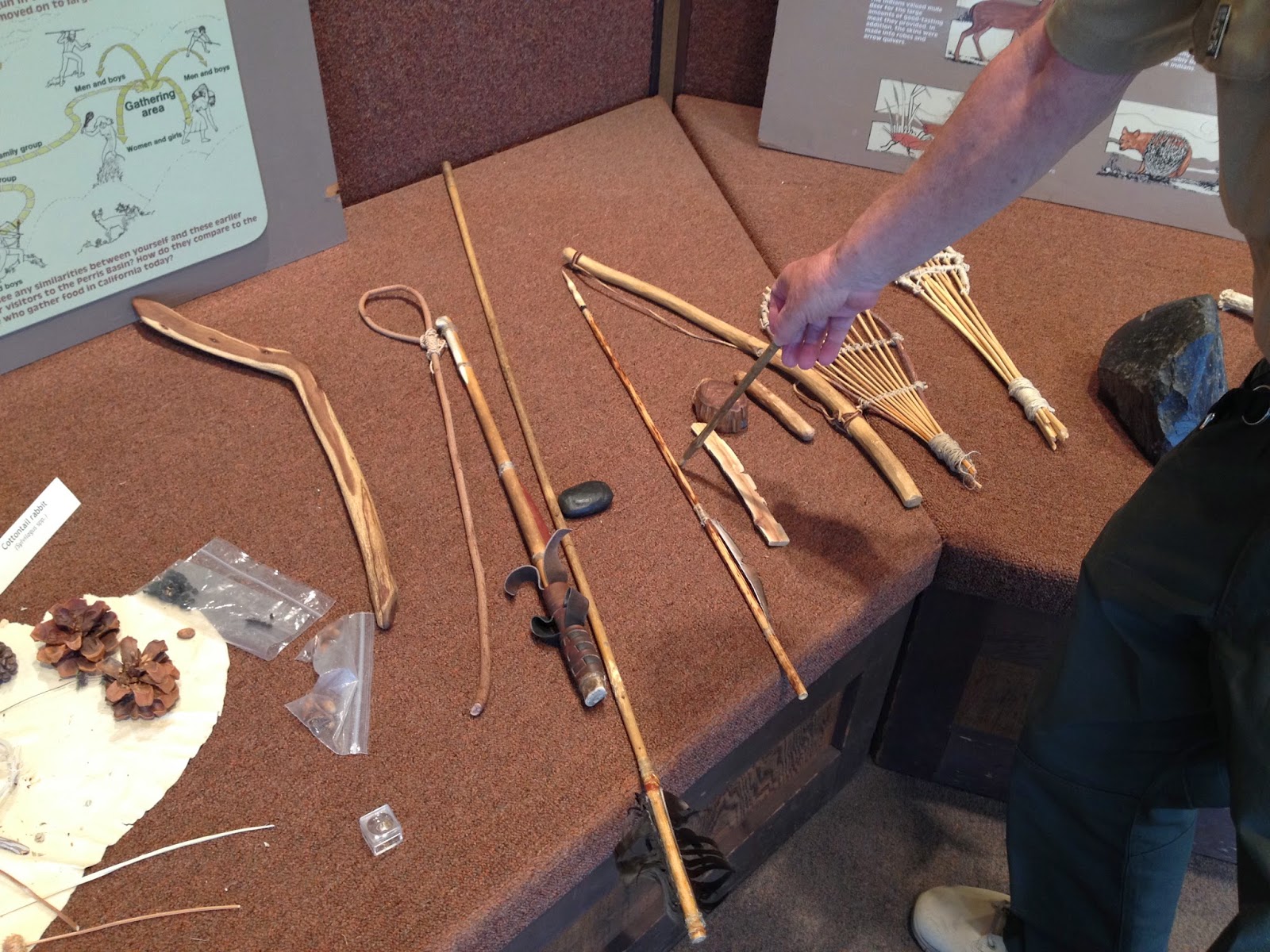
After finishing Mt. Russell, I had scoped out some of the other peaks inside Lake Perris State Park. Terri Peak might have been the next highest, but it had no cross country. Armada, while shorter, was mostly a cross country scramble and more in line with the Mt. Russell theme of the day. It was still 100F and I would get no shade or break from the heat on this short hike. I parked at the Regional Indian Museum and took the trail heading to Terri Peak. Very soon, I left the human trail to follow goat trails toward Armada. There were plenty of goat droppings and footprints to keep me going the right way through the scrub. Soon, I hit the ridge and wandered to the right to look at some large boulders, then back the other way to hit Armada. There were three large painted lines around where the benchmark used to be. I had good views of the lake from the south end, but could not see Mt. Russell since Terri Peak was in the way to the north. When I returned to the car, I took a few minutes to cruise through the Indian Museum. It had two friendly state curators who warned me that red diamondback rattlesnakes were around. I told them I was expecting to see snakes on my hikes, but didn't see any. I was quite fine with that. I got a quick tour of the artifacts and stuffed animals and we chatted about hiking conquests before I drove home. On the way back, at the intersection of highway 60 and I-215N, the traffic came to a sudden stop and the third car ahead of me smashed into the back of a pickup truck. I swerved to the left, avoiding a further pile up, but the smell of leaking fluids and smoking brakes lingered. Fortunately, it was only the two vehicles in the crash, as they both limped to side of the freeway for the unpleasantries. When I hit highway 91W, it occurred to me that Mt. Russell had been my 91st Sierra Club peak.


Start of the trail to Terri Peak and Armada BM


Off trail toward Armada BM


Scrambly


Armada BM summit


Lake Perris from the south


Box Springs Mountain with San Gabriels behind


Crow lookout


Local animals in the museum


Desert cats in the museum


Learning about ancient Indian weapons


Mt. Russell

Hiked: 5/2/2014
Distance: 3.7 miles round trip on trail and cross country
Summit Elevation: 2704'
Prominence: 1109'
Elevation Gain: 1133'
Elevation Gain (in Empire State Buildings): 0.90
Round trip time: 1 hour 50 minutes
Recommended water: 60 oz.
Parking/Fees: $10 State Parks
Difficulty: Easy

Not to be confused with the Sierra 14er with the same name, this Mt. Russell is on the Sierra Club Lower Peaks List at the north end of Lake Perris State Park. The lake itself is a large reservoir and recreation area surrounded by hills with a small island in the middle. There are also horse facilities. I arrived around 9:00 AM and it was already 85F. I parked in the horse staging area at the north end of the park. This is also a quail hunting area (shotguns only), and I hoped not be mistaken for a bird. Turns out, I didn't hear one shotgun blast on the trip and saw no hunters, but I did see lots of spent shells. It was probably too hot for the hunters.

Despite being next to a lake, this is a desert hike. It was dry and dusty from the start. There were also plenty of bugs. Spray up before heading up. Mt. Russell loomed behind other hills at the far end of a canyon. Only the first half mile or so of the hike is on a trail, then you veer into the canyon filled with scrub and boulders. There are faint use trails on both sides of the canyon. I stayed to the right and sometimes wandered too far up the canyon wall, making corrections when I saw the use trail below. At the end of the canyon, I went up the left side of Mt. Russell with no trail, which was the wrong choice. This path led me up the steep slope while bushwhacking and boulder scrambling. When I got to the top, I spotted a faint use trail on the right side that bypassed the boulders. That was my descent path. With the heat wave, the whole area felt "snakey", but I didn't see any snakes. Plenty of big lizards and ground squirrels, though. There is enough brush on the route that long pants were justified, even in the hottest weather.


Hunting season around Mt. Russell


Heading out


Butterfly in the canyon


Bushes, boulders, and boiling heat


Tight squeeze just before the summit

The summit has a large wooden cross on it, cemented to the rocks, with a light aimed at it. There was also a metal pole, but I didn't find a register. The views of Lake Perris and the surrounding larger ranges were very nice. I took some photos and rested a bit on the summit. I followed the more pleasant path down and when I got back to my car, it was 100F. Ah, nothing like Perris in the spring. I had time for my bonus peak, so I drove toward the south end of the park in search of Armada BM.


Mt. Russell summit


Lake Perris and Alessandro Island


Shriveled mushrooms in the heat wave, on the way back


Monday, April 28, 2014

Cactus to Clouds

HPS Star Emblem Peak
Hiked: 4/27/2014
Distance: 20.3 miles round trip on trail
Summit Elevation: 10834' (Mt. San Jacinto)
Prominence: 8319'
Elevation Gain: 10614'
Elevation Gain (in Empire State Buildings): 8.49
Max Slope: 50.7%
Round trip time: 12 hours 45 minutes
Recommended water: 272 oz.
Parking/Fees: Free parking across from Palm Springs Art Museum, $12 tram ride down
Difficulty: Very Strenuous

Cactus to Clouds is an epic day hike that starts in the desert near sea level behind the Palm Springs Art Museum and ends on top of Mt. San Jacinto at 10834'. Most of the gain (about 8000' of the 10000'+) is done on the Skyline trail that starts behind the museum, though some people start on the Lykken trail that intersects with Skyline low on the ridge. A lot has been written about the Skyline Trail, and Backpacker Magazine ranked the full Cactus to Clouds as the 5th toughest day hike in America (a caveat being hikes with trails). Here is an illuminating paragraph from Hikin' Jim about Skyline:
This is a committed route. What do I mean by "committed?" There is no way to abort a hike once you start. In other words, once you get onto Skyline, you're committed. If you go up, but get too tired to continue, you (in hot weather) can't just head back down. As you head down, the temperature will increase. You're essentially descending into an inferno. From what I've read, this seems to be the pattern for most of the people who have died on Skyline. They started up, got into trouble, headed down into the fiery furnace of the desert, and succumbed to the heat. Again, I'm not trying to scare anyone off who knows what they're doing; I'm just trying to be responsible and present what are the very real objective dangers.
Because the weather is relatively mild in April, it is one of the safest times to attempt Skyline. October is also popular. I began loaded with 100 oz of water and 96 oz of G2 Gatorade. The water only needed to last until I could refill at the ranger station, but it didn't, forcing me to use more gatorade on Skyline than planned. The Gatorade was meant to last the entire hike (it did), though I could have detoured to the Mountain Station store if necessary. I packed extra layers and chemical warmers to deal with the cold at the higher elevations. What I failed to anticipate is how much snow was on the trail from the Long Valley ranger station up. The previous days storm had dumped a few inches of snow around the tram, and as much as 10 inches on the summit (according to the ranger). I had gone without waterproof boots and would pay the price.

I left home just before 1:00 AM for the drive to Palm Springs. I picked Sean up at 2:00 AM and we got on the Skyline trail around 3:15 AM. I parked in the Palm Springs Art Museum parking lot, but found a parking violation warning on my windshield when I returned. Better to park in the Free Parking structure across the street to avoid being towed. The lower parts of the Skyline trail are notoriously fragmented. We got lost multiple times, but every time we did, we went straight up the hill until we intersected the trail again. It was not an ideal strategy, but it worked. We passed the park benches, but missed some of the other landmarks I've seen in trip reports. Palm Springs lit up the night sky and for quite a while, we heard loud rave music coming up from below. Eventually, we learned to follow the white dots painted on rocks to keep us on track. At some point, we spotted a light from Mountain Station that appeared a discouraging distance away. By sunrise, we were at 4000'. It was cold and we welcomed the warmth from the sun.


Start of the Skyline Trail


Palm Springs Art Museum from the start of the trail


Park Benches and North Palm Springs in the background


Rescue Box #1


Distant light from Mountain Station


Dawn


Sean coming up the trail


Sunrise over Palm Springs

We took a break at a clearing around 5300' near the remains of a campfire. We refueled and followed the winding single track trail up. We could barely make out Coffman's Crag, and I could tell the worst of Skyline was reserved for the top. After hitting the manzanita section, the trail went mercilessly up with many fewer switchbacks. After 7000', we started hitting patches of snow, and shortly after Coffman's Crag, light slushy snow covered the trail. It wasn't really a hazard, just messy. We had a good pace going until the last 2000' of Skyline, where I slowed down significantly. We didn't see a single other soul on the Skyline Trail. It took 7 hours to reach the Long Valley ranger station where we got a permit to continue.


Still a long way to Mountain Station


Flowering cactus


Rescue Box #2


Unofficial rescue box (Florian's cache?)


Shadows on the mountain


Snow capped San Gorgonio in the distance


Looking back at Palm Springs from the manzanita section


Striations in the rock


At Coffman's Crag


Sean at Coffman's Crag

The ranger at Long Valley told us conditions were icy near San Jacinto and we shouldn't go without microspikes. Of course, we made the attempt, and the snow was slushy, not icy past Jean Peak. This is where I paid the price for not having waterproof boots. The slush on the trail could not be avoided and eventually my boots and socks were soaked and freezing. I soldiered on to the summit where a half dozen people were shivering from the cold temps and strong wind. Sean and I stayed long enough to take some photos and video, but didn't linger on the windy summit. I was concerned about my freezing feet and sped up my descent. After a mile or two, the energetic descent had restored the blood flow and feeling to my toes and I was no longer concerned about damage. We got back to the Aerial Tramway and bought our tickets down. The Service Desk was nice enough to call a cab for us and it was waiting when we got to the bottom. We left Palm Springs battered and wet, but victorious.


Snow in Long Valley


View from Wellmans Junction


Rushing through the slush


Mt. San Jacinto


Final climb to the Aerial Tramway


Coming down fast from miles above you


Other Trip Reports:
Cactus to Clouds route description (Peaks for Freaks)
Cactus to Clouds to Cactus (Peaks for Freaks)

Would you like to know more...?