Monday, July 26, 2021

Mount Tallac

Hiked: 7/26/2021
Distance: 10.1 miles round trip on trail
Summit Elevation: 9735'
Prominence: 695'
Elevation Gain: 3400'
Elevation Gain (in Empire State Buildings): 2.7
Round trip time: 6 hours 30 minutes
Recommended water: 96 oz.
Parking/Fees: Free at Mount Tallac Trailhead
Difficulty: Moderate

Our plan for Tahoe included climbing Mount Tallac (SPS #225), renowned for views of Lake Tahoe and the surrounding area. Raging wildfires hadn't broken out when we made our plans, but the smoke was sure to interfere with our views if not our breathing. Leisa and I got started around 6:30 AM and could at least see Mount Tallac as we drove to the trailhead. A free self-signed permit is usually required, but a sign at the trailhead waived day hike permits for 2021. The first couple of miles were in pine trees and shade. We hiked along a ridge line looking down on Falling Leaf Lake, a huge lake itself. The next small lake we passed was Floating Island Lake and I got a good mirror image photo of Mount Tallac despite the smoke. The second small lake we passed was Cathedral Lake. The trail began climbing more seriously after Cathedral.

Falling Leaf Lake and smoke


Tallac reflected in Floating Isle Lake


Cathedral Lake

Steps had been built into the trail, a lot of big steps in the 2' to 2.5' range. The terrain started getting rocky and around 8200', the tree line ended. The following mile was spent climbing a talus slope to a major ridge. The main trail rock hopped up the slope. I noticed another trail to the south that also climbed up to the ridge, but skipped the rocks. It looked too defined to be an animal trail, but I didn't remember a junction. I found that trail on CalTopo later and while it might add a little distance, it may be easier that the talus hop. When we gained the ridge, we traveled on somewhat flat ground behind a false summit. I was surprised and awed that an idyllic scene of trees and flowers lived on this plateau below Tallac. From this vantage, we could also spot Gilmore Lake to the east.

Leisa taking on the talus


Eden on the plateau


Wild pheasant, there were several crossing the trail


The final approach hinted at scrambling ahead, but it was class 1 to the top. The summit was swarming with black flying ants that allowed me to stay there about 10 seconds. No marks or register that I could see. Views opened up in all directions, but most of it covered by white smoke filling the Tahoe Basin. We could see the south shore of Lake Tahoe, but not much past it. So much promise hidden behind the haze. We descended off the summit area before taking a break. As a hike, Tallac probably makes my top 10 for overall beauty -- minus the smoke. We noticed a few parties starting up the mountain late when we were nearly down. That probably didn't turn out well since rain and T-storms hit the area later in the afternoon.


Mount Tallac summit

Emerald Bay, Cascade Lake, Lake Tahoe, and smoke


Saturday, July 24, 2021

Mount Rose and Church Peak, NV

Hiked: 7/24/2021
Distance: 11.3 miles round trip on trail and cross country
Summit Elevation: 10776' (Rose), Church (10601')
Prominence: 3630' (Rose)
Elevation Gain: 2573'
Elevation Gain (in Empire State Buildings): 2.0
Round trip time: 6 hours
Recommended water: 96 oz.
Parking/Fees: Free at Rose Mountain Trailhead
Difficulty: Moderate

Leisa and I flew to Sacramento, then drove to Chester for what was supposed to be two days exploring Lassen Volcanic National Park. The Dixie Fire had other ideas. As we drove north, visibility became terrible and the smell of smoke was overwhelming. We went to the Lassen Visitor Center and the ranger warned us that air quality was dangerous and to definitely not hike. We couldn't see more than 100' from the smoke and large chunks of ash started covering our rental car. Lassen was a no go, and in fact, the motel in Chester as under an evacuation warning. The front desk told us they would knock on our door if we needed to evacuate in the middle of the night. We survived the night, but made plans to drive hours away to get away from the fire. We set off the next morning for Rose Mountain (SPS #210), south of Reno and north of Lake Tahoe. Air quality was a little better but the smoke and haze were still bad. Tahoe was being threatened by another big fire, the Tamarack Fire.

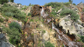
When we got to the trailhead, the smoke was still thick and it mixed with scent of pines. We weren't sure we should be out hiking, but the lot was almost full so if we coughed up a lung, we would at least have company. The first two miles of the hike were shaded and lost a little elevation before reaching the Galena Waterfall. Many hikers turned back at the waterfall. We continued into a valley below Rose that was sheltered somewhat from the smoke. We climbed up to a saddle then started the final steep mile to Rose.


Mount Rose through the smoke

Galena Waterfall


There were multiple parties on the trail, but it wasn't crowded. We came out of the tree line at few hundred feet below the summit and made pretty good time to the top. As we neared the summit, I started smelling smoke again and the views were seriously hampered. The benchmark had been stolen and the summit was too popular for a register. We rested about 15 minutes on the summit before starting down.


Leisa on the summit


Hazy views

We had noticed Church Peak on the way up and it was only a half mile away from the trail. I wanted to bag it while we were here and Leisa said she would come along but might wait for me if it looked sketch. There was a big boulder pile blocking the summit and we couldn't tell whether it could be bypassed or if you had to go over it. We got around the first obstacle, and around the worst part of the pile, but at least class 2 was unavoidable. Leisa waited for me as I picked my way up to the ridge. From the ridge, it was an easy walk over rocks to the summit. The summit had no marks or register. When I got down to shouting distance, I told Leisa that if she could make it the 200' to me, she could get the summit. She was a little reluctant, but scrambled her way to the ridge and we went back to the summit together. I think she had mixed feelings about it since we ended up pushing through some trees on the way back. No permanent damage and we got two nice 10K peaks in Nevada.

Leaving the trail for Church Peak


Me on the summit of Church

Leisa scrambling up to the ridge

Leisa on the summit of Church


Saturday, July 17, 2021

Alta Peak

Hiked: 7/17/2021
Distance: 14.2 miles round trip on trail
Summit Elevation: 11209'
Elevation Gain: 4251'
Elevation Gain (in Empire State Buildings): 3.4
Round trip time: 8 hours
Recommended water: 164 oz.
Parking/Fees: $30/car National Park Fee (good for one week)
Difficulty: Strenuous

Alta Peak is one of the popular high sierra peaks in Sequoia National Forest (SPS #200). Leisa and I picked up a couple of sandwiches from Sierra Subs in Three Rivers the previous day. We spent the night in Buckeye Tree Lodge, right outside the park entrance. We drove to Wolverton Trailhead and started hiking around 6:45 AM. The weather was perfect, mid-50s and sunny most of the day. The first three miles of the hike were shaded by large trees. The trail was in perfect condition and well signed. We climbed up to Panther Gap, then took the Alta Trail. At the gap, views started to open up to the Mineral King peaks. The only ones I recognized were Castle Rocks and Ampitheater Dome. The rest were unknown granite spires. The Alta Trail started out mild with the gain spread out until Alta Meadow. What became clear was the final two miles were going to be difficult. The final two miles gain 2000' to the summit, about the same amount of gain as the first five miles to Alta Meadow.

Signage is off by a half mile

Jurassic forest


We cached some water at the Alta Meadow junction, lightening our packs before the push upward. The trail was noticably steeper. It switchbacked below Tharps Rock, eventually coming back north of it. At this point, we were out of the tree line. Only a few hardy bristlecone pines made a living at this elevation. A few hundred feet higher, there was no vegetation at all. Above the tree line, we were hit with steady 5-15 mph winds. We met a few hikers coming down from the summit and we could see two hikers on the summit 400' above. The final push took extra effort, but we rolled up below the summit block as the two hikers were on their way down.


Alta summit

A ramp in front of the 30' summit block got us close enough for a couple of class two moves to reach the top. The summit was a slab angled down at 30 degrees. On the other side of the slab was a long vertical drop. The register was in an ammo box at the top of the slab. Leisa climbed up ahead of me and we both signed the register. A reference mark was by the register, but the benchmark was on a ledge on the risky side of the summit. I climbed down 4' onto the ledge to snap a photo of the benchmark. I'm not sure everyone finds it. Because of the wind, we climbed down from the summit and located shelter in a nearby boulder pile for lunch. We enjoyed taking in the Sequoia and Mineral King vistas. After more photos, we started down, taking advantage of gravity. We took many breaks on the way up, but only one on the way down. Below Panther Gap, we met a friendly doe who came up the trail within 10' of us. We backed off the trail to give it space, then it stepped to the side to graze. It was clearly comfortable with people. We got back to the car with a round trip time of 8 hours. I had over 48 oz of water left, a rare overestimate of my water needs due to the shade and cool temps. 5 hours up, 3 hours down. Leisa really impressed me with her performance today at high altitude.


Standing on a ledge on the dangerous side of the summit where the benchmark was placed


A lot of big peaks I don't recognize

Couple descending from the summit

Pear Lake

Alta Meadow


General Sherman Tree we visited the previous day. It is alleged to be 2200 years old.

This beautiful king snake was on Mineral King Road.
Tried to shepherd it off the road but it got defensive.