Sunday, February 21, 2016

Palm Mesa High Point, Norte BM, Phil BM, Cody BM, Deering Peak

Hiked: 2/19/2016
Distance: 10.5 miles round trip cross country
Summit Elevation: 5440' (Phil), 5470' (Norte), 5586' (Cody), 4780' (Deering), 4660' (Palm Mesa)
Elevation Gain: 4650'
Elevation Gain (in Empire State Buildings): 3.72
Round trip time: 9 hours 15 minutes
Recommended water: 184 oz.
Parking/Fees: $10 Los Coyotes Reservation (per car day use), parked on San Ignacio Road
Difficulty: Strenuous

Brad and I set out for the Anza-Borrego desert to climb Palm Mesa High Point and pick up several benchmarks and peaks on either side of the canyon along the way. The trailhead starts at the end of San Ignacio Road on the Los Coyotes Reservation. There is a $10 day hike fee for entering the reservation, but when we stopped at the entrance gate, no one was there. We drove on San Ignacio until it turned into a smooth dirt road and followed it until a fallen tree blocked it. We parked there and continued down the road. Our itinerary ended up:

1. Norte BM
2. Phil BM
3. Cody BM (SDC #17)
4. Deering Peak (unofficial)
5. Palm Mesa High Point (SDC #32)

We went past the main wash of the North Fork of Borrego Palm Canyon and entered a side wash below it. We followed that a short distance to a the south ridge of Norte BM. The cross country terrain was not as harsh as the area around San Ysidro or Indianhead, with a notable lack of cholla and other cactus. There were still some obstacles and a potentially disorienting mesh of side canyons. We found the Norte benchmark and register, then made the five minute commute to Phil BM. Phil had a wooden pole marker and register well below the highest boulders. I climbed all the boulders searching for a benchmark with no luck. After a very short break, we continued on to Cody BM, which was a strategic viewpoint. The register was sitting on the benchmark and it was the third time we signed in directly after Eric Su, who completed a giant traverse in December. Both Cody and Pike look somewhat tame from the east, but more like monsters from the lower reaches of the canyon to the west.


Deer at the start


A side wash, Norte BM visible left up the ridge


Approaching Norte BM (tallest summit ahead)


Norte summit


Norte benchmark, Mission Indian Agency, 1940


Phil BM from Norte BM


Searching for the Phil triangulation mark without luck


Phil BM register


Cody BM from Phil BM


On a random rock pile on the way to Cody


Brad on the Cody summit


Cody benchmark


Cody register


View from Cody, Santa Rosa range in the distance


Pike BM from Cody BM

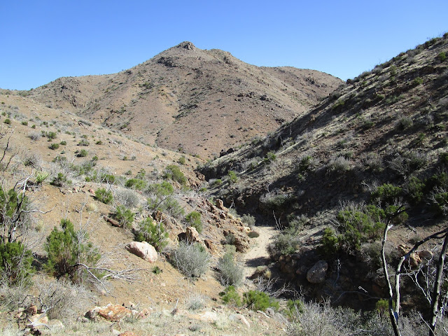
We descended sharply off Cody toward the canyon. An eyeball scan of the area led me to believe Deering Peak, an unofficial peak, was actually Palm Mesa. Deering is about 120' higher than Palm Mesa, but it was not nearly far enough down the canyon. Brad didn't question my error and we came up with a strategy to get there by contouring to a less dramatic ridge. We crossed the canyon and sidehilled awkwardly to the ridge where the going got easier. The summit of Deering had a small cairn, but no benchmark or register. I checked in with my GPS to discover that Palm Mesa High Point was a good bit further. We had burned a lot of elevation gain to get to Deering and now would have to give most of it back. We cut our celebration short and plunged down toward the canyon again, looking to preserve as much gain as we could. There were three possible ridges to climb Palm Mesa. We chose the middle ridge as a compromise between the steepest and the longest. Some period of grinding later, just before hitting the top of Palm Mesa, Brad starting getting cramps in both quads. He made it to the top and stretched out, but the cramps didn't let up. We signed the register, ate the rest of our lunch and waited. Fifteen minutes later, we both realized this might be a problem. Palm Mesa is very remote, even by Anza-Borrego standards. There was no cell service and it was at least 4 hours in any direction to the nearest help. I handed him an ibuprofen and a salt tablet and asked if he could make it back. He replied, "I have no choice." We had planned to hit Pike BM on the way out, but it would have to wait for another day. Although he offered, I didn't want to leave Brad to struggle up the canyon while I made the side trip. We made good time to Palm Mesa, but had to slow the pace on the way out. We made frequent stops as his legs kept cramping. Once we got on easier ground, he could sustain longer periods between rests. Topo maps showed a trail heading directly back to the car and we decided to look for it. Except for some scattered remnants, the trail was mostly gone. The direction, though, was true and we eventually lumbered over a hill and down to the car. I'll have to return for Pike BM, maybe doubling up with Hot Springs Mountain, but it was still a successful day -- five summits and no rescue.


Deering Peak


Looking back at Cody and Pike from Deering Peak


Heading to Palm Mesa from Deering Peak


Approaching Palm Mesa


East end of San Ysidro ridge from Palm Mesa


Indianhead from Palm Mesa


Cody and Pike from Palm Mesa


Dropping back in to the canyon


One of many dry falls in the North Fork, no water at all


Morteros


Wednesday, February 10, 2016

Echo Mountain via Mt. Lowe Railway

Hiked: 2/10/2016
Distance: 3.6 miles round trip on trail
Summit Elevation: 3207'
Elevation Gain: 1450'
Elevation Gain (in Empire State Buildings): 1.16
Round trip time: 1 hour 45 minutes
Recommended water: 32 oz.
Parking/Fees: Free on Rubio Vista Road
Difficulty: Easy

Echo Mountain was one of my first hikes and the first mountain I entered into peakbagger. Unfortunately, I didn't save any photos before I started the blog so I wanted to document it as one of the official Lower Peaks. To avoid the crowded Sam Merrill Trail, I chose to go up the Mt. Lowe Railway Trail that ascends from Rubio Canyon. The trailhead is on Rubio Vista Road and starts on the left side of a house at the end of road.

Within a quarter mile of the start, you reach a trail junction with the Sam Merrill connector trail going up on the left. You could use the connector to make a loop hike. To get to the Mt. Lowe Railway junction, continue along the trail to the right. It switchbacks up the ridge line with burned railroad ties and other bits of history along the way. As you gain altitude, the upper reaches of Rubio Canyon open up on the right. The canyon looks like it would be an interesting and difficult hike. As I climbed, I found it hard to believe the old rail system hauled people up the ridge at such a sharp angle (up to 62%! according to Wikipedia). A number of use trails branch off the main trail, but they look like use trails so there is little chance of getting lost. After a short 1.8 miles, you reach the top of Echo Mountain and the ruins of the old hotel. Just below the summit on the other side are large iron pieces of the railway on display. After looking around and a short break, I returned along the Mt. Lowe Railway Trail.


Rubio Canyon Trailhead


Sam Merrill connector trail to the left


Short switchbacks on the Mt. Lowe Railway


Some remains of the rail system


Upper Rubio Canyon


Plaque with info on the Mt. Lowe Railway, near the top


Echo Mountain summit and hotel ruins


Downtown Los Angeles through some mushroom soup colored smog


Verdugo Mountains on the left, Mt. Lukens on the right


Railway machinery


Friday, February 5, 2016

Nordhoff Peak

Hiked: 2/5/2016
Distance: 11 miles round trip on trail and dirt road
Summit Elevation: 4485'
Prominence: 705'
Elevation Gain: 2700'
Elevation Gain (in Empire State Buildings): 2.16
Round trip time: 4 hours
Recommended water: 64 oz.
Parking/Fees: Adventure Pass
Difficulty: Moderate

Nordhoff Peak is north of Ojai in the Los Padres National Forest. It ranks #18 on the Sierra Club Lower Peaks List. I hiked Nordhoff from the north on the Howard Creek Trail. To get to the trailhead, take highway 33 north from Ojai and go about 15 miles, then take a right on Rose Valley Road. In about 0.2 miles, you reach the trailhead at the first dirt road on the right. Park there and head up the road about 100 yards to find the signed single track trail on the left.

The trail is well maintained and easy to follow. Since it is on the north side of Nordhoff ridge, much of the trail is shaded. The shade and a slight, but steady breeze, kept things on the chilly side. In about 2.5 miles, you reach the junction with Nordhoff Ridge Road. Nordhoff Peak and the tower are in view from here and it's just a matter of following the road to the top. You can chop some distance off by using firebreaks to shortcut the road in a few places. There were great views along the way of Chief Peak, Pine Mountain, and the Ojai Valley. The views were even better from the Nordhoff tower. The tower is only one story and not a fancy live-in affair like Slide Mountain, but it wasn't locked. I clambered up for the 360 view and attempted to create a photosphere. However, it rendered with a jagged polygon missing ruining the whole thing. At least I got some decent photos. I made it to the top a little faster than expected and I kept looking over at Chief along the ridge. I guessed it was maybe 2 miles from the junction with trail, but when I got there, the GPS said 2.95 miles. I didn't have enough slack in my schedule to tack on another 6 miles so Chief would have to wait. This was my third hike in Los Padres but it still felt like an away game.


The moon and Venus over Los Padres


Gate at trailhead


Single track starts almost immediately on the left


Cobbled rocks along the trail


View of Nordhoff from the junction with Nordhoff Ridge Road


Nordhoff near the saddle


Mountain biker heading down Gridley Trail, the only human I saw all day


Nordhoff lookout tower


Benchmark placed 1941


Chief Peak, east along the ridge. I was tempted.


Ojai Valley, Lake Casitas (man-made), Pacific Ocean, and Channel Islands


Pine Mountain from Nordhoff


Other Trip Reports:
Nordhoff Peak the Easy Way